Camping in Australia is split into the following sub-sections:
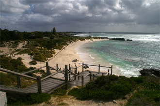
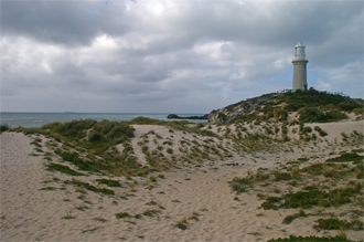
With the 8 o'clock ferry from Hillary's cancelled due to bad weather, the 10h30 ferry was bound to be an exciting ride. The sick bags handed out when boarding also gave everybody that ominous feeling, but in the end the ride was quite enjoyable. Three days followed of sheer bliss where bicycles rule the world, and people are far between. We gotta get back here in warmer weather to enjoy the snorkeling.
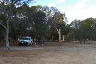
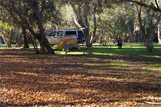
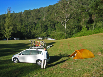
With Daylight Savings returned and getting out of the Perth not that difficult on a Friday night, we decided to head off to the Avon Valley National Park, which is less than 100 km north-east of the city centre. With it situated so close to the city, we were surprised to not see another person making use of any of the number of camp sites that are available. Had a perfect evening and followed it up with some nice hiking the next day.
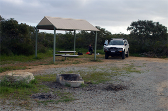
Formerly known as the Broadgrounds Caravan & Camping Ground, this park is situated a couple of kilometres east of Toodyay, on Racecourse Road. It offers very peaceful surroundings and extremely quiet nights. The ablutions are very clean, and there is even a campers kitchen which provides a fridge and microwave. It even has some local wildlife (a couple of emus and a kangaroo) in an enclosed pen. The birdlife (once again) was quite amazing.
Having passed through Woodanilling on our way south to the Stirling Range National Park, we thought that it would be a good place to stay on our way back to Perth if it worked out convenient. The campsite is situated on the main road through town and has a number of trees to shelter you from the warm autumn sum. There is also a cafe which offers meals to passing traffic and residents. The ablution facilities are great (and very clean) and it only costs $10 a night for two! We spent a nice relaxing afternoon just "parking off" and then drove the 260-odd km back to Perth the next day.
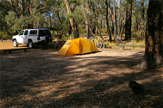
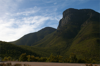
Travelling down from Perth on the Thursday before the Easter Weekend, we shared the only campsite within the Stirling Range National Park, Moingup Springs, with only a couple of other campers. The evening and early morning birdlife was unreal with each bird species trying to outdo each other in noise. A truly amazing experience. The number of kangaroos which passed through the campsite during the night also numbered quite a few. The next day we did some mountain biking along the main gravel road through the park and again saw quite a few kangaroos in the early morning. Mountain biking is however restricted to this road and all fire-trails are out of bounds due to the prevention of transmitting die-back. The ride was however good with a few steep hills.
The next night (Easter Weekend proper) was a lot busier and the campsite was basically full. This prevented the wildlife from re-visiting during the night, and we thought that there was no further reason to stay. Following an early morning walk up the Bluff Knoll (1095m), the highest point in the park, we headed off to Woodanilling, a very small town just north of Katanning.
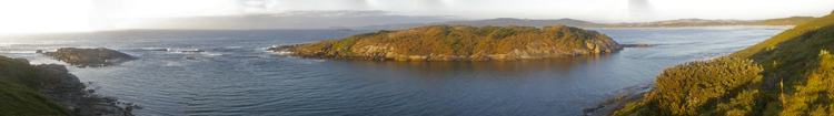
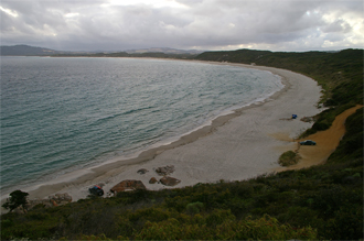
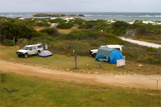
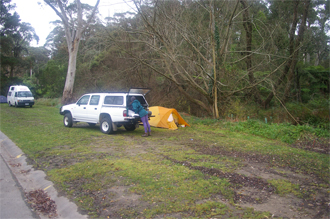
Following our hike on the Bibbulmun Track between Walpole and Peaceful Bay, we made our way down to Mutton Bird Beach which offers a number of informal (free) camping areas, both on the beach and in other secluded bushy camping areas. We opted for a spot overlooking the sea which was a short 4WD from the bitumen road. As free campsites go (and also paid sites go), you just cannot beat this spot. At sunrise and sunset, you can watch the dolphins swimming past, and during the day, swimming/snorkeling is a must. We were lucky enough to have perfect weather and had breakfast/coffee on the beach every day! Also, if you really can't put up with the camping/solar shower any longer, you can pop into Albany situated about 25km away and have a free (clean) shower at the municipal facilities on the corner of York and Stirling Streets.
Having driven down from Perth, we decided to spend the night in Albany before catching the bus to Walpole and starting the section of Bibbulmun Track. We chose the Albany Gardens Holiday Resort (Big 4) as it was located close to the town centre and we would be able to walk to the Trans WA bus stop. It was a nice place to stay, and they were also kind enough to let us leave the car there for the duration of our hike. We didn't bother booking, but on our return were surprised to find it full! Luckily we weren't planning on staying there any longer.
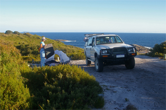
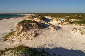
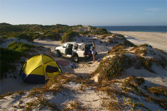
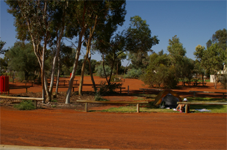
Having camped at Lancelin on a previous weekend, we decided to take the obvious next step and enter the 4WD "restricted" area just north of the town. After briefly stopping at the parking area for the off-road recreation area to fit the dune flag and lower the tyre pressures to cope with the sand, we were on our way. If it wasn't for us taking a wrong turn and ending up on a beach noted for its "extreme" sand conditions, it would have almost been a boring drive. The track conditions were very good, and any 4WD would have handled them easily. We visited Dide Bay to check out the views and then made our way up to Narrow Neck using the inland road. The beach between Dide Bay and Narrow Neck can sometimes pose very difficult driving conditions and we were not in the mood to fight our way up the beach. Finding a camping spot just in the dunes was easy, and we had uninterrupted views of the sea. The wind came up in the afternoon which made everything very sandy, but this did not detract from the great experience. Soon after sunset the wind died down, and Sunday morning was just perfect, and just after our morning swim, a few dolphins came to feed within 20m of the shore. This area has got to be one of the best camping areas in Australia, and it's only 90 minutes from Perth. We can't wait to go back!
Club Capricorn is located about 50 km north of Perth in the seaside town of Yanchep, and although the campsite doesn't overlook the sea, it is only a short walk away. The sea had a menacing look about it on this weekend, but the sheltered natural "tidal-pool" of Yanchep lagoon is about 1 km south of the resort and is a pleasant walk along the beach.
Lancelin is situated only about 120 km north of Perth and is great for a weekend away. There are two campgrounds in the town and we opted for the one on the southern end. It has easy access to the beach and typical to the west coast, swimming occurs in a sheltered shallow bay with the reef being about a kilometre offshore.
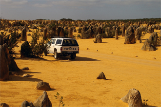
Leaving Perth early on the Saturday we made our way along Wannaroo Road to Lancelin where we thought it would be an easy four wheel drive along Gray Road to Cervantes. Enquiring at Lancelin Info Centre about the track's conditions proved useful in that we were told that the 40 odd km to Cervantes would take about 5 hours and the views were not that great (whatever that means). Not wanting to have such an epic, we decided to drive the long way around and arrived at Cervantes at about lunchtime after taking in a few view sites along the way. Our main reason for wanting to visit Cervantes was to see The Pinnacles which are limestone extrusions sticking like pillars out of the ground. Having previously visited the Walls of China in the Mungo National Park in NSW, we thought it would be similar. We have to admit that the Pinnacles do seem a bit more impressive than the Walls of China, and due to their proximity to Perth, they are really a "must-see" for all.
After visiting the various view points and picnic sites around Cervantes (which included a visit to see the Stromatolites at Lake Thetis), we opted for camping at one of the free campsites (read rest-stops) along the main road between the Brand Highway and the town itself. The Tuart Reserve "camp site" was chock-a-block with people and campervans, so we made our way to the less comfortable Hakea Reserve rest stop where we were the only ones (A little later some Americans arrived and also spent the night). After a great braai, we bedded down for one of the quietest nights camping that we have experienced.
Waking up early on Sunday, we again visited the Pinnacles to get the early morning experience and then had some brekkie at the Thirsty Point view point which is situated right on the most beautiful beach with crystal clear turquoise water.
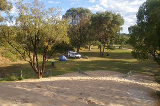
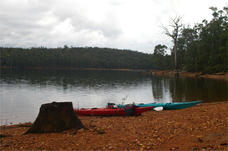
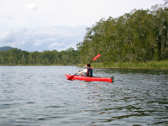
Having "recovered" from the trip across the southern lands of Australia, and with spring in the air, we decided it was time to get away for the weekend. Having spotted Wellington Dam on a map of the south-west region of WA, we thought that this would be a perfect opportunity to get the kayaks back on the water. It's only about 200 km from Perth so it didn't take that long to get there. We had decided that we would camp in the Wellington Dam National Park, and with the Honeymoon Pools campsite being closed at the moment due to bridge maintenance, we ended up camping at Potters Gorge. It was really beautiful and the birdlife was amazing. There were so many Australian Ringneck parrots which really are beautiful and fun to watch. We spent a few hours that afternoon on the water and when we got back to the campsite, had our first swim of summer. Bugger, that was cold!
It rained throughout the night which didn't really bother us, and we awoke to a beautiful morning. So, it was back onto the water to check out the dam wall. The rain clouds started rolling in about mid-morning, so we decided to get off the water and go and check out the local kiosk and tourist drives. Then it was back home. A great weekend out, and next time we want to take the mountain bikes as it seems that there is plenty of hiking and mountain biking in the area too. Can't wait.
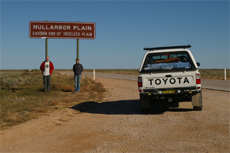
The time had come to make the epic journey across the Land Down-Under. We left the smog of Sydney early on the Saturday and headed off on the Hume Highway towards Goulburn. Stopping for a couple of cups of coffee along the way, and doing a few obligatory geocaches, we camped the night in Hay. Although there was a cheap option of camping for free down by the Murrumbidgee River,we could not do without a nice hot shower so decided to camp at the local camp site. After a pleasant night's sleep, we headed off the next day towards Adelaide. Instead of following the Sturt Highway, we opted for the shorter (and probably better) route via the Mallee Highway. This took us through Victoria after crossing the Murray River. Arriving in Adelaide in the late afternoon, we made our way to the Hills area where we stayed and caught up with some long lost "rellies". After putting us up in their great guest cottage, and surviving the night of sub-zero temperatures, the next morning we started the part of the trip that we had been waiting for - the road towards the Nullarbor.
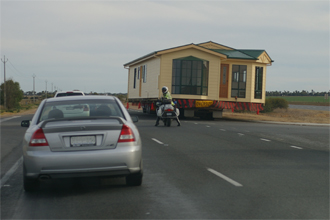
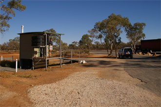
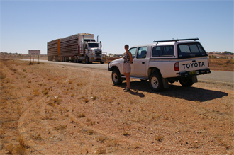
The trip to Port Augusta seemed to go on forever, especially when coming across a different kind of road hazard such as fully constructed houses on the back of trucks. Wonders never cease. We understand that the houses are constructed in Adelaide and then transported to the Mining towns where they are simply placed on their foundations and connected to the water and electricity systems - house completed! Finally arriving in Port Augusta, we could now begin our journey west towards the Nullarbor. After a relatively stress free, but long, we pulled into the local camp site in Ceduna. After finding what we thought was a nice site and pitching the tent, we realised that we were camping in a mozzie haven, and a continuous bed of devil thorns. We decided to move to clearer ground. In the very early hours of the following morning, Judith woke saying that her Thermarest was FLAT! Bugger. Not wanting to mess around, we decided to get up right then and there and repair the puncture. Using the bath in the ablution block to locate the leak, boiling water for the repair kit, etc, etc, we finally managed to get it all fixed by the time the sun rose. At least we had the Nullarbor to look forward to later in the day!
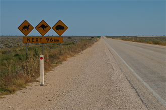
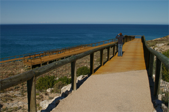
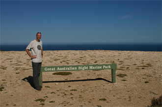
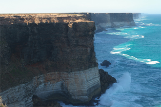
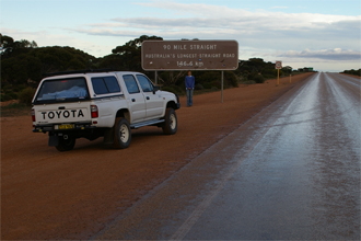
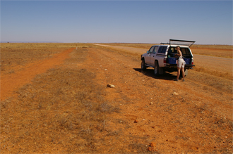
The crossing of the Nullarbor was the highlight of the trip as it is one of those roads that all Aussies and tourists alike should do at least once in their lifetime. There isn't much out there, but that is the beauty of the place. We were fortunate enough to see some of the wild camels roaming the plains and stopped at the dedicated whale watching site which must have been about 20 km off the road in the Great Australian Bight. There is a fee to walk the 400 odd metres to the cliff line, but the views were just awesome from wooden walkways, especially on such a beautiful day. There must have been about 10 adult whales with their calves and they weren't too far off shore. The people taking the fees were very friendly and offered to lend us some binoculars so that we could even get a better view of the whales. After spending the day stopping at every view point imaginable, we finally pulled into Cocklebiddy after sunset. Although the camp site was basically a gravel parking area, it was a very pleasant stay, particularly with the fact the our puncture repair to the Thermarest was satisfactory.
Watching the beautiful sunrise while packing up the tent, we couldn't help but notice the threatening weather in the west. It must have only been about 15 minutes on the road when the first rains hit and the head wind made the fuel consumption "hit the roof". The weather started clearing in the afternoon, but the temperature was decidedly cooler. We ended up spending the night in freezing conditions at Southern Cross. Waking up to frozen towels (they were frozen to the windows of the car and were as stiff as boards!), an fully iced up tent, and ice all over the car, we quickly packed up and were on our way again.
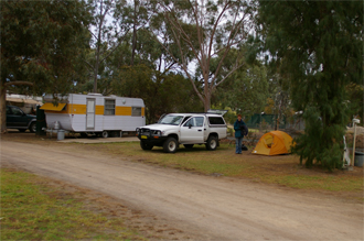
And then we saw it... Perth in the distance - our new home. There was no relaxing to be had as we wanted to try and find permanent accommodation as soon as possible, especially with the Tour de France live on TV every night. So, it was straight from one estate agent to another as we tried to find a suitable home to rent. That night, extremely tired from the long day, we camped at Karrinyup Waters Resort which was to be our home for a week. Luckily there was not too much rain during that time, but we were very pleased to move into our new home.
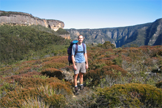
Located at the end of Megalong Valley Road, just south of Blackheath, the National Parks of NSW has created, as far as we are concerned, the best camping area in the Blue Mountains. The Dunphys Camping Area has a couple of gas barbecues (free), a pit toilet, and a beautifully manicured area for camping (also free). It seems that very few people make use of it as a camping ground, and this can only be attributed to its existence not being known. Many walks/hikes start from this area and the exploring possibilities are endless. Listening to the birds in the evening is just awesome, and waking to the same sounds, and those of the many kangaroos, is just plain amazing. This one is very highly recommended.
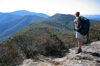
Having never visited the Kanangra Walls in the Blue Mountains, we thought it was about time to see what all the hype was about, and with a geocache situated at the summit of Mt Cloudmaker, we had no excuse for not visiting. We started hiking from the Kanangra Walls car park at about 10h15 on a beautiful autumn day with the sun gently warming our backs and not a breath of wind in the air, and felt confident on reaching the summit of Mt Cloudmaker with plenty of time to spare.
The walk started off uneventful following the signs of the Plateau Walk until the minor rock scramble down Smiths Pass. Here we had to remove our backpacks and hand them down to the person below - Nothing too hectic though. From there, the path undulated more and more as we progressed, culminating in the torturous descent into Gabes Gap, and the following ascent up Mt High and Mighty. What made this more depressing was the knowledge that we would have to repeat the process the following day. Deciding to camp about 500 m before the summit of Mt Cloudmaker, we left our packs and took the waterbag/filter to collect water at Dex Creek, a "permanent" water source about 2 km past the summit of Mt Cloudmaker. On reaching the summit and locating the geocache, and signing the Mt Cloudmaker logbook, the comments in the logbook about the lack of water at Dex Creek were a little disconcerting. Not having a choice as our water stores were low, we continued on to the creek anyway. Bugger! Dry as dust - Not a drop! Having to make it back to the tent by sunset meant we now faced a night without a warm meal, and a day with less than one litre of water between us - Unhappy Campers! The total hiking distance was about 16 km going out and 11 km coming back -- a long way (and a night) on two litres of water each! However, we managed to remain upbeat (barely) and survived the return journey, albeit a bit "dry".
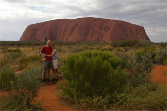
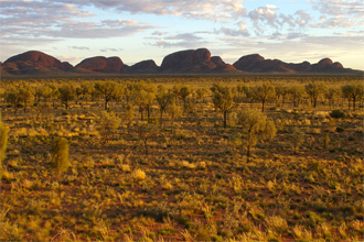
Not having enough time to drive the approximate 2,200 km from Sydney to Uluru to view what is probably the greatest Aussie Icon, we resorted to flying directly to the Connellan (Ayers Rock) Airport which is situated about 10 km north of the Ayers Rock Resort. You can hire a vehicle from the airport, but we decided to make use of the free bus service which meets all flights and transports one from the airport to the various hotels and campsite within the resort. We had arranged to hire a vehicle for a couple of days from Thrifty which is situated at the Outback Pioneer Hotel within the resort. This allowed us to enter the Kata Tjuta National Park on our own schedule instead of relying on the somewhat expensive Uluru Express shuttle service, or other bus services/tours.
The Ayers Rock Resort is not situated within the National Park, but the entry hours for the National Park are generous and sunrise and sunset should not be missed. We were pleasantly surprised by the resort shopping centre which offered all necessities and curios at reasonable prices. The local IGA supermarket was well stocked with fresh produce and was not expensive.
We stayed at the campsite which had beautifully manicured grass sites and was very clean. The pool was an added bonus for the mid-thirty degree Celsius days. One gripe that we had was that the Fact Sheet for the campsite said that there were communal kitchen facilities which we understood to be at least providing an urn for boiling water, and a fridge. Although a decent sized fridge was provided, no boiling water was available. There were a few gas cookers and barbecues dotted around the place, but most of these didn't work. Also, if there was any sort of wind, you had absolutely no chance of getting water to boil as the burner kept being blown out. All this made us rethink our decision to leave the MSR stove at home!
Although many food places exist at the Resort Centre, we found that the best (and cheapest) meals were obtained from the Outback Pioneer Kiosk at the hotel by the same name. This offered take away meals at prices better than what you would find in Sydney, and is definitely recommended.
The only wildlife that we saw was a single Dingo which wondered past the campsite, although most nights you could hear a number of them howling at the full moon. One night, at least one came running between our tent and our neighbour's, which did make for some excitement.

The municipal campsite at Blackheath is one of the best campsites in the Blue Mountains, far better than that found at Katoomba. It is situated in a quiet area and has never been that busy when we have stayed there. We have found that the towns situated in the Blue Mountains get less and less trendy the further you get from Sydney. Leura, being the nearest to Sydney, is basically the home of the weekend cappuccino brigade and far from my ideal spot on this planet -- I say, leave them to it. Katoomba is far better, but is also quite commercialised, and then you get Blackheath, which is still very rural.
Past experience has shown us that most campsites in NSW become noisy and chaotic with drunken louts over long weekends and are therefore best avoided during these times. Therefore, over the October long weekend, in order to get some peace and quiet we decided it would be great to hike into the Colo River Valley in the Wollemi National park and camp on the river bank. We accessed the National park from Putty Road via the Alidade Hill Fire Trail, and although the dirt road is relatively good, some places do require a vehicle with a higher clearance. We left the car in the parking area at the end of the road (which is only about 9 km long) and hiked down into the river valley.
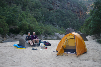
The walk down is relatively short, but quite steep. Once down at the river, we packed our backpacks into survival bags, climbed on our lilos, and floated a couple of kilometres downstream. Having passed a few sand banks along the way, we eventually found one that was to our liking and pitched the tent. We spent two nights in the most beautiful surroundings and had the most peaceful days and nights that you could imagine. The weather was beautiful and when it got too warm, we simply flopped into the beautiful Colo River to cool down.
Despite taking flippers along, we actually found the going quite tough when lilo-ing back upstream. As a result, we ended up walking along the river bank for much of the way, which also required a bit of bush-bashing.
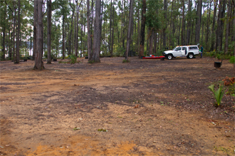
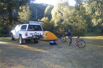
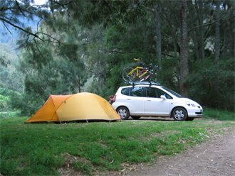
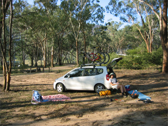
Following a full day of hiking and mountain biking in the Wollemi National Park, we camped the night at the local caravan park situated on the banks of the Colo River. The caravan park is on the eastern side of Putty Road just after the bridge over the Colo River when travelling North and was pleasant. The camping area is very big and we were able to pitch the tent a fair distance from our nearest neighbour. Had a great braai (barbecue) while listening to the Bellbirds and Kookaburras doing their thing. Having the national park so close, we couldn't miss the opportunity to do some more mountain biking along the numerous fire-trails the following day.
Jenolan Holiday Park in Oberon is another great example of a beautiful, quiet, campsite in a small town. Situated close to the centre of town, it is a convenient place to stay and is far cheaper than the camp sites on the Great Western Highway. This one is definitely recommended.
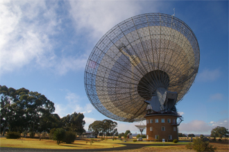
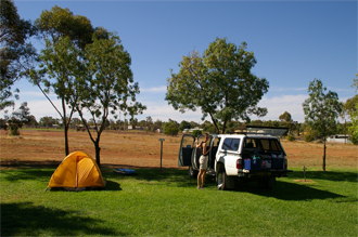
Parkes is situated approximately 400 km west of Sydney and is home to the famous Parkes Radio Telescope whose involvement in the Apollo moon landings was highlighted in the movie "The Dish". It's a great movie and a must see if you haven't seen it already. We stayed at the Spicer Park Caravan Park which is situated in the centre of Parkes and is close enough to walk to the town centre. The telescope is approximately 20 km to the north of Parkes, off the Newell Highway, and is a must see if in the area -- the Visitors Centre is very informative.
We were the only ones camping on the weekend, but then again, it was one of the wettest weekends for a very long time. Nevertheless, the campsite was great and we would definitely use it again. On our way home, we spent the night in Bathurst.

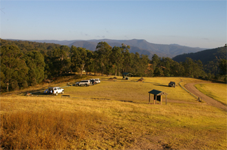
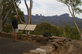
Wurrumbungle National Park is situated approximately 450 km north-west of Sydney, near the town of Coonabarabran. Like Parkes, there is also an observatory nearby (Siding Spring Observatory), but we didn't visit it on this trip. Being the Anzac long weekend, the campsite was quite busy but it is big and was not overcrowded. There are no grassed campsites available as the area is generally quite arid, but this just adds to the ambiance. There are a number of day walks which take you to various view points and all the ones we did were great. We took the mountain bikes along, but didn't really find much use for them as the track we thought would be great, turned out to be way too steep and too technical for our liking.
To get some kilometres under our belt, we left Sydney after work on 23 March and got to Lithgow by about 20h00. It was cool and dark by the time we arrived and camped at the local campsite. We were the only ones camping which would make you think that a pleasant night's sleep was in order. However, this was not to be. Diesel trains travel through Lithgow all night and there must have been a level crossing nearby which resulted in them hooting their hooters at regular intervals throughout the night. I swear that we could hear the trains being shunted too.
We were on the road early the next morning and travelled through Bathurst, Orange and stopped for a bite to eat in Dubbo. It then that it felt like we were finally leaving civilisation behind. The signs at the entrance to Nyngan indicate that the outback starts there so civilisation was definitely being left behind from then on. Got to Cobar about mid-afternoon and camped at the really nice local campsite.
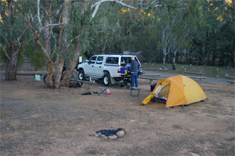
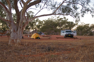
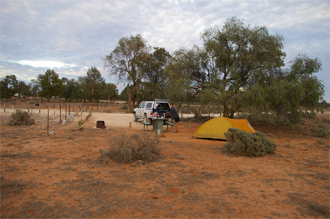
Left Cobar on a beautiful crisp morning through Wilcannia and White Cliffs, and opal mining town from yesteryear. Having had surfaced roads all the way to White Cliffs, the road deteriorated somewhat, but a 4x4 was not a necessity. Camped the night at Mutawintji National Park which was an awesome experience. The National Parks in the outback are probably the best in NSW. It seems that not many people make the effort to visit these parks, and there is just so much sky during the day, and so many stars during the night, which are even made better by it being so peaceful. Did the Bynguano Range and Homestead Gorge Trails in the afternoon, and then viewed the sunset while completing the Sunset Ridge Trail. Got back to the tent in the dark and had a beautiful nights sleep.
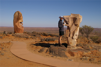
Day 4, and only a relatively short day. We visited the Living Desert Sculpture Site which was awe inspiring and offered great views of the surrounding plains and Broken Hill in the distance. Did some geocaching in Broken Hill and then visited Silverton, which has featured in a number of international movies. The local campsite seemed somewhat of a dusty bowl, so after lunch, we were happy to move along to our next destination which was Kinchega national Park. We drove around the entire park and decided to camp at the Lake Cawndilla Camping Area, but there was nothing that looked like a lake. In fact, we did not see a drop of water, which just shows how the drought is taking its hold on the land. We drove to the Kinchega Shearers' Quarters which, after giving us a brief history lesson, allowed us to have a shower in the only amenities block in the park. Once again, the campsite proved to be an absolutely wonderful place to spend the night.
Day 5 was the shortest day on the road for the entire holiday. Leaving Kinchega NP early the next day, we made our way to the Mungo National Park going via Pooncarie. After the obligatory circular drive around the Walls of China and to see what the Belah camp site had to offer, we decided to camp at the main campsite. This allowed us to drive the short distance to the office in the evening and thus go to bed clean after having a shower. For sunset, one just cannot miss the drive to the Walls of China and the views of the splendid sunsets that are on offer. What struck us the most was that you are allowed to walk all over the dunes and really have a good look around; it is a great experience.
Having camped at the three National Parks which were our intended destinations, it was time to start making our way back home to Sydney. We left Mungo NP early, and made our way to Balranald along good gravel roads. Although we stopped to do a bit of geocaching along the way, we ended up camping at West Wyalong which was again very pleasant. The final day saw leaving West Wyalong early, and getting back to Sydney at about lunch time. Overall, we did exactly 3,000km and having fallen in love with the area, can't wait to do something like that again.
Not to be confused with Lake St Clair, Tasmania, this Lake St Clair is situated north of Singleton, NSW. The lake offers the opportunity for any number of water sports and fishing, which meant that it was the perfect place to take our kayaks. Being another Aussie long weekend, what should have been a quiet camping experience turned out to be the usual drunken mayhem when the sun went down -- just what is it with low-class Aussies (and there are plenty of them) combined with a long weekend? The camp manager tried to keep a handle on the situation, but I reckon that he also feared for his life.
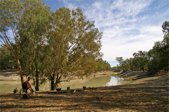
Myall Lakes National Park is a Ramsar Wetland of International Significance situated approximately 200 km north of Sydney. There are various campsites in the National Park, and we decided to camp at the Korsmans Landing campground situated on the western side of Two Mile Lake. Access is off the Pacific Highway, near Bulahdelah, along very good gravel roads. Although we shared the campsite with some day visitors over lunchtime, we had the whole place to ourselves by the time the sun went down. There are new pit toilets but no other facilities at the Korsmans Landing campsite, but having a swim in the lake was most refreshing. We camped quite close to the water which meant we didn't have far to carry the kayaks. We spent quite a few hours kayaking on the water and saw quite a bit of birdlife - most notably some Pelicans.
The Wombeyan Caves campsite is situated south-east of Sydney and although quite difficult to get to, is well worth the effort. Travelling along the M5, we turned off to the caves at Mittagong, and drove along the somewhat narrow and rough-in-places dirt road (with many a blind corner) to the caves. The other option to access the area is from Goulburn, but that was too far out of our way.
The campsite is very big and there is plenty of room to pitch the tent. The following day, we even found more areas where one could pitch a tent and even be more isolated (It's amazing how many times in Australia in particular, one can camp in what is believed to be an isolated and hence quiet spot, and some idiot has the radio blaring for most of the night -- and this time was no exception). If you want to see kangaroos, believe me when I say that you can't go wrong here -- they are everywhere.
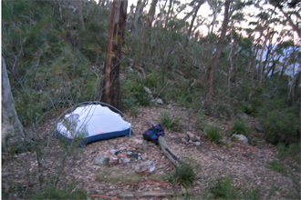
Found this camping ground by chance when scanning the web (link), and what a great place it is. It's very peaceful and must be one of the best kept secrets of the area. It is located just downstream of the Chichester Dam which, by the way, can easily be reached by walking alongside the sizable water main which seems to be the main supply to Newcastle and its surrounds. The ablution block is not much to talk about, but we ended up swimming in the local creek so washing wasn't an issue.
The campsite is split into three sections, with the first being nearest the "amenities block", the second being slightly further away, and well, the third was over the creek which would mean a wade across the river every time one needed the toilet.
The birdlife is spectacular, in particular the sounds of the Bellbirds and Kookaburras are really impressive.
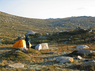
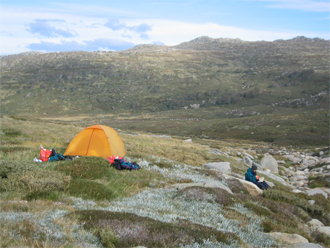
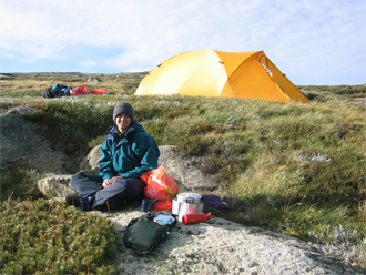
Drove down from Sydney to Thredbo and caught the ski chairlift up to the high station which made it somewhat quicker (and I guess a lot easier) to get up high on the mountain. We then continued walking along the steel walkway to the ridge just below the summit of the Highest Point of the Continent, Mount Kosciuszko (what an important term for basically the top of a hill at only 2,228 m). We continued up the winding road to the summit and took in the views. By this time, the sun was getting low in the sky and we decided to drop halfway down into the adjacent valley and pitch the tent for the night. There was a nice, but small, stream of water which allowed us to wash the days grime from our bodies and following a quick bite to eat, it didn't take long for us to drop off into a deep sleep -- it had been quite a long day.
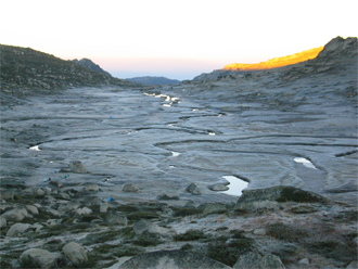
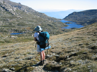
Woke up the next morning to a glorious day, and after packing up, we headed off towards Carruthers Peak, passing Albina Lake, and Club Lake, along the way. After having a break at the top, we headed off down towards Blue Lake, and instead of following the concrete pathway down the hill to the Snowy River, we took the bundu-bash route following Blue Lake Creek past Hedley Tarn. Although a lot harder, it made it more worthwhile as walking along a concrete path in these sorts of surroundings just seems plain wrong. We walked a little way up Club Lake Creek, one of the smallish tributaries to the Snowy River, and set up camp for the night.
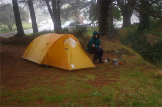
The next morning we awoke to the sound of rain falling on the tent. Packing up in the rain was not fun, but once on the move, we made relatively quick progress. The Hill up from the Snowy River to the Charlotte Pass car park was somewhat steep, but once onto the fire-trail it was easy walking. We couldn't miss the opportunity of boiling up a cup of coffee at hikers hut, where it was at least out of the rain and howling wind. Although, we still had an extra day in hand, based on the weather, we decided to get back to Thredbo, and drive all the way home. It was a long day, but at least we didn't have to fight all the traffic at the end of the long weekend. The hike was great, and would definitely like to visit the area again.
Jenolan Caves is situated in the heart of the Blue Mountains and is approximately 45 km off the Great Western Highway. The road to the caves is very narrow and bendy, and between the hours of 11h45 and 13h15 is a one-way only (good if you are travelling to the caves). If you want to leave the caves between these hours, you may take the alternative route via Oberon which is slightly longer. The little "town" of Jenolan Caves, if you could actually call it a town, has a hotel and the usual gift/curio and coffee shops. I believe the one-way road idea is more to create revenue for the coffee shops than actually to keep things safe on the twisty road. After checking in at the local shop, the campsite is found by travelling back (north) along the access road (no access during the above times) and turning right onto a relatively well hidden gravel road which drops into the valley. The road is quite steep and rough in places but a low clearance vehicle can make it (well, in dry weather anyway!). The campsite has a single toilet and shower which I'm sure must be so overused when there are any more than just a few campers present. Camping is along the creek and really beautiful and peaceful. Once there, you can always walk to the "town" along the well defined walking track through the beautiful forest surroundings. Near the town, there is a dam with the most amazing turquoise coloured water -- quite impressive.
UPDATE: July 2012 - We've been advised that the campsite on the road to Jenolan Caves has been closed for some time and is no longer available for camping. This is a pity as it was a great spot.
Our "Camping in Australia" guidebook indicated that there was a camping site in Glen Davis -- who would have guessed, so we decided to try it out! Glen Davis is a very small town situated approximately 30km off the Lithgow-Mudgee Road. The campsite has no charge and to top it off, has great ablution facilities. We had two other families camping there when we were there. The campsite is also the overnight stop for the hike from Newnes, and although we didn't do anything significant, we did walk up to the base of the cliffs to check out the views. The following day we mountain biked along the gravel road a bit beyond Glen Alice which is situated north of Glen Davis.
We were actually planning to spend the weekend at a campsite adjacent to Port Stephens because we had heard such great reports about the place. It didn't take us long to realise that what some find great, others find not so great (to put it politely)! If camping within two feet of your neighbour's tent is your kind of thing, head on out to Port Stephens -- you will have a great time. Okay, this is a little unfair as only one of the campsites that we passed looked like this (read Nelson Bay), others looked nice, but still didn't suit our "non-commercialised" fancy.
After spending most of the morning and a bit of the afternoon driving around the area and just checking it out, we looked in our Camping in Australia book to try and find a place to camp for the night. Who would have guessed that a tiny town like Clarence Town would offer just what we were after. There are two campgrounds, but we chose the Bridge Reserve Camping Area on the banks of the Williams River. A massive area beautifully grassed with trees providing shade -- what more could you want? Again, it was not very busy, especially for the camping area available, and proved to be a great place to stay.
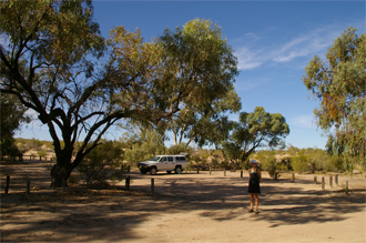
We spent our first three weeks in Australia camping at the conveniently located Lane Cove River Tourist Park near Chatswood. Despite the drought "breaking" on our arrival, this proved to be a great decision as we were able to mingle with the many foreign tourists and also got a chance to see and hear the local birdlife.