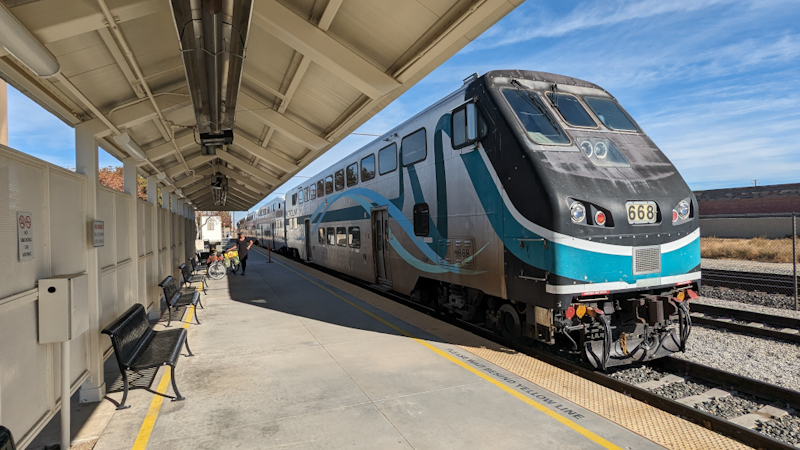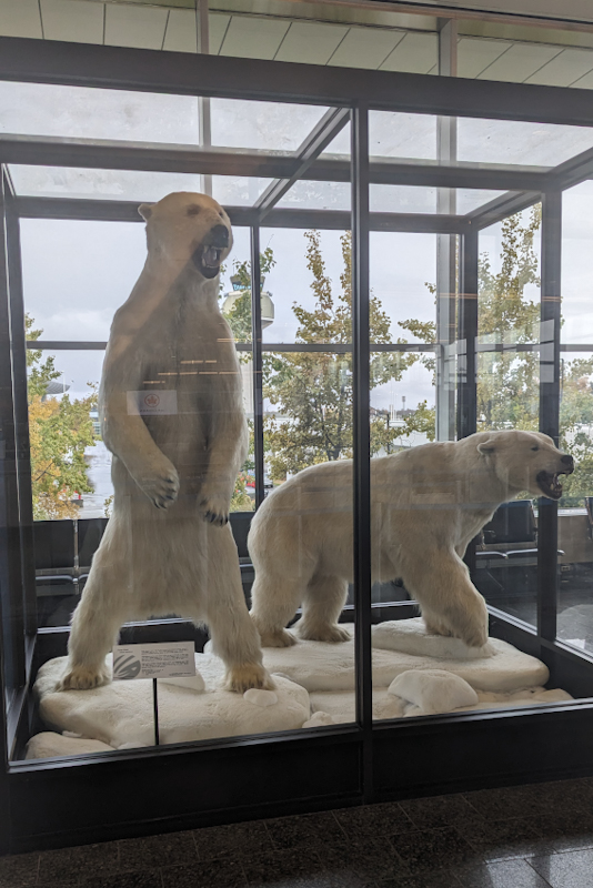
We were pleased that our stay in Anchorage's answer to Fawlty Towers had come to an end. It was not a very comfortable place to be, however it served its purpose and was close to a few shops so that made it worthwhile. We got a cab to the airport just after 11:00 even though our flight was only at 19:00 that night. Ted Stevens International Airport is an interesting place to be, there are large stuffed animals in glass boxes; polar bears, brown bear, moose and an enormous halibut which is a fish. The airport has freezer storage for hunters and you see many people flying out checking in guns and meat in eskies. Alaska airlines has a huge network of flights (we had under-estimated this especially when we got to Seattle and flying out to Salt Lake City our plane was in a long queue of Alaska airline planes waiting for take off). Planes fly out of Anchorage to many places in Alaska reachable by plane only. Many people stock up at Walmart and Cosco in Anchorage and take full crates home with them. For locals, most of the year there is no cost for luggage. So the time passed easily. We checked in and then went to our gate to wait for boarding. We knew that Siwei was flying to Honolulu an hour before us and his gate was only two along from ours so we were able to catch up with his journey since our paths had last crossed between Fairbanks and Delta Junction. His Australian visa had been granted so he is going to fly from Hawaii to Sydney on 28 October and after touring Australia he will fly to New Zealand on 27 January. He does not plan to get to Perth, which is probably a good thing given the months he is going to be in Australia; Perth is too hot!
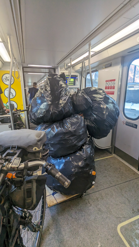
We had a three hour flight to Seattle followed by an 8 hour lay over, where we found a quiet area and slept on the floor, surprisingly well. We had a two hour flight to Salt Lake City, arriving around 11:00. We got our luggage and put the bikes together. For the first time we just did this in the hall which the luggage carousel is in. Normally we go outside, but it was raining quite heavily and also it cost $7 to rent a luggage trolley which we need two of to move the bikes and bags outside which is crazy. Due to the rain, we decided against cycling to our hotel. We try to keep our bikes and bags invisable to hotel reception staff, so pitching up with everything wet is not a good start! The Trax (train/tram) Green Line runs from the airport with a stop at our hotel which was perfect. Mike needed to collect an Amazon order from a parcel locker near the airport so I waited on the platform with the bikes while he caught the Trax there and back, it only took 30 min. The Trax has ramps which activate at the push of a button which made getting the loaded bikes on and off very easy. There was the usual mix of passengers: air travellers just back from their holidays, affluent and excited, ordinary commuters, total nutjobs yelling and carrying on and sellers of "pharmaceuticals". Pretty standard for US public transport in our experience. It was only $2.50 per trip which is very cheap. We bought $5.00 day passes as Mike had to get the parcel and we might go out later. Our hotel was really nice, very large room with kitchenette and BATH and RECLINING chair. So comfy! Our room was spotless and the hotel was very quiet. Such a relief after our first impressions. While Mike went inside to check in, I noticed a luggage trolley packed with what were obviously the belongings of a homeless person, everything in adhoc bundles and plastic bags piled high. Said lady came out of the hotel and said she was so happy just to be able to have a lie down and wheeled the trolley inside. Then when Mike came out, a bloke who I had observed with tiny ziplock bags filled with various powdery substances walked up to us and seemed to offer us something. No idea what he was talking about. It was almost the last straw, we were unpacking the bikes to get everything into the hotel and I just snapped, "Are you a guest here?" I asked. Unbelievably he said yes. He kept mumbling what he was offering. "I do not want to have a conversation right now," I said and he backed off. Over the course of the next two days we would see him and another bloke sitting in a massive ute in a handicapped bay by the hotel door. Everyone else just went about their business. There is so much shady stuff that goes on in the open in cities here and people sort of turn a blind eye to it.
We were pretty tired but showered and slept and around 20:00 decided to get the Trax to Walmart a few stops away to resupply. We were pleased we did that so we could rest the next day. We relaxed for the morning, having many cups of tea and using our kitchette to the full! We then went out to Backcountry, a 3 km walk from our hotel. We are very familiar with their online store but can never order from it in Australia, either they can't sell to us or the postage is too expensive, something like that. The West Valley store is a shopfront attached to a massive warehouse. They have a row of online computer screens where you access their website and then write down the item number you want, size etc. on little cards. You give it to the person at the front desk who enters the info into a PX and then wait for a warehouse bloke on a bicycle to ride and collect said things, and then place them through a large hatch onto a table, calling your name. You try it on, like I was looking for a pair of hiking shoes to cycle in, and then you can either put it back at the hatch if you don't want it, or buy it. It is a great retail concept. You don't really have to interact with a sales assistant. In the end I got a pair of Asolo hiking boots and Mike got a pair of sandals to replace his Keens which had worn out (as they are a New Zealand brand, we keep calling them jandals and laughing). He also bought a pair of cycling boots as they are really hard to find and his current ones won't be going home anyway. So all in all, we were very happy!
It is always hard to leave a hotel, especially such a nice one, but we had relaxed and reset and now have LA almost in our sights, with about 2400 km or 5 weeks riding left. We slept in and I used the recliner till the last minute. We organised ourselves and packed, and Mike put the pedals on the bikes. One of my pedals had been feeling very worn probably the bearings were going. My pedals would often freeze overnight in Alaska and then not rotate easily in the morning until they defrosted. Since then one of my pedals was playing up. As we are going to be heading off into the middle of nowhere again, he wisely said we should go back to Backcountry to perhaps replace them, which we did. The bike mechanic suggested a better pair. These pedals have done 8000 km of often hard riding so while it was unfortunate to have to replace them, it is probably understandable. Funnily enough, we bought the pedals and my worn out boots together in Port Angeles Washington and they both wore out at the same time! Not quite the same sort of item though. Just goes to show how pedalling wears stuff out! The guys and gals at Backcountry were really nice and we enjoyed shopping there.
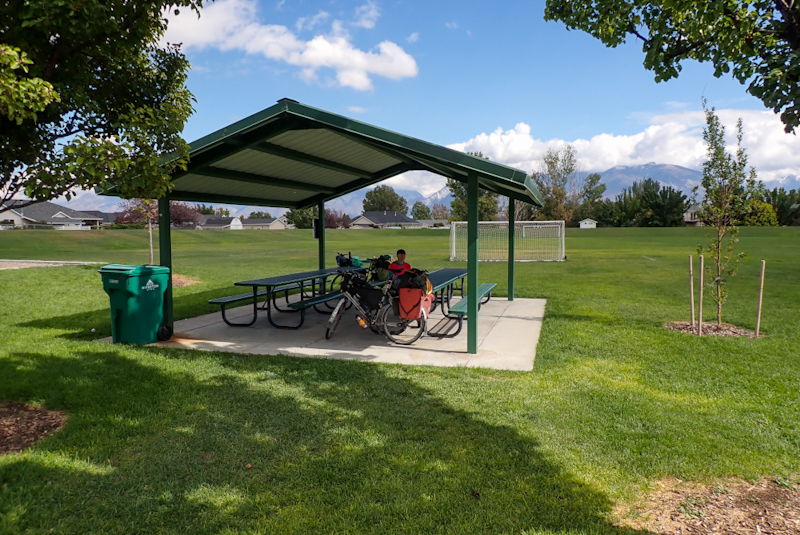
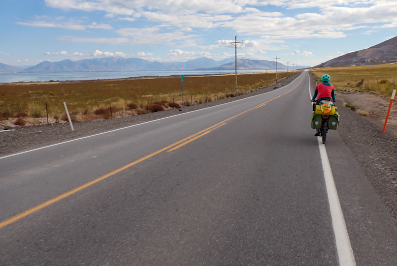
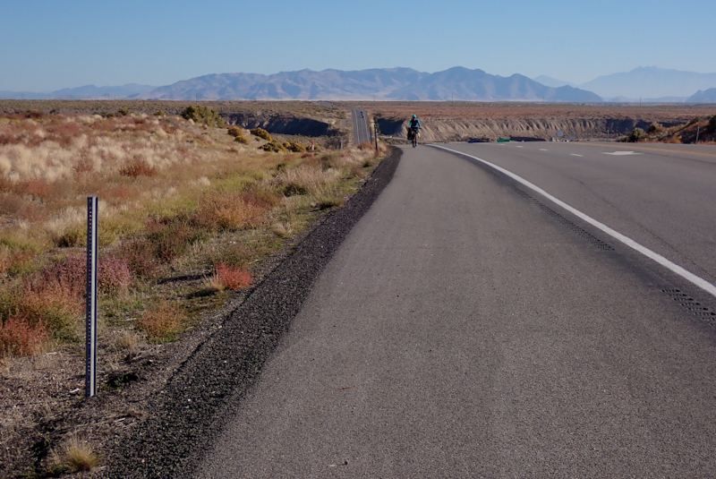
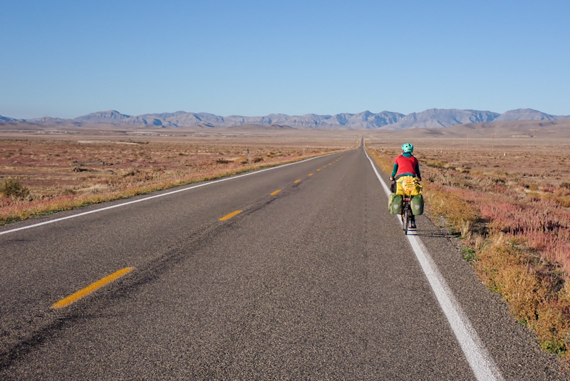
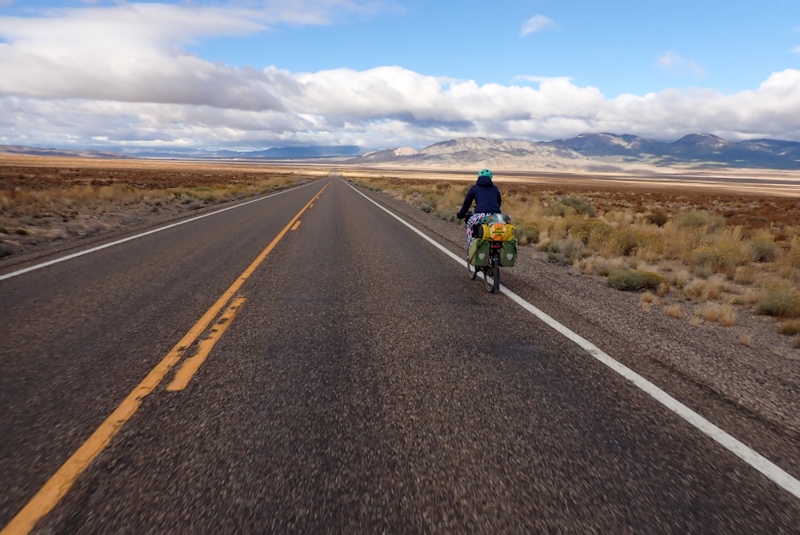
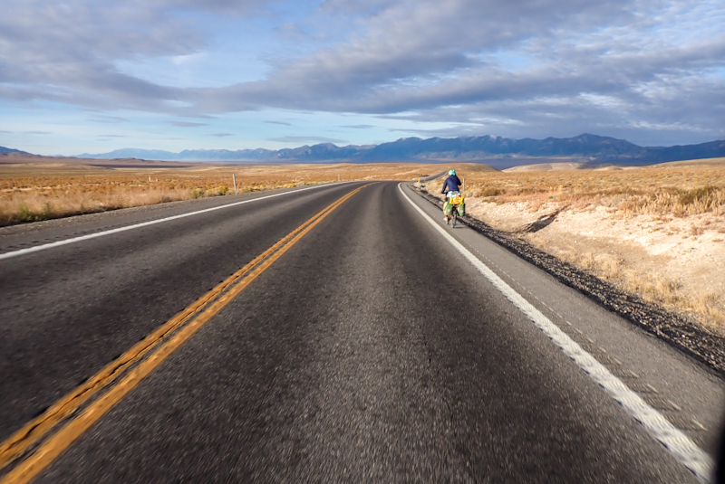
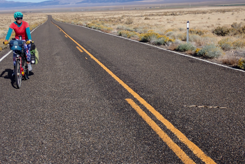
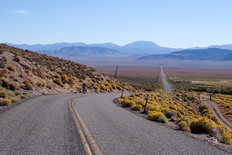
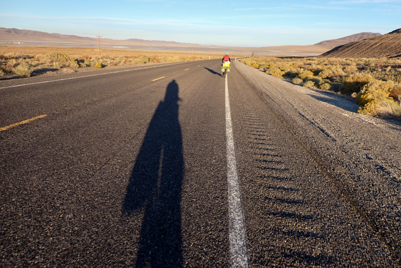
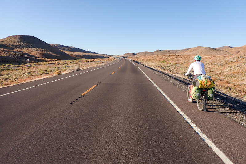
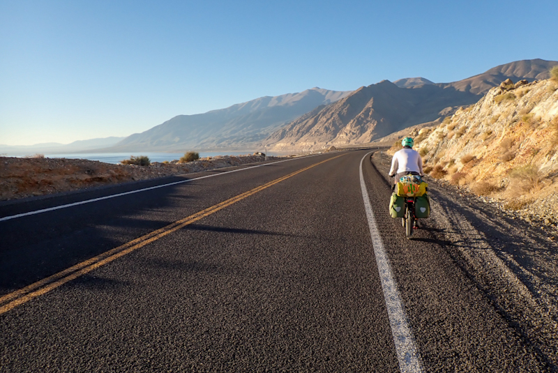
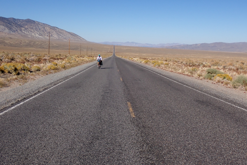
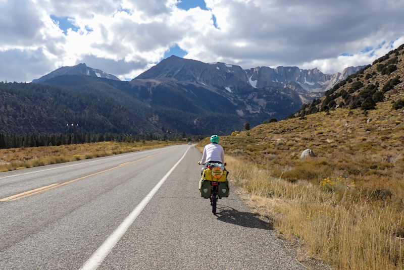
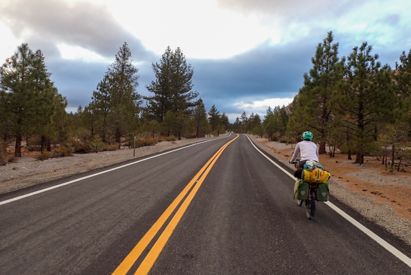
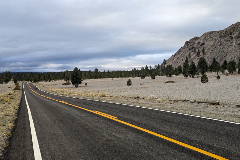
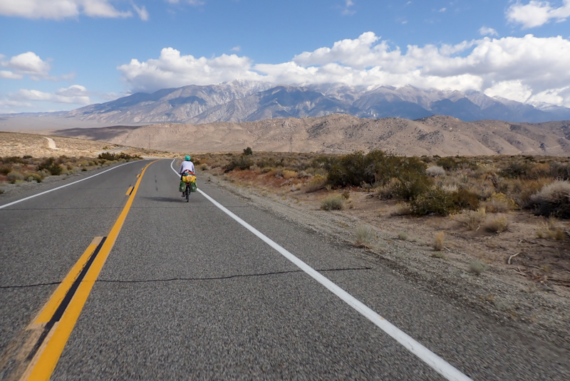
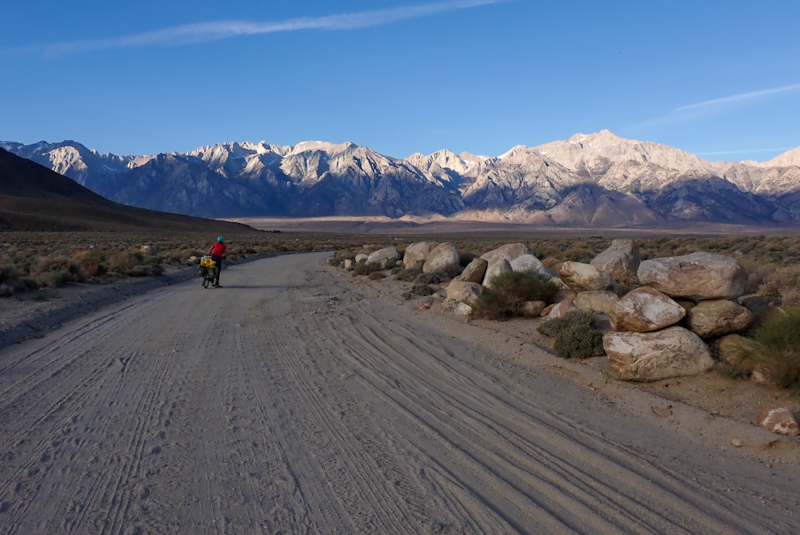
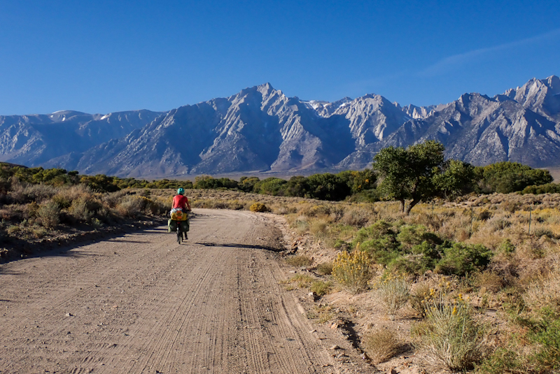
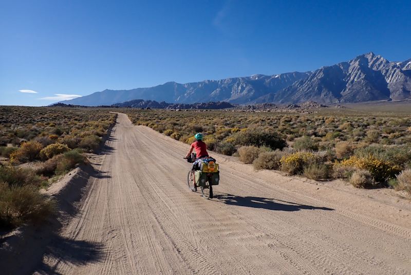
So we finally made tracks out of Salt Lake City at 13:00 and after only a single block of riding we did not make one turn off the road we were on. It was just straight south. Superb riding! Pretty flat and the bike path on such a busy road was brilliant. We always felt safe and absolutely like we were meant to be there. Utah once again raises the bar. The weather was perfect, a comfortable 18 DegC and we stopped for coffee and to eat at lovely park with good facilities. The mountain views were amazing, some snow on top and red rock already evident. It took about 50 km to get out of the city limits and suburban gardens. As we cycled past Lake Utah, the arid plant life and desert feeling emerged. So different from Alaska and we really liked it. Suddenly we are seeing dry grass and thorny ground cover again. It's amazing, it feels like we have come full circle.
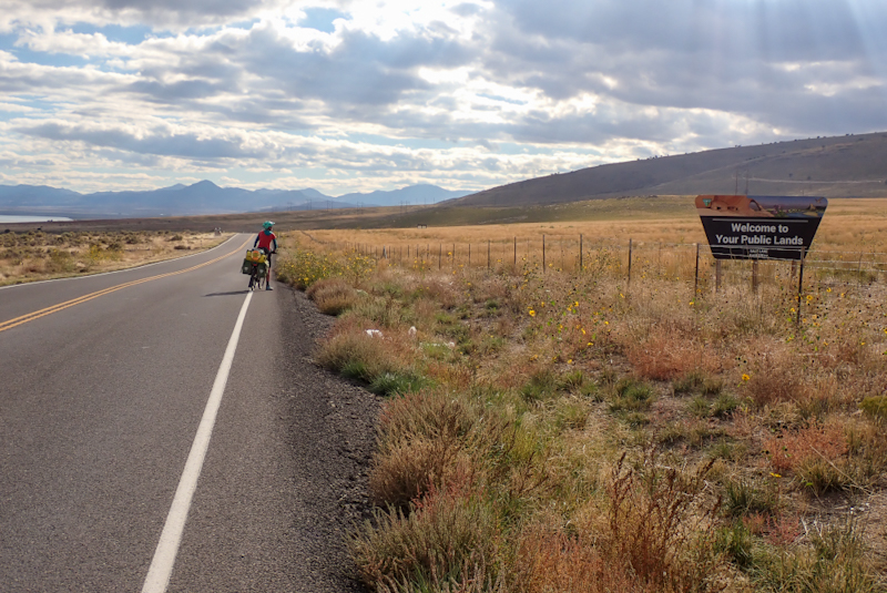
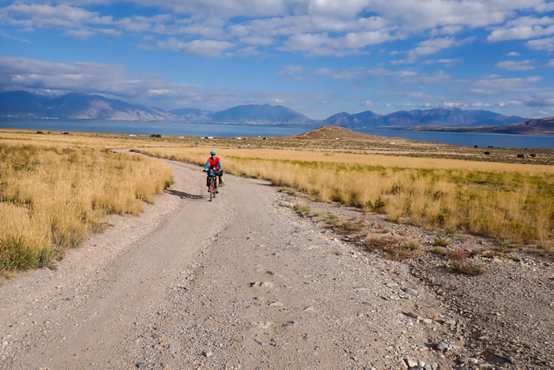
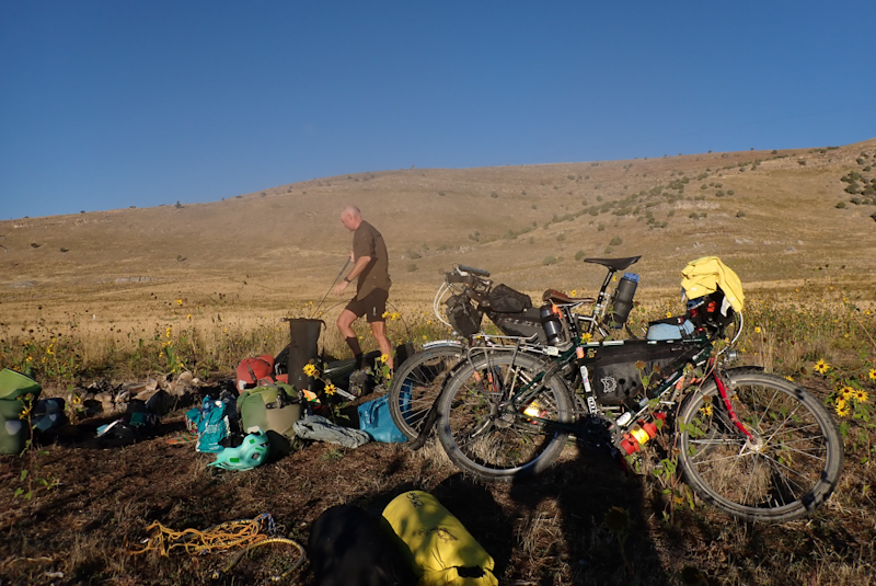
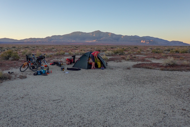
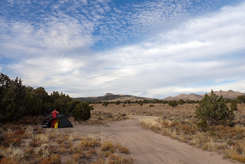
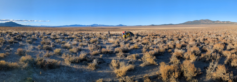
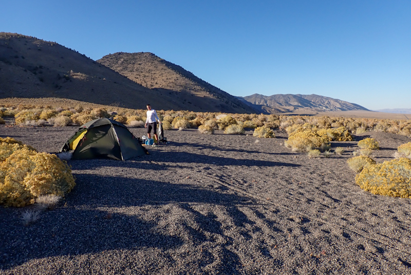
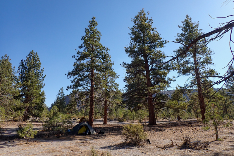
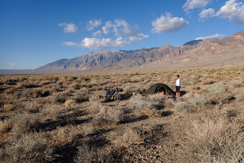
We were heading for BLM Lands and soon saw a sign saying, "Welcome to your Public Lands", so nice to be made to feel welcome! The track that led to the lake was pretty popular with many RV's and campervans parked there. The track leading to the hills on the right was our pick - no other campers and really quiet. It was a pretty rough track but we got off the road and found a pretty good area to camp in amongst the wild sunflowers. For the first time on this trip maybe, there is less than 12 hours of daylight so we had some tea, ate some Tex Mex Trail Mix and it was time for the tent and for Mike to try out his new mattress which he is doing right now as I write, with a lot of satisfaction evident in the occassional snore I hear.
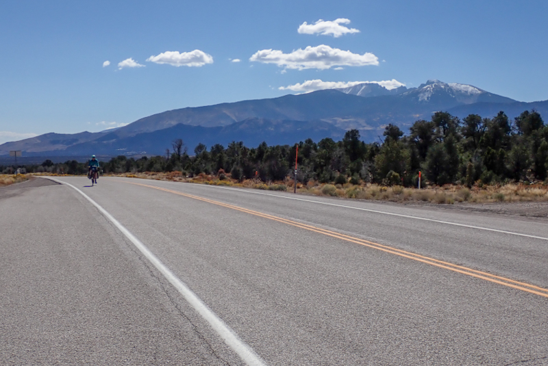
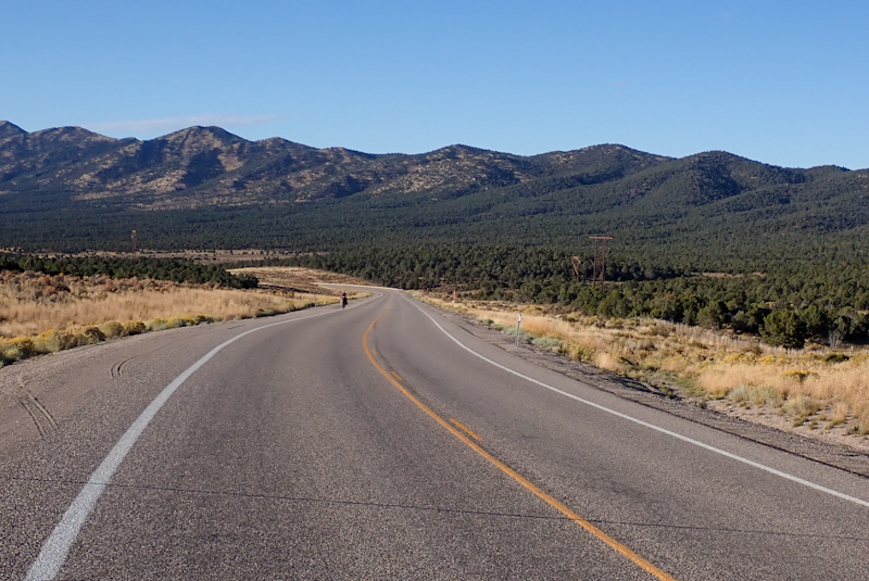
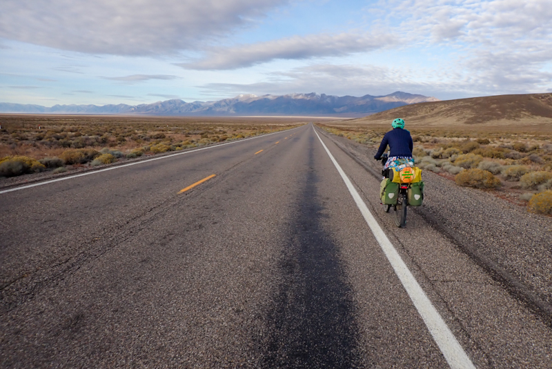
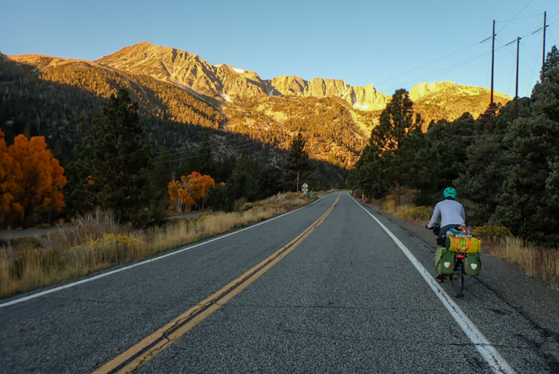
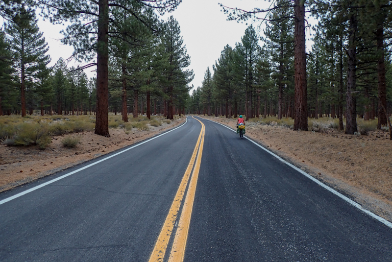
It is good to be back in Utah, quite a change from Alaska! First time in weeks that we set off in shorts and shirt. After having a range of warm gloves available all day while there, they are now packed away! We set off along the flat route 68 all the way to Elberta where we turned right onto route 6. We stopped in Elberta at some benches outside the Catholic church for coffee and to inspect my brand new right pedal which was squeaking alarmingly and had been for the entire 30 km ridden so far today. It was doing my head in! So disappointing as they were expensive pedals and it is so disheartening when you replace something not entirely broken and gain a new problem that you have to solve. The pedals are ONEUP and have a very large bearing. When the bike mechanic asked if we wanted him to fit them, I agreed. Whenever this happens my instinct is, "Mike would do it better", however it seems silly not to let a bike mechanic fit a pair of pedals.The pedals had not been rotating freely, however we thought that maybe they were a bit stiff. Mike and I decided to grease the pedal to see if that would stop the squeak and he found that they were installed very tightly. We then read online about these pedals and they are supposed to be tightened to a very specific torque at first and then they may relax over time and become more free spinning. They had been installed way too tight. By putting them back on not as tightly the squeak went and we were very happy. He can always tighten them as time goes on as the tension is what holds the bearing in position, which is a pretty complex design which we've never encountered before
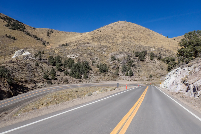
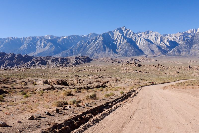
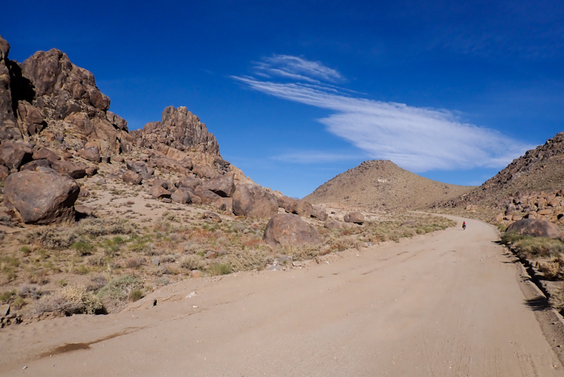
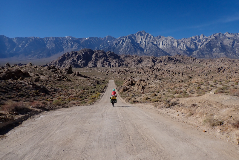
We set off happily for our first 600 m climb in AGES over 15 km to Eureka. The road was good and the climb was fair. The scenery was beautiful. What I thought was red earth from a distance on the mountain slopes is actually the leaves of trees turning red for fall! It is so surprising that you would find those sorts of trees in this desert environment. The climb went to 2000 m and it was the first time we had been at that sort of elevation for ages. The riding was hard work! We remember this from being in Utah, Arizona and so on months ago, we just get out of puff so easily. You have to acclimatise. We decided not to push too hard as our bikes are heavy with food anyway so that is extra effort and you tire easily. I had to take more breaks than usual and felt quite lightheaded on stopping. We arrived at Eureka for lunch and ate at benches at a petrol station and then tried to find water, stopping at a park where there was none available and then at another petrol station where there was a sink where we could fill up. Eureka is a mining town, it is small and neat. After this it was pretty much downhill for the rest of the day.
We were heading towards Lynndyl and passed Little Sahara Rec Area which was an option for camping as it is BLM Lands but the turn off came a bit soon. Shortly before Lynndyl we came across the turn off to the old Route 50 which was a semi-sealed road, gravelly. Although there was BLM land on the opposite side of the highway, it was fenced without any openings and the vegetation was quite thick. Walking along the gravel road, we came across a little spot where we could pitch the tent. It was a sunny day and we actually lay down in some shade to rest before showering with our shower bag and getting into the tent. It is really great to have sunny days to look forward to and also to be warm.
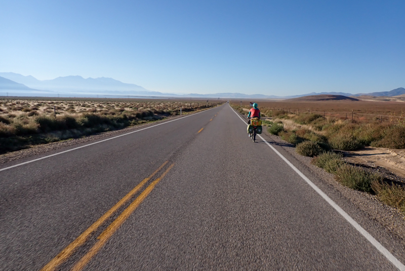

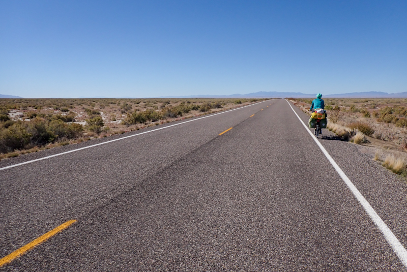
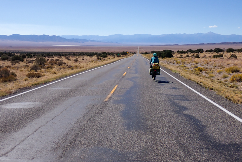
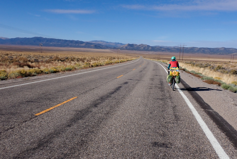
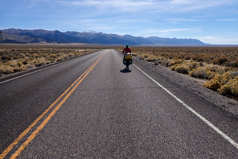
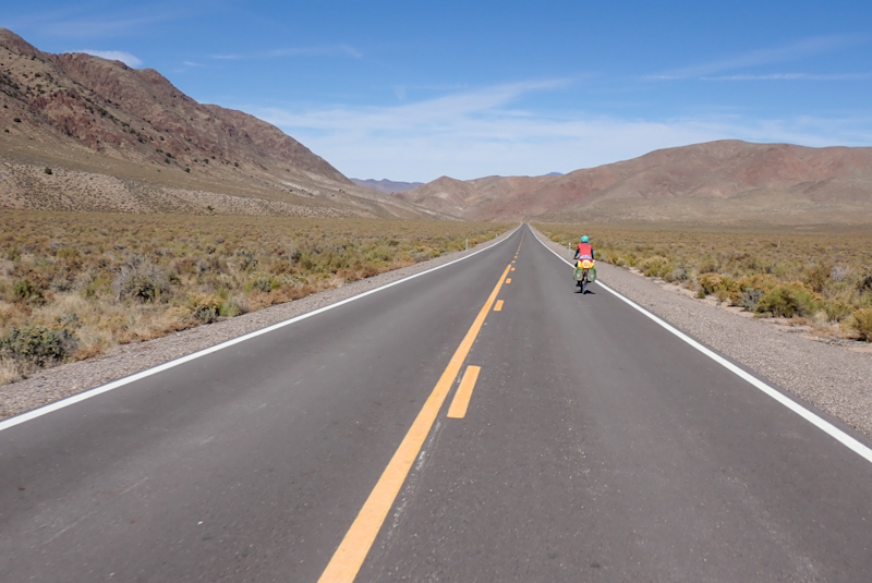
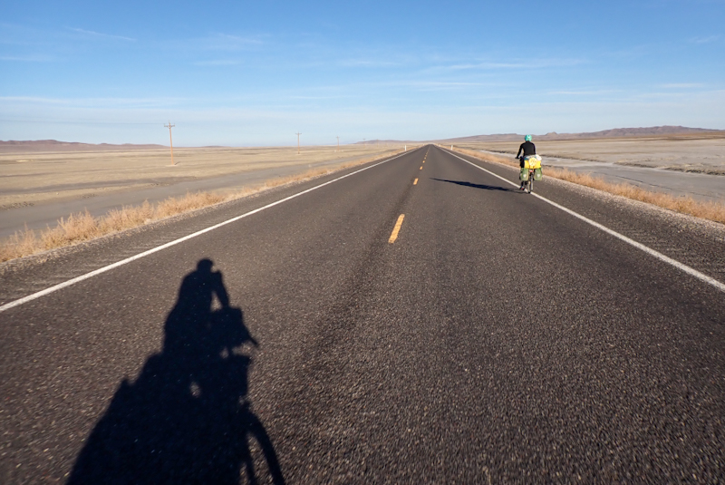
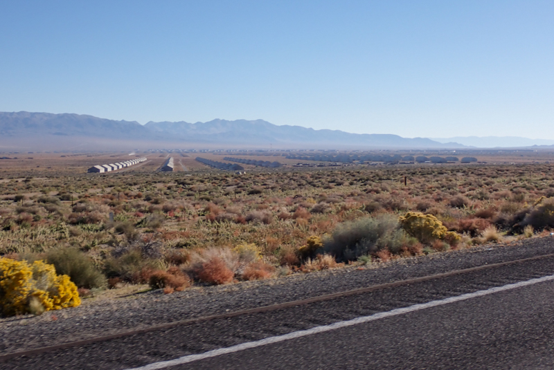
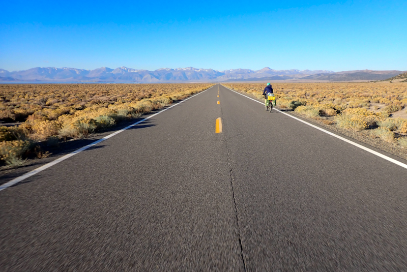
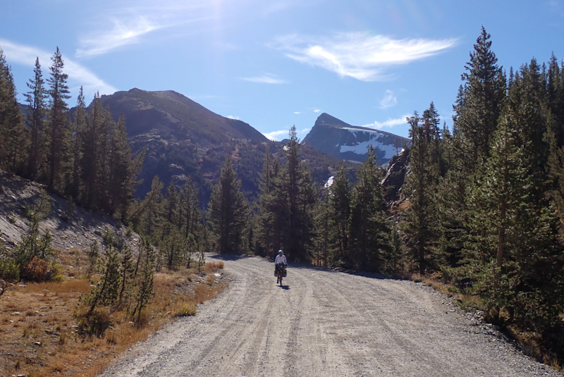
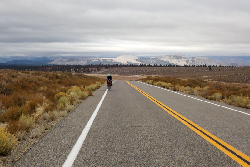
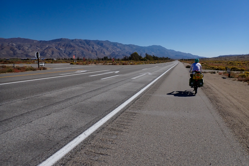
Flat and fast today! 97 km in 4 hr 30! Our lungs were happy after yesterday, although we are still at around 1400 m above sea level and amazingly it does make a difference, we feel more tired than we expect. First off, we aimed for Delta at 38 km and stayed a while there. Such a lovely little town, neat and everything in its place, lovely city park and all lawns emerald green. We stopped at the grocery store to pick up bread and cinnamon toasties cereal and milk, of course! The large 33 ounce bags of cereal were on special, half the price of the small boxes so I walked out of there with this masive bag and 2 L of milk. We got through most of it! Mike bought a pack of 100 cable ties (called zip ties here) as you can never have too many. We sat on a bench in the park and ate a lot of cinnamon toasties and filled up with a lot of water as we might not see water for the rest of today and tomorrow. We left when Mike could not move for a tummy full of cinnamon toasties. At Delta you turn onto US Route 50, or as it is affectionately known, "The Loneliest Road in America." Just our cup of tea! 650 km from here to Fallon (the road continues to Reno but we plan to turn off at Fallon to join the 95) and only 4 towns along the way. The road passes through flat desert valleys and climbs over high mountain passes, well high-ish, maximum 2300 m.
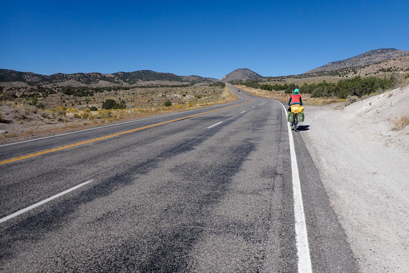
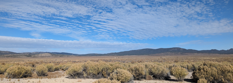
The kilometres flew by along the flat road. It was quiet, not much traffic passed us except for the odd campervan and RV and even those did so politely. Hardly any trucks. After 5 miles we passed through tiny Hinckley and a little later the road bent to the left and then to the right, then straight on til morning! There are low mountain ranges all around, the sky was clear and the afternoon warm. We drew up to Sevier Lake, a lake wich does not fill, so a little like an Australian lake. It was empty today too but the mirage even showed the mountains reflected in it which was tricky! As we rode along we spied a gravel embankment by the roadside and went to inspect what was over the other side - a lovely large gravel area perfect to camp on. Due to the embankment, we were hidden from view. We relaxed in the shade of the bikes for a couple of hours and decided to sleep under the stars tonight which we have not done for a while. This might be our last night in Utah as the Nevada border beckons, but we might just stretch it out for another!

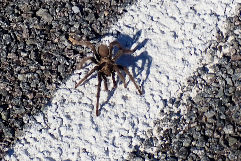
We loved sleeping under the stars! The night sky is dark here and the moon rise was late, however around 04:00 we woke up and felt our sleeping bags, they were pretty wet with condensation on the outside, which was disappointing as we thought we might stay dry. The moisture did not penetrate the bags and in the morning I wiped it off with a towel, however we will not sleep under the stars again until we're dure we won't get wet. After our first climb of the day which was pretty easy, we saw another reason not to sleep out, a big hairy spider (tarantula?) legged it across the road right beside us. Mike stopped to have a close look and take some pics - it was the size of an outstretched hand! We descended into the next valley and then had a 520 m climb up the next pass. I coped better with this climb than the one two days ago, my breathing was better. I do not chat to Mike on the climbs, I think this helps! We love this road, the riding is spectacular, amazing views, some of the best of the trip. We stopped at the top to have lunch and relaxed in the shade of a fir tree. We set the sleeping bags out in the sun to dry and they did perfectly.
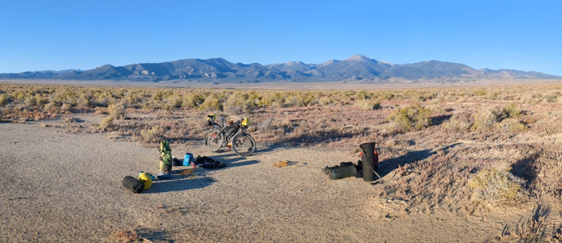
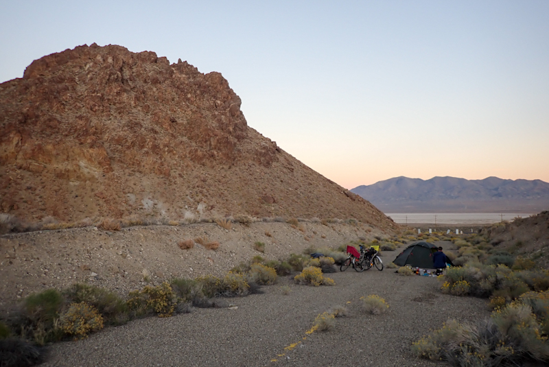
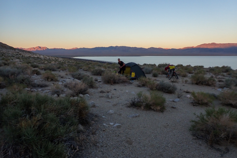
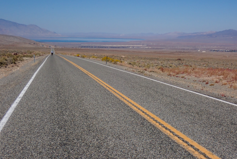
After this was a massive, nearly 40 km descent to the Nevada-Utah border. The first part was pretty steep and around a curve, then as the road straightened out we just dropped down, we could see the Great Basin all below, the road dead straight and we just dropped lower and lower. Distance became distorted as things looked close, like we could see the border fuel station and casino, however it took ages to get there as it was actually far away. We stopped there to buy bread and milk to finish off our massive bag of cinnamon toasties and picked up enough water to get us to Ely, about 100 km away. We rode a couple of km and came across a track off to the right. A few hundred metres along we picked a sandy patch to camp. It is amazing being in the Great Basin, totally flat and surrounded by mountains. Nevada is an hour behind Utah so sunset here is 18:00! It was good to "gain" an hour!
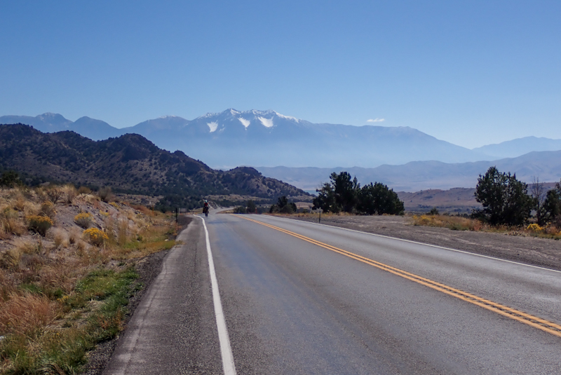
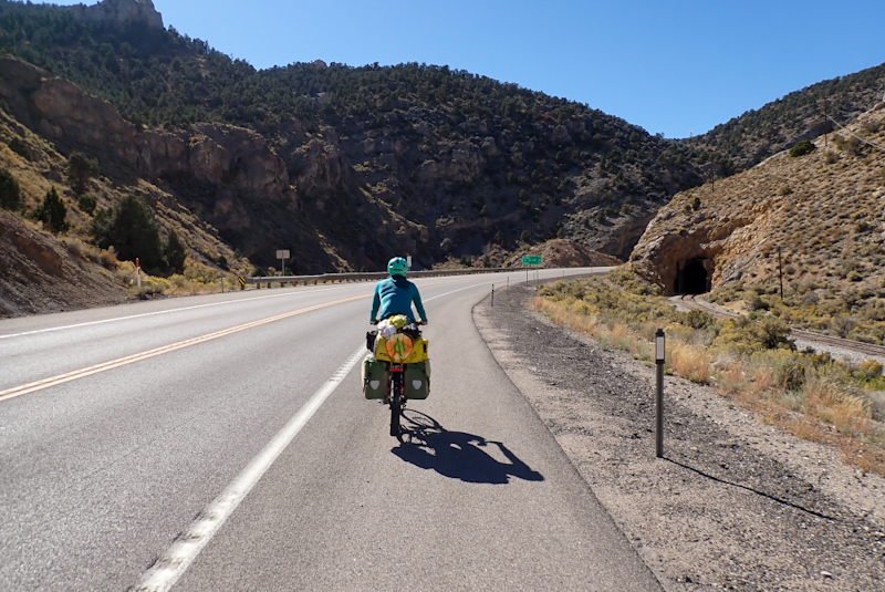
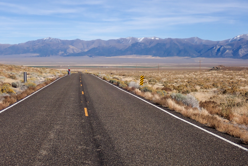
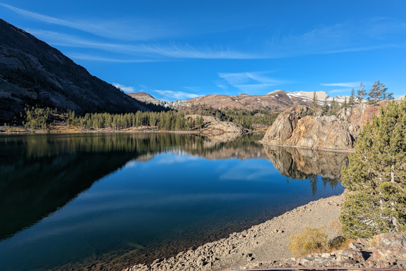
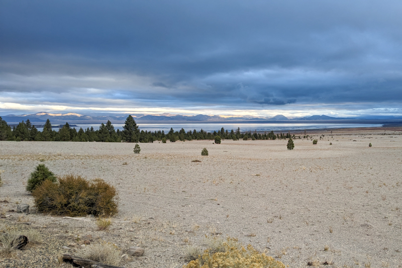
We woke to an orange glow on the eastern horizon, another perfect day in Nevada! We got going around 07:30 which is the new 08:30 and passed the turnoff to Baker and then the turn off to the Great Basin National Park. This park had been recommended to us. It is an amazing sight, a high mountain range in the middle of the desert, rising out of the flat basin. Wheeler Peak in fact rises to just over 13 000 ft and many peaks had dustings of snow. Once again, the scale of the place is astounding. We experienced this in Death Valley and now here on Route 50 going through these valleys and ranges. It seems that as the lanscape is totally bear of anything besides mountains and valley floors, your mind struggles to judge distance or size. If you are in a city with a high mountain peak behind it, you can see the buldings and understand their size so you experience the mountain height by comparison. When we looked at Wheeler Peak we could not believe there was snow on top, it is in the desert and did not look that high. This is why we find cycling through this sort of landscape surreal. There is just nothing else like it.
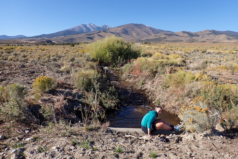
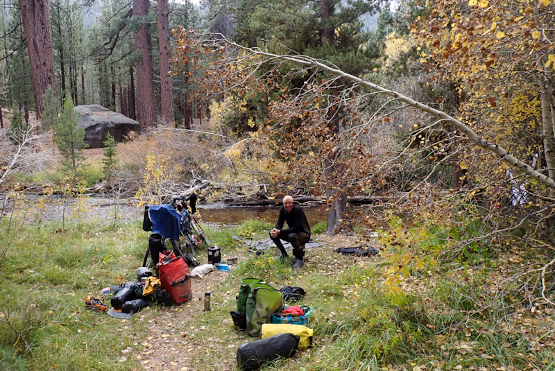
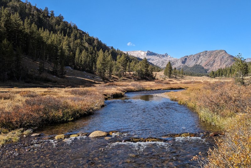
We did not go into the national park as we have more than enough to see everywhere we look. The park is small but packs a punch due to elevation gains so there are aspens turning red with fall colours and subalpine trees, but to get to these places we would have had to climb 400m and we have enough climbing to contend with on route 50 anyway. A few km further on we came across a creek crossing the road and the water looked fresh! We could not believe it! Looking up valley we could see snow frosted mountains so clearly the creek is fed by these. The water ran close to the stone culvert and so I sat there and took off my lightweight wool hoodie and over shorts and washed them in the creek. I could not resist taking off my shoes and socks and getting into the stream, it was glorious. I commented to Mike that I was disappointed my swimmers were packed away as it was perfect for a dip and he replied, "Well, the road is so quiet and passing cars wouldn't see you anyway." So I popped off my cycle knicks and got in, I kept my crop top on. It was so brilliant to be able to lie down in a cold stream and so unexpected! Who would have guessed in this desert environment you would find such a thing? Mike could not resist either and got out of his shoes and socks and shorts and was sitting on the culvert about to take his shirt off when he said, "Here comes a cyclist!". Two unusual sightings then - a stream and a cyclist! Of course he stopped and leant his bike up near ours and came over. I was lying in the stream below him and Mike was still perched on the stone culvert, covering up with his shirt. Cyclist said "hi", I said, "I must warn you, we are half naked!". He smiled and walked a little upstream to dip his hands in the water and wash his face. He told us that there is a glacier up in the national park that feeds the creek! He was camping at Sacramento Pass campground and cycled to the national park and was now cycling back. After all this excitement Mike had his dip and then we got dressed and filtered water for a couple of water bags and drank, and refilled our bottles. While I was packing my water bag away I saw a coyote cross the road! We sailed up most of the climb up Sacramento Pass and stopped at the BLM campground for our flask coffee. After this we still had to get to the summit (2181 m), all in all a 580 m climb
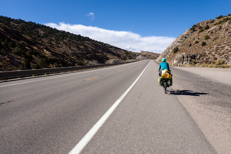
The descent into the next valley was amazing, not too steep and you just had this massive view of the valley floor, the high mountains on the other side and a large wind farm though the centre, thankfully not working very hard. At the other side of the downhill lay Conners Pass, at 2356 m the highest on this stretch of Route 50. We stopped at the bottom to eat lunch, no shade unfortunately but the temperature was only around 22 DegC, although the sun is hot and we are wearing suncream! We can hardly believe it either! Then we started the climb, the first 13 km of which was dead straight uphill. When the road entered the national forest we started to look for a place to camp as we did not like our chances of completing the whole climb today. We saw another cyclist coming down the climb! We found a track down into the pine forest and a place to camp. Total climbing today 1060 m in 64 km. Enough! We love this road, the climbs are not tough but they are long and the views are extraordinary.

After dark the critters came out as they often do, probably little mice or maybe only one. Going to sleep it was running amok in my vestibule and would go away and then come back later, clearly impressed with all the exciting things to look at. As this is quite a common occurence camping in the bush, one just runs through all the things that it could possibly get into. We always keep all our food in the bear containers and keep them away from the tent, even in places like Nevada where there aren't any bears at all. It's a habit. Also, it is reassuring when the little mouse is running around that you know it won't chew into your pannier or the tent to get at food. We don't go to bear safety extremes of putting the toothpaste etc. in the bear containers however. After my mental run through I was confident all would be well. Funnily enough, the thing I was worried about was a water bag with a tiny bit of water in it. I wondered if the mouse might be thirst crazed like a cycle tourist? Which is stupid as they live here and are used to there not being much water. This morning when I got dressed I found that the little bastard had chewed multiple holes in one of my socks! These are my "Darn Tough" brand, with scary grizzly bears on them with their claws out. So the sock did not pass the mouse test and mice are not scared of grizzlies. When we brushed our teeth I noticed that it had also chewed holes in the bag we keep the toothbrushes and toothpaste in. Sock must have tasted as bad as it would after 5 days sweaty riding. As I keep my socks in my boots you can imagine that I was just really relieved it did not decide to take some bites out of my brand new Asolo hiking boots which I love.
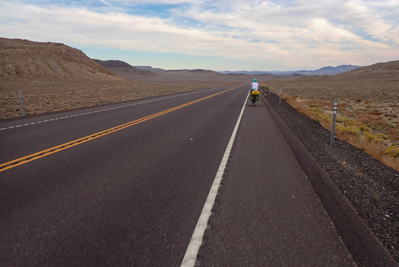
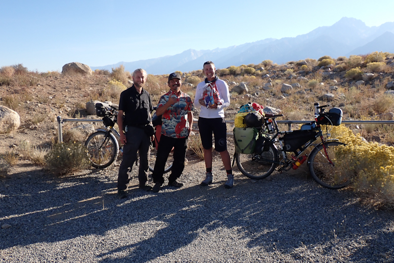
We finished the rest of the climb from yesterday, after the effort of pushing our bikes up to the road and chatting to the cyclist we saw yesterday. We could not face the extra effort yesterday, but this morning it seemed easy. Then of course down the other side, a lovely gentle descent now towards Ely. As the road curved towards the town it was a different descent to the others we have had in the last few days, we did not drop as far and the valley floor did not seem to lie miles away. We stopped at Elk Rest Area for coffee and then as we arrived in Ely we saw a pair of cycle tourists! We crossed the road to where they were standing in a pull out and had a long chat. They were French and have ridden from Vancouver. They have also been on the road for 7 months and have been in Malaysia, New Zealand, Australia and now here. They will ride to Louisiana and then take a boat to South America. Before they were cycle tourists they hitchhiked from Cape Town to Indonesia or something. They were pretty cool to chat to and we had a few laughs about the signs that paranoid people in some US States put up at their properties. Their best (worst?) example was in Washington state, "Trespassers will be medically experimented on." Seems a bit extreme. After the chat we went into town and picked up water at the public tap which is a great service. We stocked up on some food at the grocery store. Mike chatted to a local who warned us about an approaching storm which would bring heavy wind and possibly rain. We then went to a park to eat our lunch. Mike has been having some trouble with his rear wheel (again?) in that the back brake seems to judder at a certain spot. A couple of days ago he found a loose spoke and tightened it and yesterday he trued the wheel. It seems perfect but the brake is not working correctly. He did some investigations and all seems good, but he will have to monitor it. There may be a problem with the rim. We will see how it goes. Not great when you are riding "The Loneliest Road in America", but what can you do? It is not dangerous, but if it fails then we will have to beg a ride!
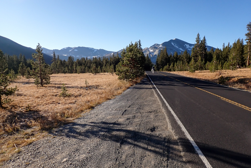
We planned to ride about 20 km from Ely, almost to the top of Robinson Summit. It is 125 km from Ely to Eureka, the next water resupply so we were pretty heavy with water, nearly 30 L all in all. The afternoon was cooler than it has been and it was pretty windy with some cloud cover coming through. We enjoyed the ride once again and found a great campspot with some fir trees easily accessible from the road.
The weather certainly looked set to change, definitely the start of a cold front with high cloud this morning. It was also much cooler than it has been, just above zero DegC and the breeze was already coming up. We were expecting a headwind today and worse weather tomorrow. On the road today we had to complete the climb up Robinson Summit, a few km ahead, then drop down and pass Illipah Reservoir Campground which was about a 5 km detour off road if we wanted to go there. As we climbed to the top of the summit (2319 m) Mike started to feel more and more stressed about his rear wheel. It was not right, the brake was not usable and he knew for sure that the rim had been compromised, even though it was not obvious when looking at it, there could be a slight split in the sidewall. This was the rim we had ordered to Glenallen on the Richardson Highway, Alaska. At the time it was the quickest solution to get a rim from Anchorage. Although the make of rim would not have been our first choice, we were hopeful that the wheel would get us to the end of the trip. Looks like the rim is not cut out for heavy touring.
We stopped short of the summit and he contacted Brandon from Bike Hub Store in North Carolina who had been beyond helpful when my rim split in Shoshone, Death Valley. He was once again superb. He is an expert, being the distributor for rims and hubs of the highest quality, including the Andra 30 which is the rim we always ride and have clocked up to 50,000 km on. He cuts the spokes himself to the correct length and is just so on the ball that he is a pleasure to deal with. So a few e-mails and phone calls later we had a new rim, spokes and nipples on their way to the UPS Hub at Eureka which is the next little town along. They would arrive in two days and the postage was reasonable coming all the way from North Carolina to, well, the middle of nowhere! It sure is good to be back in the lower 48! Mike felt the stress dissolve as he knew that he would be able to build a new wheel easily with the best components. The rim we had bought from The Bicycle Store in Anchorage shipped to Glenallen was not a bad rim, but just not good enough quality for the heavy loads.
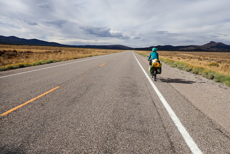
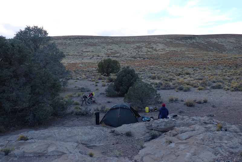
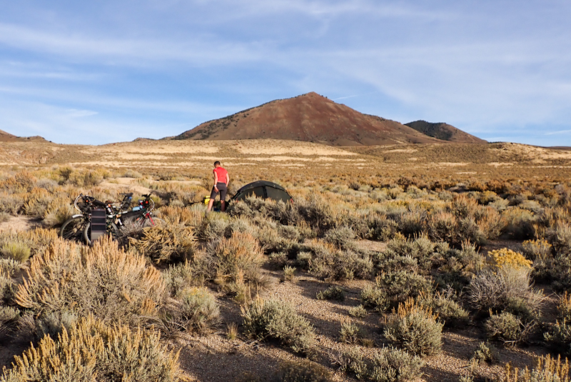
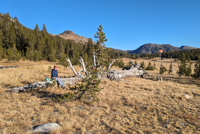
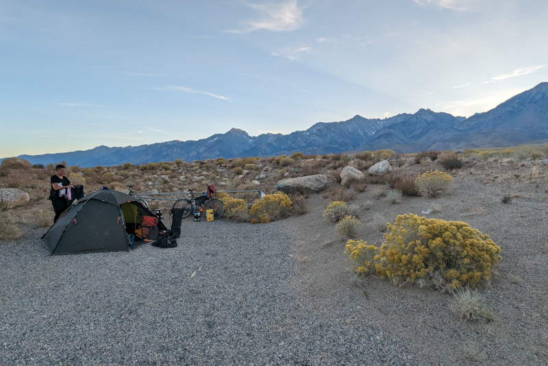
We took a rest after the summit and descent into the next bare valley. We sat by the fenceline and gated entry into BLM land looking at a herd of wild horses, drinking our flask coffee. The places you can get to on a bicycle! We decided to ride around 50 km today, so just beyond the reservoir turnoff. We did not need additional water and would not go to Illipah. We would have a rest day tomorrow as the weather was going to be bad, strong winds and some rain and anyway, we were due a rest day. We passed the reservoir turnoff and started the climb up the next summit, Little Antelope. The landscape has changed a bit since Ely, the up and downs are not quite as dramatic as the Great Basin area. It was a much cooler day. We passed a turnoff to a graval road at about 45 km and went down it. It took a bit of effort walking about but we found a great place to camp in the shade of a cedar tree. The area is forest but also used to graze cattle and so much of the earth was pretty churned up. Our campspot was gravelly and free draining in case of rain. We were exhausted, Mike particulary so with the stress of a problem rim on the Loneliest Road. We pitched the tent, had a 2 litre shower (reminds us of the Australian Trip through the desert), ate and went to sleep. It was a nice early finish and we had dinner later but were still in bed by 18:00, it was pitch dark by then.
Rest Day: 11 October - We had a restful day. It was much colder than it has been, only a few degrees above freezing. The weather came through, a couple of fronts. One brought rain before 08:00, the next around 10:00 brought snow! We were so happy to have taken the day off. It seems so strange to see snow falling in the desert, but we are at 2300 m so it would not be too unusual. Mike worked on our route going forward. Strange to think that by this time next month we will be home. We have decided to forego State Route 95 south from Fallon and will instead ride the 50 all the way to Carson City (capital of Nevada) before going south on the 395. We rode a bit of the 395 near Olancha after descending from Lake Isabella in March before Panamint and Death Valley and really liked the road. It is a highway but has a really good shoulder. It gives us the chance to branch off to Yosemite and perhaps Sherman Pass and then rejoin. We will then enter LA, we will decide later but will probably take the train in from somewhere out of the city.
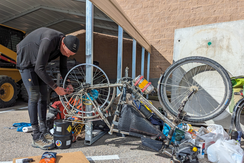
It was pretty chilly up on the summit of Little Antelope this morning! Some more frozen white stuff fell from the air all over us, super dry and tiny balls of white snow. We got going in winter gear - warms jackets, long tights, and heavy gloves not to mention buffs, balaclava, beanie etc. We could not believe that two days ago we were seeking out shade everywhere and wearing suncream. The winter that had nipped our heels in Alaska had finally caught up to us in Nevada! It was a bit windy too and cloudy. We finished the climb and then hurtled down the descent getting colder as we dropped into the Newark Valley. We rode along the flat for some time and then up the cruisy Pancake Summit. We took a break before the climb up Pinto Summit, the last before Eureka. We had our flask coffee in the shelter of a pile of snow dusted gravel and then set off. The headwind was very cold and the climb ended up being quite a slog. The descent revealed a large, crazy cloud sort of swirling all around us and starting to dump fine rain or sleet or something on us. Luckily we could just pull into a Lion's Rest Area just before the town and sit undercover. We were freezing. My hands were goners. I took out a pair of handwarmers desperate for warmth. We had only a few km to go to the town.We would actually ride straight through Eureka as everything we needed sat just outside on the far side. It's a bit of a weird set up, but the major store for groceries, hardware etc. plus the fuel stop, called Raine's, is actually out of the town. It is a very new building with a large carpark which can accomodate RVs and campervans etc, so that probably explains it. We were happy being there. The UPS Store is inside and they had Mike's package right there for him, he could just grab it. The UPS truck had actually passed us this morning driving from Ely which was quite exciting! Mike set himself up round the side of the building, sheltered from the wind and started dismantling his rear wheel. It still wasn't obvious what was causing the brake judder, but there could have been a hairline crack in the centre webbing of the rim between the spoke holes which pushed apart when under pressure. There was nothing on the outside which looked to be a problem.
I went to see what hot food they had on offer and we were impressed! Pulled BBQ Pork sandwich, mac' cheese, cheeseburgers. Delicious! We ate as it was midday and then Mike continued with his job. A bloke who worked in the grocery store offered him an area in the store to use to build the wheel, but Mike was happy outside on the bitumen. Later on he came out for smoko (the bloke from the store) and chatted to us. He was impressed by Mike sitting looking so "chilled" building a wheel just like that, "don't you like need a stand or something?". It's amazing to see him build a wheel just sitting on the ground. One moment there is a rim, some spokes and a Rohloff hub, next thing there is a wheel, so strong it can hold all that weight on the back of a bike. Then the bloke asked if we had any weed. We said no, he said "no worries, just wondered". "These climbs are hard enough at altitude without smoking anything!" I laughed. I went back into the store and bought a bunch of things we needed for the next 4 days or so to Fallon and then unpacked my bike to pack some of it away; the rest goes in Mike's bear container which was currently acting as a wheel truing stand. Multi-purpose! The weather had improved greatly and it was a sunny day. So much so that when it came time to leave Mike put on shorts and we both shed a few layers. We filled up with water and then hit the road. It was about 15:30 so we had been there quite while! The shop was really nice, good stock and very nice people working there.
Mike's new wheel was beautiful. It was one of the wheel builds that went so well, the wheel pretty much fell into place. What a difference having high quality components! We set off and it was a lovely ride, about 20 km further along the road. Amazing that we could still put in an 80 km day and he could also build a wheel. So even with a major gear setback we had not lost any time. We found a track leading into BLM land in a valley where we were surrounded by a ring of hills. Perfect. We went a way along until we found a bare patch of sandy ground to pitch the tent. Sunset is now around 18:10 and it was already 17:00 but we did not have much to do besides pitch the tent and have a super quick shower. Not that we had even sweated today! In the tent by 18:30. Very cold again. Hopefully as we are much lower down than last night there will not be snow!
Wow - coldest night yet! Minus 9.9 DegC. "But it's a dry cold!" although true in these parts was literally cold comfort. I slept in a down jacket for the first time ever. We have not been wearing our double wool leggings as the weather has not required it. Mike put his on around midnight. The morning dawned wide open, clear skies, sparkly tent, ground, bikes, bear containers covered in ice. Gloves on! We set off later than usual. The ride was straight forward, not much in it. Hardly any climbing, but we both felt tired. Maybe all the stress and busyness of yesterday? The views on the 50 are still magnificent. The road has a rhythm, gentle climb uphill to a summit and the coast down the other side into a new valley. It is a great ride. The high point today was Hickison Summit after which on the downhill Mike spied a grove of fir trees off the road. We pulled over and he went to inspect. There was a dirt track that led from the road and curved round to a little low lying area amongst the conifers, a hill between it and the road which was quite rocky and offered useful boulders to lean against or sit on. It was a great campsite. We needed an early fiinish. There was plenty of horse turd about and later after a relaxing afternoon we were observed by a mother and child burro (donkey) on the hillside opposite. We appeared to be trespassing on their spot! They stood there for ages and then moved higher up the hill. We would not have mindeed sharing with them. It will be a cold night again tonight but the weather is supposed to warm up again. Tomorrow morning there is to be a partial solar eclipse so hopefully it will be a clear day.
The weather has turned warmer, it was just under zero DegC when we woke up. We got going and after a few km downhill we started the next climb up Bob Scott Summit. The road was fairly busy and we think that people are travelling this way to view the annular eclipse. Baker and Ely were supposed to be good viewing places for it. We pulled off the climb at 09:20 to wait for it. Mike made a pinhole in my state map of Nevada so we could see how much of the sun was blocked by the moon. DON'T LOOK AT THE SUN!! Is important advice when an eclipse is on and we didn't have those special glasses. It did get a bit weird with strange light, and everything went quiet, and then after about half an hour everything was back to normal. We finished the climb, steep descent and then straight into the next one, Austin Summit. This one was longer, a bit switchbacky without having any real switchbacks and a bit steeper. The drop down into Austin is STEEP and just very immediate. We were happy not to be riding the road the other way around as to climb out of Austin would be brutal. We pulled into a beautiful park with kiddies playground, swimming pool (closed), many bins and BBQ's and water available. We filled up our water bags and bottles for the next leg to Fallon (180 km or so) so that was about 26 L. We chatted to a lady from Washington State who had come to take care of her friend recovering from a stroke in Pahrump, Nevada. He had unfortunately been hiking the PCT when it happened without any warning. Another lady from Sacramento, California also chatted to us. We rode through the town and stopped at the gas station for petrol for our stove. There was also a food truck there which made hamburgers, but it was closed. Why would it be open on a beautiful Saturday? We bought some ham and had sandwiches at the turn off to the 722 which is the state route we are taking off the 50. This is actually the original road which was diverted as Caroll Summit, the highest climb on the road, was often snowed in and necessitated road closures.
We were happy with the 722, as you ride along it you face south down the Reese River Valley until the road takes a bend. After this it is dead straight for about 15 km until it takes another bend. All this time we were climbing at a low grade towards Railroad Summit. Along the road there were a couple of ranches and a few herds of cows. We have been seeing this in the valleys crossed by the 50. The other straight things were the two snakes we saw lying perfectly still on the road, just tongues flicking. They might have been rattlesnakes, we have never seen one. They made no attempt to get off the road. The road is pretty quiet as an alternate route. It does feel like a pretty lonely road.
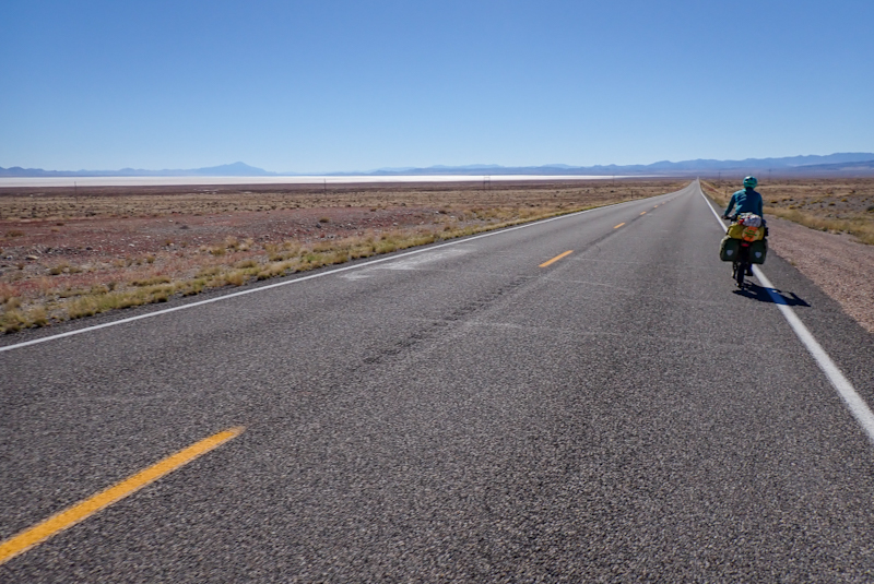
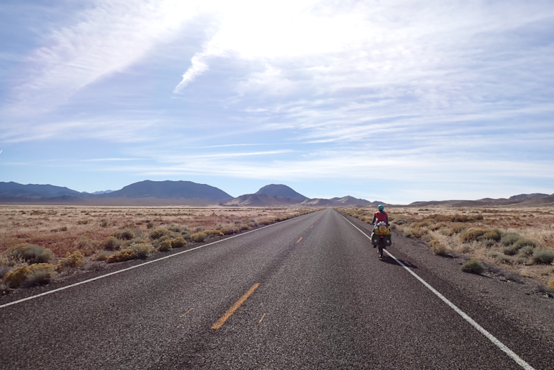
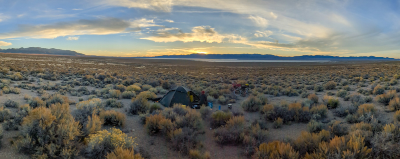
After the summit we dropped down into the next valley, passing Iron Mountain. The valley had a massive salt pan which was a surprise. We descended for a few km, actively looking for a campsite. It was getting late, about 16:00 when we saw a track going off the road. We walked along it and it led to a natural gravel area which made a lovely campsite. We were exhausted! It felt like a long day and we felt that we had travelled far. The sun sets at around 18:15 so a 16:00 finish does not give you that much time to unpack, pitch the tent, shower, cook and relax. We were both sort of staggering around trying to get it all done. Not much down time! We got a litre of gatorade into each of us (we carry the powder and mix it up) and that helped. It was a superb campsite, after all the housekeeping we sat and watched the sunset. It is completely quiet, we have seen about three cars go along the road in the last 4 hours. The views of the sun setting behind the mountains bordering the salt pan were amazing.

The night passed silently. Dead quiet. A beautiful spot. Cold morning, minus 3.5 DegC. We watched the sunrise over the hills across the salt lake while having breakfast. We could see our road slide into the distance until it disappeared at the next mountain range. It was a quiet ride through the valley, pretty flat until it crept up towards where we would start the climb up Carroll Summit. We passed a ranch and tried not to disturb the cows. We stopped for our flask coffee at a turn off along the road. The bull in the paddock nearby immediately took offence to our presence, bellowing and huffing. There are ranches in every valley and before you even know that one is there, you will see a group of trees which every farmer will plant and which have probably been there for over a hundred years. The ranch will have cows and green patches where hay is grown. Right now hay is busily being prepared and stored under large shed roofs. We have been passed by many a truck stacked with bales of hay. From the spot where we stopped for coffee we could see the road disappear into a deep sided canyon.
The road wound up inside the canyon. It crept around bends as it made its way towards Carroll Summit. It is a very picturesque route and a brilliant surface and we were amazed how few motorists use it. We loved riding it. We chased many small herds of cows on the open range. Cows can never figure out cyclists and will always run. After some time we arrived at the summit and the descent was as good as the climb. The road quality actually improved as it twisted around bend after bend making its way down. There was even a little stream following the road that looked fresh and good to drink. We stopped for a rest at a little picnic spot. After Eastgate we rejoined the 50 and were quite disappointed as we had so enjoyed this alternate route. The rumbles became a problem on the 50 for us now as they took up almost the entire shoulder. It was totally ridiculous. Just give us a place to cycle! The road was pretty busy too when we joined, but luckily not in both directions at once. After a while the shoulder was actually falling apart under the rumbles. We just hoped that the cars could see the problem. No one seemed to mind us being on the edge of the lane. At this point we were still descending into the Dixie Valley. This area is all part of the US Navy. The B-17 range is here and they fly manouvres over Dixie Valley. There is a large salt pan at the bottom of the valley. Just at Fallon is the Topgun Naval Air Station School and we saw those aircraft flying daily over Panamint Springs in March/April so they use a large part of the airspace in Nevada too. Being Sunday, no manouvres today however the sky above the valley was criss-crossed with civil aviation flight paths.
Due to the military presence, no camping for us until we climbed to the top of the next summit and found a strip of old highway blocked off on both ends by piles of gravel and chevron signs. Perfect! Another winner campsite, easy to get to and completely out of view of the road! We ended today at 15:00 after a good day's ride and relaxed for some time in the shade of our bikes before sunset.
We had around 3 km to ride to the top of Sand Mountain Summit and then we descended into a wide salt pan valley. The road stretched straight on through the salt flats. On our right was the massive sand dune that is Sand Mountain which is formed by the sand blowing off the salt flats. We stopped for our coffee break after 30 km, when the road left the salt flats and we were entertained by the antics of the Top Gun school pilots in their B-17's flying manouvres over the valley floor. Flying in pairs so close to each other at times they would seem like one aircraft. After this it was around 20 km into Fallon. I was not feeling great, hayfever! There is a lot of hay around so not surprising. When we got to Oats Park in Fallon to fill up our water bags I took some hayfever medication and felt better. We take antihistamine nasal spray every day and Clarityne tablets, however every so often you sort of think, "Am I really going to keep taking this stuff EVERY day for 8 months?". We underestimate all the stuff we breathe in as we are outdoors ALL day EVERY day. Poor respiratory systems have a lot to cope with. And we are always going to a new area with new allergens. Not to mention the overloaded hay trucks that drive past us (they are the worst, nothing causes as much backdraft as a hay truck) and shower us with the stuff.
We went to the post office as Mike has been trying to organise a USPS shipping label. What a drama this has been. Not for the first time trying to do business online in USA with a foreign credit card is a debacle. One merchant actually told Mike to "get some actual cash or money order" and then try to submit an online order. She sounded as if a foreign credit card was an insurmountable problem. Anyhow, post office visit was no help. We ordered a Dominos pizza online (amazing that, you can get a pizza no problem, in fact they will make it for you in good faith that you will pick up and pay) and then went and sat in the shade behind Safeway. Mike walked over to collect the pizza. I picked up a bottle of Canada Dry at Safeway. We planned to go over to a nearby park for a few hours as it was a pretty warm day and then press on when it cooled down, however it was pretty comfortable behind Safeway; no one bothered us or even came there. So we just stayed there for about 3 hours. I went back in to do some more shopping at Safeway, some supplies for the next few days, including a tub of mint ice cream to eat now. Then to Big 5 Sporting Goods as I needed a better sunproof top to ride in. My little Smartwool lightweight hoodie has allowed me to get a proper tan on my back which is not really the outcome I was looking for! It has worn thin though, Moab (where I bought it) was a long time ago The elements are pretty brutal on clothing. I replaced it with a white (I know, there was no other choice....it won't be white for long) long sleeved UPF 50 Columbia special sun resistant number.
We set off around 15:00 and it was easy to get onto the 95 south. This road goes all the way to Los Vegas, but to start with crosses some pretty desolate country. It took a while for the Fallon farmland to run out and we were back in the desert. The road was good, the rumbles did not cause any issues. As we worked our way towards a range of hills the road became perfect! It seemed very new and the pavement was very fine, the rumbles completely under the white line only and the best thing was the road was so quiet! There were many trucks and other vehicles on it but the road surface seemed to dampen the road noise. After a small climb it was downhill into the next valley and we could see an old road to our right which we could push the bikes through some bushes to get to, great gravel campspot once again. Some thorny bushes though. The northerly wind came up and it was a little overcast and quite warm. We were only in the tent once it grew dark.
The 95 continued in fine form today, a beautiful road, perfect surface, A plus plus for the builders, one of the best roads we have ridden in the US. We had a bit of a climb before dropping down to Shurtz, a Walker Indian Reservation. They had a lovely park/picnic ground and as always in indigenous villages we just had a lovely relaxing time. The tourists don't come to these places, they have great facilities and don't do stupid things like put padlocks on the spigots as they do in other places and then you are stuck filling up water bags from a bubbler. The best thing? No one comes and bothers us. It might sound selfish or arrogant or anti-social, but one downside to living in the public domain is that people don't really think you have personal time. We might be exhausted from the day and just want to sit and stare into the middle distance and then someone comes along to tell you their life story. Anyhow, we loved this spot and spent a couple of hours there.
Continuing south along the 95 it is joined by the 95 Alt and both roads had some road work going on. Both roads looked to be perfectly surfaced as well. We hit a stop-go as we approached Walker Lake. We were able to ride it as it was 3 miles long or so even though there was a pilot car. It was pretty cruisy as the wait time was so long that we did not have traffic in our lane for ages afterwards. It is amazing being back in the Lower 48 to see the number of trucks that drive up and down these roads day and night. To us it is a marvel.
We decided on a short day as due to military land surrounding the next town of Hawthorne, we would either have to ride well beyond it or stop short. We went for stopping short as there is no rush for us in these last 3 weeks of the trip. We saw a track going up steeply off the road towards a rocky outcrop. This allowed us to get off the road and provided a great campsite. The rocky cliff gave us shade all afternoon and later we moved nearby to a flat area to camp. The views of the surrounding mountains and the lake far below us were magical. We could see Hawthorne across the lake, 30 km away! After we set up the tent and put our stuff inside, we left the doors open as we usually do and sat around outside for a bit. As I walked back to get into the tent I saw a huge desert tarantula tiptoe along right there. These things are huge and scary and very interesting to watch as they walk along in slow motion. Mike took the trowel to scoop him up and tossed him far away. A bit creepy and it's not even Halloween yet. Hope he does not come back. Snakes, spiders, bears, whatever, they are probably always around the tent; we just don't see them. Luckily not bears anymore. We can hear the coyotes howl again tonight. Maybe they will eat the spider.
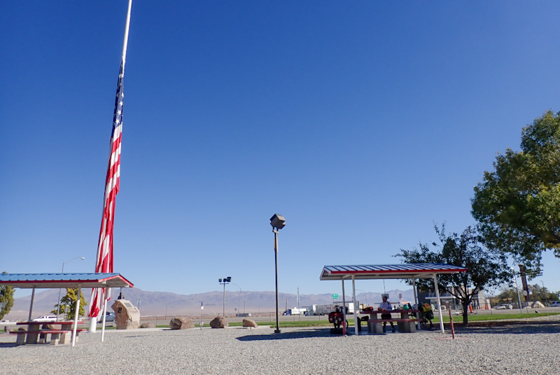
My right knee has been painful during the night and on waking and I have thought it is due to sleeping with it at a strange angle, but this morning it was particularly bad and so I took ibuprofen and hoped for the best. It took about 2 hours to work but the pain was gone by the time we reached Hawthorne. Yippee - I gave it a stern talking to en route... "only 2 and a half weeks to go knee!". The ride to Hawthorne was great, all along the lake with high rocky mountains of the other side. Signs warned of a MAJOR sheep crossing, the big horn variety, but we saw none. As the stop go was still in action we had long periods with no vehicles passing us and when they came, we pulled off the road for a bit. May as well have a road to yourself if that is an option! As we neared Hawthorne we could see the ammunition storage bunkers, they look like concrete sheds. Hawthorne's claim to fame is "The World's Largest Army Ammunitiion Depot". Even long after the town there were ammunition storage buildings, not sure if those ones were in use but they weren't fenced off or anything. Next to the ones in town was a reservoir and water towers, but as Mike said, if things started going off the army would just roll out of town saying, "Goodbye Hawthorne". The town feels just like a military base. The veteran's memorial park has the biggest US flag we have ever seen. If it unfurled in the breeze it might engulf you sitting there on a park bench. Mike filled up our water bottles and bags at the little sink in the restroom as the bubbler was not working and there were no taps to use. We shopped at Safeway again. We ate cheese and tomato buns at the park and then rolled out of town around 12:00. I took another inbuprofen, knee was good which was a relief.
We had now left the 95 and were on the 359 which is a short road which leads to California. Back to the start! It is also quite a climb and the first 10 km or so a bit of a slog. How is it that after over 7 and a half months of this (honestly, we have only 2 and a half weeks left) after resupplying with food and water the bike still feels so heavy. It doesn't get easier! The weather is still good though, warm and sunny, slight breeze at our backs. We did work up a sweat going up the hill today. The 359 is a quiet road, we only saw a handful of cars the whole time. At the start there is a sign warning that the road may flood 15 miles further on and then the lights on the sign will flash. It was strange going along the road and seeing many large pine cones strewn about on the edges, even though there were no trees in sight. They must have been washed down by flood waters from the forests high above. Wow, when we got to the flood prone area the evidence was impressive! The road itself was fine but you could still see the mudslides that had come down from the mountains with the snow melt. There were tree trunks and banches and the culverts were buried. Over a large area too.
We pulled off onto a dirt road to rest in the shade of our bikes and eat some bananas. I lay back in the shade to rest. A car pulled off the road to find out if we were okay or needed anything! Then a few minutes later a ute turned onto the track with three blokes inside and they also stopped to offer assistance. It was nice! We came across a gravel pit around 15:30 and as we did not want to go much beyond 16:00, we decided to stop for the day. We still have around 10 km to climb to the top, but after over 800 m climbing on the day filled with food snd water it seemed enough. We are pretty tired! The area is small gravel aggregate dotted with small bushes. No tarantulas yet!
We had planned for a rest day today, but we didn't get into the tree zone last night on the climb, so opted just to get to the summit today and then have the rest of the day off. Late October in Nevada is still not cool enough to spend a day without shade. The climb up Anchorite Pass starts just before Hawthorne and is 1100 m elevation gain. It took us 90 minutes today to ride the remaining 400 m we did not climb yesterday. We had a late start, sleeping in til 07:30. The gravel pit was just next to a US Army Munitions Demolition area. When the red flag is up they are busy with demolitions. We did not hear any booms, although there was a sign much earlier on the road which said the road was closed everyday of the year between 07:00 and 09:00. As we were on the road at 09:00 we fiigured we were safe!
The climb was fine, it is always so much easier to face the remainder in the morning rather than in the setting sun. My knee was quite stiff and sore this morning. Come on knee, not long to go! As we hit the summit we saw two Nevada DOT (Department of Transport) workers busy pounding a metal pole into the ground. They have been busy replacing the small reflectors on these roadside poles all along this road. They were friendly and we stopped for a chat with Jimmy and Jerrod. They were from Nevada and had a great sense of humour, telling us that it was all downhill now and we would have food, water, people and civilisation down there. They agreed that replacing these reflectors was a waste of time as they would all be run over in a few weeks. We had a laugh as we said we loved Nevada and they said that would come as a surprise to a lot of people. After our chat we pulled off into the bush along a track and it was not hard to find a campspot amongst the fir trees to while away the day. Very relaxing! California tomorrow.
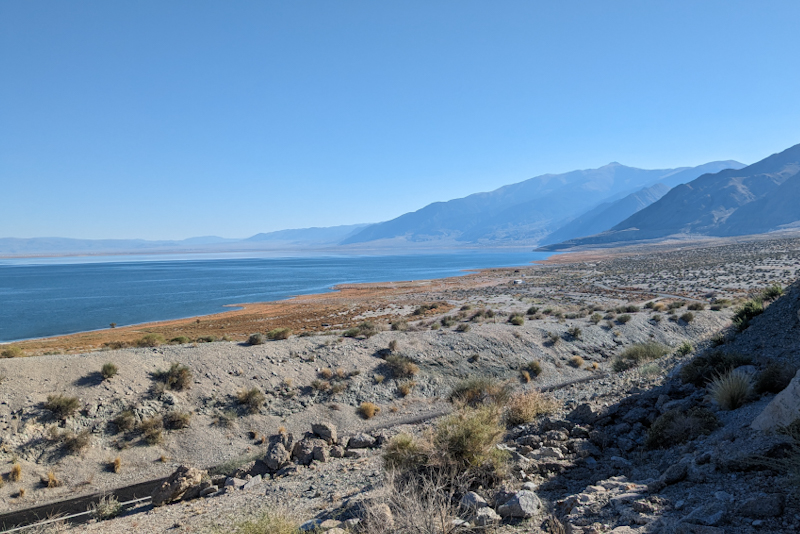
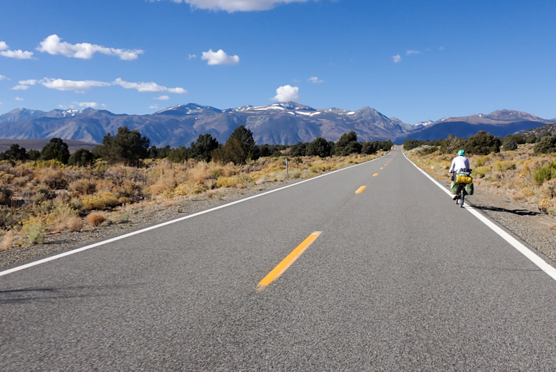
Straight downhill to California where the 359 became the 167. Views of snowcapped Sierra Mountains all the way! Beautiful. We turned left onto the 395 at Mono Lake. This area is wide open, we could see a very long stop go in operation to our right , this must be the roadworks still on the go to clear up the damage from a slip on the mountainside earlier this year. The slip was caused by the massive late snowfall. When we were in Panaminnt Springs this section of the 395 was closed. Joining the 395 it is a very impressive road, beautiful surface and wide shoulder. Great riding.The shoulder disappeared completely for a few km but Californian drivers are very aware of cyclists and also that stop go meant we could time it to coincide with a break in the traffic.
We arrived in Lee Vining and took a lunch break at the community park. It is a great spot. There are plenty of benches under the cover of solar panels! We met Tom from California out here to photograph the fall colours which are quite the tourist drawcard in these parts. We had seen the orange swathes of aspens creeping up the slopes of the mountains as we drew near. After the break we turned off the 395 onto the 120 which is the Tioga Pass Road that is the eastern entrance into Yosemite National Park. The road is steep in parts. It had a good shoulder for the first few km. It is a 20 km climb to the Tioga Entrance which is at 3030 m. From the turn off to the 120 it is a 950 m climb, so this is not for the faint hearted! We stopped after a few km at the water fill station which was... CLOSED for the season. You could have guessed it right? A bit pissed off we continued. Luckily there are running streams up here! The Tioga Pass Road runs through the Inyo National Forest and there are many pay campsites along it. They are all closed except for the Lee Vining Lower which we passed. National Forests usually allow dispersed camping, not so this one, for obvious reasons (it is the gateway to Yosemite and so sees a huge number of visitors). We pulled off the road at the Poole Power Plant Road and could easily walk our bikes along the pathway that runs beside the Lee Vining Creek. It has been so long since we have seen such a beautiful creek, crystal clear with lovely swimming holes along it. We found a grassy patch to relax away the afternoon and pitch our tent when it grew dark. We had a wonderful, cold, proper river swim in the creek. Amazing! Mike last had one in Denali National Park, I can't remember when I last had one! There are massive fir trees here with HUGE trunks. We wonder if the are sequoias? As we are in a pretty deep valley we lost the sun quite soon. Tomorrow we will climb about 850 m in 14 km to get to the top of the pass.
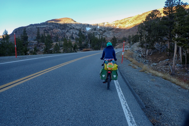
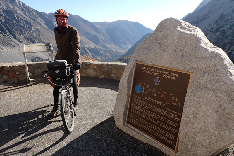
Perfect day for the big climb up Tioga Pass! Sunny, cool to start and no wind. We got on the road around 07:15 and there were already cars driving along it to Yosemite. The first 10 km were hard work at times and the last 4 less so, but we did well. The climb took nearly 2 hours with an average speed of just less than 6 km per hour. It was a beautiful climb. The views were great, still some snow about on the craggy cliffs of the Sierras. It is always best to get right into a climb from the first minute, you seem to settle in quicker and your breathing stays under control. When we turned onto Tioga Pass yesterday after a pretty easy ride up to that point, we were instantly out of puff. When you start off at 7 km per hour you don't really have a chance! It is so amazing after the desert (which is really only about 40 km away, to have towering trees, running streams and full reservoirs! We stopped for our flask coffee after about 10 km and sat on the banks of a reservoir, it was a beautiful stop. After another kilometre we reached the Saddlebag Lake turnoff which leads to a pretty rough gravel road. We found our camp spot after a few hundred metres. A pebbly area next to a clear, bubbling stream with a deep swimming hole and lots of shady trees. We relaxed all afternoon. The road was quite busy with cars going to and fro, but due to the poor surface they went slowly. Some fly fishermen came along and fished, one caught a fish after only a few minutes! Tomorrow the plan is to complete the climb and then maybe drop down slightly into the national park, we will see how busy it is. We will then ride back down Tioga Pass, into the desert! Our current elevation is 2920 m. We climb to just over 3000 m in a couple more kilometres.

Cold night, minus 2.7 DegC on us rising, minus 5.1 DegC when we left, the temperture always drops as the sun rises. Perfect day! We rugged up and rode the other 4 km or so to the summit of Tioga Pass and the entrance to Yosemite National Park. We dropped down a few km to a viewing area. Interesting that here motorists are not permitted to leave any food or food storage containers inside their vehicles when parking to go for a hike or overnight. There are food storage lockers at every parking area. Bears try to break into cars to get to food! We stopped at an open meadow and admired the view, sitting on a log drinking our coffee. We had long since decided against dropping down the to main valley of Yosemite. There is only one campground open and it would not work for us to ride there down Tioga Pass and back again. Also, we are not interested in busy tourist traffic. Too hectic. We loved our time here and the camping experience we had in Inyo Forest. We climbed back up to the gate and then flew down Tioga Pass. It was only in the dropping down that we appreciated the steepness of the climb up! It is the highest road for automobiles in California. It is a beautiful road.
It was pretty windy at the bottom. We filtered water from Lee Vining Creek and rode down the rest of the road to the Mobil gas station on the corner where we bought some food. As it was a Sunday, this was a pretty busy spot with motorcyclists out for a group ride and so forth. We were set to travel a few km down the 395 before turning left onto the other part of the 120. We decided to do this before we knew it was going to be a raging southerly wind, boy were we glad we did! The 7 km we had to ride into the wind were pretty bad, so it would not have been good remaining on the 395 any further! The 120 is a great little road and the view of Mono Lake from this side were stunning. The hills ahead were pretty dramatic too. We rounded the bend into the southerly wind again and could see the forest we would be camping in. Big pine trees appeared suddenly after the huge flat plains that run up to the lake shore. The forest had a grey gravel floor, the trees spaced far apart with pine needle strewn areas at their bases. The pine cones are huge! The biggest we have ever seen! However the gravel was also the softest we have ever experienced which made it impossible to push our bikes so we unpacked and carried our stuff in. The wind continues but luckily it is forecast to shift to a northerly tomorrow! Apart from the wind, perfect weather day.
Today was one of the most diverse scenery-wise days of the trip. We started off in the forest and along the road an information board about the Mono Craters (volcanic structures) explained the soft gravel - it is pumice stone. We stopped again at the historical site of Mono Mills, the sawmill which provided wood for the gold mines at Bodie via narrow gauge raillway. There was a lovely picnic area and lots of information about the hive of activity we would have found had we been here in the 1800's! We were particularly impressed by the descriptions of the woodmen who would chop down massive trees in the forest and have to haul the heavy trees by mulecart from the hills to the mill, through the soft pumice gravel! As Mike said, pointing to the photo of the heavy wooden cartwheels, "Imagine how this would have sunk if we have to drag our bikes through the stuff!". The 120 road was so pretty as it wound through the forest, but also very hard work with short steep climbs. As with minor roads, they lack consistency in grade so it is hard to get momentum. We stopped for our coffee break after riding 9 km in 90 minutes! We were pretty tired. It was an overcast day but we were warm due to the climbs, however with a downhill coming we put on gloves and beanies. Suddenly we were out of the forest into desert again! We cooled down quickly and had to stop to put on a warmer jacket and gloves (me) and buff and gloves (Mike). We had another climb but it was so cold now (5 degC) we did not even get very warm, it wasn't very steep. So after 15 km we were back at 2500 m.
We stayed in the desert, descending right down past a canyon until we were in a valley again. It was beautiful. Then more climbing, again short and steep climbs which nearly finished us off. We rested at a track which went off the road to a lake. We had lunch and a little sleep. After this things improved, we had a lot of downhill and the climbs were not so steep. We climbed up finally past beautiful rock formations and then dropped down into Benton. Throughout the day we had benefitted off and on by a northerly wind, after Benton it would drive us home.
Benton is tiny, its drawcard is hot springs just outside the village. It lies at the foot of the White Mountains which cross from Nevada into California. They are not a long range but boy are they impressive! So high! Most of the day we could not see the tops, but we could see the clouds bringing snow to the higher peaks. We saw this before Eureka on the 50, the cloud seems streaked in rain but doesn't move, so you know it is freezing rain aka snow. This is just based on our observation! Sure enough when we got to Benton, the clouds had cleared and we could see the dusting of snow over the peaks. Some of them go to over 4000 m! We picked up water at the community park (very nice toilets!) and rested there. We went to the slightly strange Smalley's Store to pick up bread and cottage cheese (our new protein source and easy to come by in California, even in the smallest place). Smalley's had a great selection, if small. We got the nicest bread there. He also seemed to sell rocks. There are many around here to be fair. Going around a corner in the poky little shop I almost walked into a tiny old lady with a tiny dog on her lap sitting on a big wooden chair. Maybe Mrs Smalley? Or Smalley's Mum? She just stared at me. I happily walked out with my purchases, including a pack of mint Oreo cookies. We jumped on our bikes, into the path of a roaring tailwind and the next 22 km or so went in the blink of an eye! We were now on US Route 6, the 120 ending at Benton. This is also a great road, some trucks on it, but being California they give us plenty of room. The 6 runs along the base of the White Mountains on the left and to our right we could see the towering Sierras. We flew along the valley, which is all ranches. Green fields of hay, cows and horses. The tailwind was amazing after our slow morning. In the end our average speed was just under 20 km/h, which was pretty good. We pulled off the road onto a small track into BLM lands towards the White Range. We ate our cottage cheese sandwiches and the Oreos and then showered, and into bed.
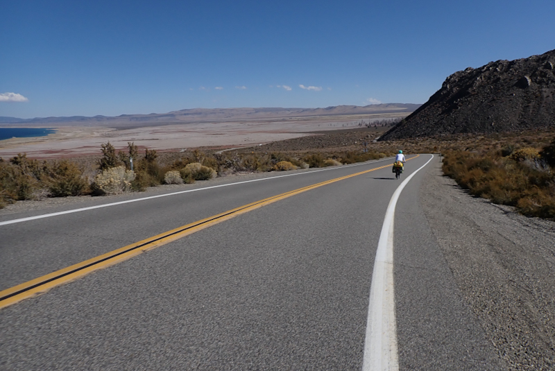
We heard coyotes again last night and the distant noise of trucks but that was all. We hit the road and had a quick 30 km to Bishop. Here we shopped at Vons. This is like Safeway. Such variety, so much to choose from! It was a bit mind boggling. This was our last proper shop before The Sherminator (Sherman Pass, another one to the one in Washington State!). We went to a lovely city park with fountains, ducks and lovely green grass to eat and pack our food supplies away. Leaving Bishop US route 6 became the 395. It is so amazing to ride this road, between the Sierras and the White Range. The weather was perfect, a bit cool, a slight breeze. The views are amazing. The 395 is amazing too! Such a quick road with a WIDE shoulder. It is dual lane road and often a divided highway. We love riding it! We stopped again 25 km later at Big Pine to pick up water. We would have a slight headwind for the rest of the day, but as the 395 is infamous for its crosswinds which blow over trucks and trailers and make it unrideable for motorcyclists, we were happy with our lot. The day had very little elevation gain so pretty easy.
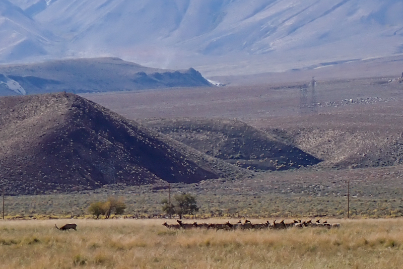
One impressive geological feature were the very dark, almost black and very jagged rocks all over the place. They were clearly volcanic and just strewn all over the hillsides, road margins and even the median area which divided the road. It looked like a massive explosion had happened at some point and this was the outcome. It probably had. A trillion years ago. The scrubland was becoming a bit more diverse, different colours and textures. For the first time on the trip, the "Wildlife Viewing" signposted area actually had some wildlife other can cows. Today we saw a single stag with about 20 does in the adjacent field.
As we neared Independence we saw a small pull in with a gate across it on our right. Mike checked and could see it was BLM land just reaching the road. It wasn't much, just a gravel patch but that is all we need. We sat down in the shade and just then a truck pulled in and two blokes got out. One said, "Hi, I am a trail angel!" by way of introduction. Well, we couldn't believe it! Of course we have heard of trail angels, but have never met one! His name was Jay (a nurse from Sacramento) and Jessie (who had just walked the PCT for a few months) was with him. The town along the 395 all act as resupply towns for the PCT hikers. When we ride Sherman Pass we will cross the PCT at Kennedy Meadows. Anyway, Jay spends some time when he is off work supporting the PCT walkers with food, lifts, etc. He whipped out two folding chairs for us to sit on and invited us to have a look through his food boxes for whatever we wanted. He gave us a gallon of water and I chose some gatorade powder, a bag of Doritos, some M&M snacks, some things to add to meals, and a huge bag of almonds! It was so cool and unexpected! Jay gave us his phone number in case we needed anything. It was pretty ineresting to learn about the network of support that is there for the walkers on the PCT. Jessie shared a lot of information with us about laudromats, places to shower and places to charge your electronics. In fact, both of them spoke of places to do laundry so often we got worried about what we must look like! They chatted for a while and then left. We took showers using our shower bag as usual just off the 395. No one looks anyway, they are all concentrated on the road.
The moon is waxing and rises early so it is very light at night. We sleep with the tent outer open and just the meshdoor closed on the inner to keep the tarantulas out! It was not so loud last night even though we were camped just off the 395! We aimed to get all the way to Fossil Falls Campground today. We camped there over 7 months ago after crossing the Sierras via Walker Pass. It was a big ask, 110 km and we have been riding quite hard, not long days but we haven't had a day off in two weeks. Anyhow, our plan was to aim for it and see how it went. It was a lovely ride through Independence (very quaint little village) and passed historic Manzanar. We turned off the 395 after almost 20 km to ride through the Alabama Hills west of Lone Pine. This scenic area was used in many western movies, cowboys and the other guys ambushing each other, etc. Think John Wayne and co. It is possible to access the area from Lone Pine, but for us it seemed better to do a loop. It's about 20 km from the turn off called Moffatt Ranch Rd as it leads to the ranch of that name. It is a very sandy track, sometimes unrideable due to thick sand and also corrugated in parts. That's washboarding for the American readers. After a while it changes its name to Movie Road, for obvious reasons. We should say though that had we not known about the movie link, you would never have guessed it, there are no cheap touristy gimmicks on the road or anything. The landscape is amazing boulder and rock formations all sort of tumbling across the base of the Sierras. The prominent Mount Whitney with its clear portal road looms over all. It is a dramatic area. We had to gain 300 m in elevation along the road before dropping down again. It was pretty slow going but not too bad. We got off the bikes to walk to Mobius Arch, a natural arch which is much photographed. At first we had a laugh with another couple as we thought this teeny arch which you almost had to lie down to see was it, but later found the real one! It was a beautiful day, not too busy. There was some impressive cloud cover coming over the mountains; there had been a cold front which dumped a lot of snow in other parts of the country and we presume the cloud was part of that system. We don't get clouds that look like that at home, that's for sure. Sort of massive waves of cloud. Hard to describe.
After the short walk we were back on the bikes and it was not long before the road joined the bitumen. It was a very worthwhile experience and we would recommend a visit. You can also camp along the road, but only at official dispersed camping areas. No facilities, but there was a lovely creek flowing near the start of the road. As we came to the road which would take us to Lone Pine, it was closed. There was a detour in place but that would take us back to the 395 after Lone Pine. We took a punt and went down the closed road, pushing the bikes between concrete blocks. The road dropped swiftly down towards the town, following a river course. We lost a bit of height and then the reason for the closure revealed itself, the road was pretty much gone, washed away by a very fast flowing river at some point. This went on for a few kilometres, until the road was back to normal just at the town. We were able to push our bikes through the debris, sand and bit of broken road surface. We rode through the town and stopped at the Eastern Sierra Visitors Centre, which was brilliant! They had plenty of tables to sit at and the centre itself was very interesting and had a great store which really nice local park merchandise on sale. I have been wanting to buy a Smokey the Bear t-shirt and found a really nice one so was happy with that. We chatted to two motorcyclists touring the area. Mike found a photographic record flip file in the centre which showed the damage caused to the area by Hurricane Hillary in September, especially to Death Valley. Badwater Basin was turned into a lake! Many roads were damaged and some are yet to reopen. Even the road past Panamint Springs is only single laned. As we rode along the 395 towards Olancha we saw Lake Owen full of water. When we were here in March it was just a dustbowl!
There were roadworks before Olancha. Basically what looks to be one of the last stretches of single lane road on the 395 is going to be reborn into a divided highway with double lanes in each direction. A huge project it would seem as riding along we could see the other half of the road quite some distance away starting to be built. It may be that the whole road gets redirected here. As we were going along on the shoulder of the single lane road we heard a low hooting from behind and a voice over a loudspeaker "We have a very large oversized load coming through. A large oversized load." This was the pilot vehicle. We pulled off into the dirt and about 5 trucks in a row past us, all with massive equipment of some kind. They are all friendly and hooted their appreciation. We reached Olancha and pulled into the gas station for one of the 16 inch pepperoni pizzas they make which we remembered from March. It was again delicious, however our stomaches have clearly shrunk as we could not wolf it down as we had the one 7 months ago! We had to take some of it away with us! It felt strange to ride the road from Olancha south again. We certainly never thought we would be back here! The mountain scenery is not as dramatic as it was further north on the road, but we were treated to a fly over of a couple of fighter jets! The divided highway resumed and we realised that as much as we did not mind the road, we were not going to get to Fossil Falls today. We saw a turn off into BLM Lands where there was a spot to camp and were happy to call it a day. /p>
We pitched the tent in perfect calm last night but when we got into bed a strong wind whipped up from the west. It really started hammering the tent. Mike put in pegs and guy ropes. The tent was very stable after that but the wind was really hitting it. We were worried about the ride today. Was this the wind they were referring to on the 395 highway signs which read, "Trailer and Campers - Gusty Wind Area" or "When lights flash gusty wind conditions exist"? We sure hoped not. We had 36 km to the turn off to the Sherminator and we did not fancy wind in that time, to say nothing of windy conditions on the pass itself. We woke to still blustery conditions, but as the sun rose they died down and by the time we left, like magic, no wind at all. Except for a slight tailwind!
We had 12 km to the Coso Rest Area which is a nice one and filled up with water from the water tap there. Unfortunately the water looked a little murky and tasted metallic. Cycle tourists however cannot be choosers, so we left with all our bottles full in the hopes we could find a creek on the climb somewhere. It was still water after all. At the turn off to 9 Mile Canyon Road, which becomes Sherman Pass later on, we sat and had our morning coffee. Then we were off on the climb. It was perfect weather, sunny with a slight favourable wind for us. We felt so lucky! We aimed to ride 16 km of the climb, this was 1160 m elevation gain which we reckon is as much as we want to do! The total climb in the first part is 1500 m. When you add in the second climb after Kennedy Meadows it becomes a scary number. You just have to break it down. The first 11 km went well. The road is very quiet, only a few FedEx vans, a few locals, one friendly trucker pulling two trailers and a Highway Patrol guy who pulled over for a chat and was super friendly. The road has a centre line most of the time and is sealed all the way. The views are tremendous looking back, or rather down as the flatlands of Inyo County just drop away. It is amazing how high you can climb on a bicycle! We stopped for lunch around 13:30. After this it got steeper, continuous 9% grade for nearly 3 km. Bit of a slog, but so nice to be on a quiet road so you can pretty much ride all over the lane. The roadside markers count up the miles and I guess when they got to 9 it was pretty much over, only no downhill yet! A motorcyclist coming the other way shook his fist, "Bravo!" he yelled.
As you leave Inyo and enter Tulare County there are a few buildings, a fire station and a house or farm settlement. No rivers running. Mike had a spring marked on the GPS and we walked down a track to find it. It was there, hemmed in by large green bushes and not so easy to filter water from, the level was so low. We continued to where the stream crossed the road and could walk in easily where it was flowing, to filter. The water looked great, clear, just a very small stream. A bright green frog hopped in and kept us company. We checked out the turn off to Chimney Peak Rec Area for possible camping but there wasn't anything suitable. We carried on riding. We were almost at 2000 m now and in the treeline. Not long after we could see suitable sandy camping spots between some pine trees and it wasn't too difficult to get in there. Mike ran the water we had filtered from the stream through our carbon filter as it had a bit of an earthy taste. We showered using the metallic water from the rest stop. It is going to be a cold night, it was only 2.5 Deg C at 18:30 so probably a cold morning too!
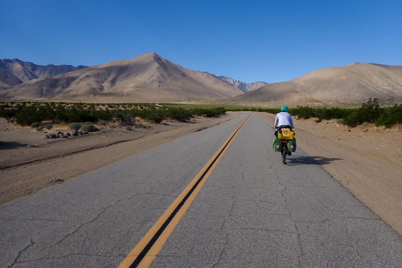
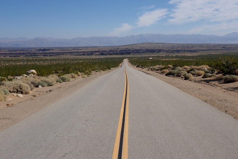
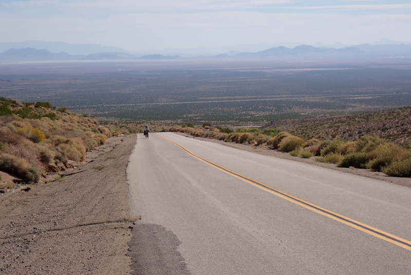
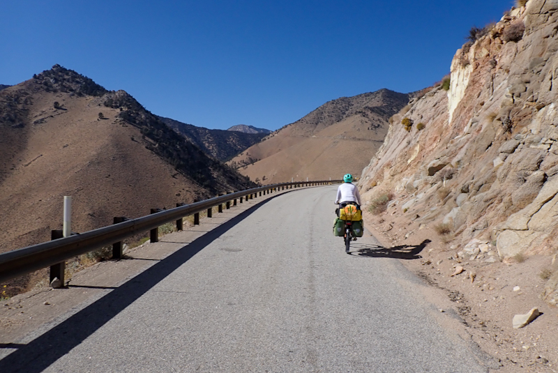
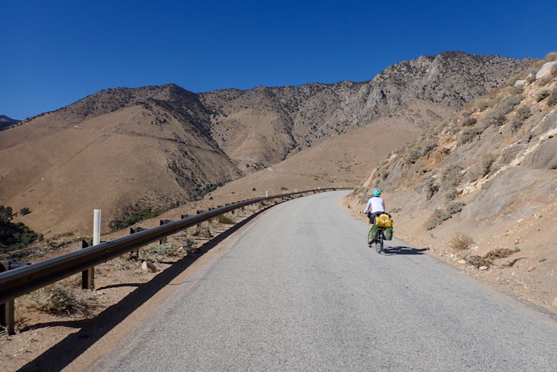
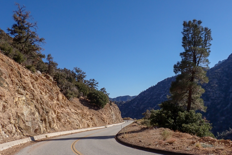
Last night I did some repairs, Mike's cycle shorts which had spit along a seam, and then finally removed a small splinter from my finger using a needle. It had been stuck in my finger since Mono Basin! We rugged up this morning as it was negative 3.9 DegC. We had only around 300 m to climb before dropping down into Kennedy Meadows. The climb got pretty steep, 10% grade and just over. The air is very dry up here, we camped at around 1900 m last night and this morning the ice on the tent and bear containers, etc. was very dry. We both had dry coughs. Luckily the descent was not crazy steep but we still cooled down a lot. We stopped at the Kennedy Meadows General Store for our coffee break. After our flask coffee I paid the store to fill up my flask again with their brew. I had considered buying one or two more pairs of hand warmers which I assumed they would stock, being a PCT supply store. At $4.99 a pair I thought I would rather suffer cold hands! Remind me of this when we descend 2000 m after the summit on Sherman Pass into Wofford Heights! We filtered water at the river a kilometre after the store and then crossed immediately into Sequioa National Forest. The road is now officially called Sherman Pass Rd. It is a narrow road, feels old fashioned. Quiet, beautiful. It winds up into the forest. It is another world.
We aimed for Fish Creek Campground which was a 12 km climb away. The climbing on the Sherminator is so far much easier than that of 9 Mile Canyon and the climb before Kennedy Meadows; generally about 6%. The ancient forest is spectacular, such a privilege to see, especially from a bicycle! It is impressive that there seems to be little evidence of fires so the forestry service and the users clearly take good care and manage the forest well. There are many OHV tracks and these are supported by the forestry service with instructions, requirements and warnings of consequences if not followed. We like how the National Forest and the Bureau of Land Management encourage responsible recreating. It feels like the National Parks almost discourage any use beyond driving a RV and taking photos.
We had lunch at Fish Creek and pushed on 6 km to a river which we could access along a track. Great campspot, great little river for water. It was nice to have a 14:30 finish, we have not finished early for a while. 950 m total ascent today in 40 km. We're camped at 2270m tonight. Tomorrow we climb around 750 m to the top at almost 2800 m. There is the chance of snow tomorrow night so we think it wise to get to the summit.
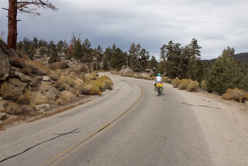
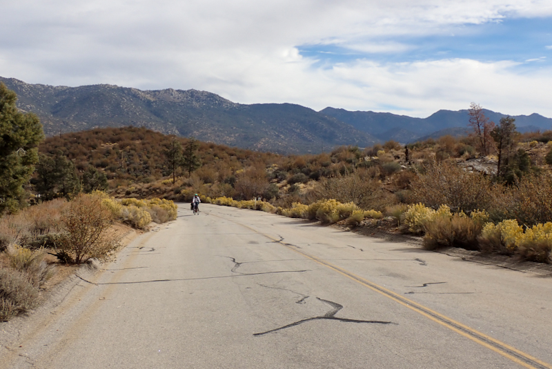
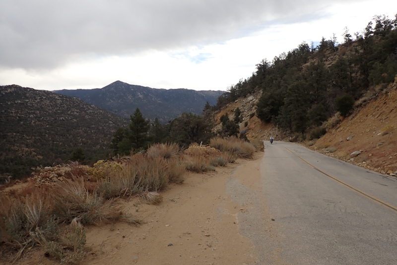
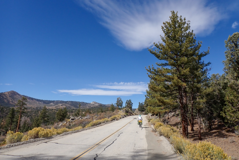
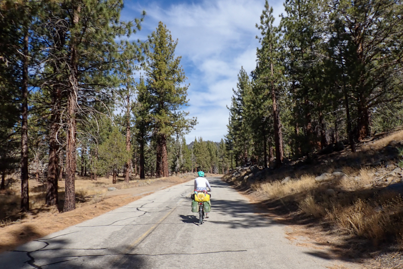
Very cold morning, minus 8.9 Deg C and almost all our water in water bottles froze. The ride was beautiful, the forest is glorious. There are now many snow mobile tracks signposted as opposed to OHV, so you know the sort of altitude we were getting to! We were very cold! We stopped after 10 km for our flask coffee. There were three climbs today, with the third being the steepest and the road dropped down in between. Coupled with a stiff breeze at times we remained cold. With 6 km to the summit of Sherman Pass we saw a sign to a warming shelter for snow mobile drivers or anyone else I guess. There was a large open area with a few tracks and the warming shelter, which was a lovely stable yurt located in a dip to take advantage of being lower down and out of the wind. We took a walk down there. It was a beautiful shelter with an indoor stove and there was firewood suplied in a storage cupboard outside. The yurt also had a picnic table inside. It was spick and span and looked really cosy. There was also a portaloo. Everything was maintained by the forestry service. We are aware that these warming huts or shelters are around in wilderness areas but it was the first one we have seen!
It was pretty windy up where we were (2623m) and we were worried that it might be even more exposed at the summit where we had planned to camp. After the summit there is a swift drop down and we did not want to end up camping in the valley. As it was only 5 km to go we decided to stay here and have a relaxing early finish. We spent the time reading and relaxing in the sun. It was a beautiful day but at 11:00 our water bottles were still pretty much frozen solid which was a bit of a surprise. Tomorrow we will get over the summit and continue down the Kern Valley to Wofford where we will meet up with Greg who we met at the Noobs Rally at Panamint Springs. It was already almost zero Deg C at 18:00 so who knows where the temperature is going to end up tonight. We love being up at this elevation and the road is super quiet which makes for an enjoyable ride, but we think that the Sherminator will be our last hoorah and we will remain at lower altitudes from now on.
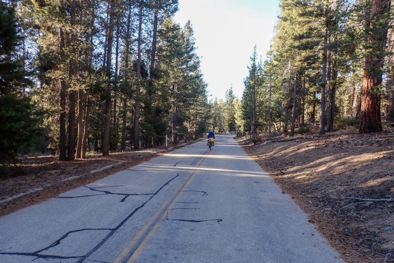
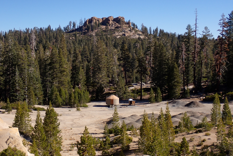
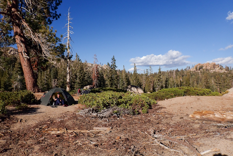
Oooh, cold night! Nearly 11 Deg below zero this morning. We outsmarted the temperature by using the old Alaskan trick of putting our water bottles inside the tent. It had been a full moon last night which had lit up the landscape. The rising sun this morning set the rocky hilltops aglow. We had 6 km to ride to the top of Sherman Pass and 2 of those were downhill so we rugged up, me back into double rain booties in the hopes my feet would not freeze (doesn't work, only psychic comfort!). Once again, we were struck by the beauty of the forest so patient in the morning light. Not a soul on the road except us. As the hill kicked, my right pedal started squeaking (like it did on the first day out of Salt Lake City), getting louder and louder, disturbing the peace. Mike was a way ahead of me. The squeak turned to a grating sound and suddenly, nothing. No pedal. It had detached itself from the crank and lay in the middle of the road. WHAT????! Whoever heard of a pedal UNSCREWING itself from a crank? We were mortified. Mike played around with the pedal, it was so tight it barely rotated at all, even under force. Clearly the bearing was stuffed. Was it the cold? Can pedals sieze up in very cold conditions? Surely not, after all, Mike's pedals were fine and the bikes worked properly otherwise. Mike used a drop of oil to try to free it up and put the pedal back on. All of this meant he was by the side of the road, gloves off, minus 6 DegC. The last thing you want anytime, let alone nearing the top of a climb. We got going again, I was spending more time looking down at my pedal to check it was not unscrewing itself than looking at the view. Mike was so disappointed . The day was ruined. Now both pedals were squeaking. Squeak, squeal, squeak, all the way to the top. We pulled into the vista area. The views were huge, all the way to Mount Whitney which we had seen from the other side only a few days ago at Lone Pine. It should have felt like a huge accomplishment... bloody pedal. We sat on the top and had our coffee, Mike trying again to loosen up the pedal. He put it back on and we set off down, down, down. Luckily we had 2200 m vertical descent, so no pedalling was required. Descending 2200 m, this is not an experience we have had before. There cannot be many roads which require it. It is an immense drop in elevation. It was fast and twisty and beautiful. The landscape changed before our eyes, the plants changed in minutes from sequoia to high desert scrub. There were switchbacks and huge boulders almost on the road. When we stopped by the roadside I could hear a high pitched pneumatic sound, like air escaping. It was one of our Nalgene water bottles and air was trying to enter it. Mike opened them all to allow the pressure to equalise, some would hardly budge! Eventually we turned onto the Kern Valley Rd and the descending is now all along the river course. Some pedalling was required. My left pedal fell off! I was devastated. Did not want to ride anymore. Did not want to tour by bicycle anymore. These pedals had only done about 800 km from Salt Lake City and they were stuffed. Had he been there, I would have thrown them both at the head of the guy who had suggested them as replacements. Mike calmly screwed the pedal back on. Now both pedals had pretty much seized and so even pushing off was hard. It is actually quite an important feature that pedals have some rotation in them. I had to manually turn them so they were flat to ride off on. Oh man. The Kern Valley has many campsites and this being one of the last great weather weekends they were busy. It was now around 10:00 and people were setting off home. The road is narrow and twisty. Greg had warned us about that. The cars were mainly impatient. One tosser yelled at us to get on a bike path as he passed after sitting on his hooter. Bike path? Sorry, didn't see one. And actually did you know bicycles have the same rights as road users as you do, scumbag? Next thing another bloke was yelling at us out of the window of a passing car. Mike nearly gave him a serve, but I realised suddenly it was Greg! They pulled over, Cathy was driving and they both got out! So cool! So good to see them! Of course they solved my pedal problem in a thrice! Mentioning that a few km down the road at a campground (owner used to run adventure biking and paddling business as well as campground), John, may have pedals or may know where we can get some! Amazing. We headed off, planning to meet Greg and Kathy where they were camping at Wofford Heights. We pulled in at the campground, Rivers' Edge. Greg and Cathy had stopped there too and chatted to the girl in reception. Greg had spied a pair of SPD pedals amongst some cycling gear the shop still had for sale, but it didn't seem there were any platform pedals. We went in and it was pretty cool that a campground store had these really good quality bike parts for sale. Clearly, the guy John, who used to run the biking business, knew what he was about. Anyhow, I spied two boxes of what looked to be pedals and they were! Pretty robust looking mountain bike pedals! $35.00 a pair! Winner! Everyone was thrilled! The receptionist said the only thing she knew about the bike stuff was dusting them! Mike put them on there and then and off we went again! So amazing to have working pedals! We pulled into the Tillie Creek Campground which was almost empty, the last night of the season. Cathy and Greg had a great spot a minute's walk away from a beautiful swimming hole on the water, complete with small fish so Mike & I had a lovely dip. We spent the afternoon and evening chatting with Cathy and Greg who are such great conversationalists and so easy to talk to. They made us a delicious meal. We had a lot of laughs!
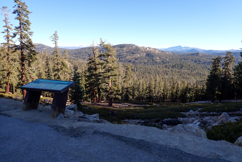
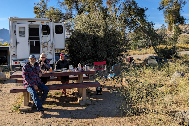
We had a great night's sleep, didn't even hear the alarm. We got up at 07:30 to a few mugs of Greg's amazing coffee. Brought back memories of Panamint Springs! This was followed by the best breakfast - bacon and eggs with warm biscuits. It is just amazing what Greg can rustle up in his camper kitchen! Very impressive. We felt really looked after. As Mike said to Greg and Cathy, after meeting them at Panamint and becoming friendly over the course of a few days, seeing them again it felt like we had known them forever. For those readers who have not followed the story from the start, Greg had kindly agreed to hang onto Mike's broken Rohloff speedhub and so we had mailed it to his home from Death Valley in March. At that time we thought we would ride back through Callifornia along the coast, but of course we have not done so. Greg had arranged to have a weekend up here in order to meet up with us so we could collect the Rohloff to take home with us for repairs. The fact that he was willing to do all this for people he had only just met says a lot about Greg who we are so pleaed to call our friend! We were all ready to leave by 10:00 and said our goodbyes. We cycled to Lake Isabella. The road there was not fun to cycle, very narrow shoulder and very impatient people on the road. Not a great road for cycling. We arrived at the laundry in Lake Isabella. We had not done the laundry since we were on our way into Anchorage, last month! It felt somehow momentous to be arriving back in Lake Isabella. We remembered how happy we were to finally get there in March, having followed the Sierras almost to their terminus to get over them! The laundromat was fine, they are always a little sad, but everyone using them is there to get their clothes clean so really, all in the same boat! It is always so good to have clean clothes! That took over an hour and then we went to Von's to pick up the usual staples. Only a week left!
Leaving Lake Isabella to make our way back to the 395, or rather the 14, the road was pretty busy and we had a bit of a headwind. We decided to get out to the BLM lands, as far as we could along the road. We ended up doing pretty well, stopping at 16:30 at a small pocket of BLM land which you access along a track, right in the deep valley before the climb up Walker Pass begins properly. It was a great campspot, massive boulder backdrop. We were hungry and had cottage cheese and salami sandwiches. We pitched the tent and a bloke drove up the track, a Kern Valley Parks official called Larry. Super friendly he had seen us leave Lake Isabella and just popped in for a chat! We spoke about the forests and different trees and he was really knowledgable about the high desert. He even showed us ancient Native American grinding holes in a rock right next to our campspot. He gave us some water, fruit and a bag of salad and nuts! People always surprise us! A parks truck pulls up and the bloke is only after a chat! At first you think, are we going to be told off for camping here or something? Then it turns out to be such a positive experience. Like I said to Mike, the morning's ride had not been great, some motorists hooted at us and were a bit aggressive, it made us feel bad, but we will forget that bad experience quickly and never forget Larry and our chat. The good does have a much bigger impact than the bad. It sticks. Speaking of which Mike e-mailed the guys from OneUp (my problem pedals). They replied same day (today). Really nicely written, empathetic, took ownership, explained what the problem might be (bearing is in too tight) and suggested a resolution (they will mail us repair parts and get a bike store local to us involved in the repair if required). They were keen to recover their reputation. Can't ask for more than that!
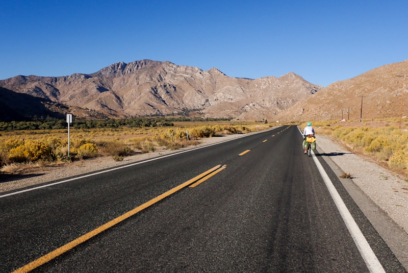
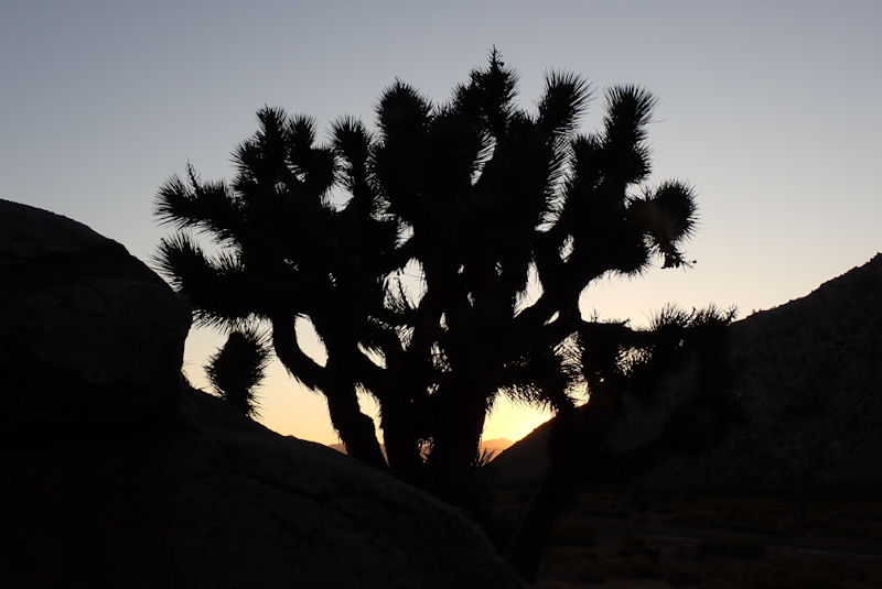
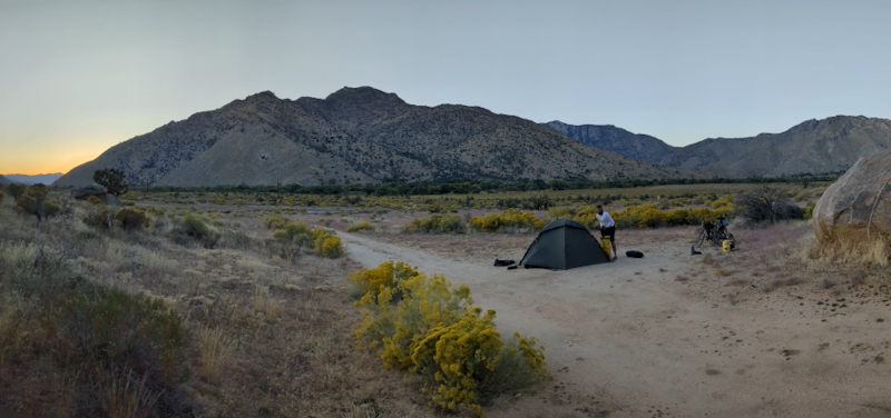
The nights are so much warmer here, still less than zero Degrees C however, but not much less! We were awake early, around 05:30. The road was quite busy with truck traffic. As we were finishing breakfast, around 07:00, a number of road maintenance vehicles drove past going east, so we anticipated roadworks. We got going before 07:30. The road is pretty twisty with many blind bends and no shoulder. Combine this with busy morning traffic, including double trailer trucks carrying aggregate or sand and we were pretty nervous. We have felt pretty nervous now two mornings running. Strange when you think that we have ridden almost 15000 km. There is this sudden vulnerability. It would be an easy thing for one of these vehicles to come fast around a bend and not see us. It did not feel good. However, we had ridden this entire road before and knew what was coming. We got through the road works as they were setting up so that was a win. It was electrical services and there was a stop go after we got through, it is always obvious in the way the vehicles come through in groups. We stopped at Berts Canyon Picnic Area for our coffee break. As we remembered from March, the road improves after this, less twisty and a wider shoulder. From here we just worked our way towards the Walker Pass Campground, a climb of just over 700 m for us. In March we sheltered from the snow there! We did not stop as the road gets steeper at this point. We love the Joshua tree forest all the way up the valley. Then after 22 km we were descending faster and faster towards the juncton with the CA 14. This descent is quick and straight east. We stopped again near the junction and sat on the stone marker to shelter from the wind. We did this in March too, that time under the bothy as it was freezing cold and raining. Then we turned north as we did last time and after a few km east towards Inyokern and Ridgecrest. It feels like we have come full circle! At Panamint Springs we heard a lot about Ridgecrest, particularly from people whose cars had broken down! It is a large centre for the area. It's also at the bottom of the descent and so we had to climb out of it! We rested in the city park for a while and collected water. We shopped at Walmart. Being Halloween today this was an interesting experience, some shoppers were abusing staff, many people were yelling. It seemed all to do with Halloween and the staff took it with a smile. When I went down the candy isle to get some chocolate, the place was cleaned out. The regular candy was there but all the Halloween chocolate shelves which we had seen fully stocked since Faiirbanks at the beginning of September were completely empty. I heard many people wish each other "Happy Holidays!". What??! What kind of holiday is this? Stuff your face with candy day? The place felt like the lunatic fringe. I got out as soon as possible. Mike had waited at the area where the trolleys are fed back into the store behind a little wall. When I came out one employee was telling another who had just arrived for work that they were short staffed as people had called in sick. This was a major problem as it was a holiday. We don't get this. The country opens for Good Friday (which we would say is an important holiday or religious observance day anyway) but Halloween....watch out!
We took the 395 out of town 8 km up the hill into BLM Lands and found a nice place to camp. We enjoyed our lunch/supper of fresh bread, egg mayonaise and chicken salad. As we sat on the ground in the shade and ate, a Desert Tarantula scuttled passed. We forgave him, it was Halloween after all!
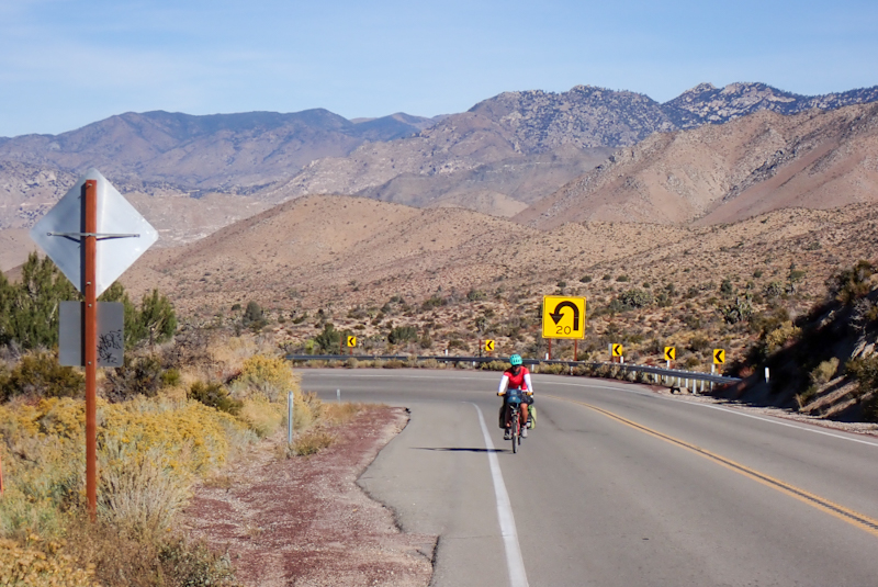
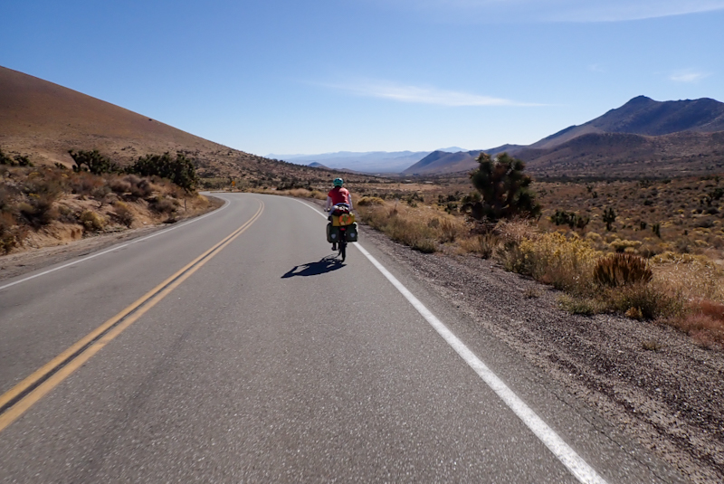
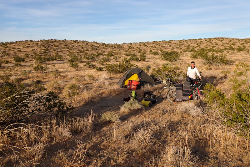
Mike woke up around 02:00, hearing an animal closeby. We had ended up with some empty containers from our salads and other food last night which we had put together in a plastic bag. When possible (and ALWAYS in bear country) we would pack our garbage in a bear container or bear bag, but now that Mike has packed his broken Rohloff and other stuff in his bear container, and we are not in bear country anyway, we left the small bag of garbage on the ground, along with Mike's 1 kg jar of Nutella. Well, something made off with the garbage. We hang our heads in shame as we should not be feeding wildlife and anyway, it would have left the plastic containers all over the area. We got up out of the tent and walked around a bit, but it was gone. Luckily, the Nutella remained. With only 200 km to go in this caper, we slept in this morning and left a little after 08:00. Can you believe we still climbed over 500 m in 50 km? Neither can we. However we were on the 395 which is a great road to ride. It is very busy with trucks and RV's and cars, but there is always a wide shoulder. We passed through Johannesburg. Yes, really. There was actually a street called Oom Paul. It was pretty much a rundown old mining town, so in that respect similar to Jo'burg, South Africa! After this we saw a semi with trailer which had run off the road and there were three tow trucks trying to right it. I also saw three desert tarantulas on the road and hope to have avoided all three. One I maybe squashed. After 50 km we had completed two climbs and were now on the flat however there was also a headwind. The landscape was a bit uninspiring. We pulled off for lunch and decided to call it a day. We are in no hurry and we could just pull off into BLM land in a totally flat area which went on forever. We rode in a bit along a track, set up the bikes with a small tarp to create shade and lay down all afternoon reading. It was great! The best part was that the water bottles on Mike's bike warmed up so when it came time to shower using our shower bag, we had a warm shower! First one in nearly a month.
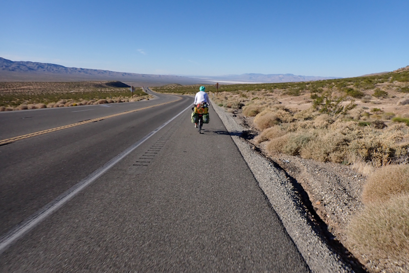
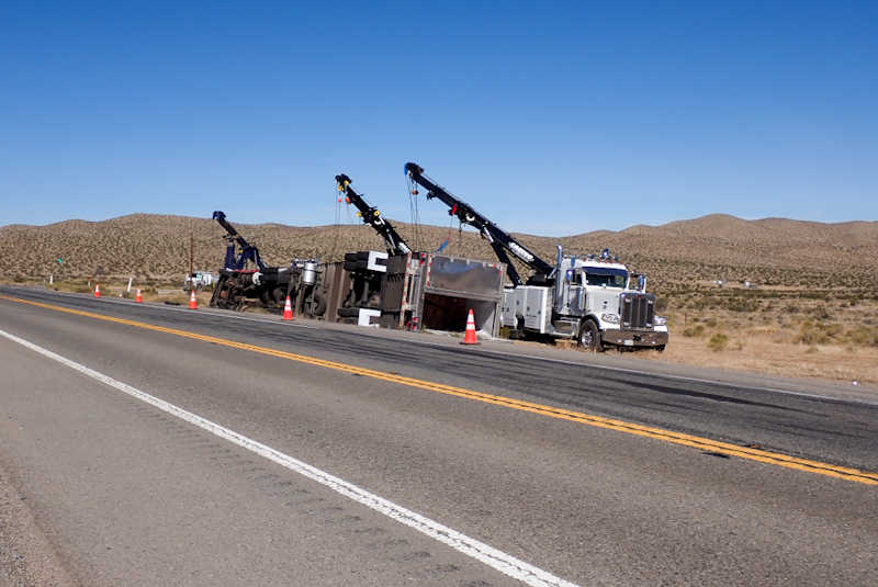
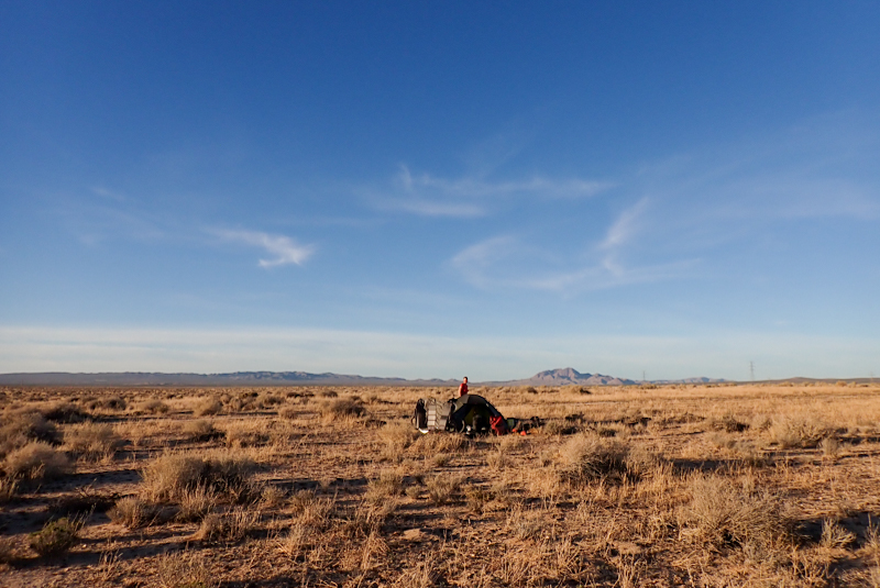
Pretty chilly morning, minus 3.2 Deg C. Strange thing about last night, we camped near Andrews Air Force Base and a radar station, and the hill to the west of us was lit up in the dark with hundreds of red lights, not sure what this was. Top secret! No longer. We had a cruisy ride to Kramer Junction and shared a breakfast Sub, however they had no eggs so it was not really a breakfast Sub. After this we had our last 200 m climb of the trip. From here it is pretty flat. The 395 is a good road, interesting though that after Kramer Junction it is still single laned, with no overtaking. Overtaking is prevented by a wider yellow line, almost a median strip, with double rumbles and also small poles all the way. It is good not to have overtaking for us as it prevents the stress of a car oncoming in our lane, which happens daily. We are in the shoulder anyway, but it is always too close for comfort. Must say that the 70 km to Adelanto was straight, boring and the trucks and cars were getting on our nerves. So loud! So many! We could smell Adelanto before we arrived. No idea what smelt, some sort of industry. The Southern California Logistic Airport is there, stores many planes from the looks. Also a large Walmart depot.
We went via Adelanto as we had had an amazon order delivered there, so had to make a turn to the post office. We stopped at a supermarket and tried to get water at the Chevron service station. At first the woman told me I had to buy it, but then came out as we were going to ride off and said she would open the tap at the back. She took us round there and filled our bottles, which we were grateful for. After the post office we left the town. Total shithole. The road we turned onto which eventually leads to Palmdale was such bad quality it was totally third world. California is known for its wealth, so how roads like this exist here is beyond us. Anyway, it improved and we tootled along, turning off at El Mirage. We had such a bad feeling about this road and everyone on it. It is an awful area. We found a place in the dunes hidden away and pitched our tent as the sun was going down. Everywhere we have stopped today there have been thorns, first time this has happened on the trip. We had devil thorns in our tyres and now thorn bushes getting thorns in our socks.
Today we have ridden over 15000 km. It feels like enough suddenly. We have 65 km to go to Lancaster from where we catch the train into LA. We decided to book into a hotel for two nights in Lancaster (we are already booked into a hotel in LA for three nights). So, last night in the tent, short ride tomorrow, and we are more or less done!
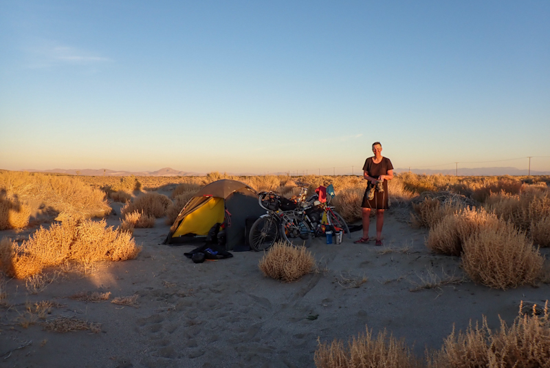
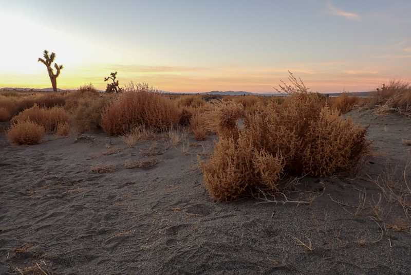
You won't believe it except you probably will...rear wheel puncture this morning for me as a special gift! I totally expected it after all the thorns yesterday so I checked all our tyres when we got up. Mike was as always, good humoured about it. I am always impressed by this! Actually, first puncture of the trip for me. Not bad for 15000 km! The road we had camped on was really busy, no shoulder. Work traffic, we guessed. Quite a few trucks. We had 15 km on it before turning off, so we made short work of it. It got better after we turned off it towards Lancaster. The views? Total desolation, with a few Joshua trees thrown in for good measure. Some houses and shacks dotted around, "private property, no trespassing". We are familiar with it all by now! They stake out their claim on parched desert soil, erect a massive fence which is the biggest investment they make in the property, install two viscious dogs to stand guard and protect absolutely nothing. Crazyland! After turning west once again at one point a pack of 10 or 12 dogs just ran out of a property right at us and gave chase. Mike yelled at them and it put them off. We stopped at Saddleback Butte State Park for our coffee break. We had initially planned to camp here AND have a rest day as we had time to kill. The picnic area was good, nice facilities. It was pretty warm and dusty. Funny how when you get to the end these things start bothering you whereas they never did before. As we sat under a shelter, we heard dogs barking. Up on the hill above us stood two large German shepherds, edging closer to us. No one was around. Who did they belong to? They were behaving pretty aggressively. After a while they disappeared into the bush. Jeez, we were happy we had decided to book into a hotel and forego this campsite! Imagine having to worry about roaming dogs on the offensive? From here we dropped down into the town, it seemed to take forever. The views did not improve. We hate American cities, well the ones we have seen anyway. Maybe there are better ones? Just cars and carparks and fast food. We went to a Dominoes as we had a voucher for a free pizza. We then went on to a park nearby which was nice. We were able to clean the bikes and throw away a lot of stuff we no longer required, or which had worn out. It was quite a job getting our front and rear hubs clean, but our bikes looked much better. We have to do this for Australian customs, but actually the bikes deserve it too! By the time we had finished it was nearly 15:00 and we could check in to our hotel which was only a couple of km away. We have two nights here and then catch the metrolink to LA on Sunday. The hotel is very nice, coffee is available 24 hours a day in the lobby so that is a winner! We showered and relaxed and later took a walk to Albertson's supermarket around the corner. We got delicious orange chicken and rice for dinner from the "Chinese Food" restaurant next door. We also got a 1.85 kg bag of small chocolates (230 pieces!) to tide us over!
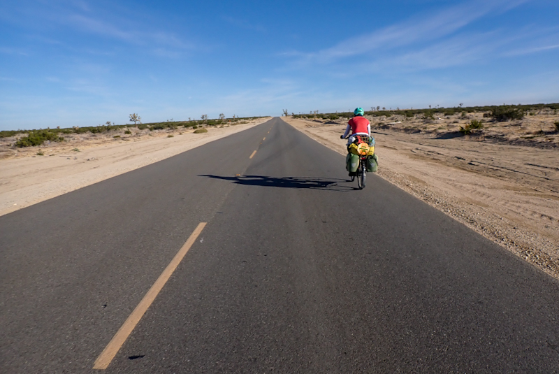
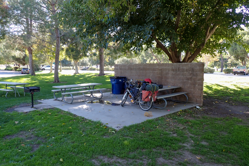
So the trip is now at wrap up! We have cycled 15149 km up and down the western USA, and as far north as the road goes above the Arctic Circle. A trip this long only ends up making sense when you are home again and in the months to come when you reflect on it. As the mental health experts are always telling us, it is heathy to engage in an activity which demands that you are present in the moment, not thinking of the past or worrying about the future. This is exactly so when we travel this way, you live only in the moment. You don't cast your mind back to the start and marvel at how your fitness has improved. You don't think of the next tough climb as it doesn't help to. It is only today, the next 20 km, when can we pick up water, when is coffee break, which occupies you. Anyhow, the adventure continued as we travelled to LA.
We had two nights in Lancaster and on Sunday, 5 November we travelled to LA. Initially we had planned to take the train from Fontana into LA, however the San Bernadino line closed for this weekend only and we remembered Jay, the Trail Angel, had mentioned the train from Lancaster which is why we went there at all. The Metrolink train is a brilliant service. Lancaster is the starting point and the termination is Union Station, LA. It was a quick, flat 5 km ride from our hotel to the Lancaster train station, through suburbia and on a Sunday, so pretty cruisy. The trains run every 2 hours on a Sunday and the trip takes two hours. It only costs $10 for a day pass on the weekend so for $20 both us and our loaded bikes were transported to LA and then via two further connecting metro trains, to our hotel. We even used the tickets again to get to some shops we needed to go to from the hotel. So no complaints there, brilliant service. There is a very large step up into the train and we could not have got the bikes on or off while loaded if we were on our own. Only the Metrolink has this large step, the metro trains are easy roll on roll off. Each carriage has storage areas and the bikes are securely strapped in so we could sit and relax. We got the 10:11 train and it was quiet on board. Daylight savings ended today so clocks were turned back an hour but the train station clock had been put forward an hour so it was a bit confusing. There were quite a few people with bikes on the train. At first the views out the window were rolling desert hills and small outlying towns. It is all very dry and desolate. As we got into the outskirts of LA we just felt more and more as if the life was being sucked out of us. It is huge. We know that the LA population is over 10 million. The ENTIRE population of Australia is 25 million, so this is a seriously large city. So many buildings, powerlines, cars. There are massive carparks, huge amounts of concrete and the air is so thick with haze that the mountains and skyscrapers are just about visible. It was in short, the last place we wanted to be.
We got onto the blue metro line at Union Station. We have mentioned this before about public transport in the US. It is definitely not the transport of choice. Americans love their cars and most do not get out of them. Public transport is a lower socio-economic activity. Anytime we have used it the people on it are weird/drug addled/crazy or dodgy. Of course most Americans would not agree with us when we say that our experience of this country has been third world at times. But then most Americans are not getting on a train, or travelling through the backwoods. Walking through Union Station your feet adhere to the floors. They are sticky with probably months of who knows what. We had to use the elevators to get from one platform or metro line to the next and they were filthy. There was a strange man in one reorganising what looked like a pile of garbage, but was probably his belongings. Mike and I could not get in together with the bikes due to this so he went and then I went after him, bunched up with this crazy guy and his crap on my own. The blue line goes through Downtown LA and we were on this train for about 30 min. One bloke was very nice, he had his bike in the carriage in the bike storage spot and gave it up for me as it is not easy to stand with the loaded bike on a moving train. When he got off a crazy woman got on with 5 massive garbage bags of aluminium cans and plastic bottles balanced on a trolley, and was trying to force all this junk past us to sit down.She asked where we were getting off and luckily she was getting off before us. She clearly thought that transporting this stuff on the metro was okay and got quite on her high horse when we did not just get out of her way. At least she was recycling I suppose. By this stage we were pretty much over it. Then onto the green line. This was the best train line. The floor was not sticky. We stayed on an extra stop to go to an Amazon locker for a parcel and then rode 1 km to our hotel, where we could check in, it was 14:00 so we had been travelling on trains and then bikes for nearly 5 hours. We had showers and then got back on the train to go to REI to buy bike boxes. We also picked up some breakfast cereal, etc. at Trapper Joes supermarket. We got the green line back to our hotel at about 17:00. There were ony a handful of people in our carriage, the nearest to us was a woman sobbing and hugging herself, and bumping her head against the wall. Did not want to get involved with that.
Our hotel is very nice and it is in a good area, the business district of El Segundo/Mariposa. It is one of the few hotels we have stayed at where we have not smelt people smoking weed. We organised our packing better for the flight. I have thrown out my panniers as they got pretty worn with transporting the bear containers and we have both thrown out our handlebar bags, bikes tyres (they did well) and various other things. We have had a look at things to do in LA but you will have guessed that we are not hop on hop off bus/ Universal Studios/ Hollywood walk of stars kind of people. We did walk past the home stadium of the LA Lakers! Also the Endeavour Space Shuttle at the California Science Centre would be worth a look. Most of the longer trips we have done, we end thinking we will go back to the place. We don't think we will be back here though. The wilderness and geography of the United States will take your breath away and that is what we came to see. However, it is telling that this is the first trip when we have felt really happy and relieved to be going home. We have met some really terrific people here, but overwhelmingly as a country is does feel pretty hard and unforgiving. We do always remember the amazing people we met so long ago now at the Noobs Rally in Panamint Springs, Joel, Greg, Cathy, Bill, etc. That was such a great experience and really outweighed any negative experiences we have had. It is hard to explain, but Americans will always surprise you. They will always be absolutely brilliant or absolutely not brilliant and you're kind of never sure which way it's going to go!