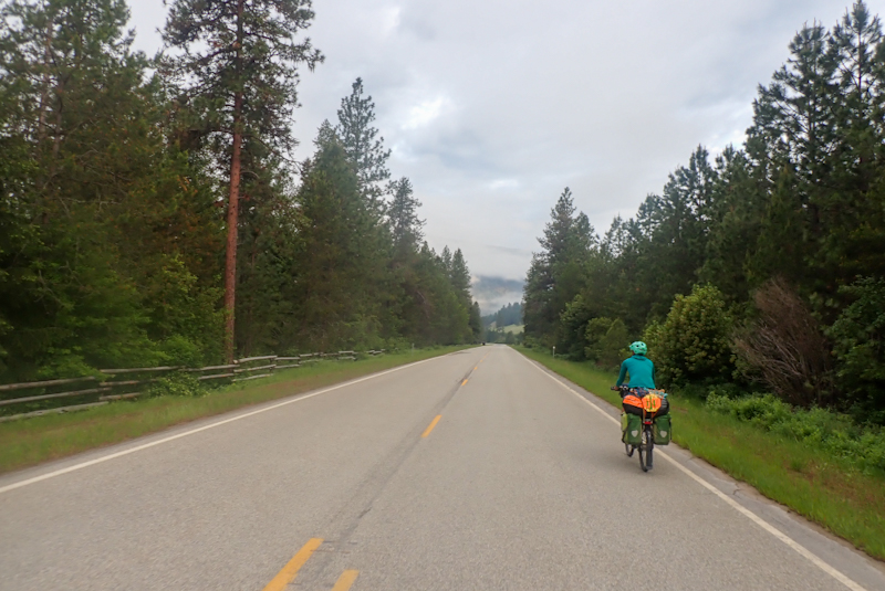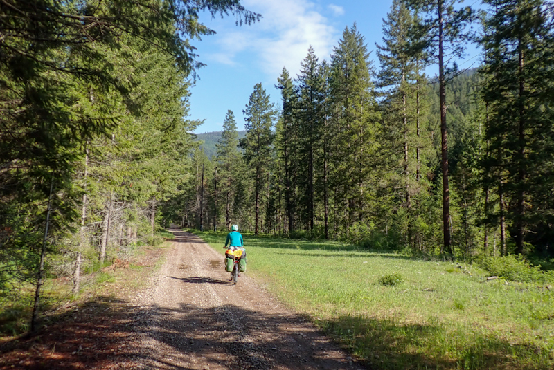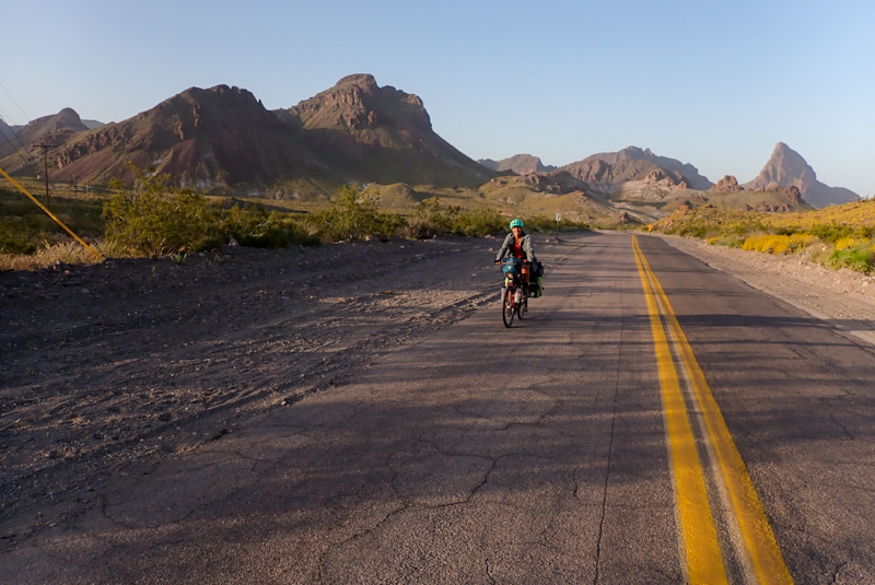
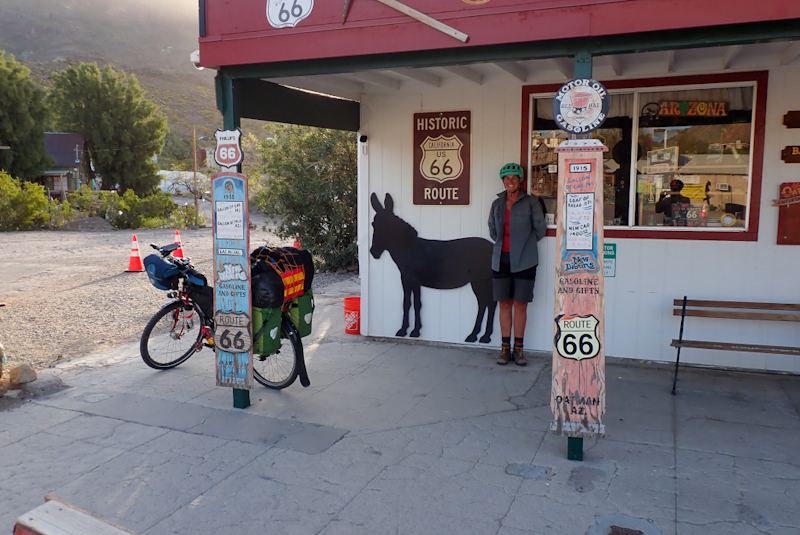
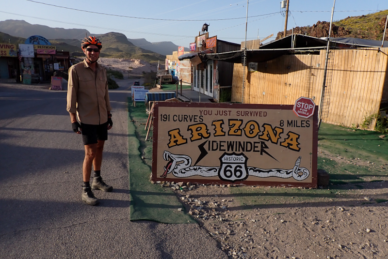
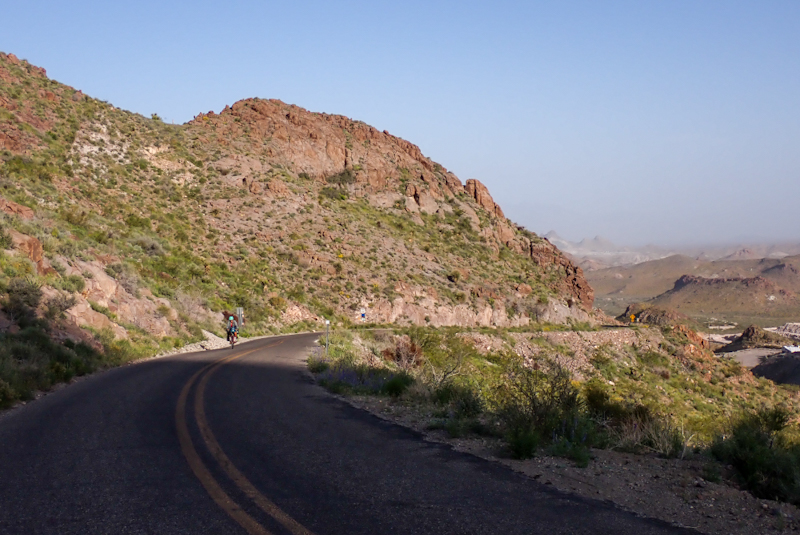
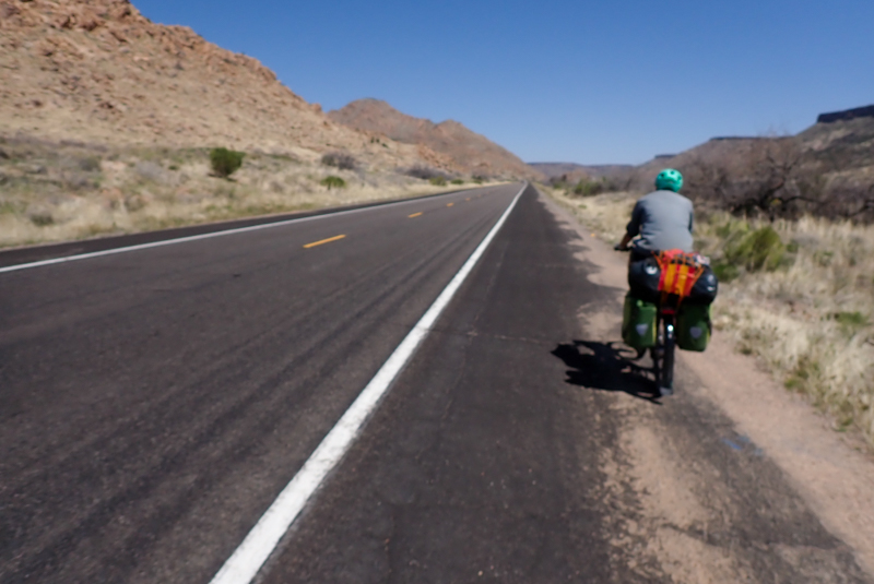
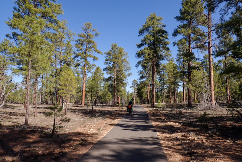
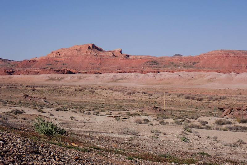
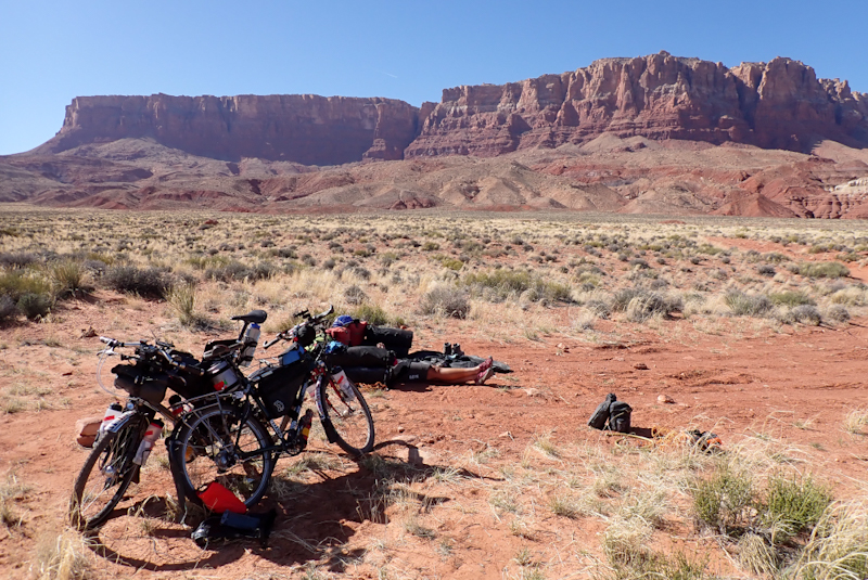
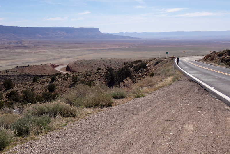
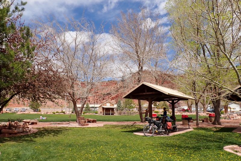
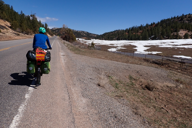
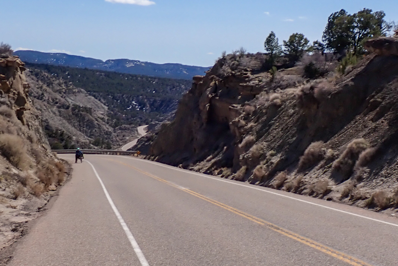
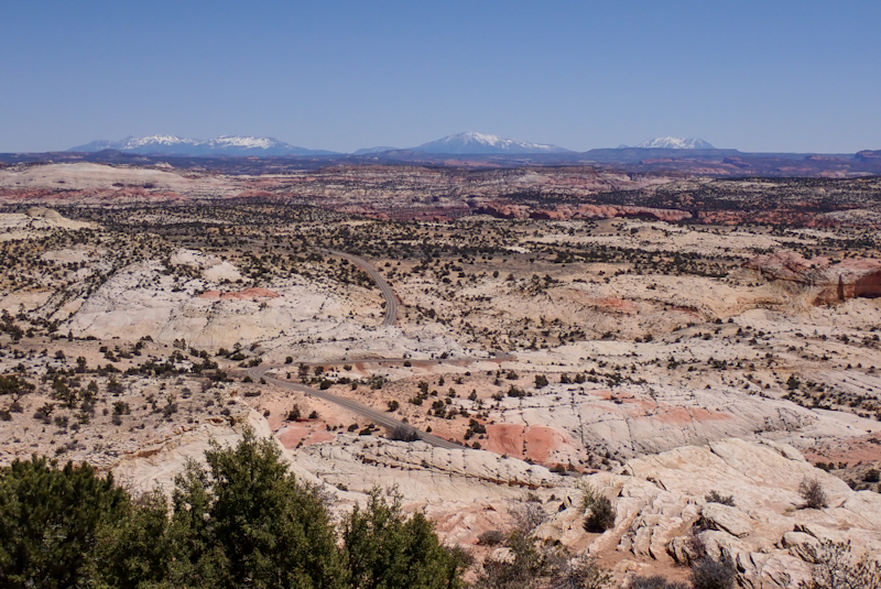
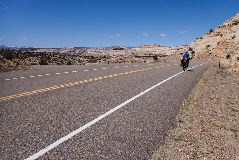
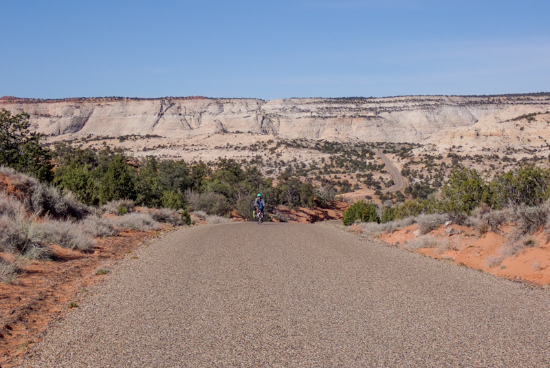
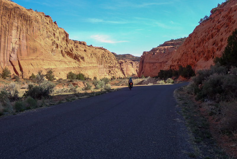
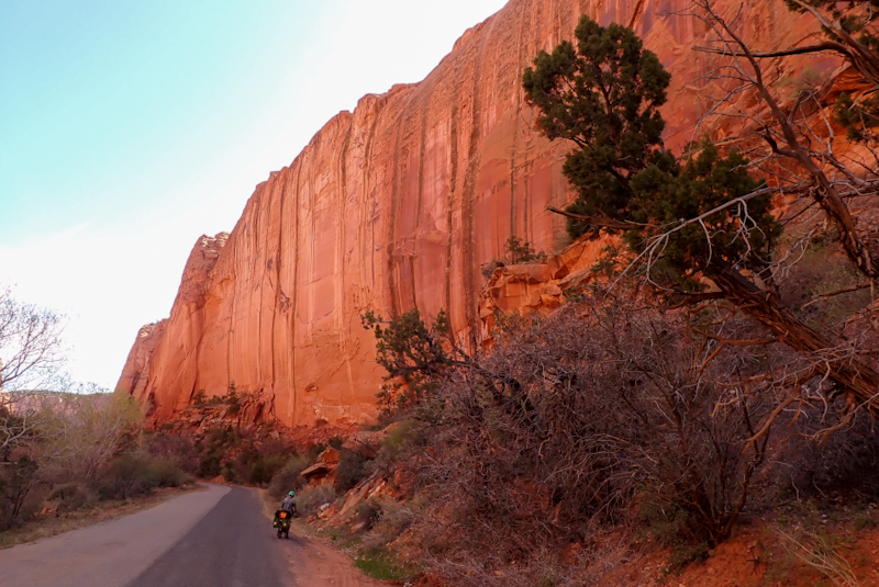
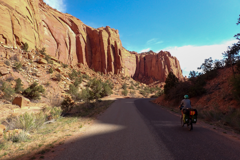
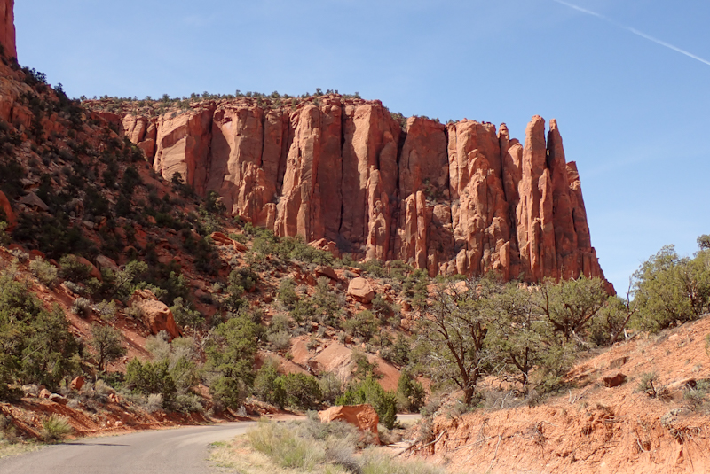
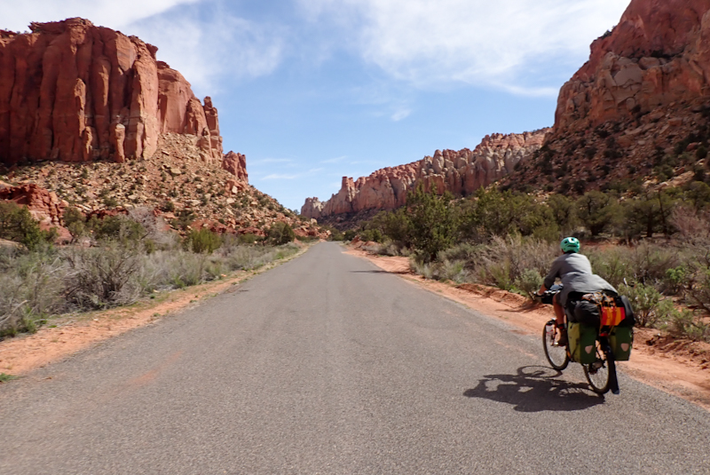
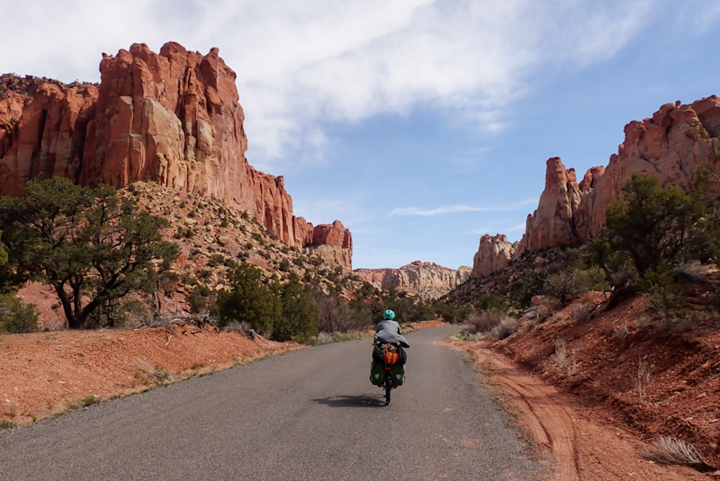
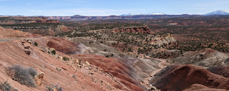
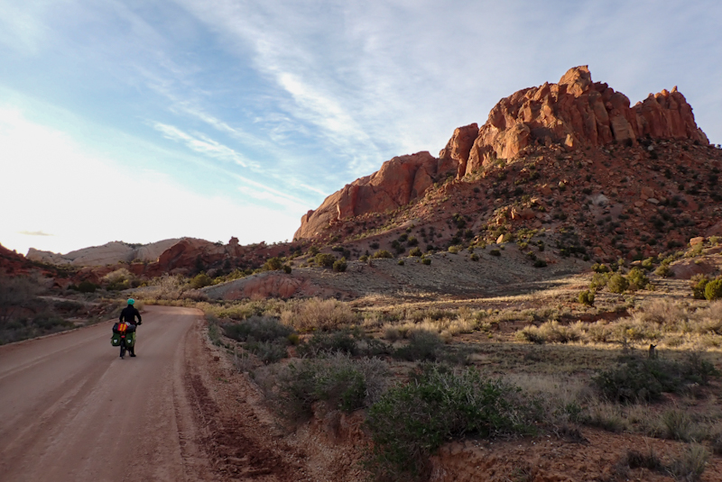
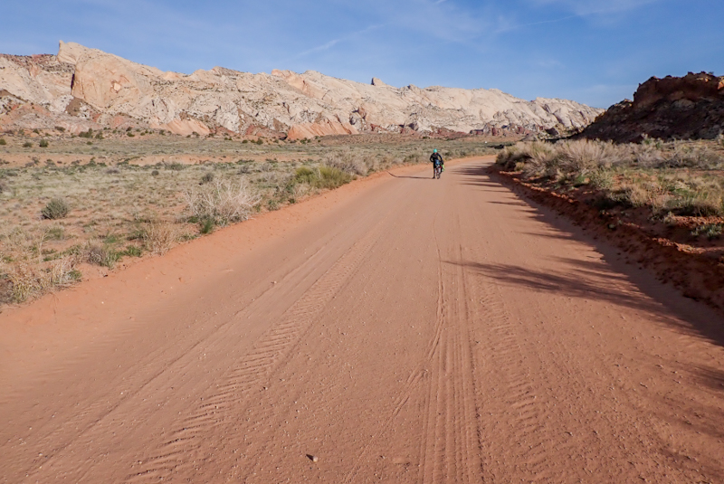
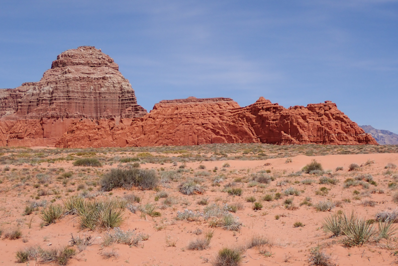
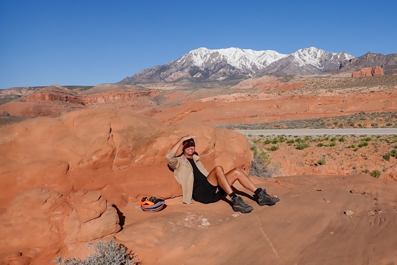
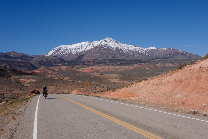
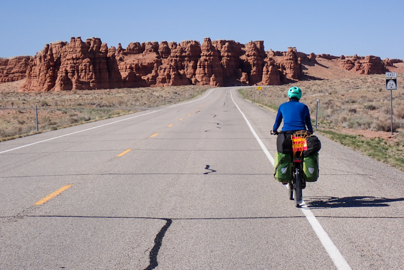
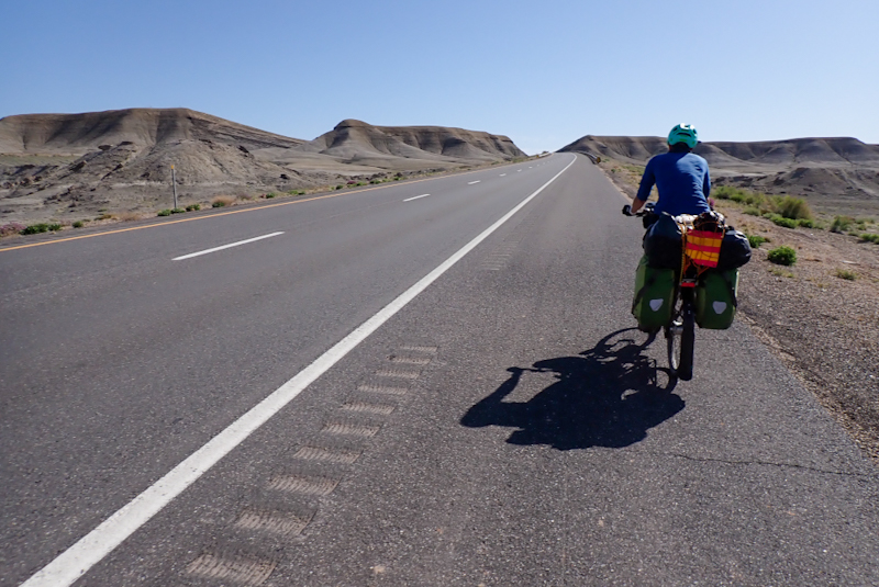
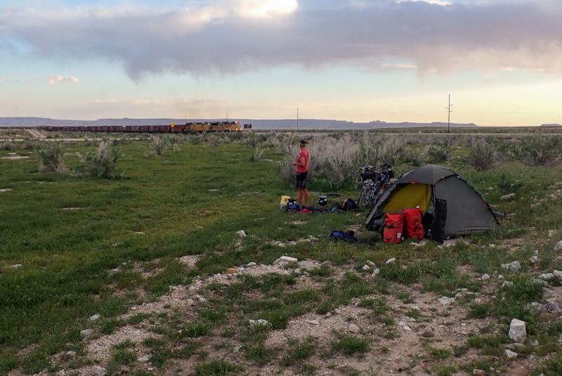
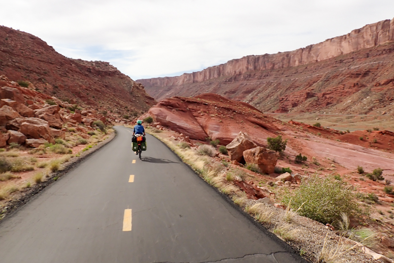
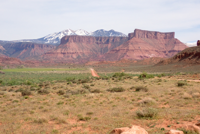
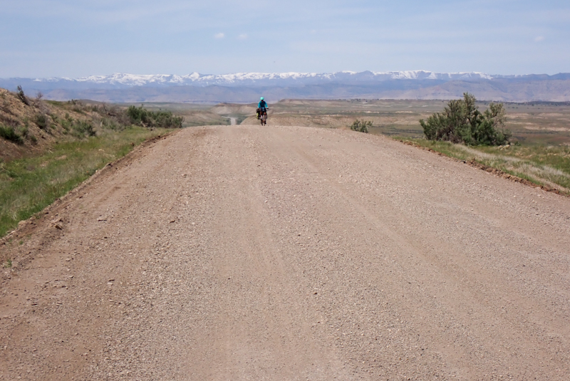
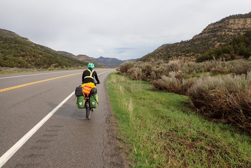
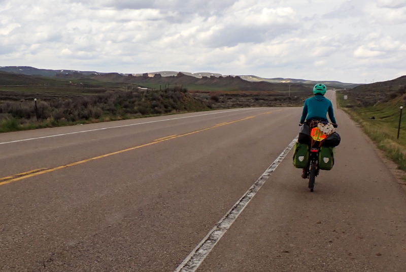
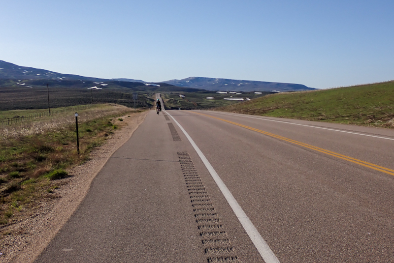
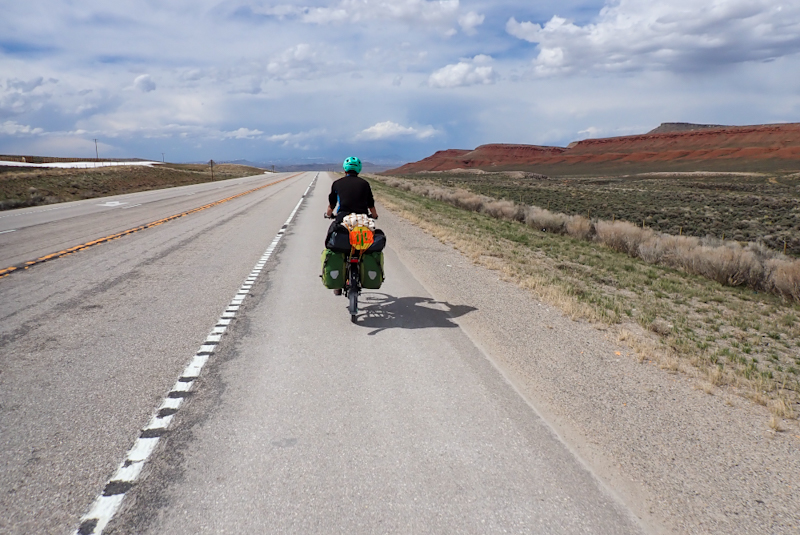
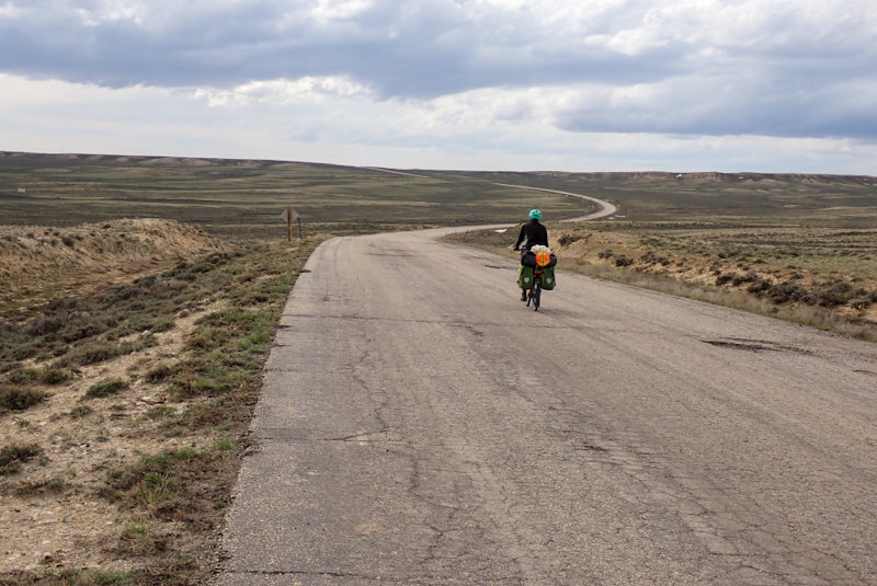
The climb up Oatman Highway to Sitgreaves Pass was stunningly beautiful. 06:30 was the perfect time to start it as the road was quiet and passing through the historic village of Oatman we had it all to ourselves. The rock formations, twisty-turning road and our first real show of spring flowers all made the climb feel worth it. The climb was pretty steep in parts, but you gotta love switchbacks. They always look mad but they do make for an easier climb. The view from Sitgreaves Pass back over the Colorado River Valley was amazing. The descent down into Golden Valley was also fabulous with views of mountain range after mountain range, the largest just towered over everything. This is just one of those roads which is a joy to ride and a highlight of the trip so far.
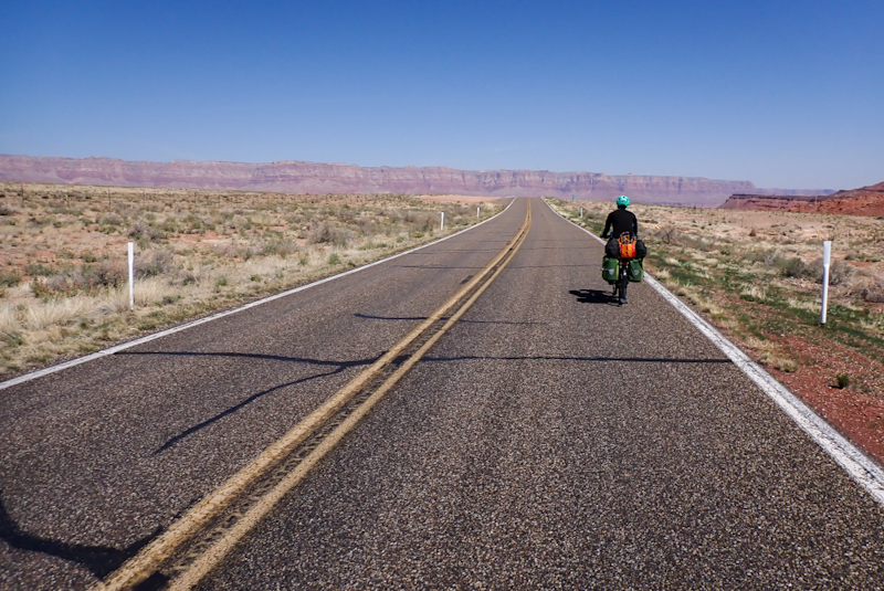
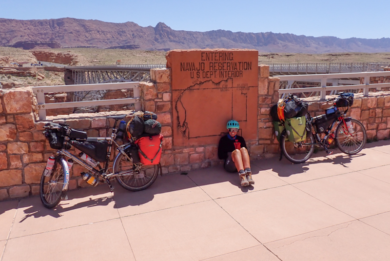
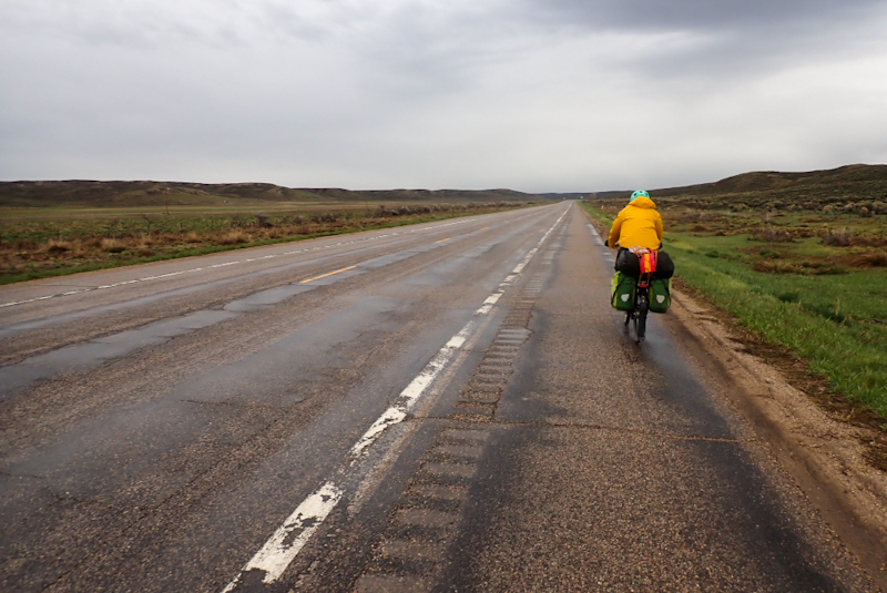
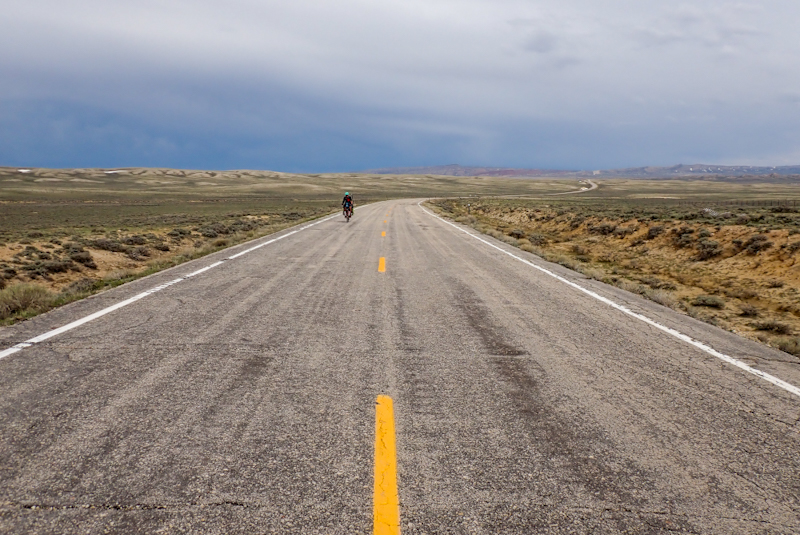
Riding through Golden Valley was unsettling. Actually, Arizona itself feels unsettling. After California where we felt safe on bicycles, it was made clear to us today that the locals do not feel inclined to share the road. Most of these guys would drive you off it, a couple nearly did. We did not enjoy riding Route 66 into Kingsman for this reason. We also found the "Trump 2024" flags and even Confederate flags flying from roofs of what are really just shacks, pathetic. We shy away from expressing our political opinions on this website, but you have to wonder about grown adults who are still cheering this guy on given the shitshow that occurred on the last merry-go-round. You may as well say, "Arizona, the home of the Grand Canyon and other low points". There was actually a bloke just near the intersection of Route 66 and the interstate selling tools and AMMUNITION from the boot of his car.
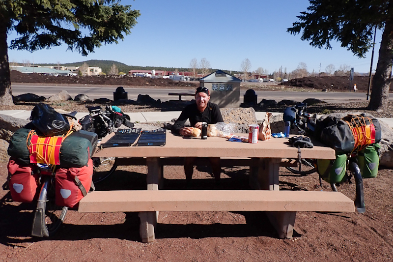
We stopped at the Amazon locker in Kingsman as we had many items waiting collection. They were: aluminium sand pegs for the tent, brake pads for my new rim as the ones we ride are specific to CSS coated Andra 30 rims and my new rim does not have the coating, a new Helox Helly Hansen jacket for me as my current goretex jacket is not waterproof enough (not that it rains), a spoke tension meter as Mike wants to check that the wheels he built are correctly tensioned (of course they are! When he checked they were perfect, places the mind at ease though) and a new pump as one of ours stopped working properly. I am especially pleased about the brake pads as I have been trying not to use my back brake much on descents since I got the new wheel (Heeee--Haaaaa!). We then went to Walmart to buy more food. Especially trail mix. Not sure where we are putting it all. We were told by a local (as we were in Needles) to watch ALL our stuff ALL OF THE TIME as people will walk off with it. Maybe one of the idiots who walked into Walmart with their firearm will try to steal our bikes, who knows. Why anyone would think a firearm is required in Walmart is beyond comprehension? Paranoia at its finest! Arizona honestly feels like a different country to California. Using the words that the local hero made of African countries, Arizona so far, is quite a shithole!
The place is such a shambles, we decided to stay in a motel, which is nice and clean and has aircon which we are using enthusiastically even though it is not hot today. There is a laundry but the driers don't work so we have hung up our washing in our room. It is really good to be able to do the laundry! It is also very cheap at $2 a load.
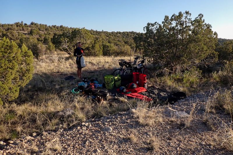
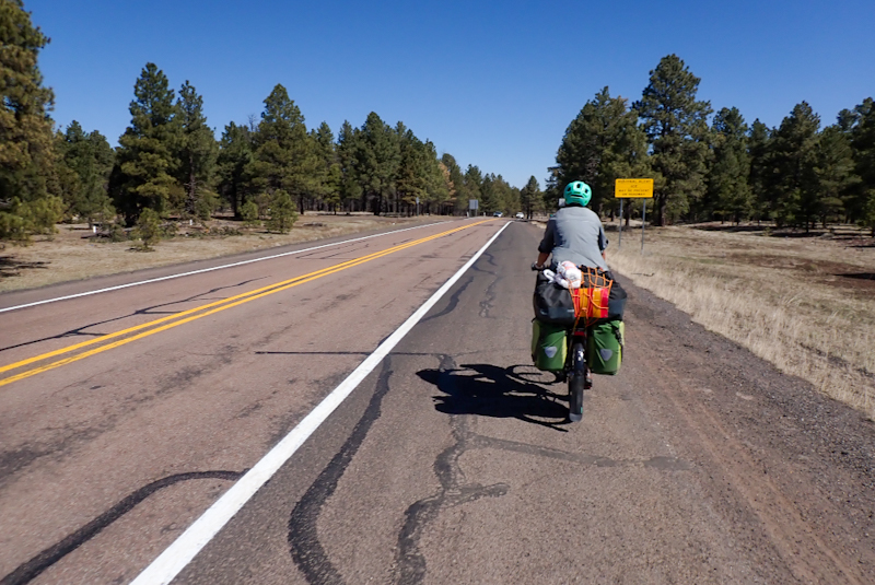
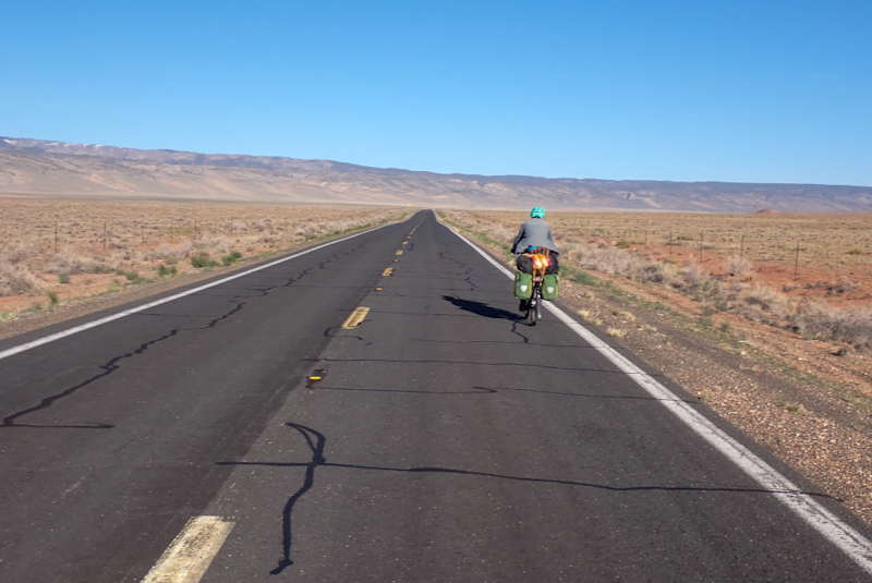
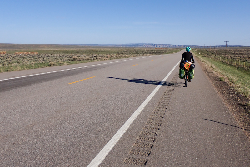
We got a lot of stuff organised staying at the motel, it is always good for a reset. We were on the road at 08:00, leaving Kingman on Route 66 in the quiet of a Saturday morning. The first 40 km were pretty boring. It was more like a highway than anything else. The road was flattish or slightly uphill and there was not much to see. The bitumen had deep cracks running across the shoulder in our path every four metres. Clunk, clunk. We stopped to eat on the side of the road and lay in the shade of the bikes. A car pulled up and two young blokes got out and walked over to us. We only noticed them when they asked, "Hey, are you guys just chillin' or did you need water or something?". It was really caring of them to do that, as they had actually turned back to ask us. We said, "Thanks so much, we are fine, just resting." I guess the sight of two slightly grubby cycle tourists lying down next to their bikes is not an everyday sight in Arizona. Or anywhere!
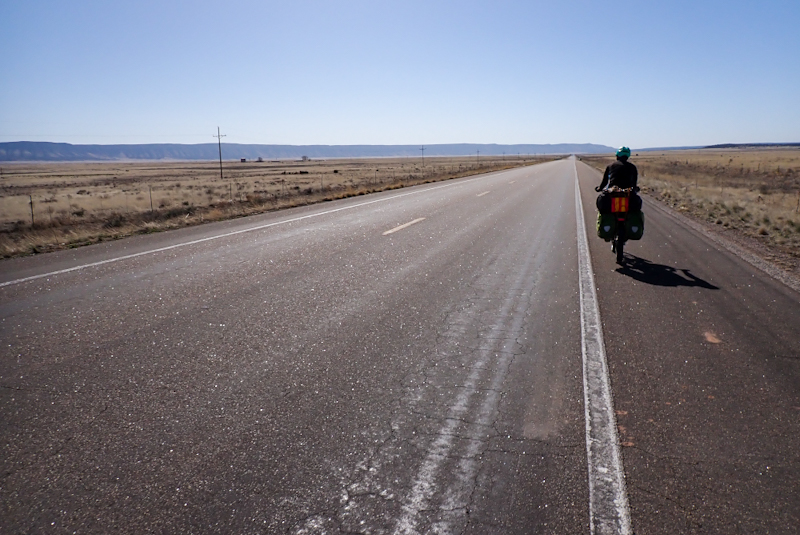
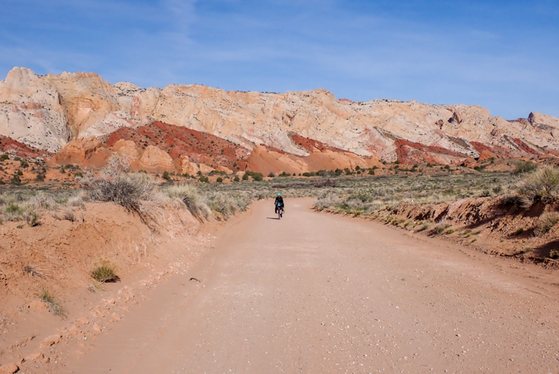
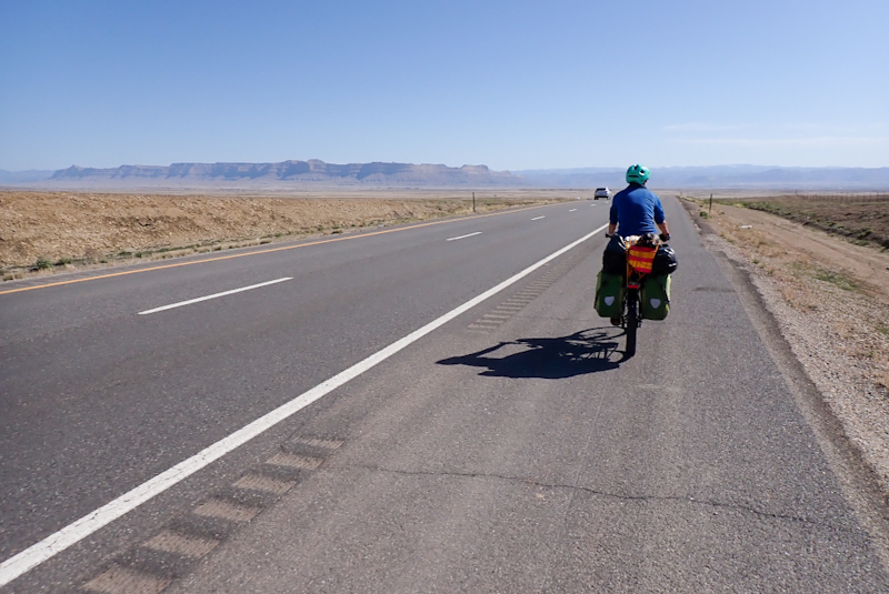
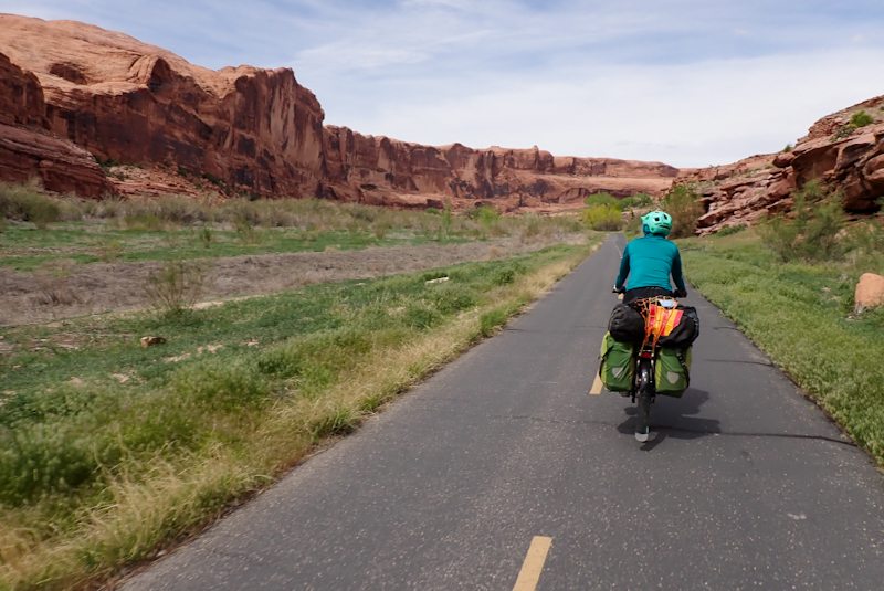
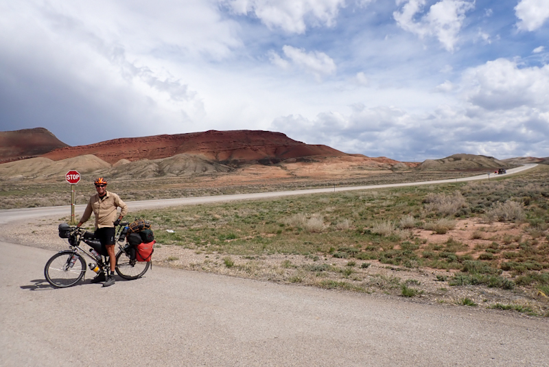
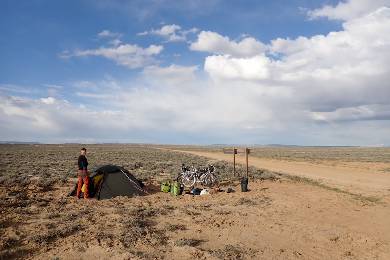
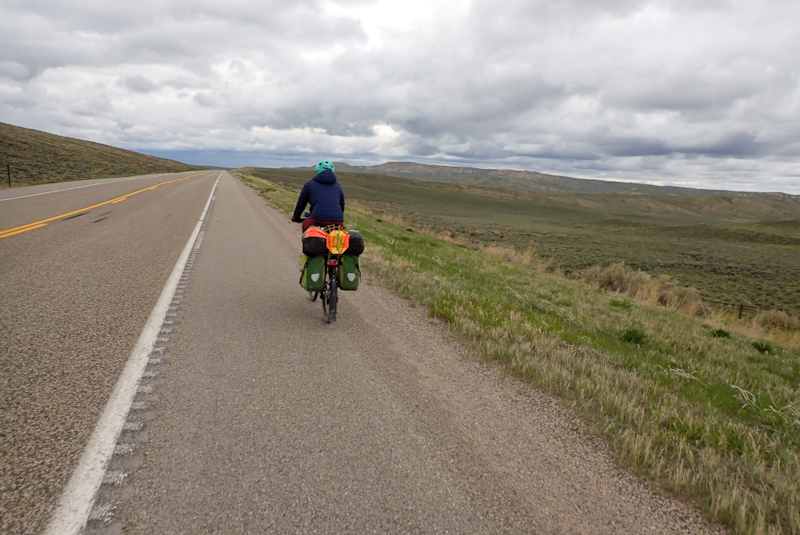
After this the road improved, it became more characterful and hilly and the lansdcape more picturesque with a few climbs. We dropped down to a valley and suddenly everything just opened up, the distant hill looked like a flat escarpment and there were cattle grazing. The motorists seemed more relaxed so everything was looking up. Had we been unfair in judging Arizona on the basis of one crap town and a valley of nutcases? Maybe. Small fir trees dotted the countryside and even cast shade! The breeze was cool as we were now over 1500 m in elevation. Peach Springs is the village in an Indiian Reservation. The grocery store is brilliant, everything is reasonably priced and you can see the prices on display. The shop assistants were happy for us to fill our water bottles at the drinks fountain. A little climb and a few kilometres further on we found a good place to camp. It felt like a long day today, with only half the riding enjoyable. It was slightly uphill all day and our panniers weighed a ton thanks to delicious food from Walmart. It's worth it.
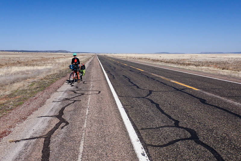
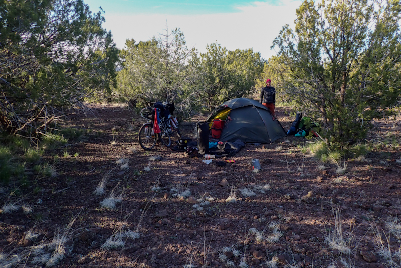
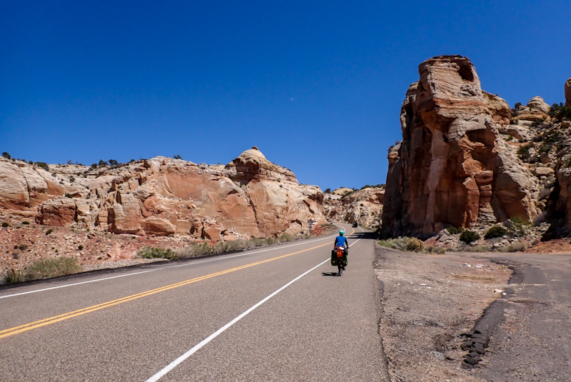
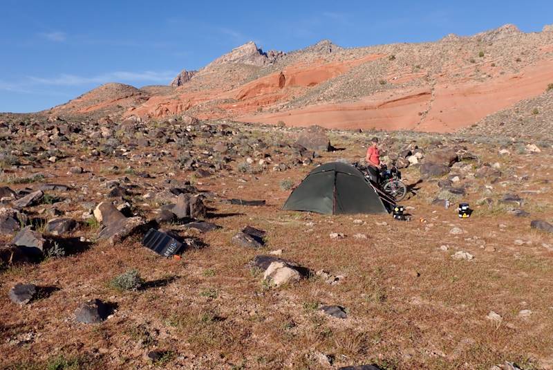
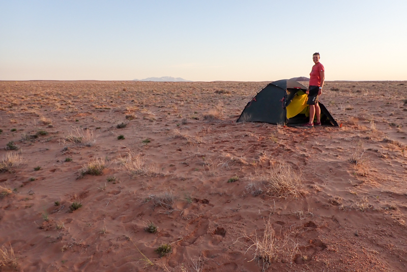
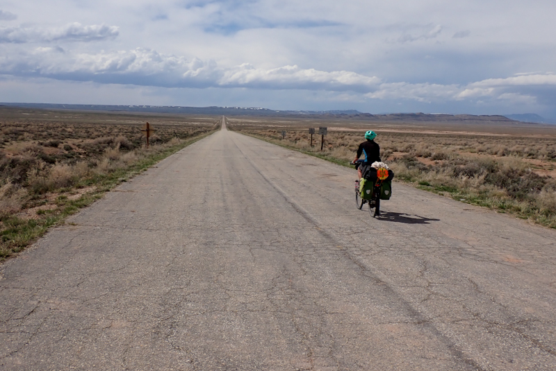
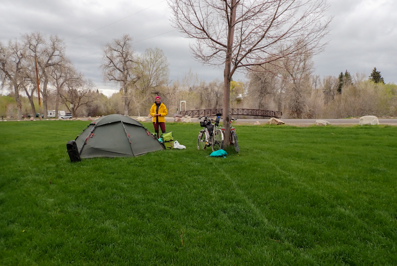
Long day and my thoughts are a bit jumbled as I process it. Not much in the way of points of interest. Firstly, we may have had our last night under the stars last night for a while! We are at higher altitude here, working our way up to 2000 m elevation and so it is colder by virtue of that. This morning we missed our alarm and slept til 05:20. When we got up it was minus 3.6 DegC! Our sleeping bags and mattresses must be pretty solid as I did not wear anything extra than normal, just closed up my cowl around my face til I had only a breathing hole! We set off at 07:00. We remained on Route 66 until Seligman, when we decided to get onto the Interstate 40. We had ridden this road before, after Mojave and loved it. Wide shoulder and great surface. Route 66 had a shocking shoulder again today with those cracks filled in with bitumen that were just a pain in the arse. Seligman trades on the Route 66 name, as does every town or village or petrol station on this road. Mostly this means arranging all sorts of derelict junk all over the place along with shops or diner's offering you the chance to step back in time to the '50s. It sort of mystifies me as the route itself has a history far older than that. We're talking camel trains. Don't see any camels around now though. Also, come on people, the '50s? Are we still living under that illusion? Anyhow, people seem more than happy to detour to these places from the highway and walk around taking photo's of e.g. a Volkswagen bus circa 1970 which is just covered up completely with stickers of who know's what. I love stickers, maybe more than the next person, but they do not make a broken down Volksie bus into memorabilia.
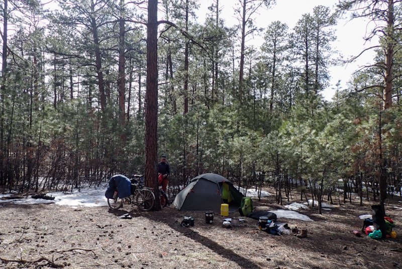
Anyhow, we zipped onto the Interstate and boy, were we in for a shock. The sign instructing bicycles to ride in the shoulder was the first clue, as who in their right mind would ride a bicycle anywhere else with trucks thundering past every minute? Well, we can tell you. The person who's just sick of the cracked and broken up shoulder full of gravel and rubbish from massive brocken bits of truck tyres to parts of engines, an office chair at one point, the list goes on. It was really just an obstacle course for us at times, and as it was downhill for quite a way, it demanded a lot of concentration. The road surface was often not much better for the vehicles. No office chairs though. Arizona roads do not a happy cycle tourist make. We stopped at Ash Fork for water and the Shell garage advertised pizzas (along with Trump murchandise). We had a delicious pepperoni pizza freshly made (but avoided the other crap) and then set off for the final 11 km of the day. This was back on the Interstate which thankfully seemed to have been fairly recently resurfaced, Hooray! Long 200 m climb along it though, with yummy pizza babies in our tummies. Nearly finished us both off! We took the Welch Road exit as there is open pinion pine forest that is used for informal camping. We were tired! Tent up tonight, no more outdoors required!
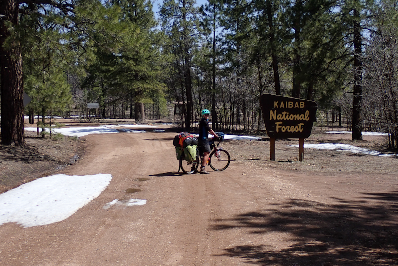
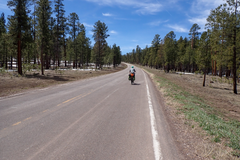
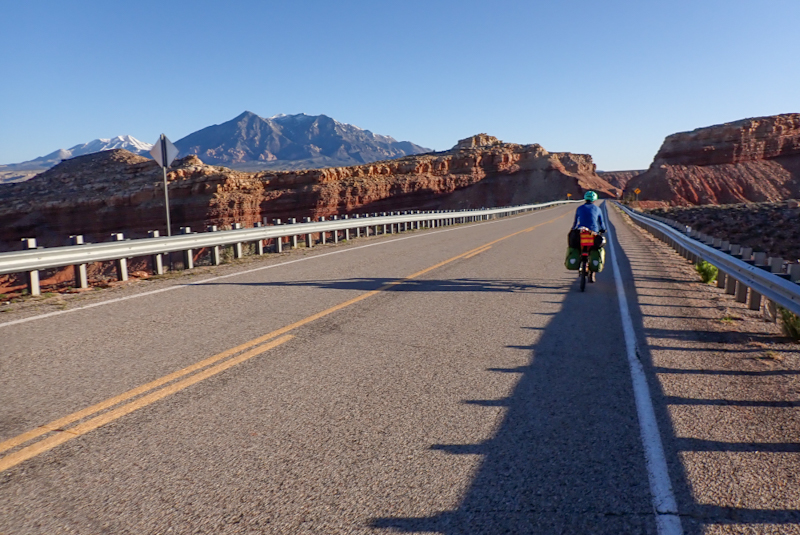
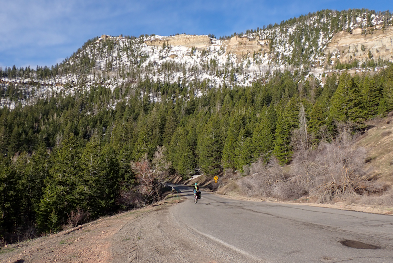
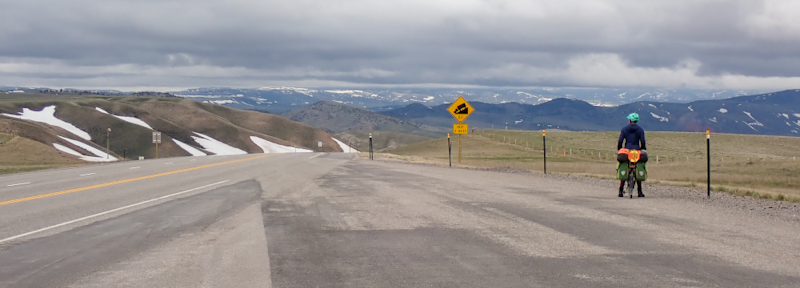
We had more climbing (350 m) to do this morning up the I40 before dropping into Williams. It was pretty chilly going downhill and there were patches of snow by the roadside. The pine forests were larger with bigger trees. Just before we reached Williams we clocked 2000 km total distance for the trip so far, and we also reached 2000 m above sea level! We ate fresh bread rolls with cheese, tomato and cold meat at Willams with fresh donuts for dessert. There is a direct route which runs from Williams straight north to the Grand Canyon South entrance. On the plus side we had a great tailwind today! The road was busy with a rough shoulder and often downhill. Part of the shoulder was taken up by rumble strips so often you only had a narrow band to ride on. The road was very busy with tourist traffic as well as a large number of trucks going to and from a quarry about halfway in. This was probably the reason for all the gravel strewn over the shoulder. It was 10:00 when we hit this road and seemed the busiest time of day. There are a few villages along it and some well-developed petrol stations. After a couple of hours the road quietened down and also flattened out. We pulled into Kaibab Forest where dispersed camping is allowed before 14:00 which is a great, early finish for us so were able to spend the afternoon relaxing. From here we have 30 km to ride to the Grand Canyon.
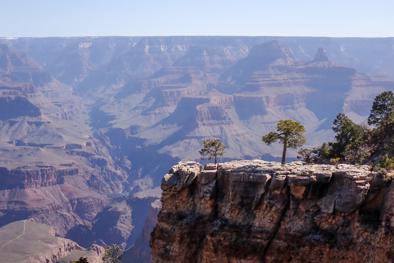
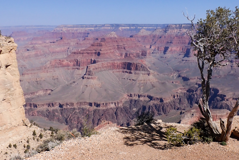
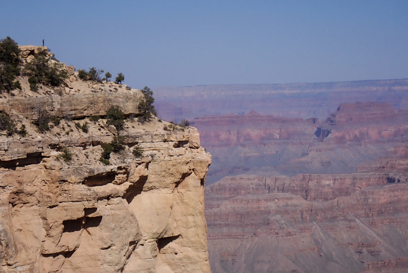
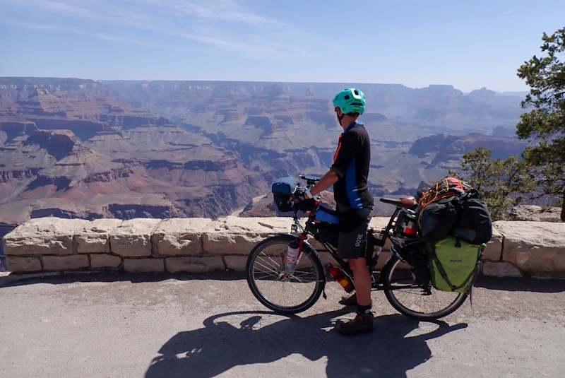
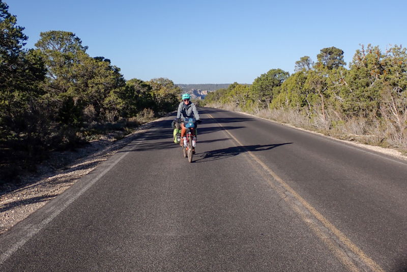
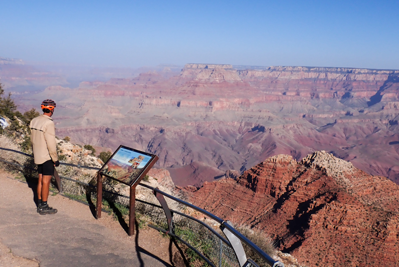
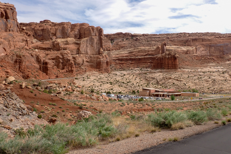
We still had our tailwind leading into the Grand Canyon National Park. A few kilometres before the souh gate the road widened up and there were many accomodation and food options. It is clear from the park infrastructure and everything that goes on around it, that it attracts massive numbers of visitors, which of course you would imagine. The Grand Canyon is world--renowned. The entrance gate had 3 of the 5 lanes open for rangers to check passes and IDs. They are very friendly and chatty. We were told that we could take the greenway cycle path into the main visitor area and this was a lovely bitumen path winding through the pine forest. The park has 4 free shuttle services and the one heading out to Hermits Rest attracted us. A ranger pulled over and asked if we needed help or directions. We asked if we could ride that route as we noticed on the map that the road was closed to cars. He said, "Yes, great road, newly resurfaced and very cycling friendly." So off we went to the Village Route Transfer where the road starts. Wow - our first glimpse of the canyon! Amazing.
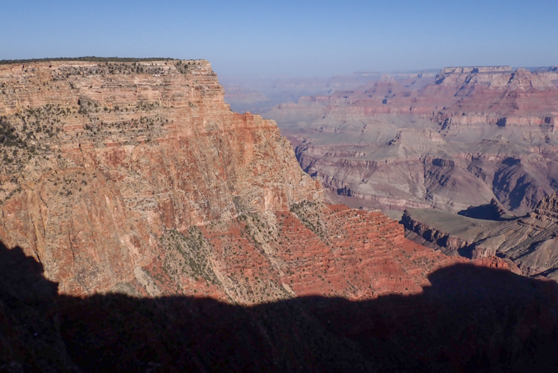
The road to Hermits Rest is great for cycling. Many people were doing it, most hiring bikes at the park. Signs on the road advise cyclist to pull to the side when a shuttle appproaches and let it pass as shuttles are not permitted to pass. As they are only every 15 min, this isn't really an issue. We made a few stops on the route to some of the many viewpoints. The Canyon is well worth a visit as there is so much to do around it, especially walking trails. It was good to be there when it was not the height of tourist season. It did not seem commercialised or trendy. We thought the park had a great atmosphere. The Canyon itself is so deep that at first you could not even see the Colorado River. We followed the road about half-way and then turned back as the wind was really picking up. We would highly recommend doing this ride.
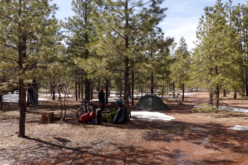
We did a bit of shopping at the main park village and were really impressed by the food and outdoor equipment on sale there. We also went to the Yavapai Point and Geology Museum which had really excellent views of the canyon and some were from inside the big glass viewing windows which was also good as the wind was pumping! We had about 16 km to ride before we turned off to the Kaibab National Forest where we happily camped near a bench! There is lots of snow still about and big pools of water from snow melt. We had a great day at the Grand Canyon!
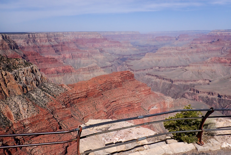
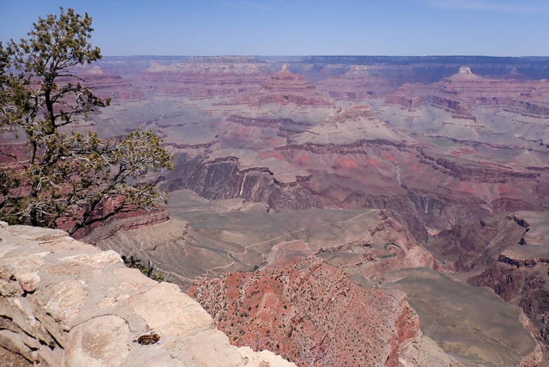
We woke in a very cold forest, many of the puddles from yesterday's snow melt were frozen over again. We set off, passing a few vehicles which had camped overnight along the track from the National Park to the forest. The road had not been in good condition for driving a 2WD through - piles of snow and ice. We had some climbing for about 18 km to the Desert View Campground and visitor centre. We stopped for the view at Navajo Point. It is remarkable how every place you stop to take it in, you see something different. The canyon is a unique experience as not only is it so wide, it is also so long and as deep. It is so many dimensions at once. We filled up wiith water at Desert View and headed off. The Grand Canyon gets 5 stars for availability of drinking water. We had enjoyed the amazing pine forests and had seen many conifers we were unfamiliar with.
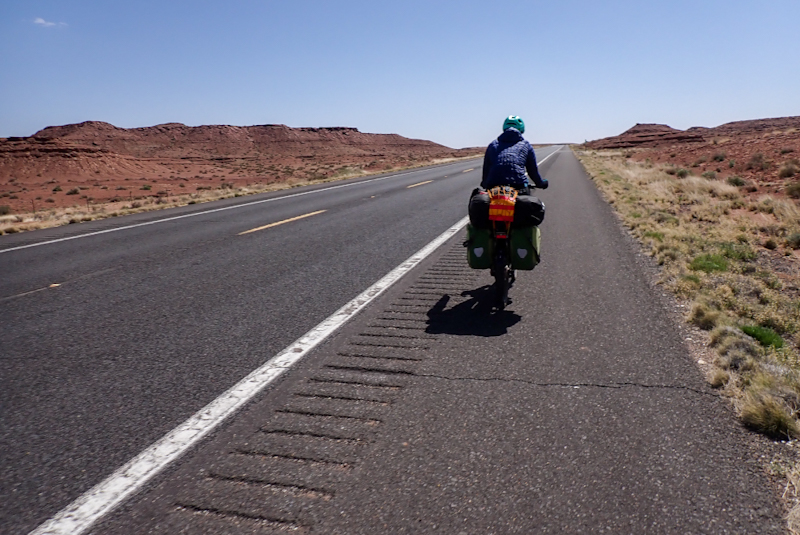
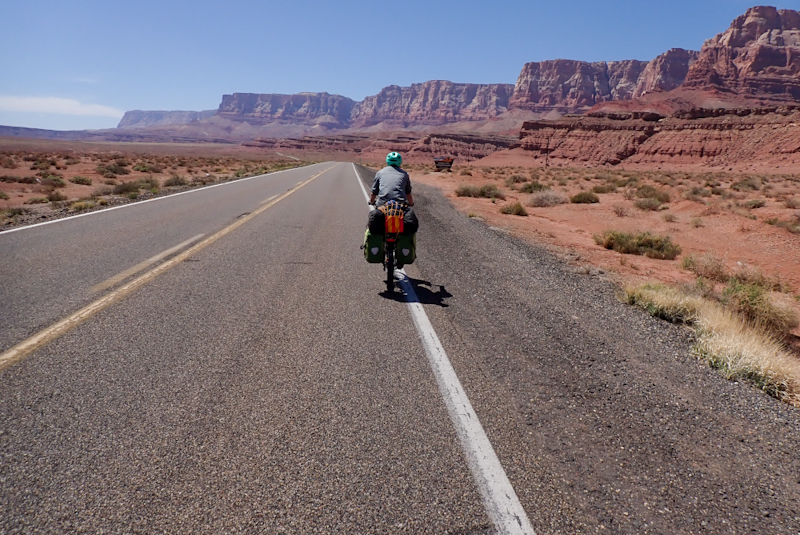
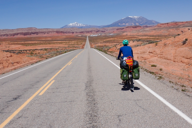
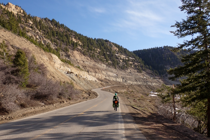
We had a massive 1000 m descent to just after Cameron from the East Gate of the park. To start with it was freezing! We had been warned that on windy days the decent could prove treacherous. The first few kilometres were particularly harrowing as the wind was more of a crosswind and the descent was pretty fast. The shoulder on the road is good however. As we dropped we were really taken with the sudden changes in landscape, from conifers to scrubland to total desert with myriad of colours. Beautiful. We were in Navajo country and stopped at a roadside jewellery store where I bought a beaded bracelet. It was nice to chat to the people who worked there. The descent finally came to a halt at Cameron and we pullled into the Burger King for lunch. We had already "ridden 70 km" without much effort.
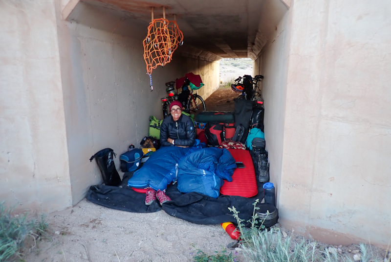
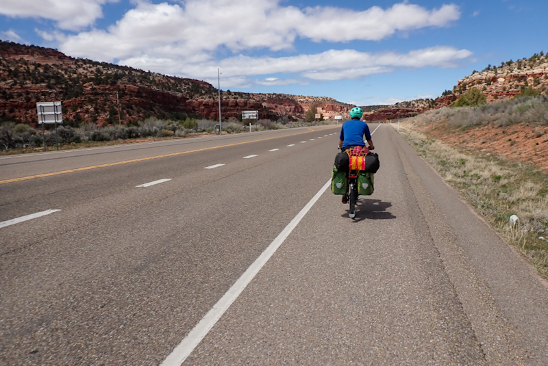
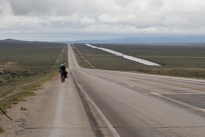
We turned north onto the 89 route and had a crosswind again as we would do for the rest of the day. This was not our biggest concern however. The first few kilometres on the road were good, decent shoulder and the road seems new. This was followed by 25 km of one of the worst roads we have ever ridden. The 89 is busy, it is heavily trafficked by trucks and RVs, etc. There were passing lanes every few kilometres. When there is a passing lane, the shoulder narrows to the point where it only really accomodates the rumble strip which sits in the middle of about a 30 cm shoulder. This situation will last for a few kilometres, as long as the passing lane does. Sometimes the passing lane is on the other side of the road, but you still lose the shoulder. On a good day, on a loaded bike you would have difficulty holding your line on such a narrow piece of bitumen, but with a crosswind and heavy traffic it was impossible. We took to riding in the gravel shoulder as the road was unsafe. We took many breaks. Sometimes I swore at the road, the Arizona Department of Transport, the RVs that drove by sucking you in as they blocked the crosswind especially if they had bicycles tied to the back. Sometimes I cried. Mike was as angry and also hated Arizona, but no tears from him. He could not believe that this road is an Adeventure Cycling Route, and yet it is. There was no option, we just had to keep going and pray the shoulder returned. We had a close call as a Chrysler sedan had overtaken a truck and then could not leave enough space as there was another truck in front of it. Luckily at this point our shoulder was a wider and we were way over on the right of it. The truck, travelling in our direction tried to brake and stay out of the shoulder, ending up forcing the Chrysler out of the lane ahead and onto the shoulder on the opposite side of the road. It was lucky to avoid oncoming traffic. We have seldom felt this unsafe on a road. At the turn off to Tuba City, the road improved a lot. The shoulder returned to stay and much of the traffic turned off. It was such a relief. We had both ended up feeling very stressed as you start worrying what tomorrow will bring with the road. We found a great campspot in a culvert, so that is pretty good! We can't wait to leave Arizona. "More low points than just the Grand Canyon"!
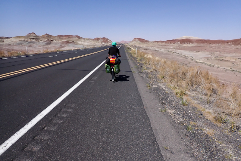
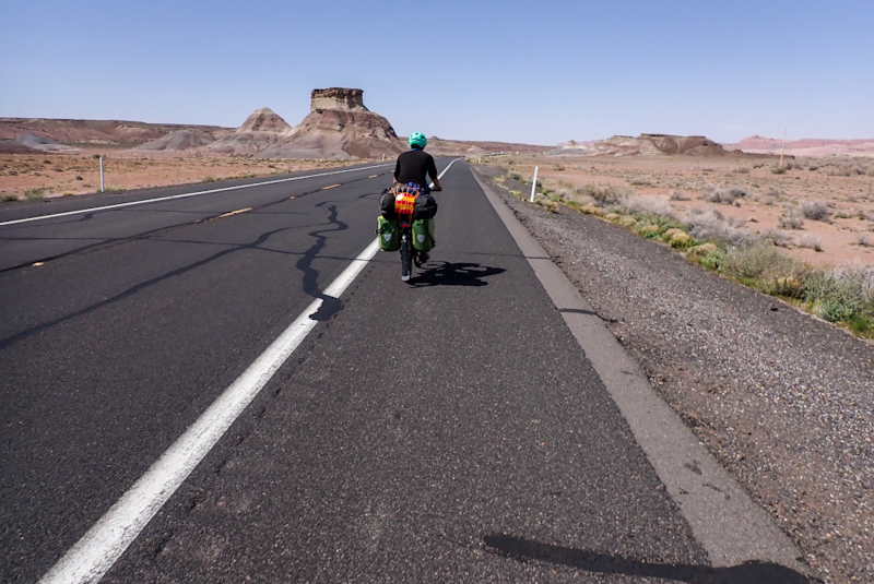
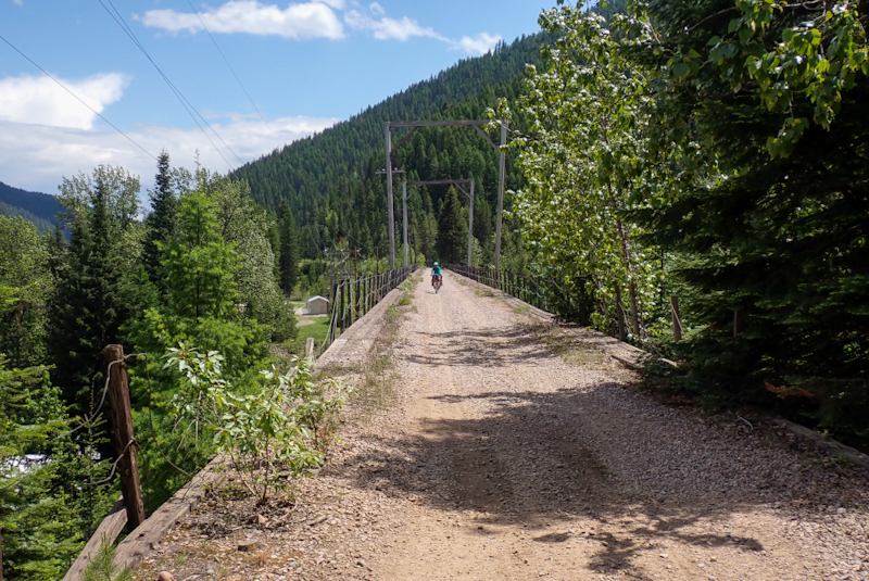
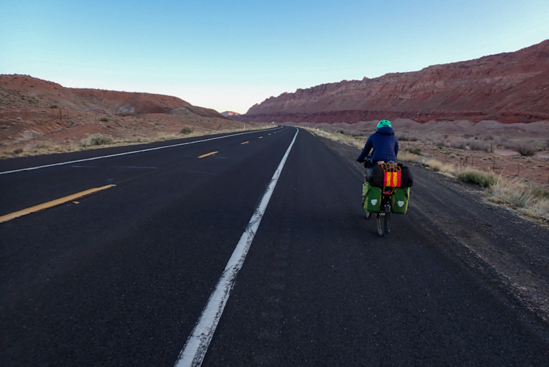
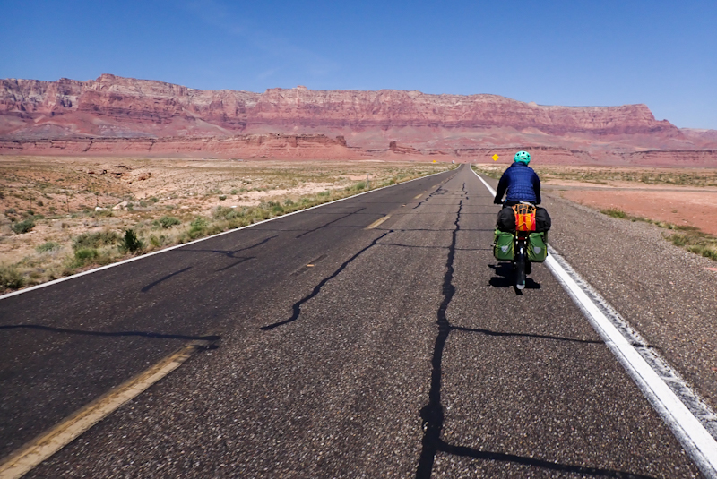
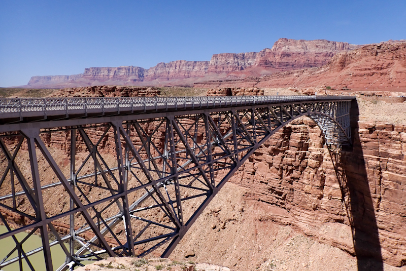
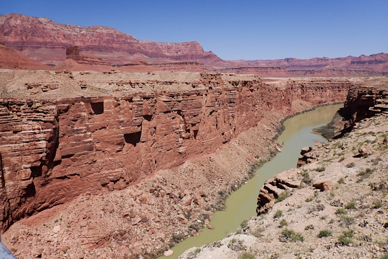
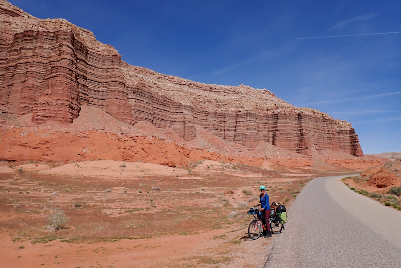
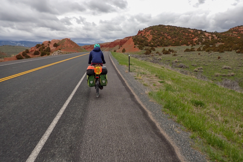
Early and COLD start! We were on the road before 07:00. It was a really cold day, icy. We were amazed to see quite a few people in high vis jackets along the highway collecting trash. It was impressive to see! We greeted a few of them. We really enjoy seeing the houses and settlements in the Navajo community which we passed today. The road follows a river course at the foot of beautiful red hills and the whole area is very striking. We would have enjoyed the views more had we had a shoulder to ride in more often. Once again our shoulder disappeared whenever there was a passing lane and at one point this continued for 8km as there were two alternate passing lanes. The road was quieter though, no wind and it was early. Mainly truck traffic and we would rather trucks than RVs. We looked forward to turning left onto the 89A and it did not disappoint. This road is also called the Vermillion Cliffs Scenic Route and it is a high point of the trip so far. The road rushes down, the gorgeous red cliffs drawing ever nearer, until you end up at the historic bridge over the Colorado River. It was amazing! Such an experience! There is a vehicle bridge and also a pedestrian bridge. The rock structures at the visitor's centre were built in the late 1930s but are in perfect condition. The whole area seems to blend into the cliffs. We had a great couple of hours there. There were Navajo jewellery sellers and one of the ladies was a person we greeted this morning collecting trash on the highway! That was really cool to spend some time talking to her. Many people in her community volunteer to do the rubbish collecting once every three months. We had noticed how cared for the highway surrounds seemed. Clearly thanks to them! I bought a tiny pair of earrings.
We continued on the 89A through Marble Canyon and picked up some water at the petrol station. The lady at the counter kindly helped us out as it seems this is not common practice. We then rode about 16 km further on to camp in BLM lands, passing the Cliff Dwellings on the way. We cannot recommend this route enough! It is amazing.
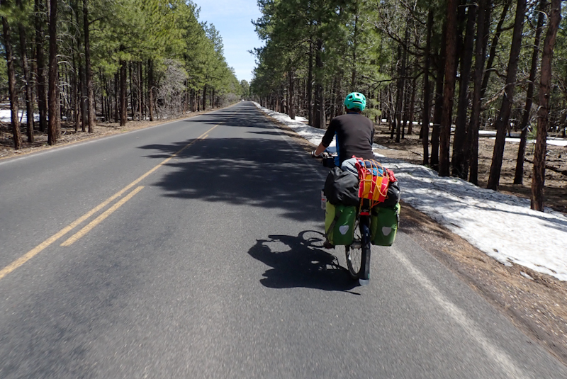
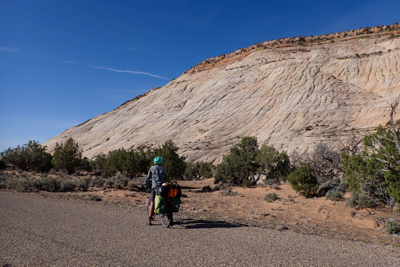
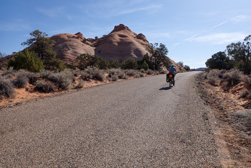
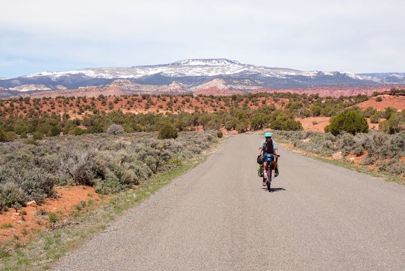
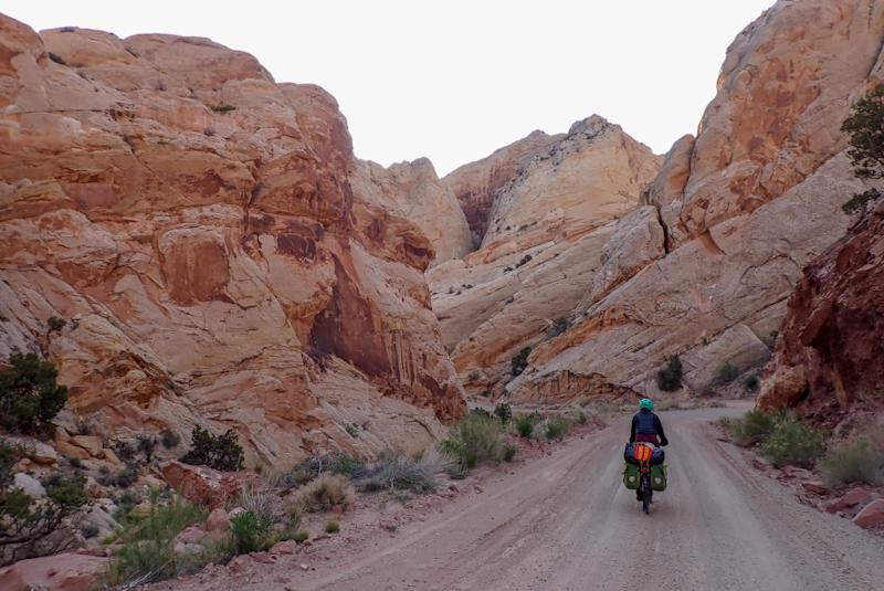
We opted again for sleeping under the stars last night and it was a very chilly one, our sleeping bags, mattresses and our custom-made "wall" of panniers did a great job in keeping us warm. Nearly minus 5 Deg C this morning! Amazing to watch the Vermillion Cliffs come to life as the sky lightened. We had a 20 km very slight uphill ride to the main event, the climb to Jacob's Lake. The start of the climb was steep with sharp switchbacks, after 7 km on the climb we had risen off the beautiful flat and treeless valley floor to the domain of the Cedar tree forest. Amazing how the elavation makes ever larger fir trees! After this though, we still had a way to go. In the end we climbed for 43 km from our campsite to the top at Jacob's Lake, elevation 7921 ft (2414 m), a total climb of 1012 m. Can't tell you how long those last 13 km felt. The 89A road though rates as a favourite of the trip. The climb was beautiful, the road has a good surface almost all the way and it is relatively quiet.
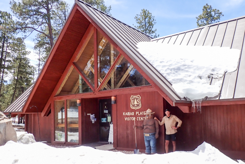
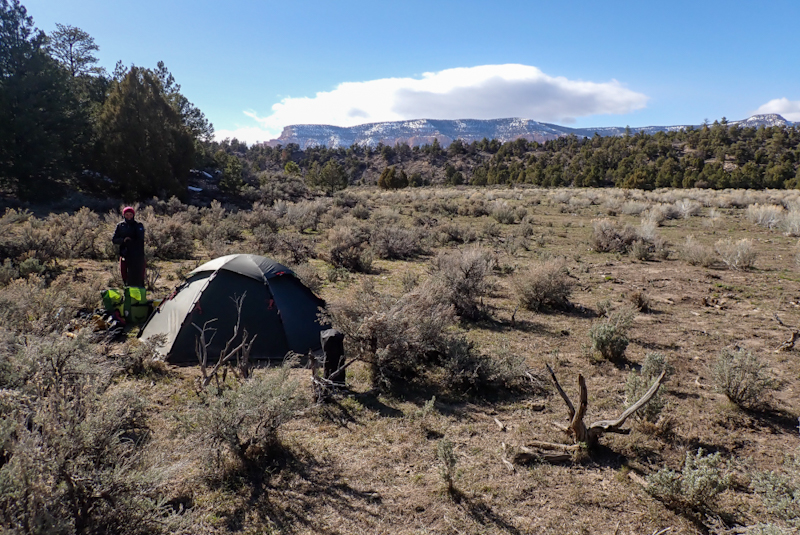
Jacob's Lake is the start of the SR 67, the road to the North Rim of the Grand Canyon. We had initially planned to ride this road out and back, before we ended up cycling way south of our planned route in California. It is still closed for the winter. It will only open on 2 June (!) after the Memorial Day weekend. This is due to snow. It is very beautiful up here amongst the pine trees. Jacob's Lake has a gas station, grocery store, lodge, campground and visitor's centre. All except the lodge were stiill closed for the season. We were able to get drinking water at the lodge. We also bought some of the famous cookies they sell. We have camped in the beautiful pine forest a few kilometres further on.
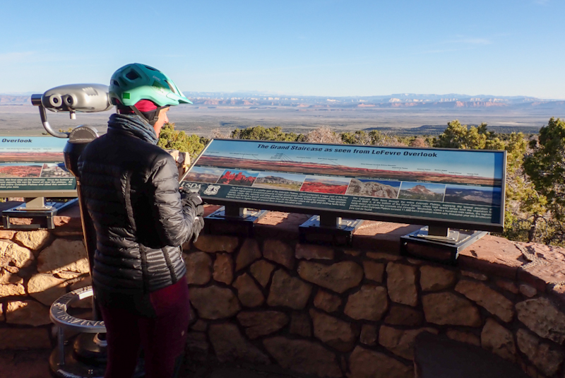
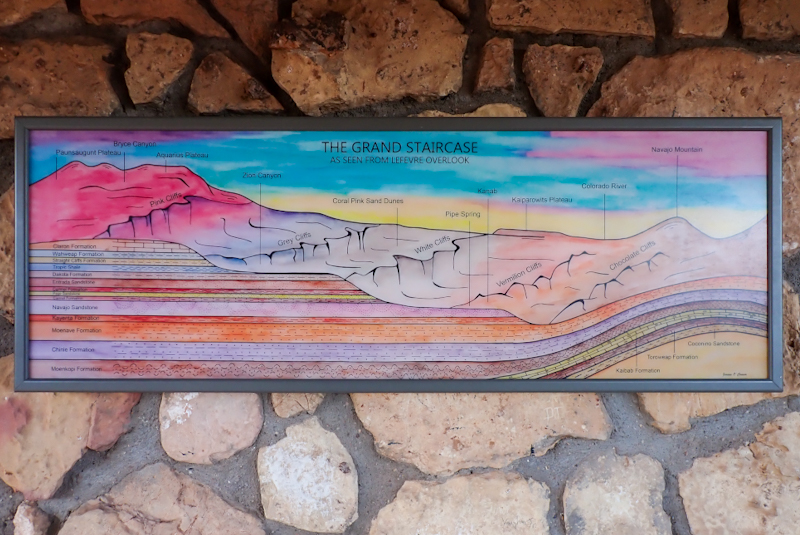
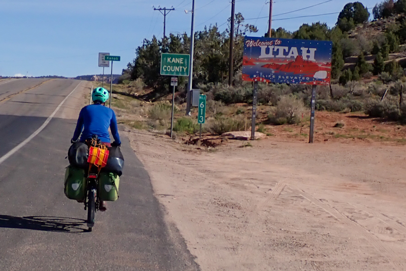
Very cold night (in the tent) and we rugged up this morning for our 50 km descent into Kanab. The road was quiet and the views spectacular. We stopped at the Lefevre Lookout which provided amazing views across the plains to the Grand Staircase and other Utah geological features. We enjoyed the descent a lot. We stopped at Fredonia, the last town in Arizona and then entered Utah, via Kanab. Kanab is a lovely town! We fell in love with Utah in about 5 minutes! Green grass, lovely buildings and friendly people who waved at us driving past and when walking out the supermarket! What a change! Bloke passing me on his way out of the supermarket, "Good day to you!". What??! How does this happen just by crossing the state boundary line? We went to the post office to collect a new MSR XGK stove as our current one needed to be retired. We can't complain as we bought it in 2015 and it has served us well on our last 5 month trip to North America, a 6 month trip to Europe, a 6 week hike and a 10 week Australian cycle tour. We had the stove delivered general delivery from Amazon which is a great service offered by many post offices here where they will hold the item for you even if you are a non-resident. We then went to the local outdoor store to have a look. Next was the public laundry where we washed and dried a load of washing. While this was happening I went to the grocery store next door for the weekly shop. After all of that we went to Lotsa Motsa Pizza, also next door, for their $5.99 All You Can Eat Pizza and Salad Lunch Special! Wow - delicious and such good value! They had about 10 different pizza types and you could just keep going back for more. We were so happy!
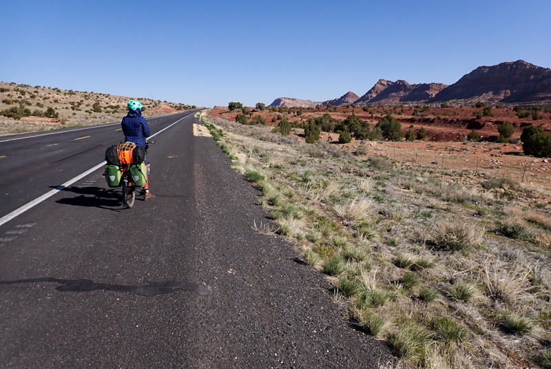
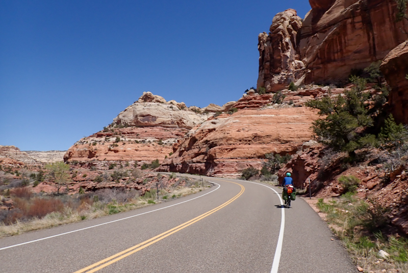
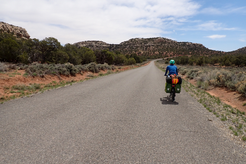
We went to the city park which was so beautiful, green grass, swimming pool, play areas, etc. to fill up with water. This proved a bit tricky as there was only a bubbler which took ages and then what looked like a hand pump for display purposes. Eventually I figured out how it worked and then things went much quicker! The whole town had such a great feeling about it! We set off around 14:00 for a climb out of the town via Kanab Canyon. The surrounding red and orange cliffs studded with fir trees were stunning and reminded us of the Flinders Ranges in South Australia. The amazing rock formations continued all the way on the climb. The road is classed as a Scenic Byway, it is Route 89 again, but a really good road to ride with a good shoulder until the passing lane when the shoulder still remains, just smaller. We felt 100% comfortable on the road. The road has signs warning of ATV drivers in the shoulder and sure enough we saw many of these vehicles being transported to pull-off areas along the road where they are taken for a spin. We camped a little short of our planned end as we saw a good spot. Almost all the land here is BLM land. While relaxing in the shade of a pine tree about 7 ATVs came along the little track on a mission.
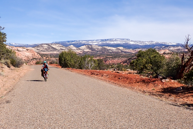
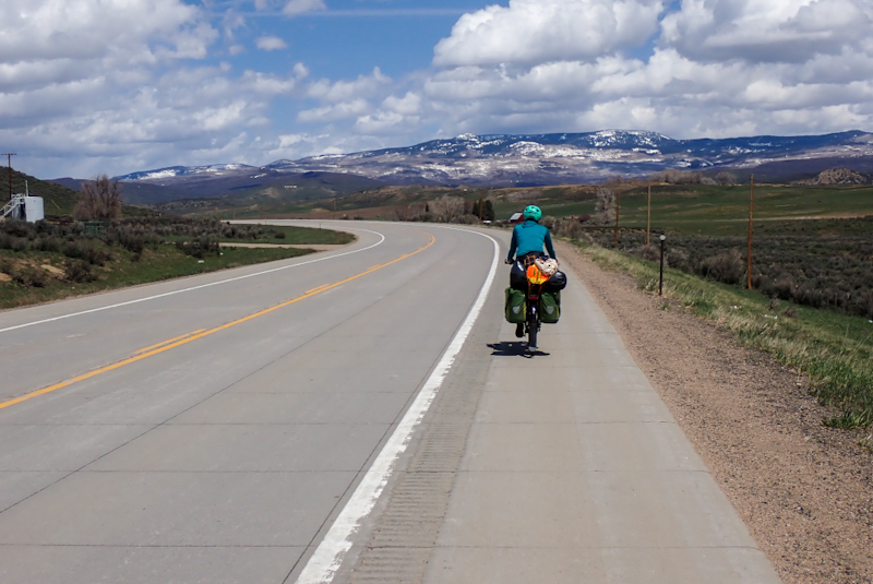
We underestimated how cold we would get on our descent to Mount Carmel Junction this morning. It was 250 m lower in elevation than our campsite. We should have dressed more warmly! The 89 route follows the river valley uphill here through a few very pretty villages for over 40 km, so it is a gradual climb. The shoulder is mostly good. This is a scenic byway and is also called the Mormon Heritage Trail (or something like that). The little villages you pass through are all pristine, very green grass, pretty gardens and neat farms. Nothing like Arizona! As we climbed the river flowed more and more strongly and we saw more and more snow. We stopped at a couple of rest areas with toilets, benches and information. We realised that we did not have this luxury through the whole of Arizona and most of California (although we weren't on the main roads in California). Utah does it right! Beautiful pine forests cover the hillside and lovely log cabin houses. At the first one, in Glendale, we chatted to two blokes who had brought their kids out for some canyoning in the area. They confirmed that three people had perished in flash flooding in a slot canyon in Grand Staircase National Monument. I had seen on the website that a search and recovery exercise was underway. These flash flooding events are common in Utah with rapid snow melt brought on by warmer rain. This year has seen record breaking snowpack in Utah and hence the flash flooding is a bigger risk.
Eventually after futher climbing, the water was just streaming everywhere having overflowed the river courses and there were whole grassed areas just underwater in the valley. We passed a farm owned by someone called Fred Major, it was called "Our little piece of Heaven", a good name! It is paradise up here!
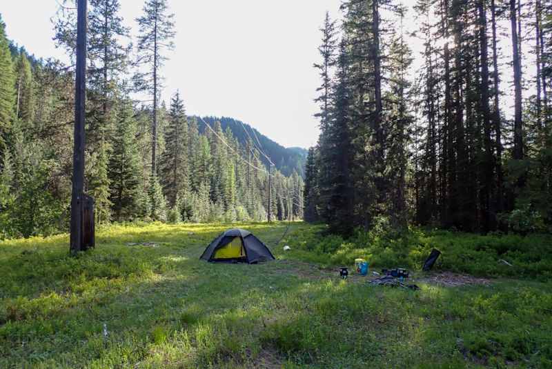
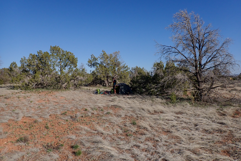
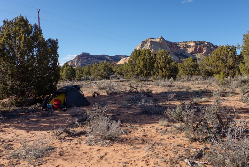
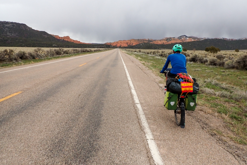
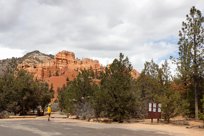
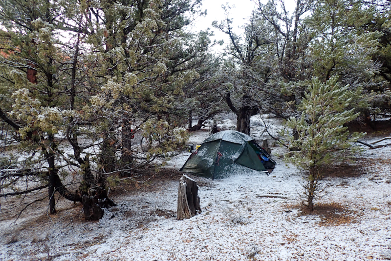
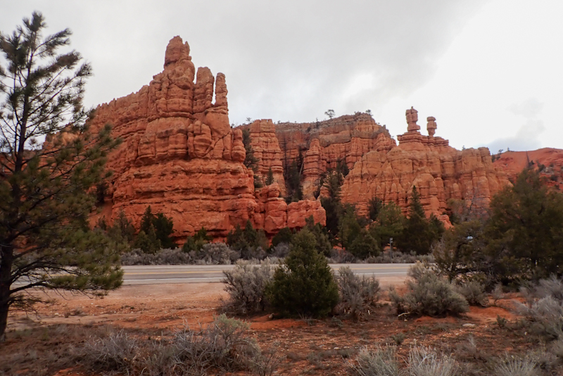
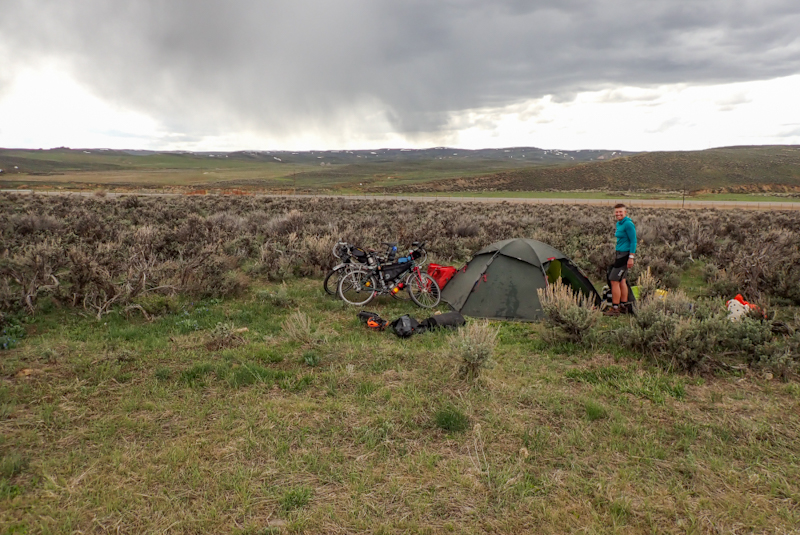
From the summit we had a 30 km descent but we were both pretty tired and did not really appreciate it! We have decided on a rest day tomorrow in the Dixie National Forest, just before Bryce Canyon National Park. Our legs need a rest after 14 days of riding. We have never ridden that far without a rest day before. My right knee has started to niggle. As we approached the junction of Route 89 and Scenic Byway 12 which we would take to Bryce and Grand Staircase beyond, we noticed large rain clouds which we have not seen for weeks! Rain was falling in the distance around us. We had about 4 km to ride on Route 12 until we hit the forest at Red Canyon and wheeled our bikes along a mountain bike trail until we could veer off into the open forest to camp. There is some snow about on the ground. We had rain from 15:00 for a few hours and then overnight in the tent it fell as snow.
We woke up after sunrise this morning and looked out, the tent was solidly iced, and covered in snow and everything was white. It was cold and we enjoyed just sleeping in until 09:00! We melted some snow and then filtered it for drinking and cooking water. There is a vault toilet back at the parking area for the mountain bike trails and I walked back there this morning, it's about 400 m away. The dry riverbed we had crossed last night had a rapid stream flowing through part of it which is great as we could filter water from that for the day. The Red Canyon visitor centre is only a couple of kilometres away and there is water there too.
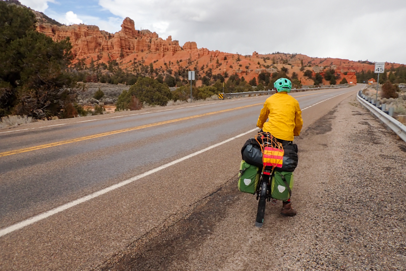
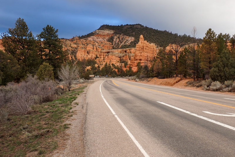
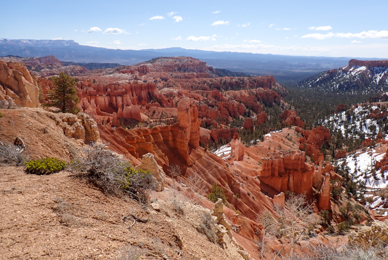
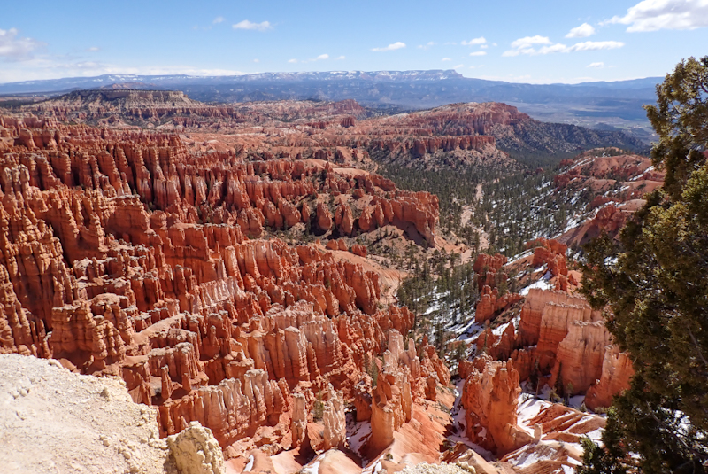
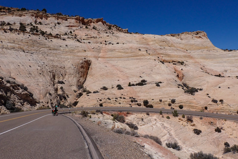
No snow overnight as we set off through Red Canyon along the FABULOUS cycleway all the way to Bryce Canyon. This provision made for cyclists is an absolute trip highlight. The path is bitumen and seperate from the road so that it curls and twists through the forest. It is only for use by walkers and old school bikes; no e-bikes allowed. After the initial climb, the route tended downhill and became more so when Red Canyon was cleared and we were on the Utah plains and freezing our.... faces off! There is a small break in the path when you turn onto the road to Bryce, but it is possible to continue on the path all the way to the main view points. Only issue was that due to the snowmelt, and then the re-freezing overnight, and our morning temps, you had to be VERY careful of black ice. Mike ended up with both feet and both wheels on ice, and could almost not move at all, even to get off it as he couldn't grip the ground with anything. This meant that we avoided some of the path going to the scenic lookouts which a bloke had just finished clearing with a mini snow-plough. We stopped at the visitor's centre and had our flask coffee. The visitor's centres in the national parks are all excellent and highly informative. I bought a couple of stickers and paid cash. "Your money is freezing!" said the cashier. I could barely even talk at all as my face had not recovered.
There is a free shuttle bus service in the park, however we chose to ride from point to point, the cycleway was too good! We spent some time at Sunset Point and all the lookouts at Inspiration Point. I feel like the canyon amphitheatre which no doubt you will recognise from photos you have seen, was more beautiful than the Grand Canyon. The experience was just so surprising. Walking from our bikes to our first view from Sunset Point, we just both said, "Oh!". It is crazy to think that we had not planned coming here and in fact we had never heard the name Bryce Canyon before. It was recommended to us by a few people we met at the Noobs Rally at Panamint. Yet everyone knows the Grand Canyon. The Bryce Canyon Amphitheatre has an architectural structure to it which is aesthetically very pleasing.
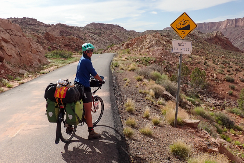
We backtracked to the Route 12 Scenic Highway and went to eat at Subway which is at the junction. Then we had a massive descent with incredible views and the most amazing thing, a BIKE PATH on the road with signs saying "No parking - Bike Path". We are in love with Utah. Even when the bike path ended there was a good shoulder. We zoomed through Tropic and Henrieville, stopping only to fill up with water at the latter. The views and landscape change so much here all the time. We had a steady climb and were thinking of camping when the Dixie National Forest started again in about 6 km time. We could see a road very high above us and could not compute that this was "our road". It was only a few kilometres in the distance. Could it be? Then we joined the dots and saw that twisting in front of us. It was what looked like an impossible climb. Luckily it was only 1.3 km long, but would gain 130 m in height, which means an average 10% grade. After a few 100 m, I was pushing my bike. Mike rode the climb with some breaks along the way. Pushing my bike was doable for me as it had a good shoulder. There was a scenic lookout on top with a restroom. Then a descent down to the plains again. We stopped at the first gate we came to, to get into the forest area to camp. It ended up being a long day, but so worth it. We were pleased that the MONSTER climb was over and was not lurking for us tomorrow! It had been a very, very cold day. I wore a down jacket for most of it, which is telling.
Everything was sparkling this morning, covered with ice. We both missed the 5:30 alarm and woke up at 05:50, the sky was already lightening up. Beautiful ride down to Escalante, along the rivercourse. There was water running in it. We stopped at the visitor's centre which is closed on Wednesday, but has nice benches, water available and the restrooms were open. We had our flask coffee here. We then stopped at the local outdoor store which had great gear, alas we did not need any. Bought two stickers though, we are starting to develop quite a collection on our bear containers. Then to Griffiths Grocery Store for a resupply. This is a good store. We liked Escalante, there were even really nice formal camping options just before the town. After the town we had some low grade climbing, Scenic Byway 12 was still an excellent road, good shoulder and pretty quiet. We worked our way up to an amazing scenic lookout over the Grand Staircase. I guess you could look at this view for ages and never tire of it. Tiers of rock in every shade of pink, red, orange and yellow. We had lunch up here and chatted to some other sightseers. One old bloke from Denver warned us not to get into the local religion for fear of two many wives! After this an amazing descent steeply down right to the Escalante River and then steep climbing up. I pushed my bike again here and there, it got to 13 and 14% grades. Still beautiful views!
The weather was perfect but we were tired of the steep climbs and after stopping at a view site we decided to camp before Boulder. We had met two blokes in Escalante who had suggested we take a smaller road through Long Valley east of Boulder rather than finish route 12 in Torrey and then take the 24. This seemed like a good idea as it would save us a 700 m climb and also there is still a lot of snow about up there. We then met Mike, who lives in Boulder and cycles to the other side of the Escalante River and back each day to work (Impressive!) and he was familiar with the road too and seems to confirm their advice. He also offered us a bed for the night and a hot shower and laundry! How cool! As it was already nearly 15:00 though, we chose a bushcamp nearby with an amazing view of the canyon.
Warmest night and morning in days. We set off and stopped just before Boulder at a scenic lookout. What a surprise to see Mike, the cyclist from yesterday who pulled in in his car, having dropped his son at work at Kiva Koffeeshop (before Escalante). We had a chat again and he seemed postive about us riding the Burr Trail Road. When we got to Boulder we had to continue past the turnoff to get water at the little museum park there. As we were heading that way, I saw a large dog out of the corner of my eye jump through a fence and rush at me on the road, growling. A lady was shrieking hysterically. The dog chased me and managed to get close enough to my right calf to latch onto it with it's mouth, but did not bite. We have been chased by many dogs whilst touring and usually they cannot get into the gap between our panniers and our legs,, so you are actually quite well protected. I was screaming out for Mike who was ahead of me and he turned back to help, dropping his bike on the road and going after the dog. I only noticed then that the dog was pretty old, so it was a marvel it had so muuch energy. An old bloke, it's owner was running down the road in a dressing gown, bearing the name of the accomodation they were staying at. He was saying, "Don't kick the dog, it's not her fault, rather kick me!". Mike gave the dog a good kick which sent it flying, and then running off down the road. "Oh no, " said the man, "How are we going to get her back now? My wife is incapacited... blah blah blah". Don't give a shit! Stay at home with your stupid dog. It's always the same: "Don't worry, the dog is harmless" until it's not. But guess what, we're also harmless until we're not. So that was a bit of an adrenaline rush to start the day!
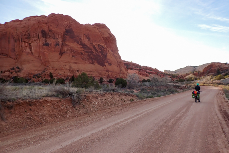
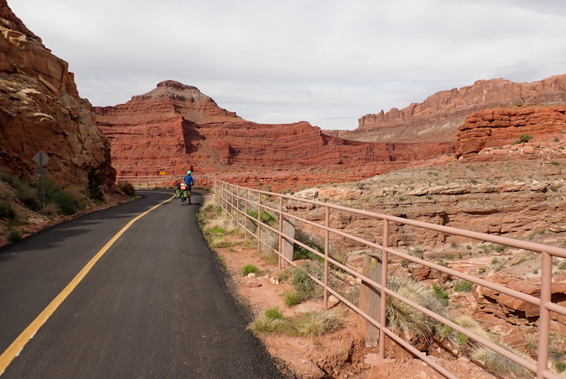
After getting water, we had our morning coffee break and then headed back to the turn off to the Burr Trail, a Scenic Backway. I will let the photos tell the story, this road was an absolute trip highlight. We could not believe the steep descent into the canyon, the beautiful ride through it and the colours. We could not help thinking of the serendipity in that chance meeting outside the grocery store in Escalante with those two men who had just driven it. If not for them, we would not even have known of it! It was quite a demanding ride with a lot of climbing and very steep descents, but the road was quiet with only a few fairly hardcore tourists, and had a good surface. No trucks or commercial vehicles.
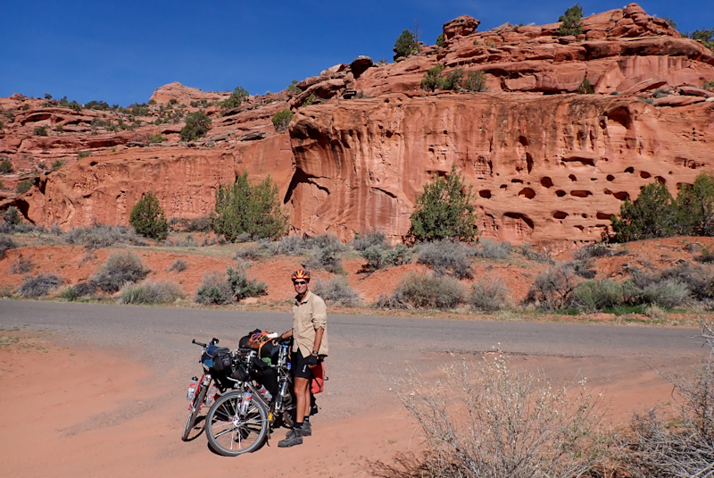
One truck did pass us and the driver got out to tell us to go back 100 m as we had just ridden past a slot canyon right on the road. It was so good of him to tell us and we could walk right into it. We stopped for lunch high above the escarpment with a breath taking view. A woman driving a bicycle touring support vehicle stopped to offer us snacks! Best chocolate brownies ever! We ended up stopping short of our planned diistance but it had been such an amazing and challenging ride and we had just taken it all in. The camping around here is brilliant and stopping before 15:00 gave us the chance to relax in it. We have a gravel road stretch on the road from here tomorrow for about 29 km. We would encourage anyone to ride this road, but you have to carry water and also only do it in the same direction as us, the cimbs the other way, well we don't want to think about them!
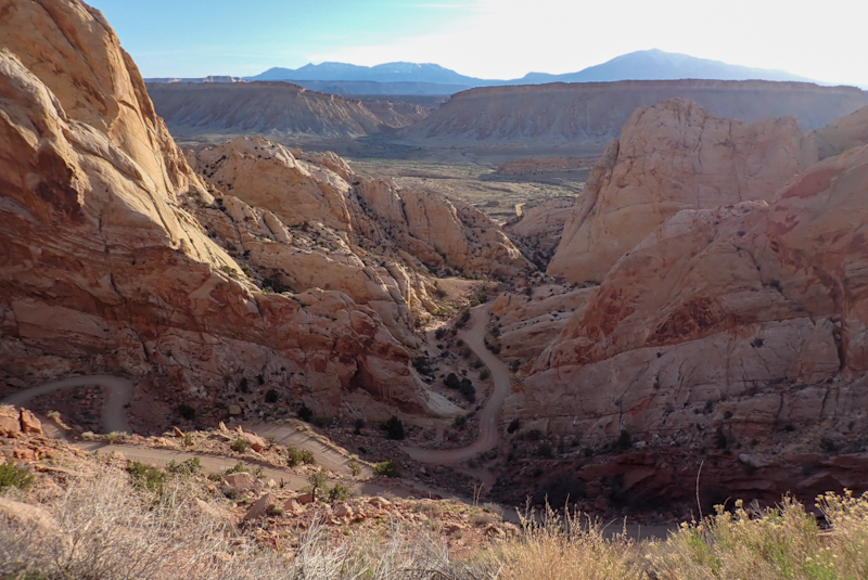
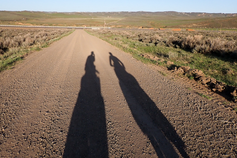
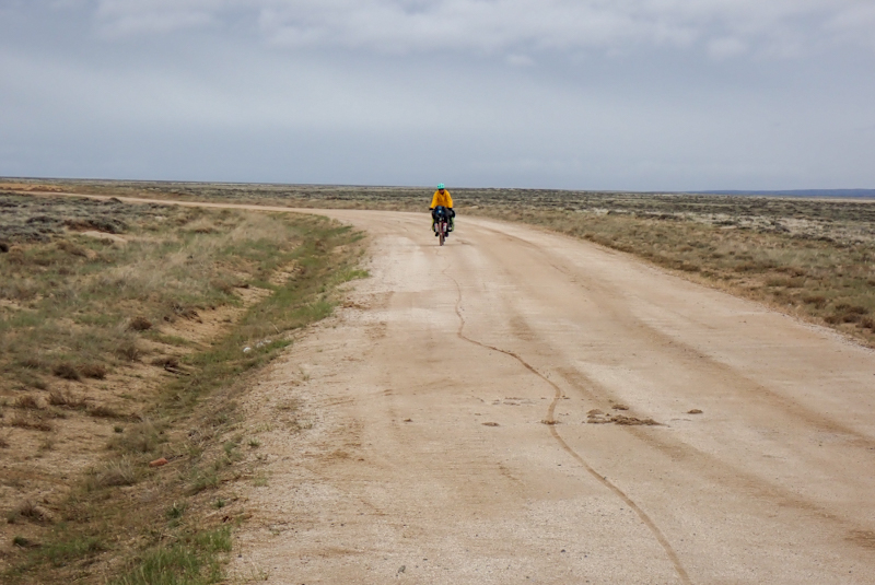
Cold morning, northerly wind. As expected, the pavement ended soon after our ride began. The sun was rising and all the mountains and hills were silouettes. The unsealed surface was excellent and we descended rapidly until we reached the famous Burr Trail Switchbacks, 12% grade, downhill for us. Wouldn't have had it any other way. The experience of looking down at this crazy steep gravel road zig-zagging below us was unique. We stopped in every bend, taking in the view and many photos. After this was behind us the road continued in pretty good form, now and then sandy patches. Instead of the 26 km of unsealed road we expected, it ended up being only 13. We saw our first car around 10:00. The road was almost always completely empty and it was great having it to ourselves. The views continued to change and unfold as the road continued. The road traverses not only the Grand Staircase National Monument, but two National Parks; Capitol Reef and Glen Canyon. A dramatic canyon appeared again and a massive descent and then we crossed the North Bullfrog watercourse which ran under a rough gravel causeway. We were able to filter water here for the next couple of days. The Burr Trail was an amazing road to ride, probably the best road we have ever ridden and we would recommend it unreservedly, again though, only in the direction we rode it.
We reached the junction of Route 276 and turned left towards Ticaboo and Hanksville. All the traffic on this road was going to Lake Powell, the road terminates there. There used to be a ferry service but for the last 5 years the water level has been too low. Route 276 is also quiet and picturesque, we had that northerly wind stilll, now a headwind. There was a fair amount of traffic going to the Lake, towing boats, jetskis, etc. There is a large houseboat storage yard called an offshore marina, which was really strange to see. There were a couple of gas stations with large stores and food outlets, closed now for the season. We reached Ticaboo and the resort was happy for us to take on drinking water. The water we had filtered at Bullfrog did not taste good even after putting it through a purifier and carbon filter, and we did not want to risk upset stomaches (probably salty). We learnt from a bloke there that Lake Powell is expecting 70 feet of water over the next while due to snow melt on high lying areas and this is the first time since 2001 that the water level will be as high. We plugged away after this, uphill, into the wind and called it a day just shy of 80 km. The last few days riding have been absolutely amazing, but demanding, and we are feeling tired. There is a mental aspect to it as the riding has required high levels of concentration at times. Also, the scenery has been overwhelming on our senses. We will head north from here and try to hit some lower country and get some kilometres done on our way to Moab.
We rode to the end of Route 276, quite hilly with some steepish climbs and very long descents. We had some great views again, of the snow capped elevated peaks of Helliers and Pennell and even slot canyons, viewed from above. This section was 40 km, then a left turn onto route 95 to Hanksville, another 40 km. Both roads are excellent quality, good shoulders and on a Saturday anyway, very quiet. The 40 km on Route 95 were easier and we arrived in Hanksville around 13:00, with 80 km done. Just shows how hard that day to Boulder was when we called it a day after riding 60 km by 15:00! We pulled into the Burger Shack at the gas station and can highly recommend the food. Afterwards we set off through the little village to the BLM office which had drinking water available at the usual pump fawcet that you find in Utah. They also had beautiful green lawns where we could relax under shade. It was a pretty warm day and we spent a couple of hours there out of the sun. We filled up our water containers and set off around 16:00. There is a climb out of town on Route 24 to the Goblin State Park which we wanted to finish today.
The road continued really nicely, good shoulder, newly resurfaced just leaving Hanksville for a few kilometres. We passed some amazing bulbous boulder shapes that are synomous with Utah. They look variably like Gaudi cathedrals, or drip sand castles, or handmade pottery sculptures, or baked goods. A car pulled off the road ahead of us and two people got out, as we neared them the bloke held out a can and said, "Do you drink beer?". "No," we laughed and so he offered us fruit flavoured sparkling water. How amazing and so appreciated! His name was Caleb and he told us that he rode from Alaska to Mexico last summer so he knew about the hardships. We had a chat and he offered us some route ideas when crossing into Colorado. The interaction gave us a bit of a boost and we set off to finish the ride. We pulled off the road at a dirt track on BLM lands. It is very sandy here but a good campspot.
It was an easy ride into Green River. Still good views, but a lot more barren. The first 40 km were on Route 24 and then we rode on the Interstate 70. It was brilliant, the shoulder was almost spotless! We arrived in Green River having already booked into Motel 6 online on the way. This is a real budget option however we figure all we need is clean, hot shower, aircon and we're good. We stopped for lunch at the local taco van which was really good - chicken enchilades and beef torta. A local chatted to us about our trip. As it was Sunday, not much was open in Green River. It was nice to see a river though! One of the reasons we picked Motel 6 was that it said online that check-in was 13:00, whereas usual hotel check-in is 15:00. We got there at 12:00 hoping they had a room ready, but when Mike went in the person was a bit odd and told him no rooms were ready and anyway check-in was 15:00. We sat outside and contemplated our next move.
From our vantage point we could pretty much see all the accommodation options in Green River. The Super 8 was just up the road and we made a booking on their website for a good rate. I even called to confirm if the Green River Super 8 had a guest laundry, yes it did. I was told once we had booked the room we could call back to enquire about an early check-in. Check-in was usually 14:00. So we made the booking and as the hotel was just next door went along to check-in. When the receptionist could not find our booking, we showed her the online evidence and she grimaced and said, "That's Green River, Wyoming. Happens a lot!" What????!!! We asked if the booking could be transferred, she said "no", we had to contact Super 8 Green River Wyoming first to cancel the booking and then book online here. So we did all that. Whiile this was going on (we were debating the booking as it was a lot more expensive than the Wyoming one), a bloke called Tom from BC, Canada, came over on his bike to chat. We sort of had to focus on what we were doing online so we said we would catch up later. He then came over a little later and actually offered to share his room with us as it had two double beds! Imagine how generous that is? Obviously he had not seen the amount of stuff we generate from our panniers! So kind though.
Anyway, we could check in before 14:00 and went to have a chat to Tom again. He is here doing an off road suppported tour of San Raphael Swell, which we rode through this morning. I had a hot date with the washing machine which ended up taking some time. We decided to wash everything and this would be two loads. The first load came out dirtier than when it went in, sometimes you get this with public laundries, the washing detergent residue becomes grime on your clothes. In this case though it was really bad. I got the receptionist to have a look and could sort of see that she might have thought our clothes would have been that filthy! Anyway, I told her she needed to pay for an addtional wash, which she agreed to. In the end all was good, clean dry washing. Whoohoo.
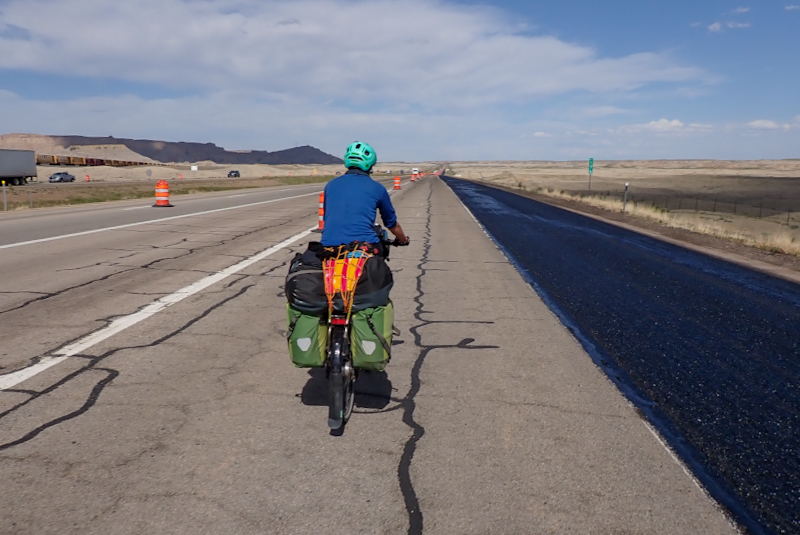
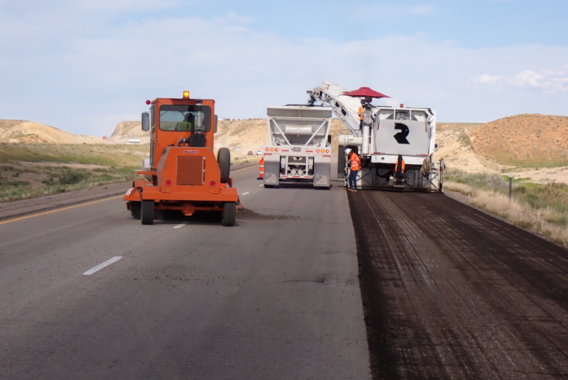
We had a nice breakfast included in our hotel booking and spent a leisurely morning in our room before checking out at 11:00. As the temperature forecast was for 30 DegC, we went to the town park after buying some groceries to spend a few hours in the shade. We did not plan on riding far today. We then moved to the shady area outside the visitor centre and had some Coke to drink. We set off around 15:00 and got onto the Interstate 70. The time on the highway passed quickly as they were resurfacing the road and so there were a lot of construction vehicles and all the things that go along with that, cones on the roadway, etc. We chatted to some of the men working there and they told us that they do not see cycle tourists usually. One took a photo of us waiting in line as he hopes to win the company monthly prize! Anyhow, it was good seeing the Utah transport department keeing things up to standard!
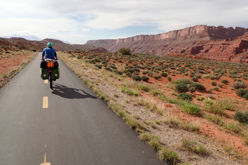
We turned off the Interstate south towards Moab on the 191. The start of this road was really good as it had also been resurfaced and there are two lanes headed south (only one north) with a good shoulder. The second lane disappeared after a few kilometres. The road was quite busy, even after 17:00. We were happy to turn onto BLM lands, crossing the railway line and found a nice spot to camp almost immediately. The weather is a bit strange. It is warm and looks like some rain clouds about. It is very green here, after totally barren landscape, one could say moonscape, along the Interstate. We have about 40 km to ride to Moab from here.
Route 191 is very busy with truck traffic and the shoulder is at times a bit narrow. There are passing lanes which help, but even sometimes the trucks get a little close. We only had to ride 25 km on it though as at Giants of Moab (dinosaur park) a brilliant cycleway begins which takes you all the way past Arches National Park to Moab (crossing the Colorado River via a bike/pedestrian bridge). We actually saw people ridng bikes on it, so it must be truly excellent considering we have not seen anyone riding the bikes they haul from state to state. We had a strong southerly wind (headwind) and spent quite a bit of time at the Arches vistor's centre. We met a guy called Noel from New Mexico who is keen to get into cycle touring. He was great to chat to and we were able to give him some advice, mainly to start small!
Moab was as expected, busy and trendy. We picked up a state map of Colorado at the visitor's centre and did some grocery shopping. We also went to the outdoor store which is well worth a visit and carries excellent stock. I bought a lightweight Smartwool hoodie for riding in. It is a perfect replacement for my Aclima hoodie I retired years ago and have not been able to replace. The store offers filtered water on tap in any quantity you want free of charge, which is a great service and we made use of it. Outside the store we met Jessica who works in adventure travel, often assisting with organised bike tours. She was a bundle of enthusiasm as she also cycle tours and loves her touring bike. She has generously offered various assistance if/when we pass through Jackson, Wyoming, as she is happy to help us out in all sorts of ways. It was great to meet a like-minded cycle tourist and we hope to see her again. We also had to collect a small package at the post office (Amazon delivery). Unfortunately even though it had arrived, as it was delivered by UPS, the post office only processes it by the next day. Inconvenient. We had to leave it and hope Amazon will refund.
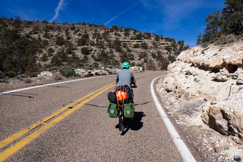
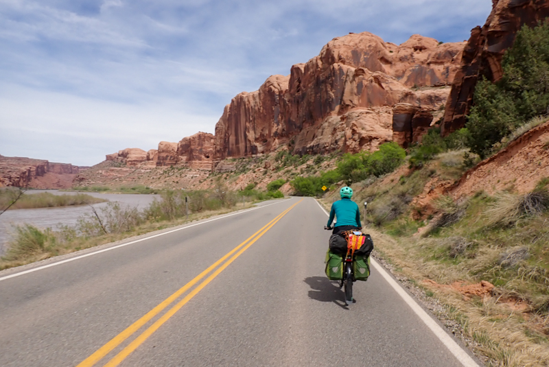
We then set off back onto the bike path which follows route 128. This contiinues for a few kilometres along the Colorado River. the river seems high to us and is fast-flowing with brown, muddy water. There are whole tree trunks being carried along in it. This is all due to snow melt. When the bike path ends, you join the road which is narrow and windy with no real shoulder. It carried mainly tourist traffic and very few people were towing caravans, I think we saw three. No RVs or fifth wheelers. Even with that it was a great experience riding this road. The canyon walls change from red and impossibly high to light brown sandstone by then end. The canyon opens up as you go, but remains a canyon all the way and we rode 30 miles along it. You follow the Colorado River upstream all the way, but it is an easy ride. There are many campgrounds along the way on the river, with only vault toilets They are nicely situated on the river. We crossed the Colorado again and were then in BLM lands and so ok to camp freely which we have done.
It was aboout 18 km from our campsite to the end of route 128. The Colorado River emerged out of the canyon and the area became rural agricultural. We took our coffee break at Cisco, a derelict settlement along the railway line. We then joined the Interstate again (I 70) until exit 227. There were some bridge repair works going on on the road which meant that the left lane was removed and the traffic was partially diverted into the emergency lane which is also our shoulder, so we had to get across into the left hand shoulder for these bits. Luckily the road was quiet. The 227 exit towards Mack took us to the old original highway which was unsealed to start, then partially sealed, then gravel, then as we crossed into Colorado, a properly sealed bitument road. There was little to see but the distant snow covered mountains and lush green pastures. We had a sleep under a shady conifer then pressed on.
Cycle tourists often arrive in the arse-end of any town, city, state, country. We get a view of life for people beyond the tourism brochures/your favourite sitcom/propaganda. Going through the outskirts of this little place we were just struck once again by how small town America seems not part of the world. Little shacks with American flags almost as big as they are, and then massive brand new housing complete with a lawn that belongs on Augusta golf course; it's just so weird. Letterboxes with "Vote Trump" sticker on it. Having grown up in apartheid South Africa fed US TV shows and Archie comics, America seemed like a dream. Now it just feels quite removed. In any case, we had the same feeling coming into Colorado that we had going into Arizona. Didn't really want to make eye contact with anyone. Actually, I don't even think we saw anyone.
There was nowhere to get water today or even throw away our garbage, other than Lake Highline State Park. We weren't going to camp there, and we noted that there was a $4 day use fee. As we turned onto the entrance road, we could see the campsite and a water pump, but we will never just help ourselves to water if not publically on offer. So we went to the entrance and it was pretty official. The receptionist asked if we wanted a campsite, but we said no, we were hoping to get water. She said we would have to pay $8 for the two of us. We said, well, only one person will collect the water. So we paid $4 and then asked where was the best place? She didn't really know but pointed us in the direction of a water pump nearby. When we went there, it didn't work. Anyway, we eventually sorted it out and found another one. The campground was packed with school kids. We set off after soaking our shirts, washing our cycling gloves etc. The area is rural and it had been ages since we had seen sheep, lambs, cows and lots and lots of green grass. Very lush! We rode about 15 km along route 139 and found the perfect campsite in BLM lands. The entrance had a gate that was high above the road, only for use by cyclists, walkers, horse riders etc. Perfect spot! We have excellent views of the mountains and spent a relaxing few hours before turning in. A massive thunderstorm moved through overhead, but did no damage.
There was rain overnight and a lot of wind and we woke to overcast skies. We had set our alarm for 05:00 and were on the bikes at 06:30. The road is very good and it was mainly commercial traffic, utes and trucks. The 139 climbs up Douglas Pass and in the beginning stages this is very gradual as it winds alongside a river, so you are climbing at quite a low grade up a river valley. From our start point it would take 36 km to reach the summit, however at 31 km the shoulder goes and so obviously that makes for more challenging riding and best done early morning or when the road is quiet. We were keen to camp on BLM lands again and the camping is beautiful on this road. We were both feeling the effects of two 100 km days in a row in our legs and it having been quite warm, and thought an early day would be great. Coming along the road we saw a gate entrance into a little grassy valley which was beautiful. Just ahead were signs warning of road work and as we had only a short distance to go on the climb, we called it a day and had a restful afternoon.
Perfect morning, cold, around zero Deg C. We had 12 km to climb to the summit of Douglas Pass. The roadworks were over which was good. It was clear that they had been doing work to the shoulder, clearing debris from rockfalls, the usual winter story around here. After 5 km the shoulder ended but the road was pretty quiet, a few work vehicles, very few trucks. We saw a herd of deer. Initially the grade climbed to 9% and then the road started to wind like a mountain pass. Before the switchbacks started we had a 12% stretch which was pretty harsh. The road condition was okay overall but took a beating in the upper reaches where it had been under rockslides and I suppose avalanche type conditions. The road and outer shoulder had been scraped clear, but the road surface was damaged. At one spot, safety cones had been placed around the edges of an obviously subsiding road, but Mike reckons that the entire lane will slip down the mountain very soon. It's amazing that more safety measures haven't been put in place. When viewed from the summit it is clear that the road in the area is very close to collapse. It concerned us as some trucks had come up there with very heavy loads, trailers of sheep, etc. We pulled off the road a couple of times for trucks that we could hear and see far off down the switchbacks. They really laboured up the climb. The summit is at 2520 m. There was heaps of snow about and tracks leading off the road into BLM lands were deep in snow. The inspiration for the trip was in fact to ride the Great Divide, starting in New Mexico. This route spends a lot of time in high country Colorado. Of course, due the the heavy snowfalls this winter, we realised quiickly that it was not going to be possible to follow this route. Seeing these mountain tracks underlined that for us. These tracks are often forestry roads and of course do not get any attention during winter, unlike the sealed roads they are never cleared of snow, for obvious reasons. They would be absolutely impassable by bicycle, as we could see today.
We had a rollicking descent to Rangely. It was about 60 km at a gentle gradient so that is fabulous in a downhill, when you don't even have to use your brakes to slow down, you just zip along at 30 to 40 km an hour. It was a little steeper at first and then you just drop into the river valley that widens and the climb is less steep. Also, we had a fantastic southerly wind which urged us along. At Rangely we bought some food at the supermarket and then went to sit on some benches at the museum. There was a fawcett and we wondered about getting water, but the sign on the restroom door said the water was not potable. While Mike was Steripenning some collected water, I went in search of someone to ask about the fawcett water and met the wonderful Diana who was so full of life that she just sparkled with it! The water was not good to drink due to the pipes being dormant all winter, she said, but she insisted that we take the water she brings from home to use during the day. She came out and had a long chat to us, telling us about life in Rangely and the challenges facing the cattle farmers. We had been wondering about the cows we saw in the bush and if they were moved for the winter. She said that many ranches do move the cattle but it is very expensiive. Some move the cattle to Nebraska which is also very cold in winter but has plenty of food for the cows and also is flat. This winter, because of the once in a generational storms, many cattle froze to death on the roadside. It is a really tough life out here for farmers and cattle alike. Anyway, we really like Diana and I told her that she was the first person we had met in Colorado and she was fabulous! She even gave me a hug!
We needed to get to the US highway 40 and settled on taking county road 1 which meant cycling 6 km into town and then turning north, so we benefitted from that tailwind again! This little road was really good for cycling as it was quiet and had a good surface. Just before it intersects with the highway we decided to camp as it seemed more sheltered from the wind than what we would have had later on (we think). The campsite is again on BLM lands and this resource is a trip highlight.

Freezing morning, tent iced over, so we rugged up and set off. We tavelled east all day on US Highway 40 with a good tailwind. After it ceased being freezing, it was a beautiful day. Diana had warned us about a large number of cow carcesses along this road, all the way to Craig. Poor animals had been caught in winter snow storms and frozen to death. Well, it was certainly true, we lost count of the number of cow corpses we saw lynig by the roadside. There were certainly many. There was still snow about here and there, even just near the road. The road itself was perfection, quiet, wide shoulder and good surface. Often undulating. It felt pretty remote. The only things on it were a closed campground at Massadonna, and Elk Springs, which was only some derelict buildings and a rest stop with toilets, picnic tables and public water tap which was amazing! Then 15 km before the end of the day we passed through Mabell which is a lovely village on the Yampa River where we bought a few things at the general store. The store was really good and reasonably priced; a community store.
Something strange about the road was the MILLIONS of tiny black grasshoppers on the road and roadside. It is a plague. Everything is so green around here, but I bet if these grasshoppers survive there will be not a blade of grass left in a few weeks. Then, once the cow corpses ended, the deer corpses began and there were many more of these, sometimes in groups of two or three. The lady at Mabell general store told us that they starved to death in the winter. They come out to the road to try to find a way to food, but the snowdrifts were feet hight and there was nothing to eat, so they just starved and died. This fall, there wil be little hunitng allowed of female deer to try to get the population to rebuild. This area is famous for deer and a popular hunting area.
BLM lands are pretty sparse around here, and we turned onto county road 53 as they start there a few 100 m in, however there were no good campspots, so we ended up climbing to the summit of this little gravel road, about a mile in, and could then find a place to camp amongst the trees.
As we woke up it started raining lightly but by the time we set off at 07:00 it had stopped. We had only 36 km to ride to Craig along the US 40 and it was slighty uphill until just before the town. Rain was forecast again (and possibly snow) for the afternoon, we needed to do a major resupply at Walmart (first one we have seen since Arizona) and also perhaps some laundry, so we investigated accommodation options in Craig. We booked into the Super8 again. It was a very cold for riding, it was around 5 Deg C at 09:00, very cold headwind. No more grasshoppers or dead animals though.
We arrived in Craig around 10:30 and went to the laundry, which has a milkshake bar inside, and the lady who ran it was so friendly, even inviting us round for a home-cooked meal. However, we weren't sure how long we would spend on the laundry, shopping, etc. so declined this time. We thanked her for her generosity. After the laundry was done, we made our way through the town to Gino's for a pizza (which was delicious) and then to the hotel to leave the bikes. It was so nice to go into Walmart together, as usually Mike is outside waiting for me looking after our stuff! We had a package to pick up in Walmart which we had ordered online. We spent quite a long time in the store. I was pretty excited to get a Kleen Kanteen stainless steel water container which we had not seen at any outdoor store and I was looking to replace my little 1.9 L keg that I carry on my seatpost. However, it turns out that it is too high and won't fit under the saddle. We will exchange it for the smaller 1.2 L one tomorrow. We spent the evening relaxing in our hotel room.
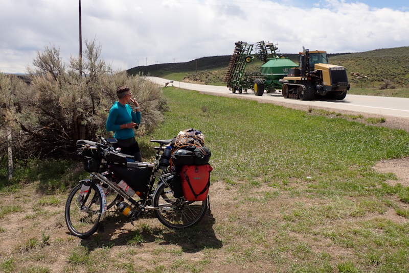
Relaxed morning in our hotel and we left at 10:30 to go and exchange my new water container for the smaller size. We were surprised how warm it was and wore shorts and light tops for the first day in a while. We found Craig to be a very pretty town and stopped at Breeze Park for lunch at 11:30 before even leaving! This park was a real find, all brand new rest rooms and benches and beautiful spruce trees. Right in suburbia too. We turned left onto our last Colorado route, 13, to Baggs, Wyoming. The road was a little rough with a narrowish shoulder to start, but soon improved massively until we hit an altogether newly resurfaced road. The road passes through farmland and is very picturesque. Many dead deer by the roadside still, one a group of five. We also saw a dead elk, but that one looked to have been hit by a car or truck. A rainshower hit and we used the bothy for shelter until it passed. Then we came apon a piece of BLM land, much sooner than we thought we would. It was a small pocket with a track running parallel to the road which we could go along and camp on a flat spot. It is very green, lots of grass and many purple and blue flowers are out. There is even a stream running under the track a little way back. It is a lovely spot lookiing out over rolling hills. A bloke came along the track in a ute and had a chat. He said he was going to do some target shooting just up the track and not to get a fright. When he started we got a fright anyway!
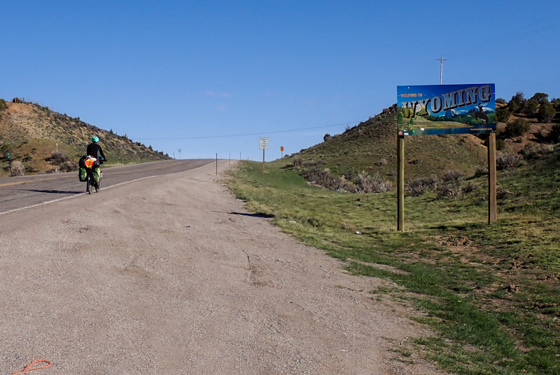
The beautiful 289 road continued for us through cattle pastures this morning. The road is newly resurfaced and has deer crossing points incorporated into it and some of the county roads which turn off even have electrified crossings to prevent animals straying onto the road. They have buttons for pedestrians to push to prevent electric shock! It wasn't long til Colorado was behind us and we had crossed into Wyoming and the little town of Baggs. The people were very friendly and the general store well-stocked. It had been a chilly morning but promised to be a lovely, sunny day. Mike went to the post office to pick up my new Igaro charger and installed it on my bike right there and then. There were a few benches and a picnic area in the town, near restrooms and water available to the public. He did a professional job as usual and we were happy that my navigation phone would be able to charge again from the dynamo. My old Igaro had stopped working a week ago going into Moab. We set off after a geat yoghurt and granola second breakfast and immediately knew the Igaro was not working. My phone did not charge at all. We stopped many times to swap things around, plug a different cable in, use a different port, swaping phones. Eventually Mike undid his neat installation and plugged the whole thing into his dynamo, but still no joy. We had at least ascertained that the problem was the new Igaro which did not work. Looking at the online manual, it spoke about red lights and blue lights on the Igaro to show it is getting a charge and then able to transfer the charge to a device. As Mike always waterproofs the Igaro by enclosing it in rubber tubing or the like, we had never seen these lights. So he spun my front wheel many times with the Igaro plugged in to my dynamo and we could see the red light flash twice to signify it was getting a charge but no blue light to show it was able to pass it on. Mike e-mailed Perennial Cycles, whom we had purchased both his and my new Igaros to ask what could be done. It took some hours for them to come back to us and say it would have to be sent back for them to have a look it. This was very disillusioning. This trip seems cursed with gear issues. It is starting to get both of us down. One wonders when the next thing will go wrong
We rode the 289 route straight north which was a pleasure as we had a very strong tailwind all day. However, we had planned to ride a scenic byway route 70, Battle Highway, east. Part of this road is still closed as heavily under snow, and so unfortunately it was a no go. Many things happen after the Memorial Day weekend here, this is the last weekend in May and traditionally it is when the snow sort of clears. Fingers crossed. Anyhow, the 289 could not be beaten for speed today and we maintained an average speed of over 19 km per hour even with all the stop/starting with the Igaro! The shoulder was pretty good throughout and the cattle farming came to an end to be replaced by gas farming? We did see some herds of deer and one herd of wild horses. There are fewer dead deer by the roadside.
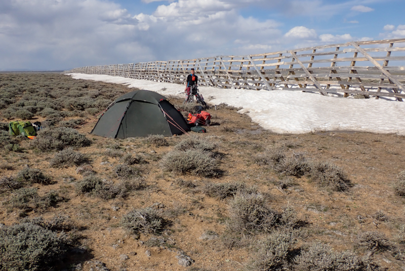
A few kilometres before the junction with the interstate, we pulled into BLM lands to camp alongside a long iceshelf. The wind has dropped now and will change direction tomorrow.
Mike received repliies overnight from Andrew, of Igaro and the service was brilliant. He advised us that there had been a recent issue with another unit which would not switch to charging mode even though it was tested before being shipped and worked fine then. He had already advised Perennial to send us a replacement we only had to inform them of the postage address. Andrew also asked us to hold onto the faulty unit until he got back in touch with us. Top service. We have asked Perennial to send the replacement general delivery to Dubois. By the end of this tour we will have been to too many post offices!
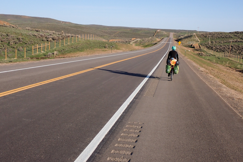
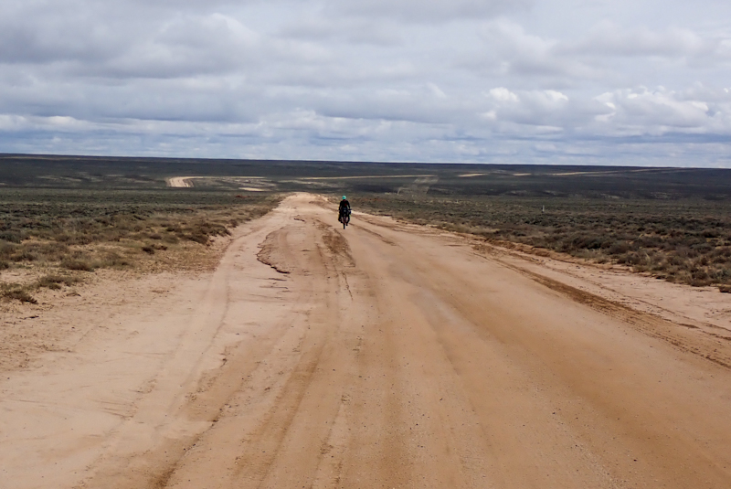
We headed off to Rawlins along the interstate, there being no other option. We don't mind the interstate, except if it's in Arizona. We had 48 km to Rawlins, with a long climb, into a pretty harsh easterly wind. So that was tough going. We rested for a couple of hours in Rawlins, hoping the easterly would lose its bite, and headed north on the 287 after filling up with water at the gas station. Rawlins is not an inspiring town. There are a number of parks though, and the town website lists the amenities on offer at each. We picked a park on the basis of it having drinking water available, but lo and behold the two taps were dry. This seasonal stuff is really starting to get our goat! Turn the water on! Open the restrooms! Memorial Day is around the corner. Going to the gas staton is fine, but of course you have to ask about the water, although they never mind. (Funny, I remember a guy hosing down pavements in Baker, Mojave, and when Mike asked him if we could have water he said no, go inside!). Anyhow, we then battled a very strong crosswind as we headed north as the easterly had become even more ferocious. There were also huge, dark purple thunderstorms all around us, but we escaped those thank goodness! Also, this is the first time on our trip that we have been on the actual route Mike had planned, as the Great Divide Route leaves Rawlins on the 287! The road has a great shoulder, but is very busy with trucks which is okay, except we have seen enough trucks recently to last us. The truck drivers are very good at staying far away from us. After 20 km a steep descent into a massive plain, red hills to or right and snow covered mountains ahead.
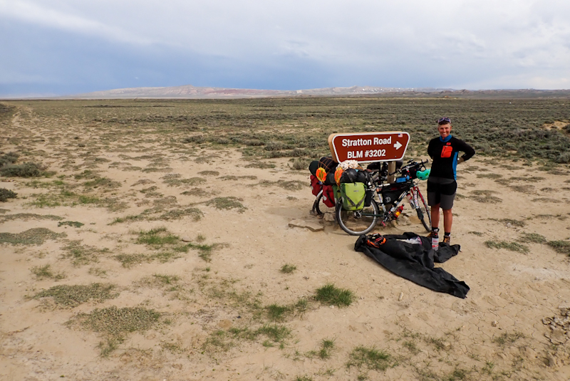
We pulled into a BLM road called Mineral Exploration Road, or Oil Road to Mines, or County Road 63, as we had planned to camp along here, before continuing north to Landers. However, this road ran west, it was a prefectly sealed road free of any sort of traffic and also it was actually Mike's planned route (the Great Divide touring route). By riding it we would have a killer tailwind (see how your enemy becomes your friend?) and would avoid further riding on a busy road with trucks. A no brainer. We went for it and what a delight it was! There were a couple of cars, mine workers from the Rio Tinto Uranium Mine 30 miles along, but otherwise it was just us on this beautiul road, a few wild horses and deer and miles of scrubland. We just kept going until the road hit and intersection with a dirt road that we will take north tomorrow. It was a long day, but so worth it in the end!

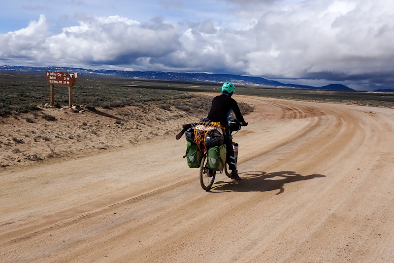
It rained heavily overnight with thunder and lightening. We had two options with the route today, either take Sooner Rd, where we camped north, or continue on the remainder of the bitumen west and then travel north from there. Either way the distance was the same, the climb the same and the two roads joined each other just before Jeffrey City, on the 287. As the road west gave us an extra 7km of bitumen, and Sooner Rd had a bit of mine traffic on it (which might impact the surface quality), this is the one we picked. So we rode to the end of the bitumen on county road 63 and the dirt road that followed got worse and worse in the wet conditions until it was too soft to ride and we pushed the bikes through the grassland. We could ride again a kilometre later and stopped for our coffee break at the junction with county road 23 which looked to be good gravel quality so we were happpy and optimistic!
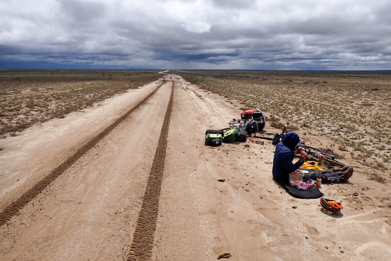
We could ride county road 23 for a few kilometres, but once the gravel disappeared and the road became sandy, it just turned to mud due to the rain overnight. There was no rain today, although th sky was consistently black so how we avoided it is a mystery. It was very windy all day, with a strong northerly head-wind. We ended up spending about 4 hours trying to navigate about 5km of this road. It was unrideable as the mud just clogged up the brakes, tyres and mudguards. Then you could not push the bikes as the wheels jammed so you were just dragging it. Except you could not drag it as your feet slipped in the mud and would not grip. The whole thing was impossible. Tread marks belonging to a car which had passed today had us thinking maybe another car would pass and give us a lift part of the way? We have never considered this, but we were so stuck. Mike took a walk into the surrounding small scrubland to see if we could push the bikes through there, but he could barely walk there, the mud was so bad. Our boots had massive, thick mud slabs stuck to them. We unpacked the bikes, but even then they could not be manouvred. All this time we were using the handles of ours spoons (our only eating utensils) to prise the chunks of mud out of the wheels. We took the wheels off to get them clean and tried it all again. We wondered, should we turn back and go all the a back to the 287 where we made the decision to turn down here? It seemed too awful to contemplate. Mike then decided that all the mudguards had to come off which is itself a big job. He did this and we loaded the bikes up again, now with the mudguards secured on top of our usual luggage! After a bit of walking we could ride and were able to continue to do so for the rest of the day.
It was a climb for about 20km, into a headwind, on a dirt road and we were pretty worn down by the mud situation earlier We had hoped to get to Jeffrey City as there is a cycliists hostel there you can use with hot showers and accomodation. It seemed possible as after the climb we would descend for 33 km, however it was already late, 17:00 and started to rain. Also, the downhill was not straightfoward, there were some climbs too. We decided to pitch the tent and Mike walked about 10 min into the scrub to a large snowpack in the distance to get a bucket of ice for water. I was so cold, really freezing. I had been most of the day. We were in our sleeping bags when I saw a person walking towards us on the road. Then I realised it was a cyclist! I was so excited I ran out to meet him. He was pretty excited to see us too! His name was Rob and has ridden the Divide Route from New Mexico. He had had some diversions due to snow but he has managed to ride it! Pretty brilliant! He was very light, hardly carried anything. It was so cool to meet him.
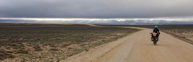
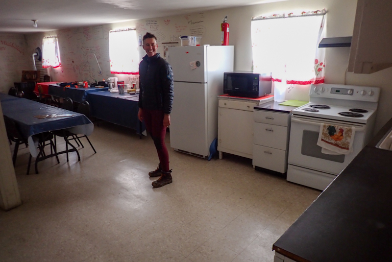
I was too exhausted last night and also very cold. This wind just makes you feel so exposed. We slept well and woke to wind again. Nevertheless, we got going at 07:00 as usual. No rain about, but very dramatic clouds. Those views of the sunlight filtering through the clouds ahead onto the hills were beautiful. The road was pretty much slightly downhill, but with the headwind it did not feel like it. We were so keen to get to the cyclists hostel at Jeffrey City. This is a really unique place, the door is unlocked and there are hot showers and places to sleep for cyclists, donation based. I was trying to keep my excitement down, as we have not been able to rely on so much as tap water lately! We pushed to get there and out of the wind. We passed wild horses and free range cows. The usual deer dancing across the road in front of us. The hostel is in a Baptist Church building and you can see the spire for a little way before you get there. It's great approching from the south as you don't even have to go into the town, just straight to the church. The door was unlocked as promised, round the back. It opens into a enormous room, more like a hall. The walls are decorated by cycle tourists, their comments, drawings and routes. Most are doing the TransAm route. People from all over the world. There is a ramp so you can wheel your bikes inside. There are seperate rooms with mattresses, men's and ladies bathrooms complete with shampoo, soap and soft toilet paper. There is a kitchen with fridge, oven and stove, coffee maker and coffee, sugar and whitener. It's actually unbelievable that this is just laid on for anyone to use. You just give a donation.
First order of business was to put the mudguards back on the bikes. Before we did that we had to prise a lot of mud off the bikes. After this we showered and just relaxed. Initially we had thought we would press on another 30 km or so, but staying under the roof was too good to pass up.
The cyclist hostel was a bit of luxury for us. It did not seem quite as cold this morning, as we left but we certainly felt the cold after a while. We were on the 287 all day and this was a grea road to ride. We are happy that we will be on it for a while longer yet following the ACA Trans-America cycle route. It was a bit breezy, but nothing like the headwind we had had for three days. Wyoming as seen from the 287 is certainly green and fertile-looking. Many herds of cows grazing about, and many calves too. The highlight of the day came with the views over Wind River from the rim and the beautiful descent down into the valley.
It looked like rain all day but we never got wet. There are now rivers about, clear ones at that which is great to see. In the end we made good time to Lander, arriving at 13:30. The last 10 km were a push as we felt the odd raindrop and could see rain in the distance. Lander is a lovely town with some good shops. We went straight to Gannett Peak Sports, a bike shop, as we had ordered a new front tyre for me as after only 3500 km, the tyre wall had a slight bulge (maybe even from when we left airport in SF). It probably was not a problem but best to mitigate your risk. We had never had this with Schalbe Marathon Plus Tour tyres before. Also, after that mud debacle, one of Mike's pedals had started to creak, sounded like a bearing problem. The bearings (but in the end pedals) had to be replaced, the staff were really helpful installing everything and they were interested about our trip. It was excellent service. We then went to Wild Iris Sports as my trusty Sea to Summit titanium spoon had snapped trying to scoop ice cold nutella out of the jar at lunchtime. These spoons were purchased in the Hague on a European tour in 2013, after I lost both in Berlin (????). You've got to be happy with 11 years of service, it probably would not have snapped if I had not used it for 4 hours scraping and prising sticky mud off my frame/tyres! The outdoor stores here have such a variety of things, it's amazing. As an example, at home we think of Outdooor Research as an accessory brand, as in hats and gloves and so on, but here there is all sorts of clothing for sale too. We replaced the spoons with stainless MSR spoons which we also like. They are heavy and robust, but then so is everything else we carry now.
We headed for MrD's Foodstore to eat. They had the best fried chicken, it was so delicious. We ate it in the dining area. It was a really nice store. Then we headed for Lander City Park, where you can camp for free for up to three nights. It has toilets, lush green grass and a gushing mountain river where we had only our second river wash of the trip! It was so good. Relaxing (dozing) in the tent later on we heard someone yelling, "Hey bikers!". I took a peak outside and it was Rob of the Great Divide who we met after Nightmare Day of Mud! It was so cool too see him! The night we met him he was trying to get to Atlantic City, which was another 60 miles. He met up with Meredith there and they took a drive here for the day and a night. So they too camped in the park! We had a chat about his trip and the highs and lows. He is also headed for Yellowstone, the Divide Route ultimately ends in Banff. It would be so fun if we saw him again! We are taking a rest day here tomorrow, our first since Red Canyon, Utah, which seems impossibly long ago. It will be great to sleep in and there is rain forecast, so even better to miss that!
It was great to have the day off yesterday in the endless rain and today was only overcast but dry! Not long after leaving Lander behind, we entered the Wind River Reservation which is where we would remain all day. The riding was really pleasant today, no dramatic elevatiion changes, just a gradual cliimb. The communities we passed through were interesting and the day went quickly. We had morning flask coffee at a small lake, where there were picnic benches, then we visited an art and craft gallery and shop at Fort Washakie. There is a good rest area at Diversion Dam. By the afternoon the scenery had becomr more dramatic and around Crowheart we could see high snow covered peaks and red cliffs. The Wind River, when allowed to roam free was full and gushing. There was a massive irrigation project in the 1920's which utilised the water in the river. The whole area today was very green and we saw many herds of cows and also wild horses and deer. We are camped at a wonderful informal campspot on a bend in the river. We even have our own picnic table. The river swim was great. We are now being serious about bear safety, which hasn't really been an issue up to now. There are also ticks emerging now. Mike had two ticks today, but at least they hadn't latched on yet.
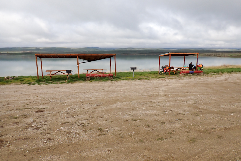
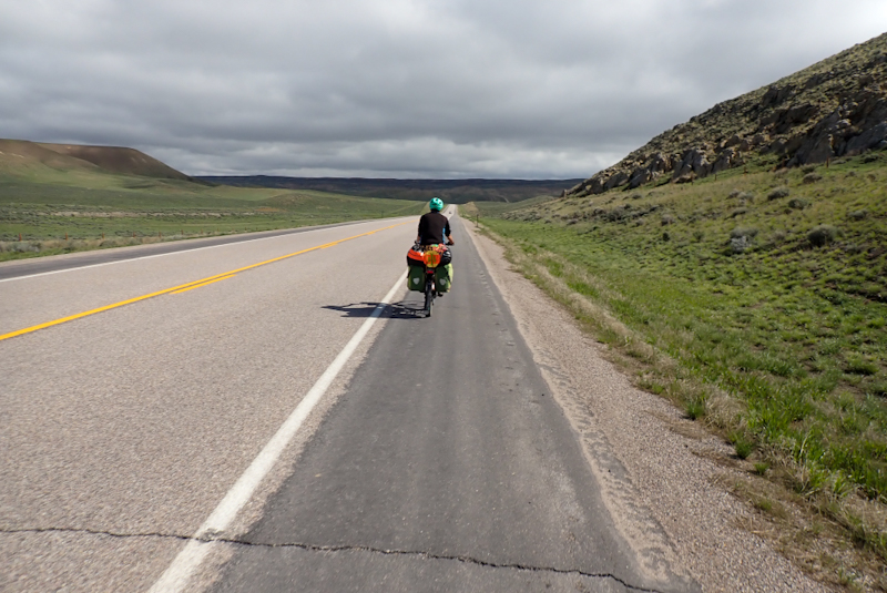
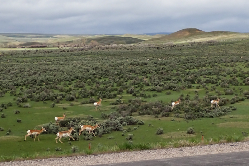
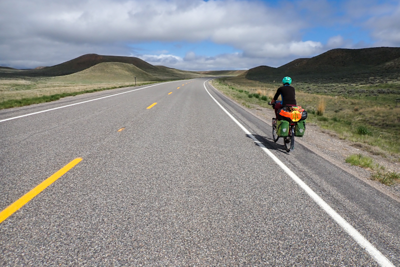
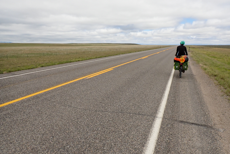
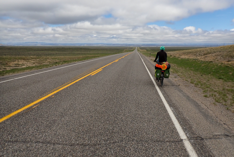
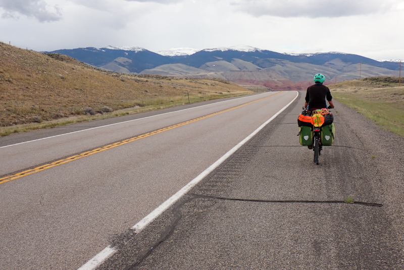
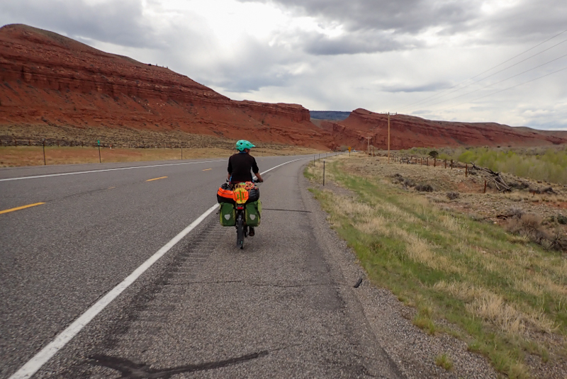
It was a perfect day to start, first blue skies we have seen in Wyoming, but ended with us being hailed on! Beautiful road, spectacular really from our overnight campspot. We followed the Wind River again up valley. Before Dubois we could not resist pulling into the National Museum of Miitary Vehicles. A stange place to have such a huge and pristine modern building. There were many vehicles from all different periods, most parked under a huge roof. There were picnic tables and a lot of parking. As it was early in the day there was no one around. The vehicles themselves were immaculate. They looked like they could all still be in use. It was impressive. We did a small resupply in Dubois and mailed my faulty Igaro back to Perennial Cycles as we still had not heard from them about having a software install done on it which Andrew of Igaro said would remedy the problem.
As we left the City Park to go have a look at the Big Horn Sheep display, Mike noticed he had a rear wheel puncture. So all in all we only got going around 12:00 and had ridden only 25 km to that point anyway! Dubois seemed a nice town, we feel happier heading north. Spruce trees and aspens with tiny greet leaves are all lovely.
There was a fairly horrible headwind the minute we hit the road which made progress difficult as we started the gentle climb which would take us all the way up Togwotee Pass. We decided that we would ride til we were in Shoshone National Forest and then camp. We still apppreciated the road, the river and the views of snowcapped mountains and green forest, but the wind made it trying. We headed for a turn off which was listed on the iOverlander app. It was right on the river but you could also cross the river via a bridge along a gravel road which brought you into a grass clearing complete with very clean pit toilet and bear storage lockers. Brilliant! As we arrived, the heavens opened and it started hailing! We took shelter in the toilet as it was the quickest solution. It sooned stopped. We had another great river swim and did our cooking far away from the tent. We now carry our bear spray wherever we go.
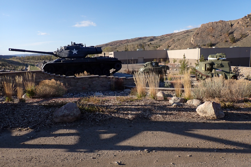
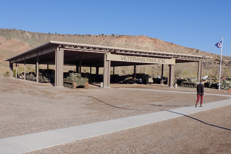
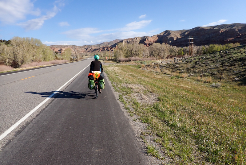
Freezing morning but clear skies. First order of business was the 21 km climb up Togwotee Pass. The scenery was spectacular and the snow grew deeper as we climbed. The pass topped out at around 2900 m which is the highest elevation we have had on this tour, maybe even for the remainder. Nearly 10 000 feet. Wyoming is certainly wild and beautiful. The surrounding mountains were so clear, edged in white. We wore our bear goggles (this is a metaphor) and kept 'em peeled for Felicia and her cubs. She is a famous grizzly that cruises along this pass road. There are digital boards reminding people not to stop their cars to have a closer look. We could not believe how much snow there was on top. Wind River Lake, where we had planned on camping last night was a write off. You could not have got to it. We saw a bloke head off on cross country skis! The Teton Mountains suddenly came into view as we descended the pass. They are very impressive and grew closer and larger all the time as we drew nearer to them. We were now crossing braided rivers rushing over stones and were reminded of Alaska, just the scale is smaller. We were at Moran Junction and then into Grand Teton National Park before we knew it. The spruce forests are sprawling here and in the National Park the trees grow right up to the edge of the road. We do love forests!
I guess the park was not very busy, but seemed so to us. Many people stopping on the roadsides to look at..... not sure what. It seems maybe there are areas frequented by certain animals and so they go on the off chance they might see them? There are some great views in the park, of the mountains, Jackson Lake and other spots. We just soaked it all in. It is well worth a visit. We left the park around 15:00 and hoped to find a good campspot in the forest just outside the park. All these parks have very strict camping rules, however it would be good if the backkcountry permits took cyclists into account. They are also very particular in terms of area and so the whole system is not flexible enough for us. After a few kilometres we spotted a way into the forest. Being bear safe means, amongst other things, storing your food and all scented items e.g. toothpaste and fuel bottle of petrol for stove about 100 m from where you will sleep. There was a good clearing a distance away from where would pitch the tent so that was good.. As we arrived, Mike's rear tyre suddenly deflated AGAIN and so another puncture to fix. However, a massive thunderstorm threatened, and ended up arriving, and raining for hours. We managed to cook, shower (eek, bit cold really and not too fun in the rain), and Mike fixed the puncture. By the time we were finished all the jobs it was 19:30. The day just goes and one is never for one minute bored!
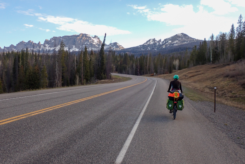
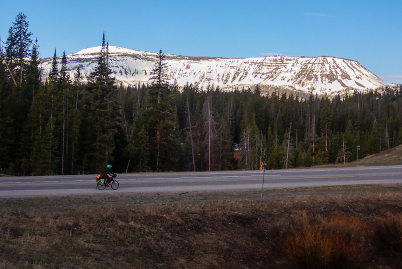
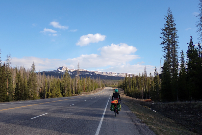
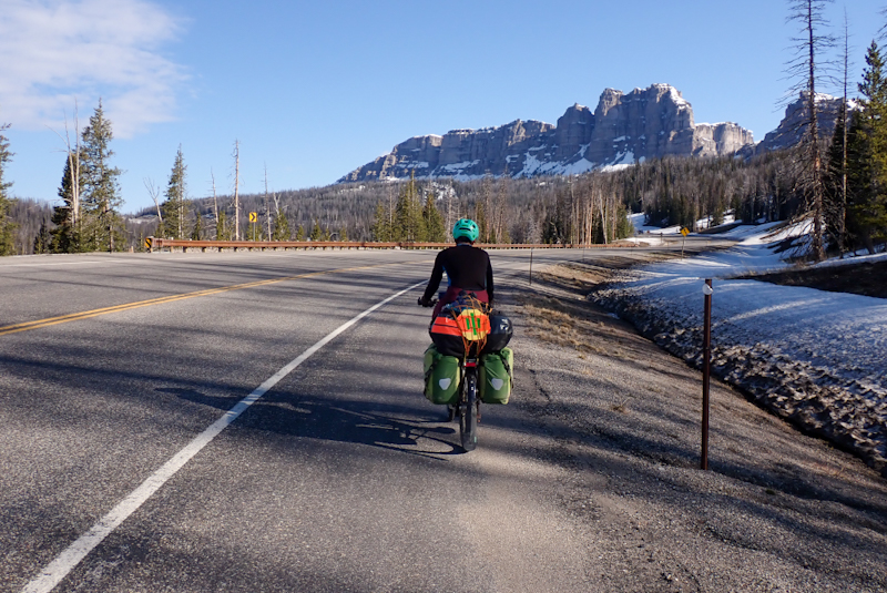
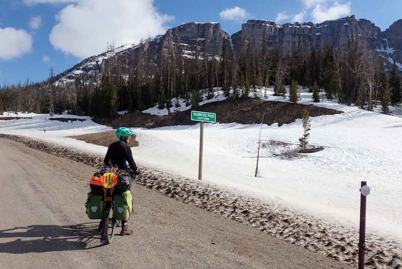
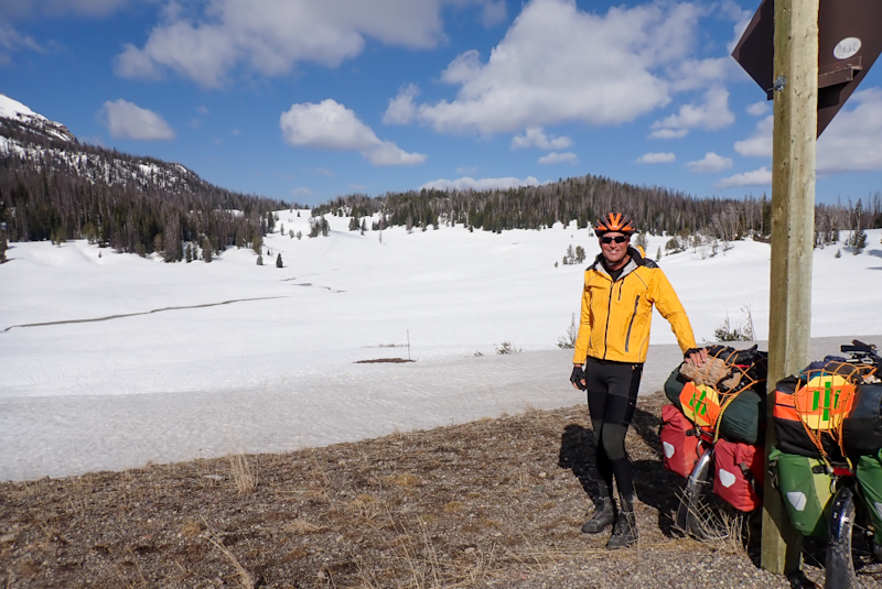
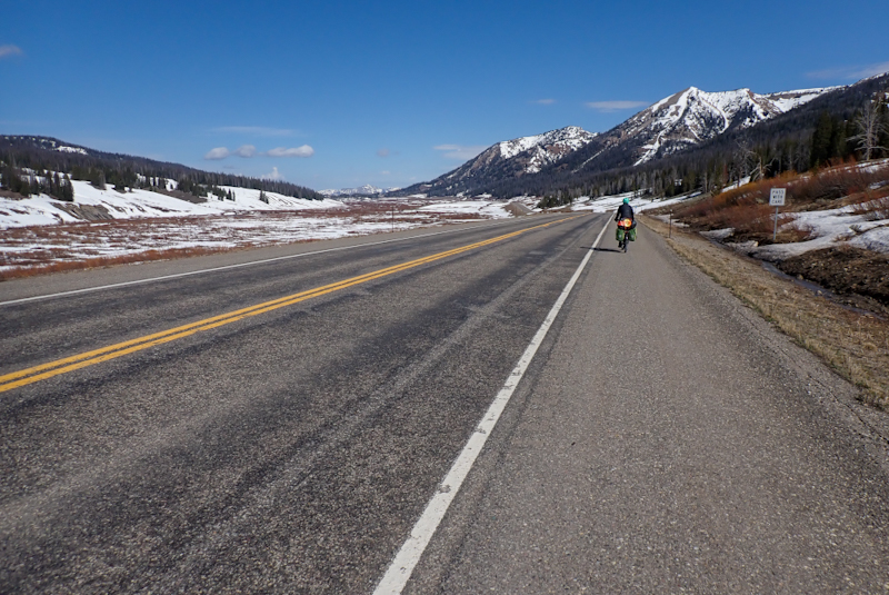
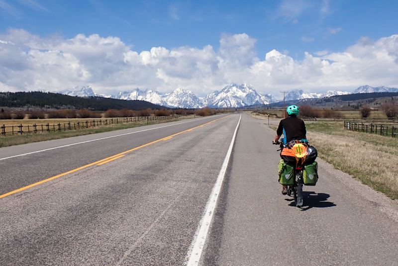
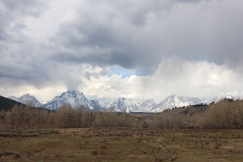
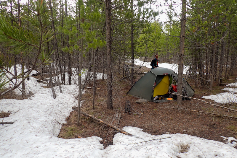
It was a damp, misty morning. When we got up, Mike noticed that his rear tyre had somewhat deflated AGAIN. Oh boy, welcome to your day! We took it easy, he put a new tube in and we had breakfast and coffee as usual. We ended up being only 20 minutes later than usual on the road. It was a descent to Flagg Ranch and then we took the Grassy Lake turnoff. Our plan was to ride the Great Divide Route to Ashton, along this road. The height gain was not much, the road only goes to a max elevation of 2300 m. There is a lot of snow around here though, the area seems not to lose it much. It is only 47 miles to Ashton along the Grassy Lake Road (or Flagg-Ashton Road), and paved for the first couple of miles. We had decided on this route as there are road works for a sizeable portion of the South Entrance Road to Yellowstone and they warn to expect 30 minute delays. Also, we wanted to try to ride the Great Divide off road again and this seemed like a good place to try. The road was officially closed and we skirted the boom gates to get onto it. It was immediately beautiful pure wilderness and the road to ourselves! We were pleased to see that some work was happening clearing downed trees that blocked the road and so on. The road turned to good gravel and ran alongside the Snake River. It was not long before we saw bear prints in the sandy track. Riding down into a grassy clearing we saw trumpetter swans and two wolves.
There are amazing campsites along this road, we passed four in total. Each has a pit toilet, garbage bins and brand new food storage bins. The views are tremendous. We got about 6 km along the road til the snow patches finally became impassable and you could not get around them in the bush. We were really disappointed by this as had hoped to be able to ride it. Pushing a laden bike through even a foot of snow is not really possible ongoing and we still had 150 m to climb and then go down, and no idea what the route would look like. We turned back to the campsite we had just passed and spent a glorious day relaxing there, having a swim in the stream, a few read/sleeps, and drying out our gear thoroughly in the sun.
Around 16:00 we set off back to camp at a couple of campspots back. This one had amazing views over the river and floodplain. This positions us well for the ride into Yellowstone tomorrow. We will get a super early start as the ride to the only campsite which is open is over 90 km and of course there are the road works and lots of sights along the way. As sometimes happens, initial disappointment turns to awe. We ended up at the most pristine wilderness campsite completely alone and hope to spot some wildlife this evening.
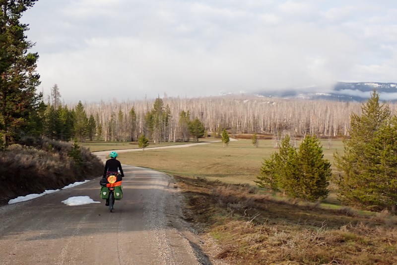
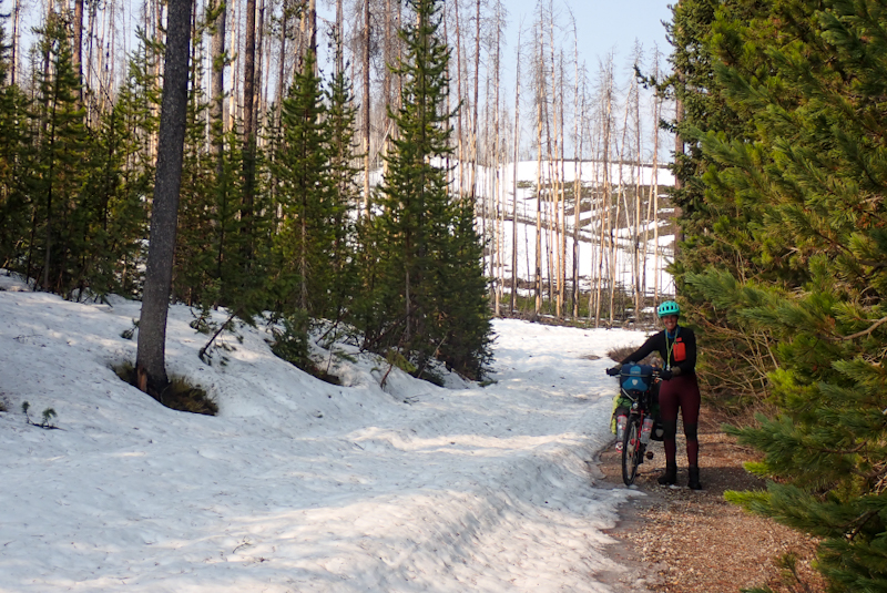
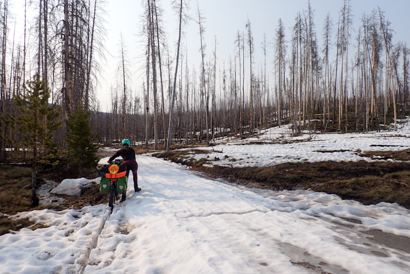
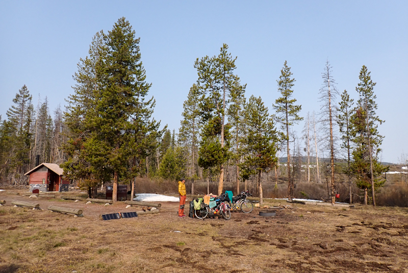
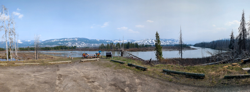
No wildlife spotting other than a beautiful flock of white pelicans feeding in the river. Such a beautiful spot however, we felt very lucky. We did have a late night visitor which sounded large and weighty as it walked passed our tent down to the river. I heard it hours later coming back, complete with some snuffling noises. Also the wolves went crazy in the early hours, you could hear them travelling through the forest howling. It felt pretty remote. It was the wilderness. We had decided on a super early start today. This was due to road construction going on in Yellowstone along the road from West Thumb to Old Faithful. On Monday, I had called and spoken to Pam at Madison Campground who confirmed that hiker/biker special rate campsites do not require reservation and also advised us that the roadworks would make cycling the road pretty tough. There were wait times of up to 30 minutes and a very rough gravel surface which we would be tackling uphill. She made it sound as if we would have to contend with this for about 20 km. So with trepidation, we set our alarms for 04:00 in order to be on the road by 05:30. Mike calculated this would place us at West Thumb by 09:00, still early enough to tackle it. We had no real idea what the road would bring, however we also had no choice now due to Grassy Lake Road's snow situation. I guess life is not too bad when a trip to Yellowstone is your fallback option!
It was very dark at 04:00 and the tent and everything else twinkled with ice in our headtorch beams. The tent fabric was solid still! We went to collect our three bear containers which we had left at the road overnight and also our bear bag which was strung up the bear pole provided by the campsite. Nothing had been tampered with overnight. It was around minus 5 Deg C when we set off. We backtracked along the road and skirted the boomgates again to join the main road to Yellowstone. No one was manning the entrance gates and we got straight into the first ascent which really only ends at West Thumb. Four strong visuals of this road, thick spruce forest, very high snowpack, surprisingly deep Lewis Canyon and lakes frozen solid. The whole experience was like deep winter. The road was quiet and all around was only snow and ice. It was very cold. When riding alongside the lake it was like going into a freezer. We could not believe it - whole lakes completely iced over! Large lakes too. We had got sweaty going uphill, I wear a very fine goose down Kuhl jacket when it is very cold and when working hard cycling uphill I warm up quickly. I exchanged my OR hefty gloves for my Rab polar fleece ones too soon and by our coffee break my hands were in trouble. That agony of cold, cold hands. But it was so beautiful, it took your breath away in more ways than one!
Things warmed up slowly and then all at once as we hit Grant Village area, suddenly the snow all but disappeared. The roadworks ended up being a complete beat up. There was a 30 min wait in a stop go, but due to the number of cars that had to get through the 3 mile stretch, the going was slow even for them. We brought up the rear, which meant that we had the road to ourselves whilst the cars going south had right of way. It was really perfect riding conditions. The surface alternated between paved and smooth dirt so no trouble riding it at all. We were happy to reach Old Faithful and the geyser precinct by 12:00 and bought bread, cheese and cold meat at the very well-equipped general store. We caught the tailend of Old Faithful's 12:30 eruption. There is a bike path which we followed for a few kilometres passed a number of other geysers and as is often the case, the main event is put to shame by the suupporting acts. We were amazed by the number, variety, colour and accessibility of these lesser known geysers! One can certainly understand why people are injured by them every year as they look so inviting! With the geysers come the bison and they are magnificent. There were many in ones and two and then a large herd, complete with at least one baby. The weather was warm and just perfect and we followed the river downhill to Madison Campground. It was just paradise, the fast floowing river, the forest, the bison! One geyser sprayed plumes of blue and pink steam! The last 10 km just went faster and faster straight downhill. We arrived at 15:20, but considering we had left at 05:30 this morning it was a very full day and we ate dinner early and needed an early night. What a day though, how can you start out with lakes of ice and end up with steamy geysers and bison? Yellowstone is a trip highlight.
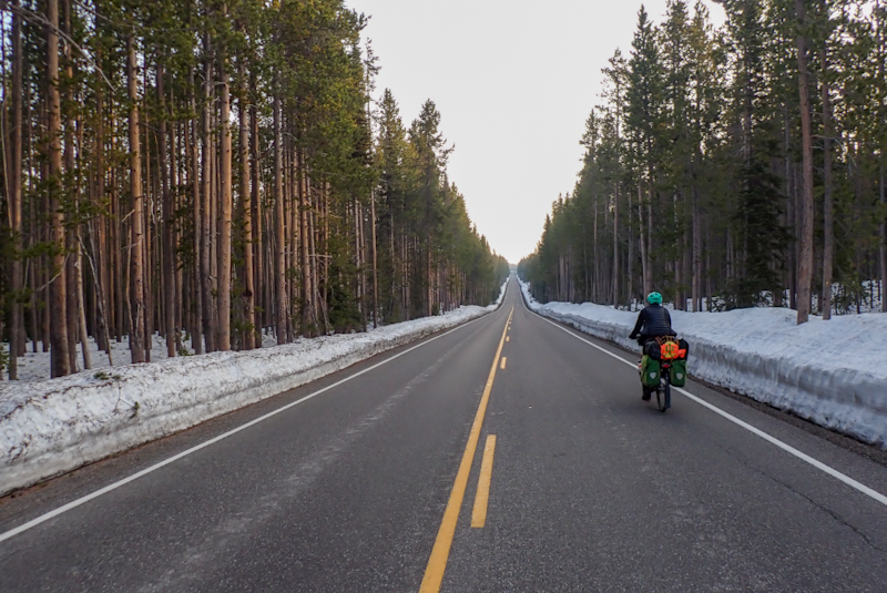
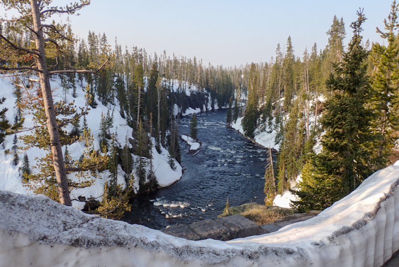
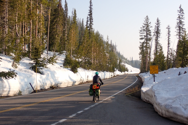
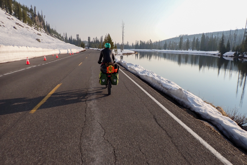
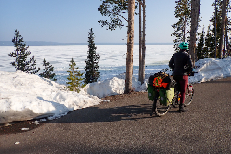
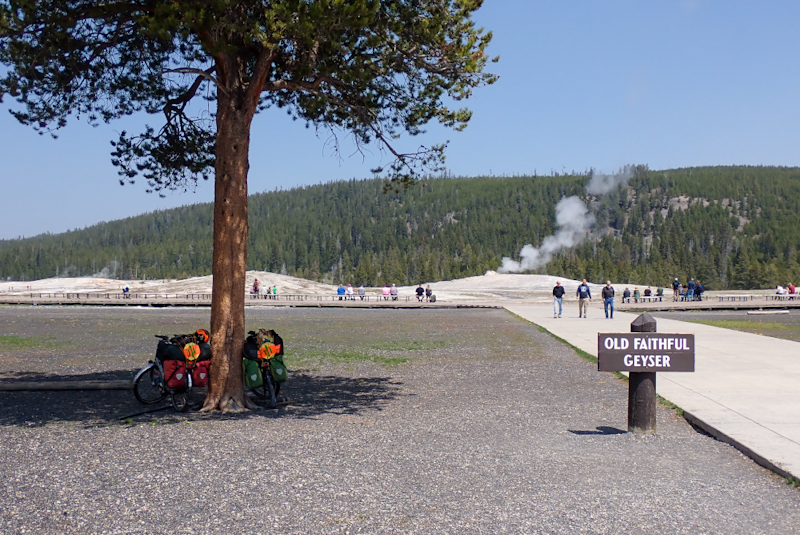
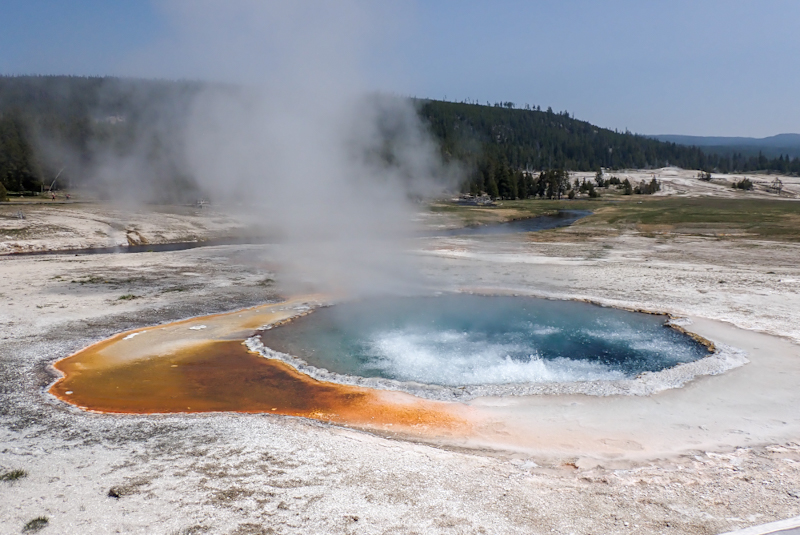
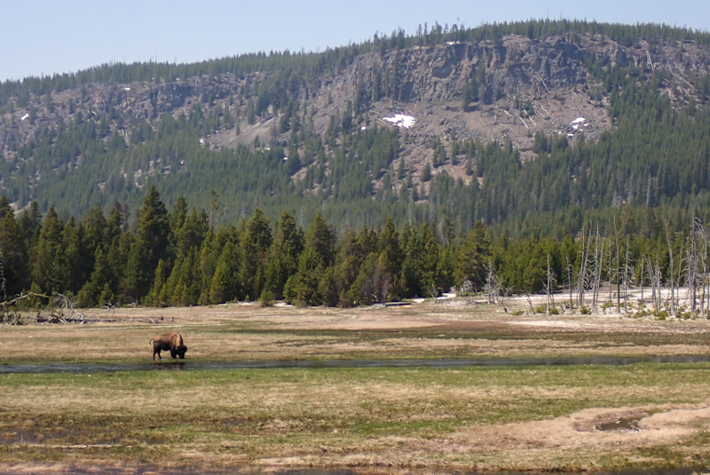
We slept like logs, and I felt a little body sore this morning, but it looked like a perfect day so we got up usual time, 05:30. It was an easy 21 km ride out of the West Entrance to West Yellowstone. The road follows the Madison River all the way and this river valley is very beautiful. At one point as we rode along I was looking directly above our heads to the right at the steep hillside. At first I thought, "It's a tree stump", this glossy brown hump sticking up from the little hill above us. As I was almost beneath it, I thought, "It's a grizzly" and in that split second choice between do we stop riding or keep going, I realised, "It's a bison!". If all you see is that hump and not the huge head, it is easy to confuse the two. Jeez, heart-stopping. A while later on we saw some people stopped by the roadside looking out over the river and a few metres on there was a group of bison with at least one baby about 10 m from us. We just had to keep going. These things are huge and can turn on you if they feel their young is threatened. A bit later on we could ride along the river on a little one way road which was great. The road had been busy wth people coming into the park, and the queue of cars at the West Entrance was something to see; over 600 m of two lanes of backed-up traffic. It isn't even June yet, so we can only imagine how busy this place gets.
We bought rice crispies and milk at West Yellowstone and relaxed in the park. We were now in Montana. We set off on the 287 which held some interesting surprises in store. The road runs alongside the large Hebgen Lake with a stunning backdrop of snow capped mountains. We came across a Geologic Information board which explained how on 17 August 1959, a 7.5 magnitude earthquake hit this lake as two geologic blocks shifted. This caused Hebgen to tilt and a massive landslide to occur downstream of it which resulted in the formation of a new lake, Earthquake Lake. The whole event was totally unexpected and 28 people were killed as campsiites were buried under the landslide. The amazing thing is that you travel all along this entire order of events. First the lake, then the river as it rushes along towards what used to be a canyon, then the new lake complete with the bare tree trunks of the forest that stood there sticking up, and finally the massive landslide which is impressive to see as thousands of boulders and rocks tumbled down the hillside. A spillway was created which lets the river continue on it's course downstream of the landslide. It was really fascinating to be able to see all of these things as we travelled.
We saw our first fly fishermen standing in a bend in the river. It looked very poetic! We stopped at a forestry campsite so I could use the toiilet and a man staying there warned us that a moose had been hit by a car a few miles ahead, and bears were active as a result. We were very alert but saw nothing. A steep scree slope to our right held a surpriise when two Big Horn Sheep calmly clattered down it, They are the first Big Horn Sheep we have seen on the road. They were a llittle curious but not fazed by us.After we passed the landslide area the plains of Montana just open beneath you and we continued downstream. We are camped over the river in a forestry area. It was a warm day, much warmer than we have had in ages. Many fishermen were out on the river. We relaxed in the shade for the late afternoon. There has been quite a bit of thunder, but no rain so far.
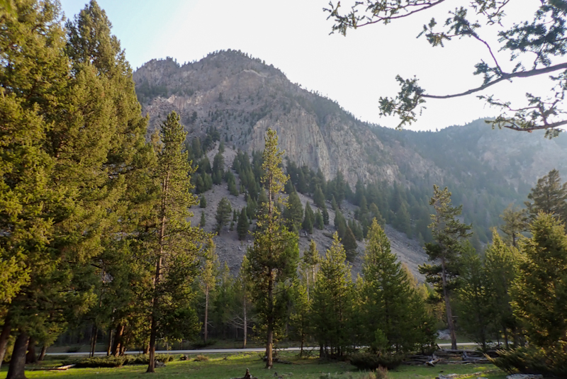
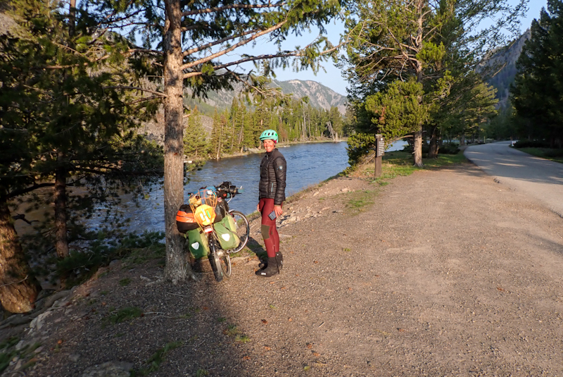
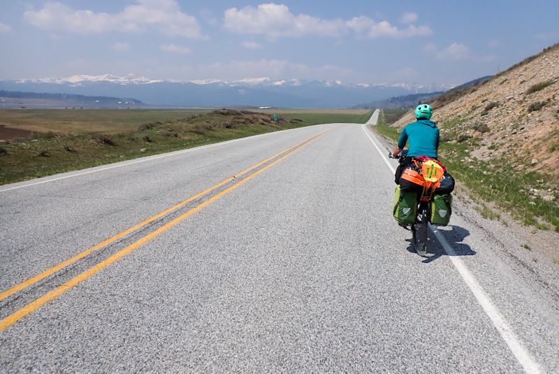
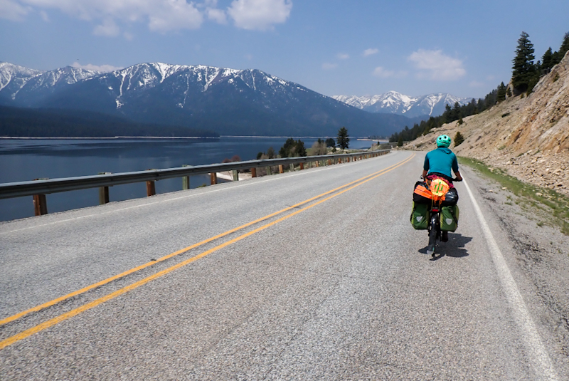
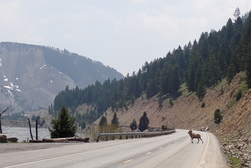
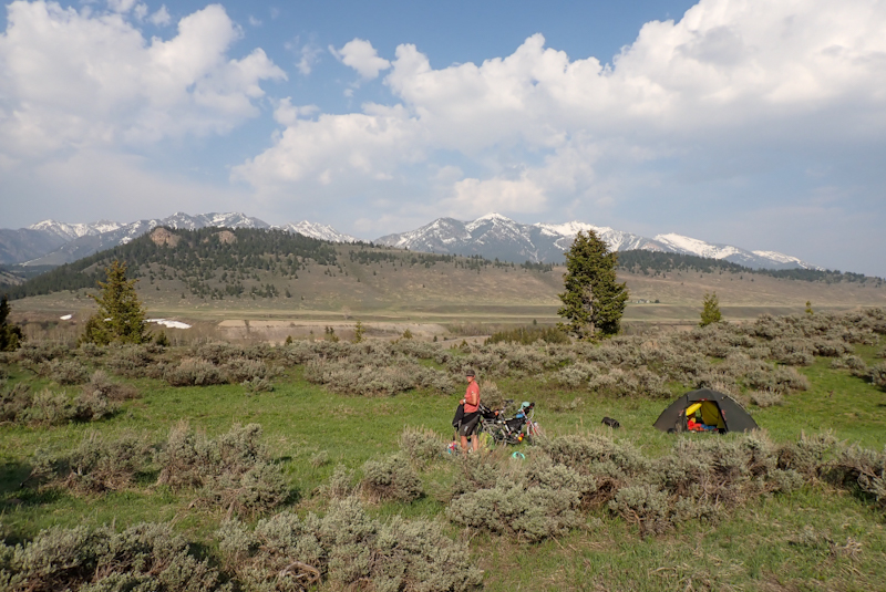
It was just under 2 km from our campspot to the Lyons Bridge Rest Area, so we packed up and went there for breakast. It is a really good rest area with heated restrooms, hot water in sinks and undercover picnic areas. We had about 56 km to ride to Ennis and it was downhill and downwind all the way so we made short work of it. At Ennis (seemed a really nice town) we ate delicious fried chicken and donuts to fuel ourselves for the 600 m climb to Virginia City. The day turned warm and we were sweating profusely going uphill. We stopped for a rest and I immediately felt faint, similar experience to the one I had in Death Valley. I got some Gatorade into me and it helped. The climb was not very steep and we stopped to rest a few times. We were at the top by about 13:00 and it was a fast descent to Virginia City. As we arrived, Mike's rear tyre went Pfffftttt.... again! Continental tube had split! At least it happened where there was a place to sit. We did not like Virginia City. These restored historic mining villages/goldrush towns seem pointless when stacked against amazing places like Yellowstone and the Earthquake Lake. They just seem meaningless. Also, there was no water to be had in this place, everything closed waiting for Memorial Day. There must have been some stuff open judging by the crowds of people piling in there.
Earlier in the day we had been looking at ideas for overnighting. There is very little BLM Land around as this whole area is agricultural. Mike found the Bike Camp in Twin Bridges on Google Maps. This is a little building for cycle tourists to use in the town rest area. It would be a long day, but apart from the climb, would be mostly downhill. We decided to go for it. After Virginia City, which was pretty barren, the landcape turned back to cattle farming and it was nice to see all the baby cows. It looked like a thunderstorm was brewing so we did not dally. We passed through a few small communities and arrived in Twin Bridges around 16:30. Bike Camp is in a lovely spot on the river and we were pretty happy with that as we could swim, however Chris, a hiker who was already staying there, showed us the shower and as it had been 10 days since our last hot shower, we were super happy with that. We wallked to a nearby pizza place for dinner and also booked into a hotel in Dillon for the next two nights.
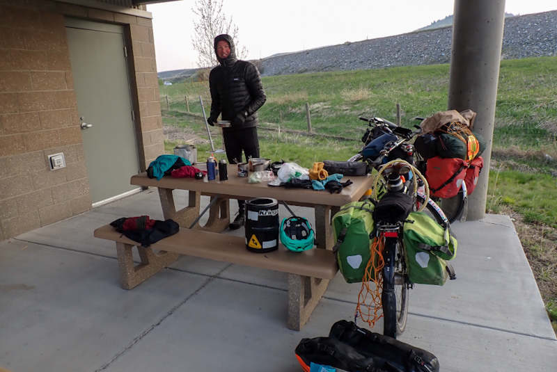
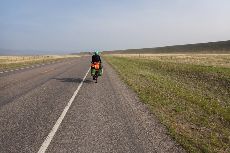
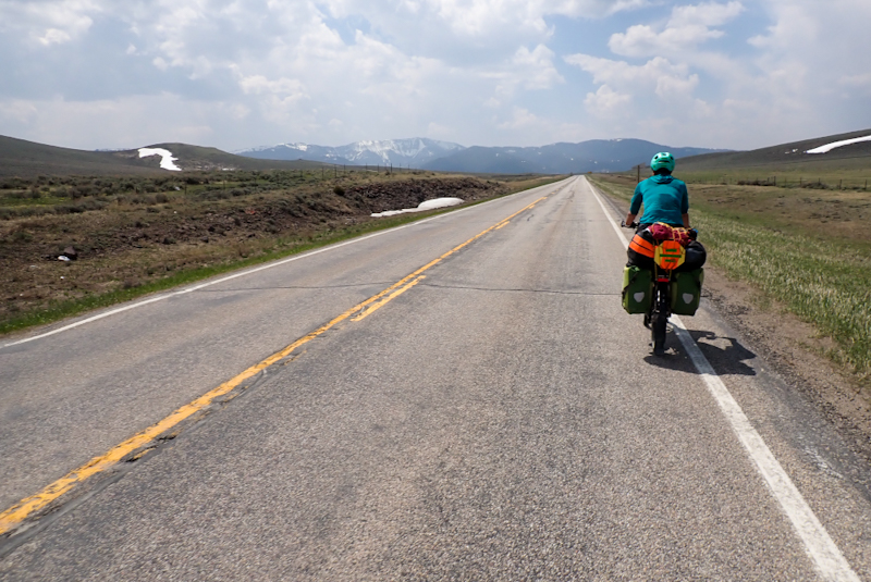
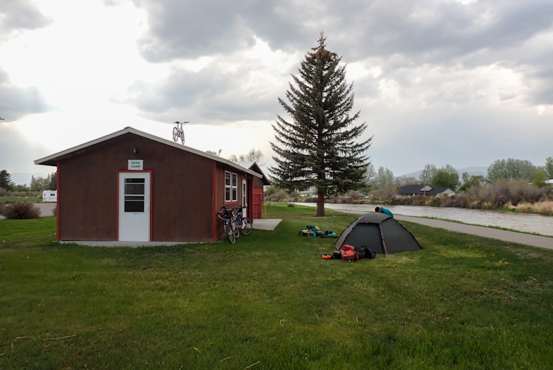
A short ride today to a hotel stay and rest day. This is the first time on the tour that we have spent two nights in a hotel. It was an overcast day, but not cold at all. It seems we have left the cold behind for the time being. The 41 road from Twin Bridges to Dillon was bad to ride as it had very little shoulder and was quite busy on a Monday morning. This was made worse by the number of large utes which rushed past us at speed. After about 30 km we got a decent shoulder. The road was not flat all the way but it was an easy ride and there were many herds of cows on pristine ranches to look at along the way with many teeny calves.
We arrived in town and went to Safeway to buy milk and cinnamon sugar cereal, our new favourite snack. Then on to Clean Critters Laundry to wash and dry our clothes. This was very much a local laundry i.e. we did not see any RVs outside or campervanners as you do at these places. There were a couple of hillbillies and one came in with about 6 garbage bags full of washing, and a dog. The dog was not in a bag but seemed to be a regular. There were signs up inside saying "Do not place blankets with horse hair or any kind of hair in these machines" and "If you are caught putting boots or anything in these driers priior to washing them they will be confiscated". I took a look in a few machines before selecting the washing machine which looked least off-putting, however all our washing came out perfectly clean. The hillbilly put on the tv to watch The Bold and the Beautiful. I did not even know this show was still on! I remember seeing it when I was 13 years old! How can the woman who plays Brooke not be in an old age home by now? She still looks good 35 years later!
We then went to the post office to pick up an Amazon order; a battery, a plug adaptor and a pair of reading glasses for Mike which were the wrong strength as they had been mislabelled! Amazon customer service being what they are, just refunded us when he contacted them. We checked into our hotel and then went back to Safeway to buy fried chicken, sweet and sour chicken, spring rolls, yoghurt, etc. Ate it all up.
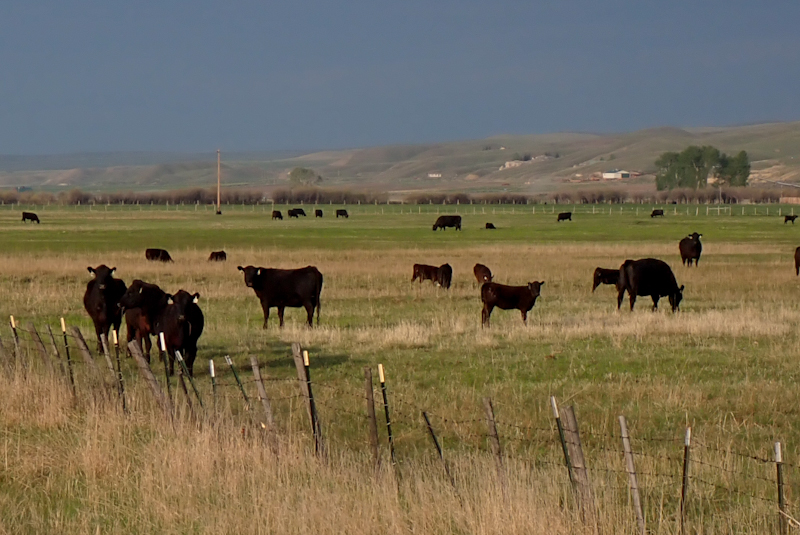
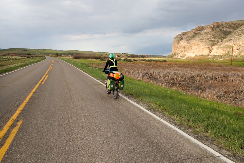
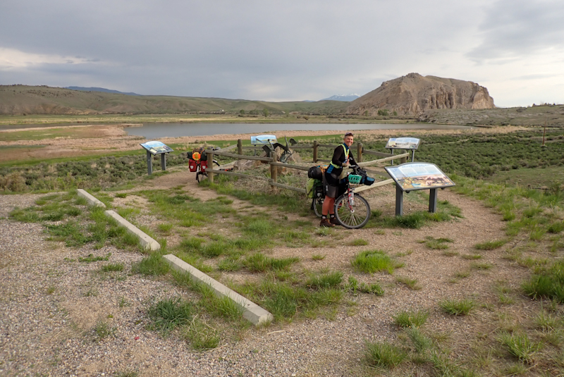
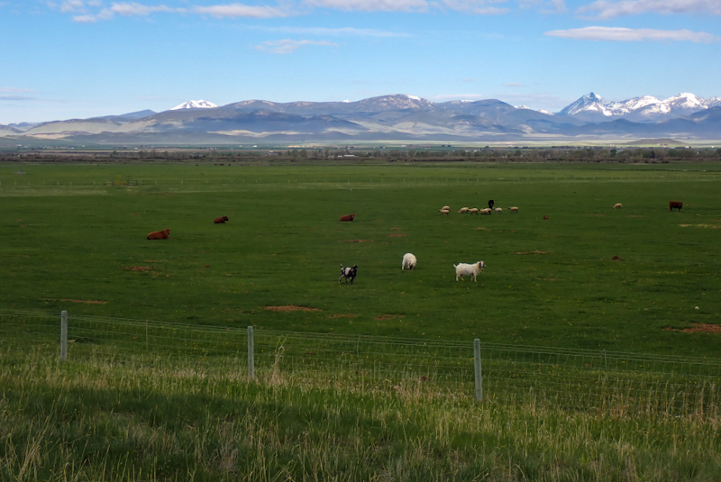
The weather forecast suggested we would be wet all day so it was a nice surprise to see a sunny day this morning. There was cloud about, but as we rode out of Dillon it grew warm. The 278 is a great cycle touring road, quiet with a good shoulder. We had two climbs which were fair. It is a beautiful valley to cycle through, all green pastures, cows and pristine ranches. We passed the Scenic Byway to Wise River and would have ridden it as it looked a lovely road, however my replacement Igaro is waiting for us in Hamilton so we have to get there by Saturday morning. We had a headwind for the middle part of the ride and a small shower of rain. As we arrived at our bushcamp the heavens opened, but we managed to get the tent up really quickly with not too much damage done. It is lovely to see such a variety of plants in the undergrowth now, mosses, berry producers and many flowers blooming.
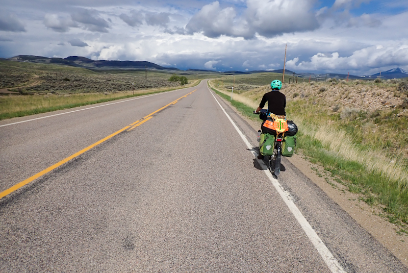
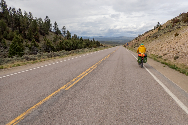
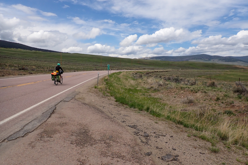
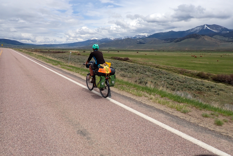
It did not rain overnight, but just before our alarm went off, the pitter patter of raindrops sounded on the tent. We got dressed into wet weather gear and got up; it's never as bad as it sounds in the tent and anyway, it stopped raining while we had breakfast. We could see we were in for a wet day as the clouds came rushing over the Big Hole Pass. We stopped a few hundred metres down the road for the Beaver Slide, a point of interest. It is actually an invention to assist in the gathering of hay. It was interesting to read about the history of ranching in this area as we looked down at the fertile valley. We continued along the valley, downhill towards Jackson where a ute had pulled over and the driver was holding a luminous flag and a large cardboard sign which read "COWS". She told us that the cows were being herded down the road ahead of us. As we came over a little rise, there they were, mainly calves and some grown cows, being herded down the road by cowboys and dogs. We crawled along, not wanting the create mayhem. There were many cows. After passing through Jackson, the cow turd all over the road continued for many kilometres, so they were herded a long way! We stopped for our morning flask coffee and a local ranch hand came driving along. He had a chat to us about his time in this valley. He had lived there for 35 years. He said the he had never been out of the USA, he had been to California, Washington and Oregon and had always lived in Montana. It is paradise, but he did say that the winters are 30 below.
Just before we reached Wisdom we saw THREE cycle tourists! Two blokes together and then a third, older man on his own. The two younger guys weren't interested in a chat, but the older man Randy stopped. He was doing the TransAm, starting in Astoria, Oregon. He had overnighted in Wisdom and was on his way to Dillon. It was nice to chat to him! Just as we made the left turn in Wisdom onto the 43, we stopped on the left at the American Legion Campground. This is a small, free (donation) tent only campground which we would have used if it was not quite so far from Dillon yesterday. However, it was packed with tiny tents. At one tent there was even a bike, partially loaded, MSR stove with fuel bottle still attached as well as windshield on the table, pannier open and lying on its side, and heaps of other things. We went into the little building to eat our lunch, expecting it to be crammed with people, but there was no one there. It was a little strange, as if all the people had just disappeared! The tent with the bike was really strange, there was even a pair of sandals outside the tent. Maybe the bloke was still inside? It rained heavily as we sat inside and we were happy to be there!
Shortly after Wisdom, we began the climb that would take the rest of the day. It was so gradual though, that you would almost not know you are climbing at first. The first bit was sort of up a level out of the valley and very beautiful as we could see the forest for the first time. We passed the historic Big Hole National Battlefield, the site of an ambush of the Nez Perce, Palouse and Cayuse Indians by the US Army. Many lives were lost. The entire story of the relatonship between the white Americans and the indigenous people seems underpinned by land treaties which were originally agreed to by both parties and later redrawn without join consent. At least this is the way it appears to an outsider. This battle resulted in many lives being lost. The visitors' centre has very good displays. It overlooks the site of the battle and feels quite poignant. You can fill up with water here, they have good water dispensers inside. There was a group of youngsters putting on wet weather gear as if they were preparing to go for a hike. We recognised the sweatshirts they had on from ones hanging up at the little campsite! Mike asked if they were staying there. They were! They were helping out with some work on the Battlefield site. After this point the road enters the forest proper and it is very beautiful. Like a switch has been flicked, no more grazing pastures, only dark, brooding forest. The road runs along fast-flowing rivers and streams. Gradual at first, the climb is through a wide valley, with plenty of grass to camp on. There are signs of bear activity here, bark ripped off tree trunks and we saw our first bear prints in the snow. Yes, that reminds me. We are again in the snow! We stopped at the top of the climb to find a campspot, but the forest tracks are deep under snow once again! We are only at 2100m! We found a tiny place to camp at the junction with route 93, across the road from the rest area which is convenient!
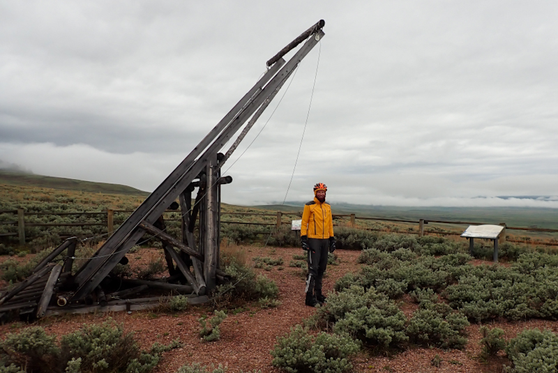
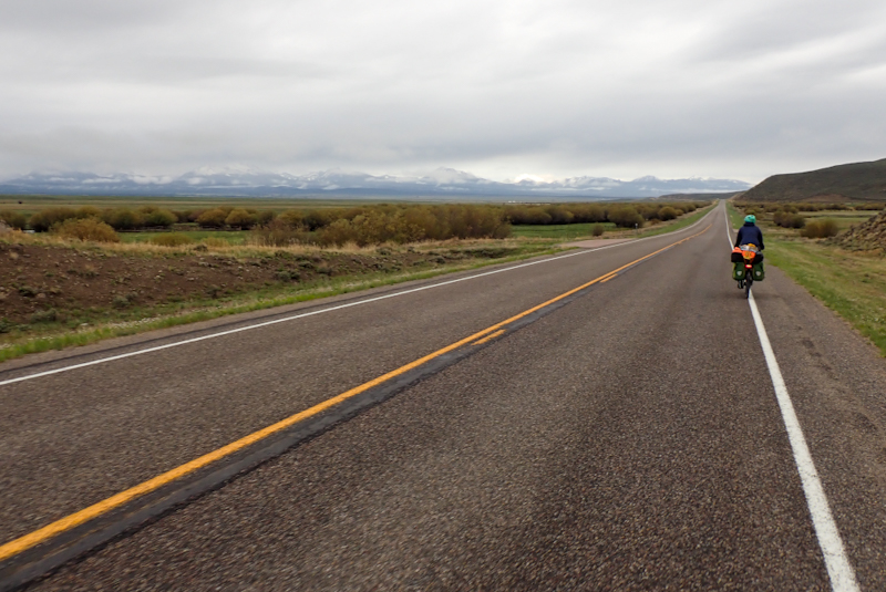
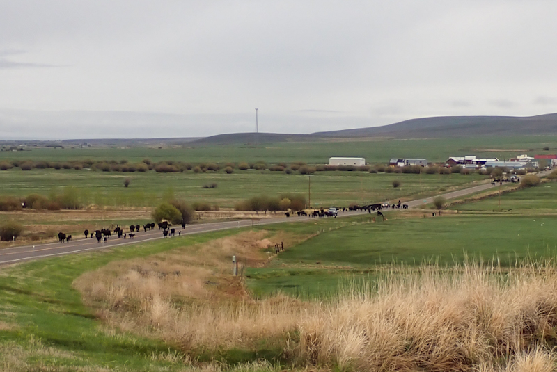
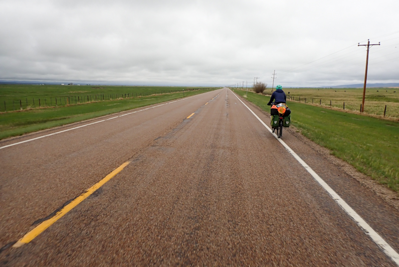
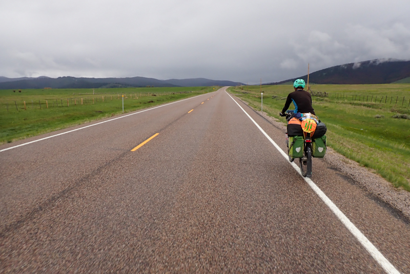
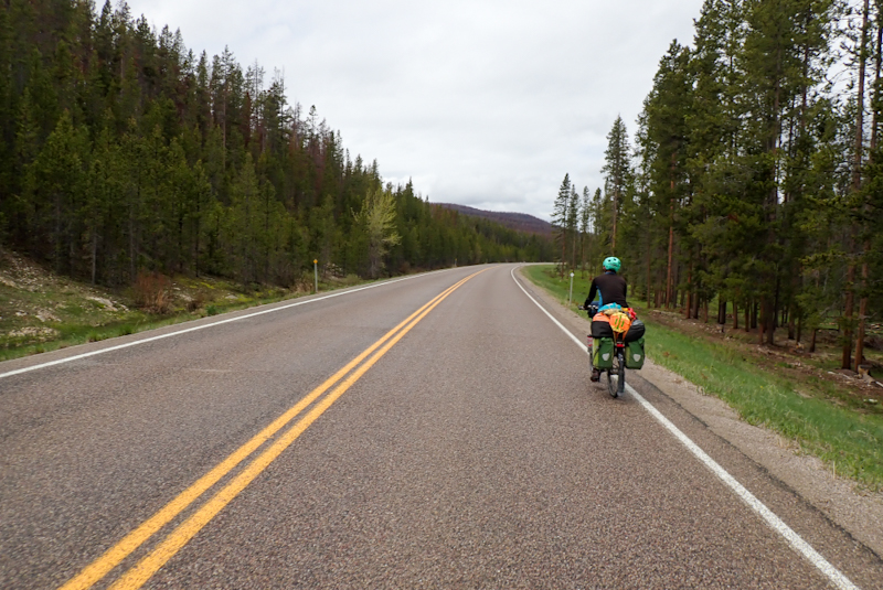
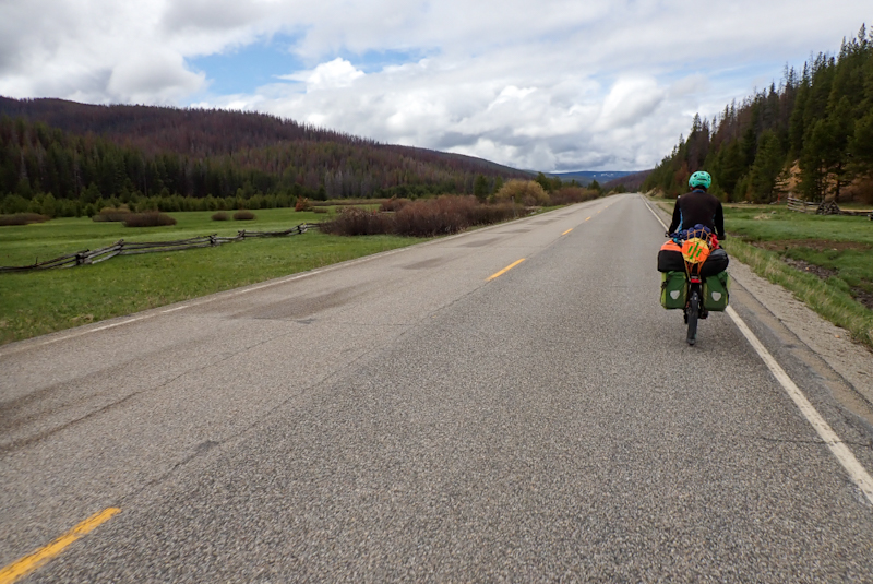
I woke around midnight to the noise of something walking around the tent, eating. It was foraging around for things and I could hear it crunching them. I even heard it playing around with a tin can it found in the undergrowth. I wanted to wake Mike up but thought I might give him a fright and he would make a noise, surprising whatever it was. After about 30 minutes I looked at the time, 0:30. It went on for ages, I heard it walking around the bikes, brushing against or sniffing at the frame bags. Then it came back to the tent. Eventually it moved away and I could hear it moving things, like a log or fallen branch. I wondered if it had found the bear containers and was moving those around. I didn't think it was a bear as I don't think I would have heard a bear, they are pretty silent. Probably a deer or a fox? Still, it was strange that it stayed around so long. When I checked the time again it was 01:20. Shortly after that I fell asleep again.
We packed up and moved over to the rest area to make breakfast. Mike was disappointed to have slept through all the excitement. We decided that it wasn't a bear. We had one of the most beautiful descents of the trip to the Bitterroot River Valley. It was just stunning. The road was quiet and we followed its sweeping curves to the valley floor. Sheer rocky cliffs and scree slopes had us craning our necks uphill, expecting to see stone sheep gallivanting on top. The valley was suddenly all rural again, lush green fields and happy cows. We stopped for coffee at Spring Gulch, a beautiful forestry campsite. We would have gladly camped here, but needed to get to Hamilton for my Igaro delivery so that I can power the GPS while riding. We enjoyed our break anyway under the Ponderosa pine trees. It was all downhill all day. We lost 1100m in total and suddenly all was spring flowers, blooming hedges and warming meadows. No snow down here! Our thoughts were with Randy who we met yesterday and who had spoken about this long uphill from Darby (going south). Better the way we did it. We rested again at Darby after a section of road where the shoulder disappeared, possibly too narrow along the raging river? We also saw where all the horse trailers which had been passing us ended up - the Bareback Xtreme Rodeo happening next weekend in the town. So many vehicles passed us over the last two days towing these specialised railers which looked like an RV that people would sleep in but with a horse bedroom tacked on to the back. "Only in Montana," said Mike.
In Hamilton we collected my new charger from the post office, popped into an outdoor store and bought food for lunch. We sat in a pretty park to eat. We grew very sleepy. Chief Looking Glass Campground seemed a long way away at 126 km! We finally set off after 14:00. The road was busy although the shoulder was wide. The Memorial Day long weekend starts tomorrow, and as is the case with long weekends everywhere, it drives people a little crazy. One guy towing a trailer hooted at me as he passed for no reason at all, I was riding in the shoulder. There is a 50 mile cycleway from Hamilton to Missoula which is widelyy advertised and it does serve to keep cyclists and cars apart, so we used that after the town. We stopped at the Rotary Picnic site on the river. It was a great spot and had an undercover area which was excellent as there was a massive thunderstorm which would have had us soaked. We decided that there was no real reason to press on to Chief Looking Glass as we could just camp here, although not actually allowed. We would hope that a blind eye would be turned to two cycle tourists on an actual cycleway on the TransAmerican cycle route! Especially as Hamilton did not put on anything for cycle tourists at all which was a little strange. There's not even a campsite. We cooked supper, had our river swim and then hot chocolate. The thing was though, a man had walked into the campsite during the early evening with a supermarket packet in his hand and had been hanging around, first walking past where we were, then going to the toilet and walking back. Then when we went to swim he was standing by a picnic table watching us. Later Mike took a walk around the picnic area and he was just standing at another table looking towards where we were sitting. It was too weird. We could not figure out if he was maybe homeless and waiting for us to leave so he could go to sleep in the toilet where it was warm and dry? But he had nothing on him at all. Anyway, even though it was already 19:45 we decided that we could not stay there and luckily there was a fishing access point on the river 3km away so we rode down there. It is walk-in only which was good and we pushed our bikes along the river trail until we found a good spot to pitch the tent. This river is magnificent and so clear! We feel more comfortable camping in this spot.
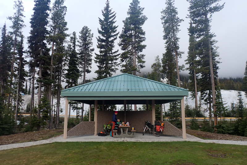
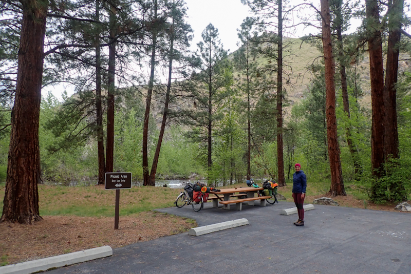
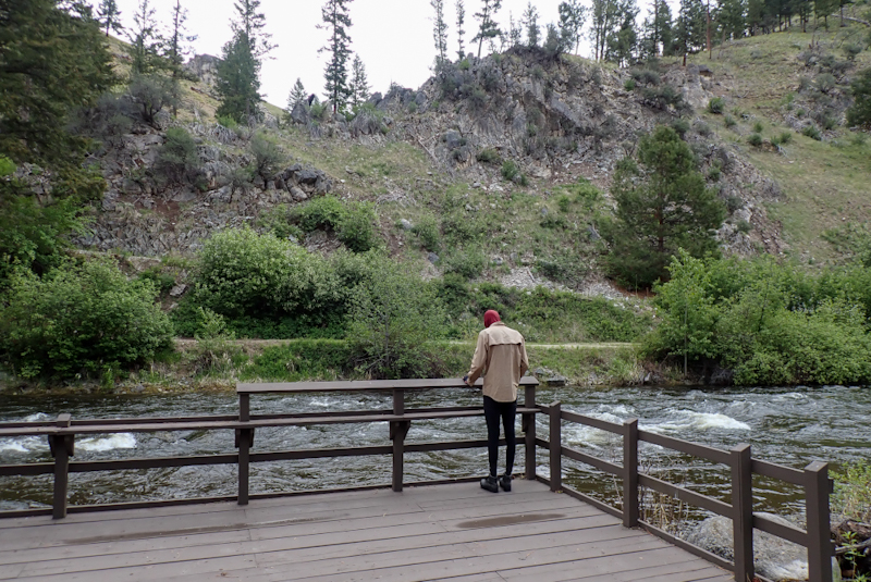
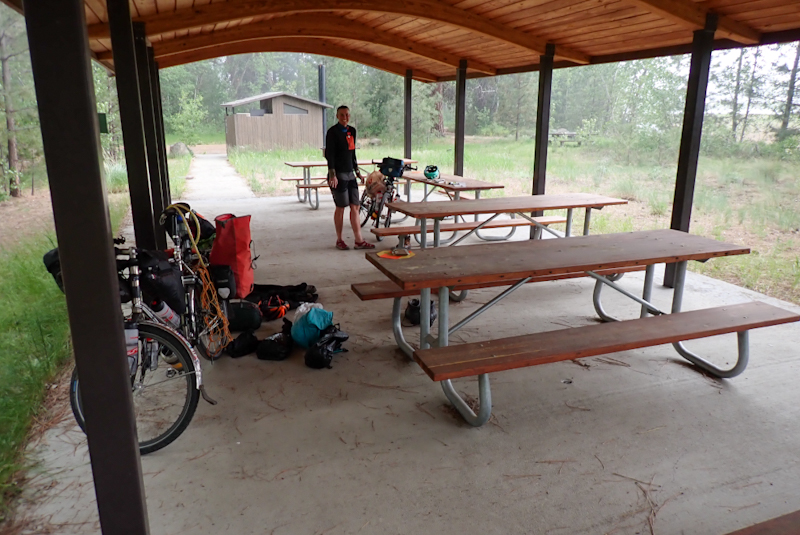
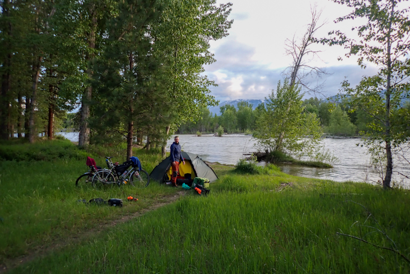
We had a peaceful night in the end and slept well by the Bitterroot River. It was raining when we woke up but it had stopped by the time we packed up the tent. It did not rain again til late afternoon. We set off on the bike path which was very good and stayed on it all the way to Lolo, except for one short stretch from Florence. We stopped for morning tea and had breakfast buritos and a Texan Donut, which is just a really, really big donut! We enjoyed the ride along the cyclepath and the sun even came out. We saw our first goslings this morning, just in time for Memorial Day! We also saw a deer get hit by a car right in front of us. It ran across the road and we don't know how the car did not see it, the driver was probably looking at us. A lot of bits and pieces came off the car and the deer dragged itself across the cyclepath and somehow got over the fence into farmland but it was pretty much done for I would say.
We turned off at Lolo onto route 12 which is a beautiful road (very narrow shoulder) and enjoyed the forest views as we climbed gently. We stopped for a break at Fort Fizzle, amusingly this is where the combined military and volunteer resistance to the Nez Perce fizzled out. As we knew already, that was to change a few days later at Big Hole. We stopped again at Lolo Forest Campground to eat and fill up with water, and then turned up Graves Creek Road, which is a dirt road which would take us all the way to Albertson on the I90. The road surface was very good and it did not take long to complete the 200m climb to the top where we found a camp spot in the forest on a flat pullout area. The place is full of people out in their ATVs and 4WDs, all joy riding as idiots like to do. The rain set in and hung around but we are snug in our tent.
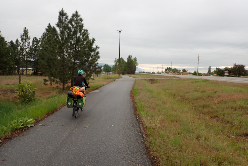
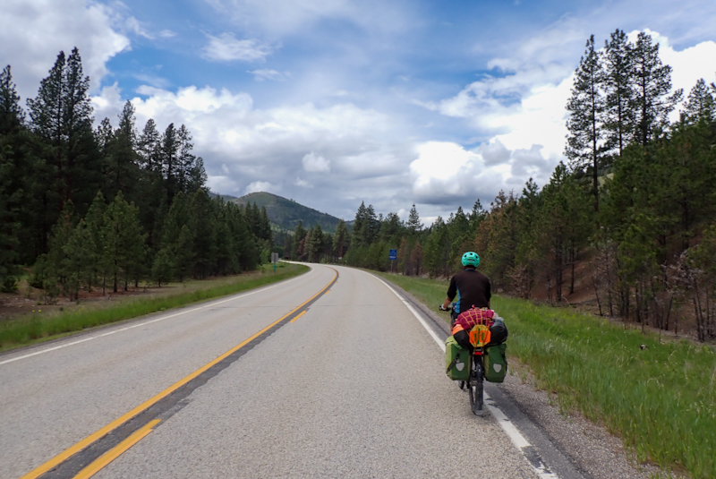
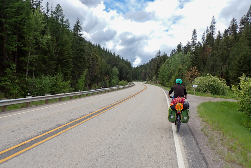
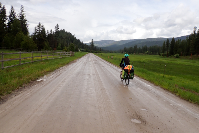
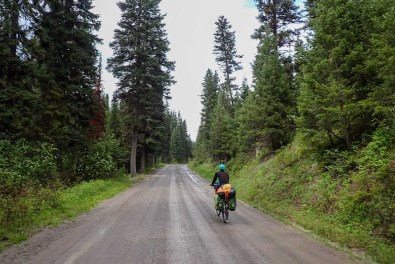
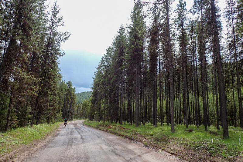
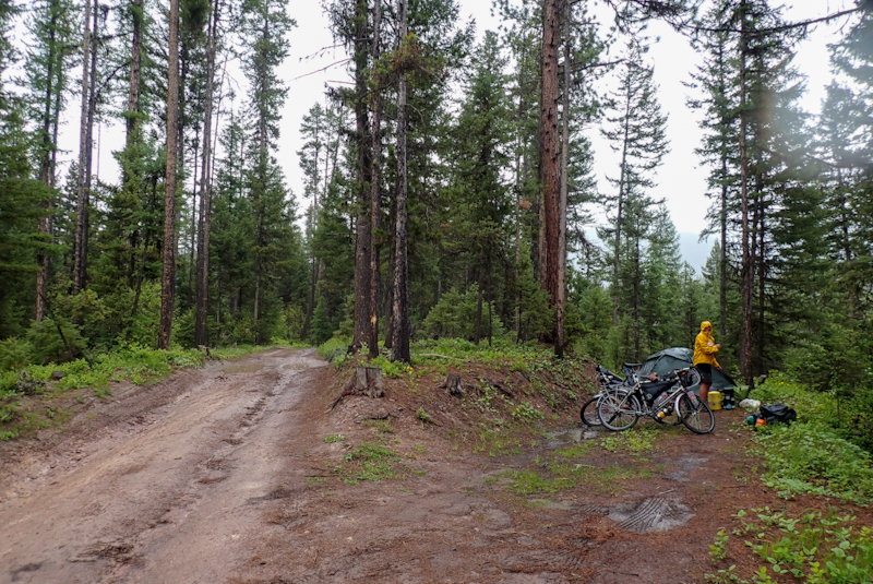
We had a midnight driveby by ATV joyriders. We were camped just off a very rutted and steep muddy track, not a road. So why people would be wanting to drive up that at midnight is a mystery. It's always the same, wherever you are in whatever country, on long weekends!
We set off in drizzle and high mist, blowing our whistles as we descended the twisting dirt road so as not to surprise any bears that might be walking along it in the early morning. After about 5 km the road was sealed which was unexpected. The valley gave way to farming once again and you can't help thinking that a Montana farmer is a lucky one. This is paradise! We stopped for a coffee break just before Albertson at a fishing spot. Albertson is a teeny village that we rode through. The sign on the pub door said "NO SNIVELING" which I liked! After Albertson we got onto an old rail trail called Mullan Road - Point of Rocks. This was pretty interesting with interpretive info boards along the way. Montana Department of Transport has done a good job here.There is a tunnel along it, fenced on one end, best to avoid going through it as at the westerly end the rocky roof is starting to collapse so the ground is a pile of stones. You can push your bike around it on a path that runs by the interstate side. We got my bike through the stone pile but Mike pushed his around. After this some loser farmer had put up fences with barbed wire to prevent access to what we presume is his farm even though the Dept of Transport signs showed the trail as continuing. Mike prised the metal teeth holding the wire in place from the post with pliers and we carried the bikes over the wires and closed it all behind us. A short way along he had done the same thing. The Mead Ranch is just at the road after the second one so it would seem they are the culprits. What is it about small town America that makes these people think they can just put up signs or fence things off and pretend they own them? The number of "Private Property" signs you see on fences, they can be every 20 m in some cases. We so often look at the US Public Lands App and land that is clearly national forest according to the official map has just been claimed by some redneck as his personal property.
After this we turned off onto a small road which ran near to the interstate. We decided to give the interstate a go. In Montana cycists can go on any road, including interstates. We have had mainly good experiences on Interstates in other states. As we got onto it, it crossed the river and the shoulder on the bridge narrowed to a foot. We couldn't believe it! The shoulder on an interstate is usually about 4 m wide! We stopped and pulled over, then checked for traffic (admittedly this is the quietest interstate we have ever seen) and went on, only to see another bridge and the shoulder all but disappearing again! We were near an exit so pulled off and then backtracked to see what happened in the distance. Sure enough, you could see anytime the divided highway bridged a river or road, the shoulder almost disappeared. Well, obviously we could not ride in such unsafe conditions. So we then had to do a complete loop around to get back to the point where we left our small road. Back on it, it was to become a bit of an adventure when the road became unsealed, then a dirt track, then a muddy, rocky, 10% grade goat track! All while it poured with rain! It twisted down into steep valleys with gushing creeks and then climbed up again at crazy angles! It was very remote. We did some walking at the steepest part. There were amazing views of the massive Clark Fork River down below us in the valley. Once there were some houses or rather shacks clustered around this donkey track and three massive dogs came running on to the road, barking and going for both of us. It terrified me as they acted as a pack and all went for Mike at once and then came for me. I threw rocks at them. Then I cried as it was so horrible and stressful. The stupid owner was calling out to them but never came out of the shack or onto the street. They were awful dogs. Somehow we managed to get away. Mike walked me and my bike from the dogs and got his bike, a few of the dogs got kicked. It was, well, it was just typical. This is America. We have been chased so often by dogs, we actually hate them. You often go past a large property and dogs come running to the open gate and you just pray that they stay at the property boundary. The only ones you can trust are the working dogs as they are properly trained. We often reminisce about the time we spent in California and the people we met, it seems like a different country. The people we met there had a world view, now it seems people just have a view of their valley.
The road lost it's remoteness by degrees and became sealed again and then eventually we arrived at Superior, a small town on the Clark Fork River. We ate fried chicken and set off in the rain again. We picked up water at Sloway National Forest Campground and turned back towards the river and onto an old railbed, invisible from the road which runs for ages, covered by pine needles. Perfect campspot! It was a full on day, we rode 100 km over some pretty rough terrain and also reached the 5000 km mark of the trip.
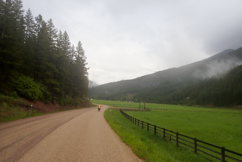
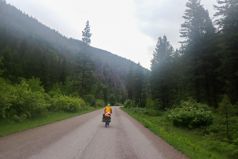
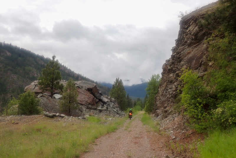
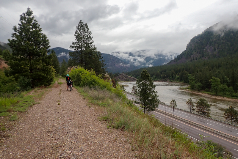
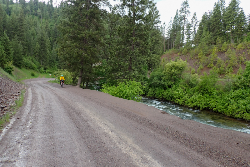
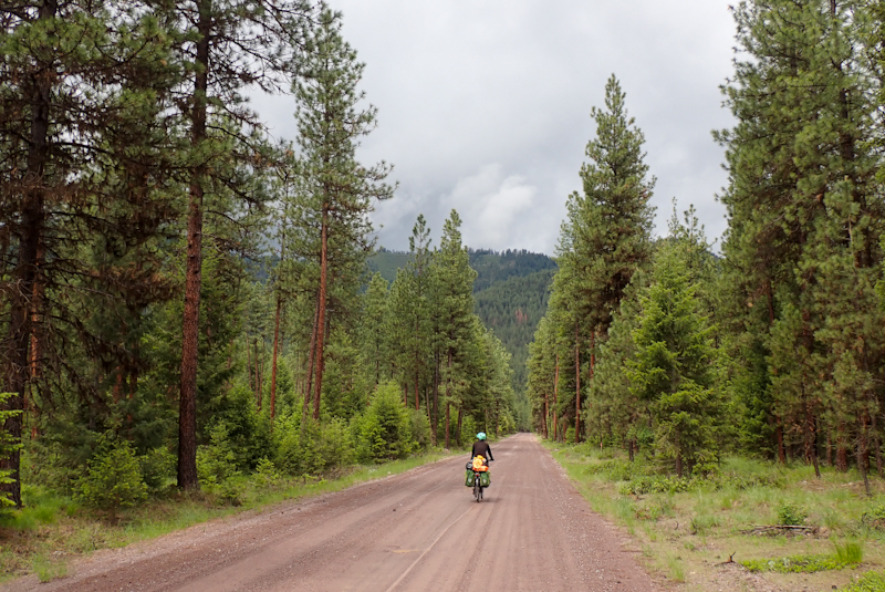
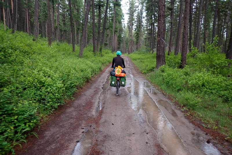
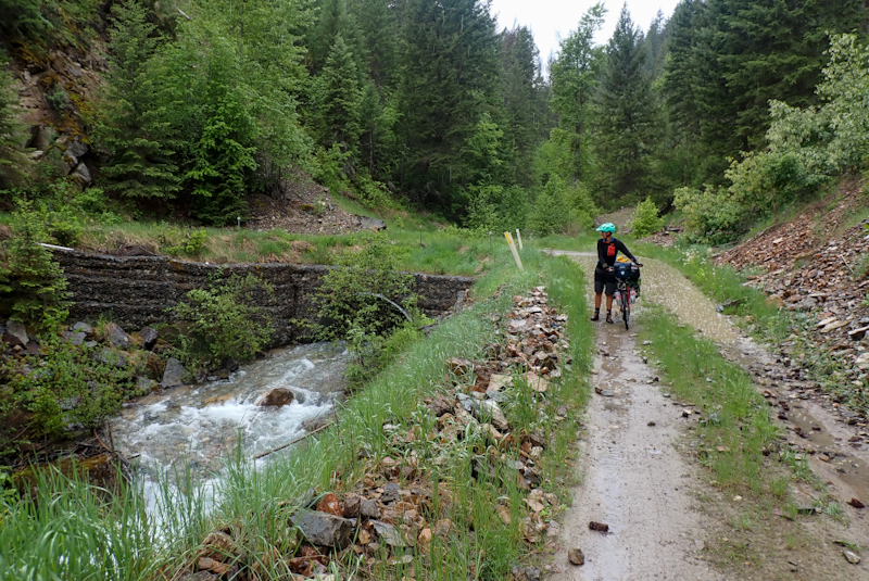
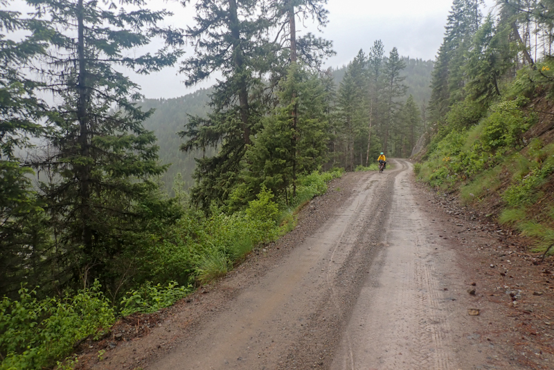
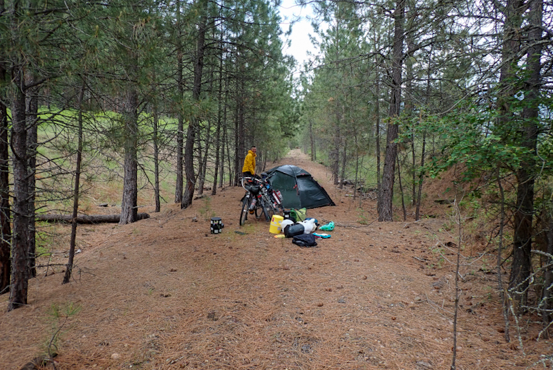
Sunny day! First in a week! So it is true, summer does start on Memoral Day! We had about 15 km to St Regis. The road we were on avoided the interstate. It was a quiet road. Our mapping program and Google Maps had us using this route. Of course as we turned onto a quieter road according to our route, a sign warned us that it was a Dead End. As we got there, we saw there were big metal gates and a MASSIVE sign read: "The Second Amendment - Our rights do not end where your feelings start". Skull and crossbones. We could not make this up. These people live in some sort of bottom feeder fantasy land. It was a public road, but these Second Amendment people had just claimed it as their own. We backtracked and took the interstate the 4 miles into St Regis. As a wise man once said, "You may be right but you could still be dead." This is how we feel in these backwoods. It seems crazy to say it, but you could be shot dead out here and the evidence buried. Once in St Regis we struggled a little but found the start of the Route of the Olympian Trail (named for a train). The route we tried first ended again with "Private Property I will shoot you dead on the spot blah blah blah" sign on a gate across a public road. Then we picked up the route further down the main drag. To be fair there are no signs about this rail trail. Although it is a very useful and really good route the town does itself no favours by not promoting it. The first few kilometres were sometimes very smooth, mostly very stony and almost always potholed. Also there was a dead end at a river but we figured out the detour. The area is very wooded, beautiful forest and a spectacular river clear to the stones at the bottom. Beautiful stuff. We really enjoyed the route, after it settled down it climbed at a slight and steady grade as railtrails do and the surface was excellent. We saw people trout fishing whilst floating downriver on rubber ducks. The first had a woman on the oars impressively maintaining control steering the vessel while a bloke upfront sat on a swivel chair flicking his line here and there as they passed, hoping for a bite!
The route parallels the Interstate and is narrow with old river crossings. It passes through a few teeny villages, one of which had the 50 000 silver dollar casino that we had seen advertised since Lolo (!) and a tree nursery. We went and relaxed on the shady lawn of the nursery for a while. The sign at the front said "Visitors welcome." That was a refreshing change from the driveway nearby, "Private property. I own a gun and a backhoe." At least there were no "Trump for president signs today". We don't comment on them anymore but yesterday a guy had actually BUILT a WALL of rocks and put up a big sign about TRUMP saving America or something. We turned off the Route of the Olympian straight downhill and met Neil, a cycle tourist from the Wye Valley in Wales. Ah yes, the Wye Valley, we remember it well! We had a bit of a laugh with him about Welsh cycle routes and the things that can kill you in American (mostly the people and the interstate in Montana). A few kilometres later we found a place to camp with river access. We had two good river swims, the water is crystal clear and really cold. Tomorrow we leave Montana for Idaho!