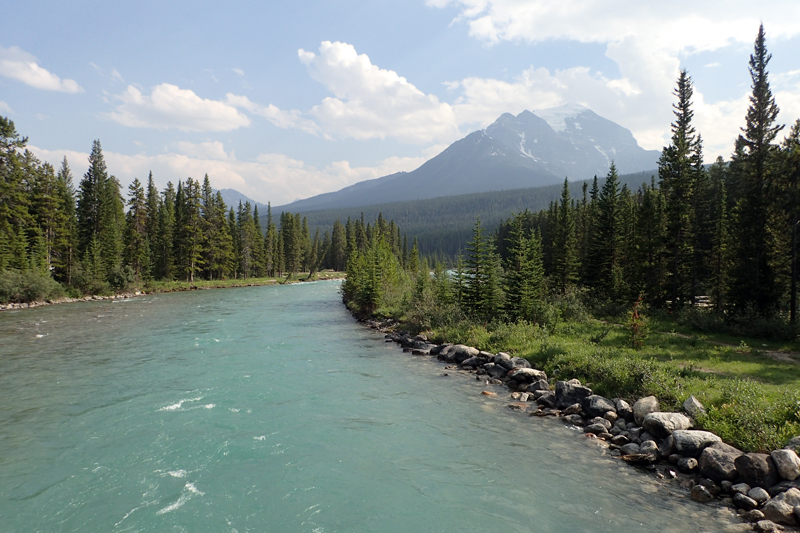
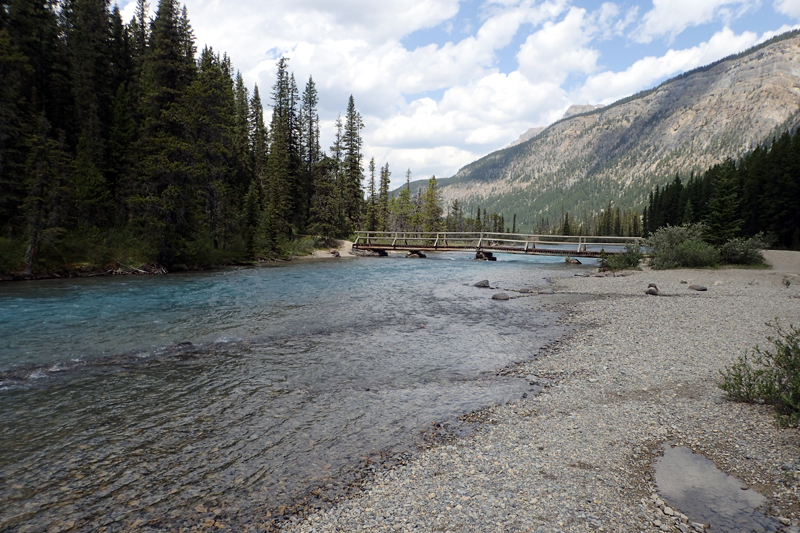
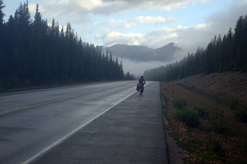
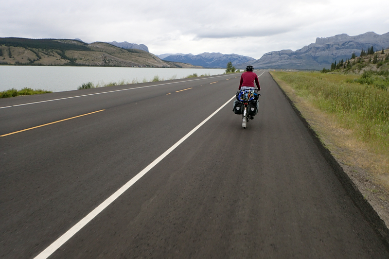
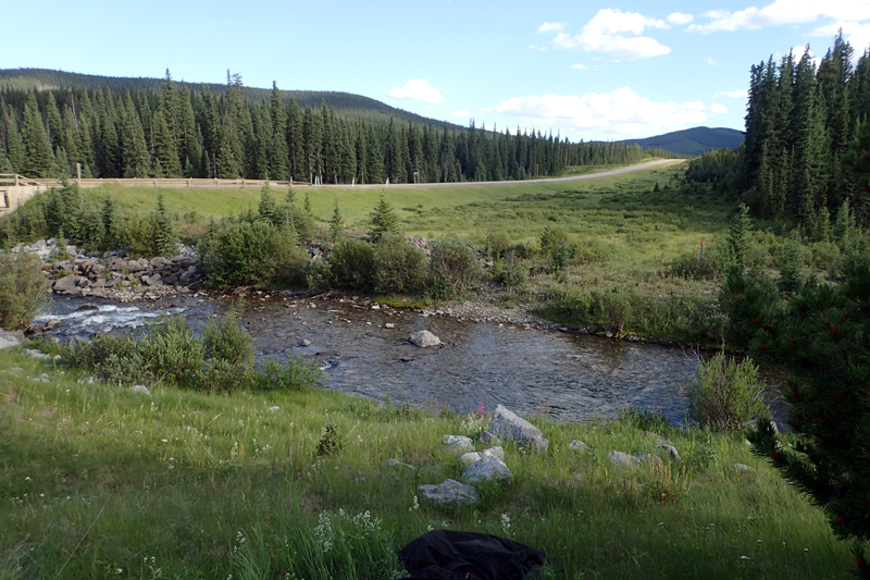
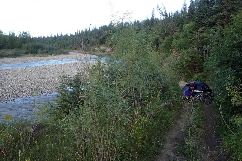
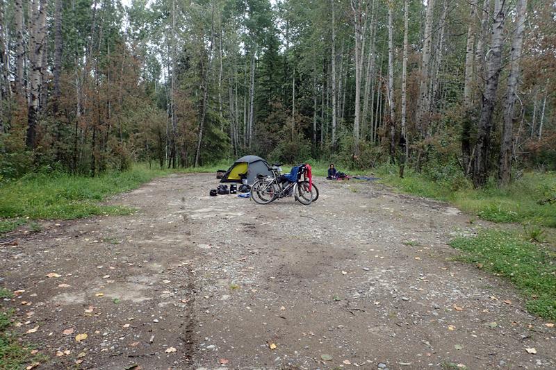
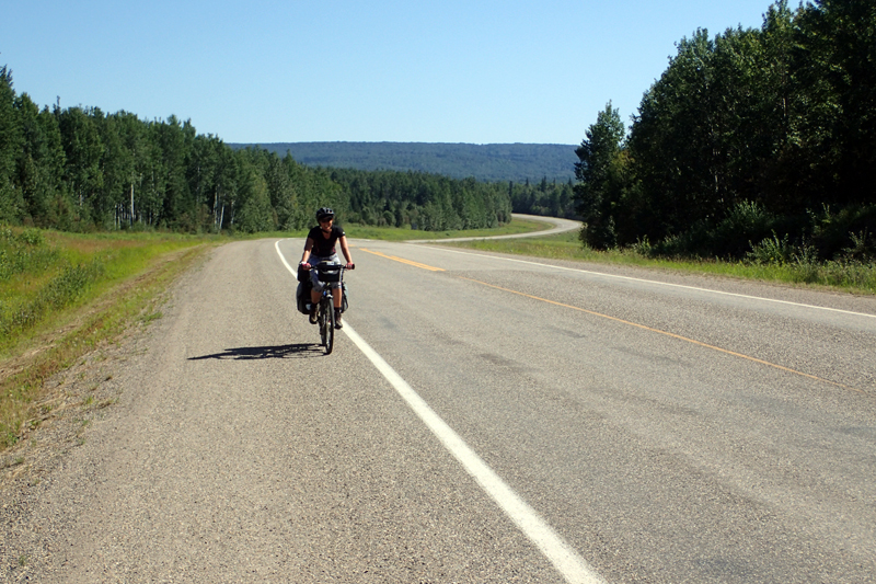
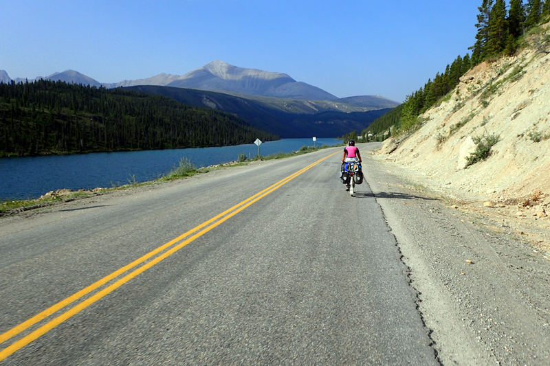
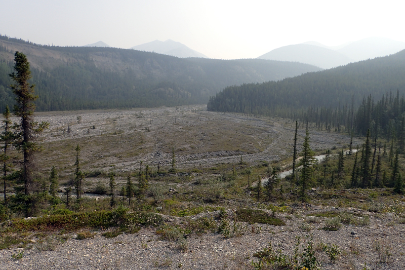
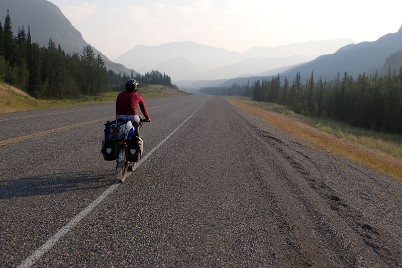
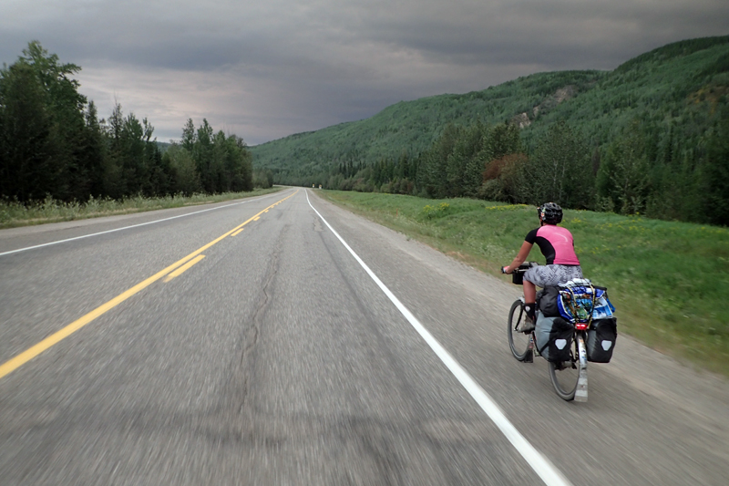
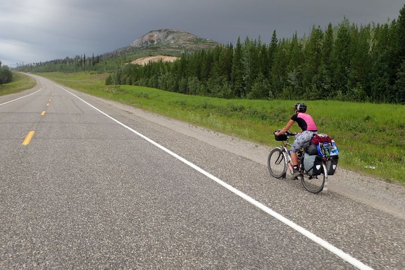
We hit the road west at 8:30 am. The Yankee Boulevard took us from our hotel right out the city to Cochrane. The road was not too good as it was highly trafficked with trucks and had a narrow shoulder, but we turned onto the 1A highway at Cochrane and from there had a good shoulder. We did have a bit of wind though. The rolling hills have now began, but unfortunately due to the smoke haze from 160 fires burning just over the Continental Divide in British Columbia, we did not have much of a view. The smoke smell was quite strong also. Of course, you can't really complain about the views when 30,000 people have been evacuated due a very serious fire situation. Due to the Gulf Stream which is a westerly wind, air quality advisories have been issued as far as Saskatchewan. Banff National Park is open, we checked online. After Cochrane we continued along the Bow River to Ghost Lake Provincial Park and ended up camping just on the rise after this.
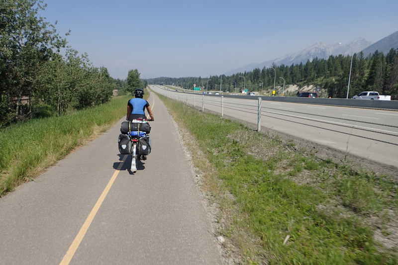
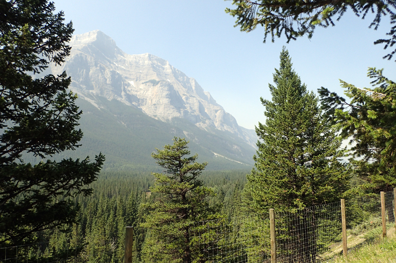
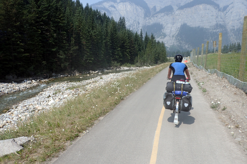
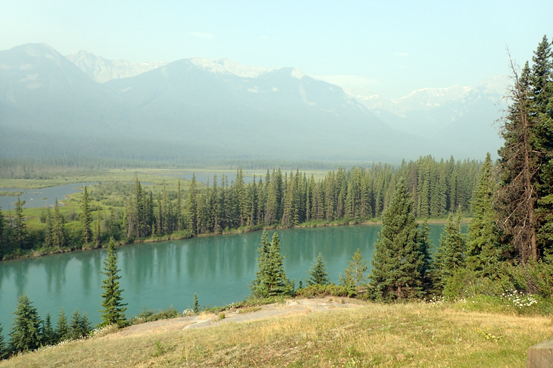
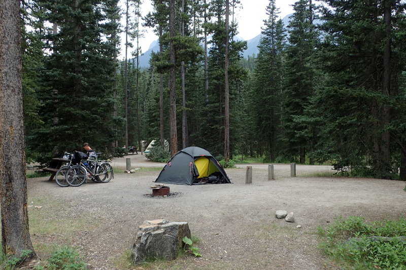
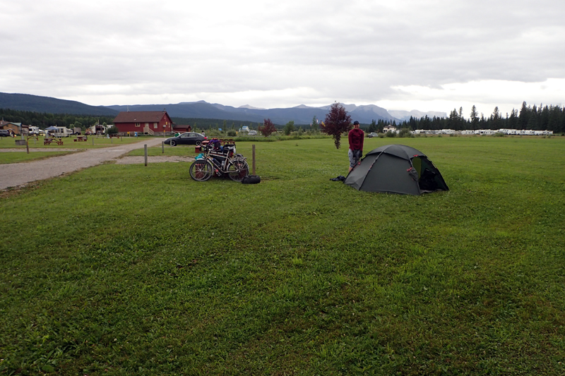
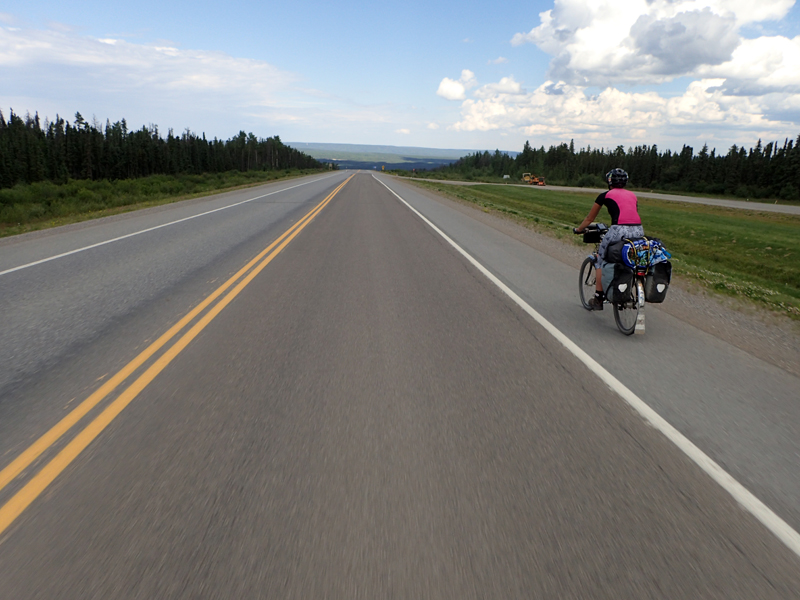
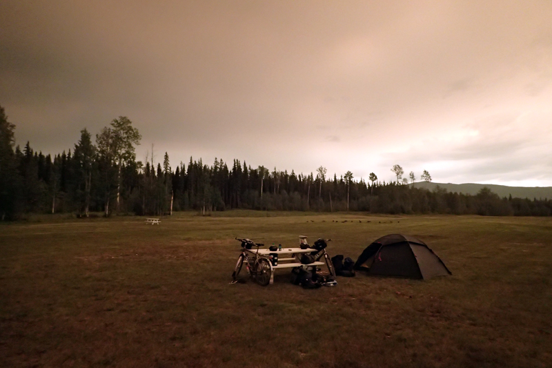
Once we went to bed last night the wind dropped completely and then so did the temperature. We have had heat for so long we did not really think we would get cold again for a while. In the hotel I had packed my warm gloves right to the botttom of my pannier. Imagine my suprise when I opened the tent at about 5:00 am to go wee wee and thought "What's this stuff on the outside... is it crusty slug tracks?". ICE all over the tent. The temperature was below freezing!! WHAT?!! This place is crazy. We hit the road in winter woolies - me in two pairs of woollen gloves! Slowly, slowly we drew closer to Banff. The Rockies revealed themselves ever so slightly through the smoke haze, visibility was better today. They are big mountains, rising above the treeline quite away. We were suprised by the level of heavy industry along the way, belching plants marring the view from time to time. Due to this, the road was heavy with truck traffic once again. We were on the 1A, most tourism traffic and RV's would be on Route 1 over the Bow River. The river itself is beautiful. We stopped at Canmore for Timmo's, of course, and then only 23 km along a beautiful cycleway to Banff. We were very impressed by this. We chose to camp at Tunnel Mountain 1 as it has no power so there was a better chance of getting in. We had tried to reserve a site, both online and over the phone, but Banff had closed their reservation service for three days due to online issues. There were still sites available when we arrived which we were relieved about. Tomorrow we ride to Lake Louise and beyond.

We had a quiet night, which was amazing considering the number of campers. The sun rose as an orange ball due to the smoke haze and we were on our way early, heading for Timmo's Banff. Banff is of course where the "cool kids" hang out and the queue out the door at Timmo's was enough of a Banff "experience" for us. We had brekky and I went to the adjacent visitor's centre to pick up a map. When I came outside to meet Mike, I saw this guy and thought he was familiar, then greeted him. Imagine my suprise when I saw it was him... Xavier, who we met how many weeks ago outside Chutes Provincial Park, our first day on the Trans-Canada Highway, Southern Ontario! How amazing! We had a good chat, he had arrived in Banff and was working there so had not got to Vancouver yet. We were so pleased to see that he had made a successful cross-Canada trip, having left Montreal for Vancouver. He said that he had experienced such bad headwinds on the prairies that he had taken to riding at night under a canopy of stars! I think that our wingle-wangle route across actually saved us some pain in the end. When we think of the prairies we escaped quite unscathed compared with what could have happened!
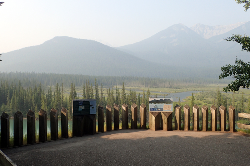
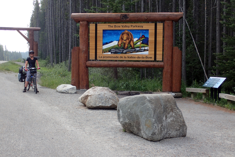
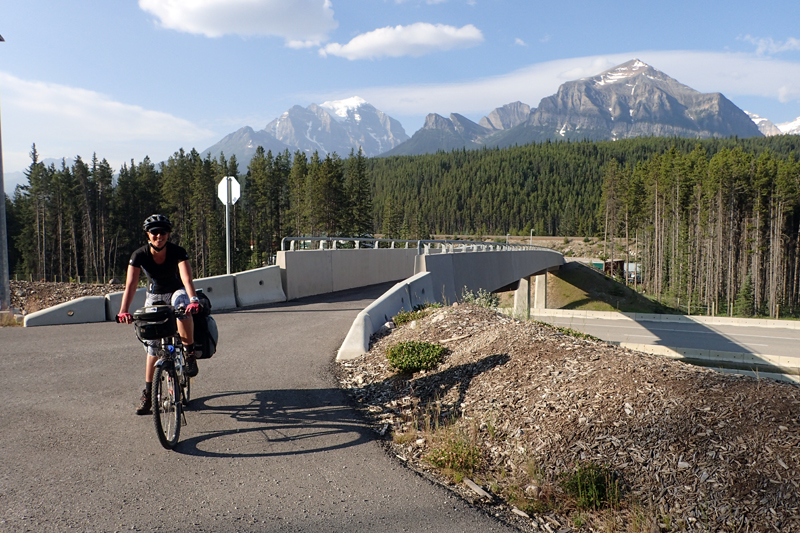
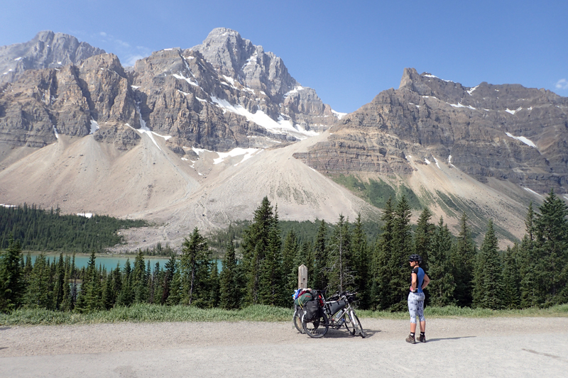
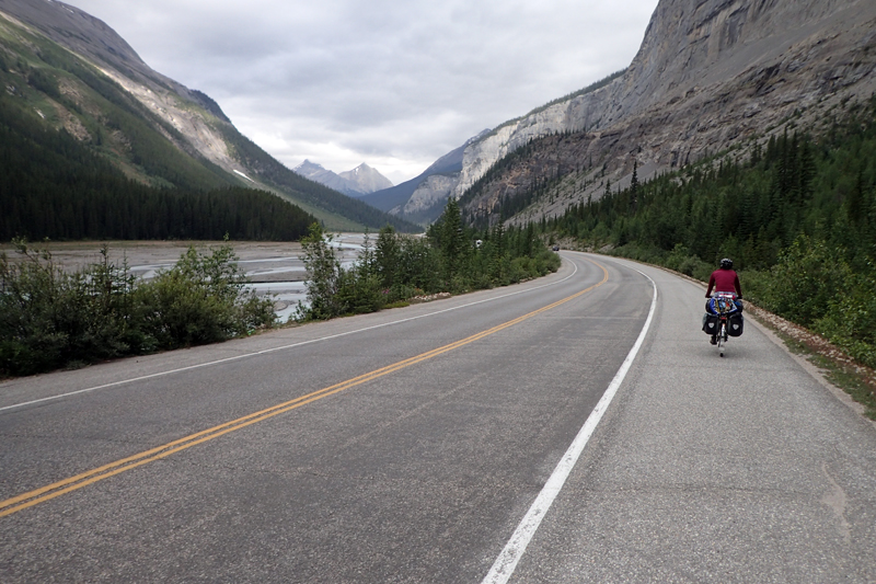
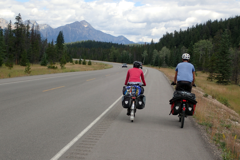
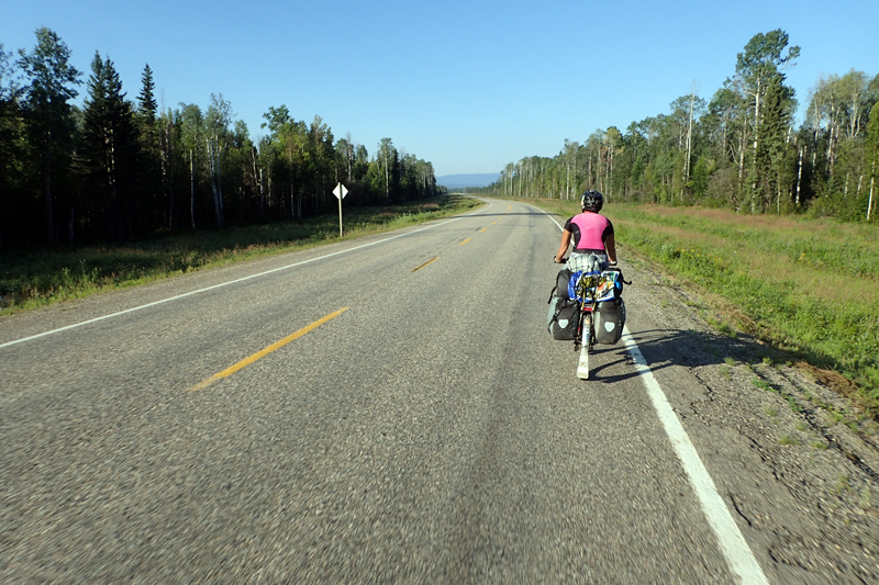
We had a cycleway outside Banff for a few kilometres and then joined the Bow Lake Parkway. This is the secondary road to Lake Louise and so no RV's were on it. The road is quite narrow at times and a divided highway at times. It is a great road, some climbing but to Lake Louise nothing too steep. It was amazing how quickly the time went with things to look at! Quite a treat after the prairies which although enjoyable, could get a bit monotonous. There were many places to pull off, info boards to read, picnic spots and so on. We had been suprised to see how quickly the campsite emptied this morning at Banff, but now we saw why. Many of the parking areas for hiking trails had signs saying "FULL". We were amazed, if the parking areas were full, what about the campsites? We were planning to reach Lake Louise Campsite today, but their website actually said it was fully booked. If we couldn't get in there, we would go on to Mosquito Creek, although that was not reservable and only had 32 sites so we were a bit nervous about not getting a site there either. Mosquito Creek is only 24 km from Lake Louise and so car campers would go there if Lake Louise was full. Anyway... we were riding in Banff National Park and that is something! On one of the steep climbs we came across families who were part of some sort of cycling tour group. There are a few of these supported bike tours where you don't have to carry anything and they organise end to end accomodation etc. We were amazed as there were young children, aged about 6 and 8 years who were clearly not coping and parents were walking with the kiddies bikes and the kiddies themselves looked all strung out. Unsuprising. Anyway, one of the women decided to try to grab hold of the little boys bike and ride with it uphill and she fell off. It was a debacle. We're really suprised that a tour group would permit children this young on this sort of route; narrow shoulder and unsafe for anyone walking on the edge of the road, let alone kiddies. On another uphill section a father was cycling ahead of his two boys, one of whom had stopped with some sort of mechanical issue. The area is frequented by grizzlies so this was concerning too.
We turned into Lake Louise village and it was mayhem! Cars everywhere and people directing traffic at two intersections. The sign for Lake Louise Campsite said "FULL" but it was only 500 m away so we went anyway and Mike asked in plaintiff tones "Would you have a tent site for two cyclists?". Of course they did! The campsite is wonderful, totally relaxed compared with Banff which was quite busy and energised, and a few "undesirables". The sky had cleared considerably and we even had views of mountains! The campsite is in two parts: tenting and RV's/vans. The tenting part is surrounded by electrified fencing to keep bears out, but you still have to pack your food away in food lockers provided in storage rooms. Even though we have bear containers they do not accept this as adequate. We like to play by the rules so bought a lock today as yesterday was the first time we had encountered this system and our bear containers cost a fair whack so we don't want to lose them. We didn't see any bear on the road today, although a motorist Mike chatted to saw a grizzly along the same road we came in on. We are happy not seeing any. It complicates matters. We spent a relaxing afternoon at the tent after going into the village for food, prices so high I thought for a minute we were back in Norway. The campsite filled up with many cycle tourists, those in pairs and also those on supported tours.


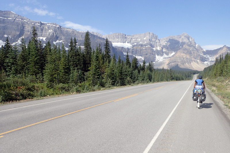
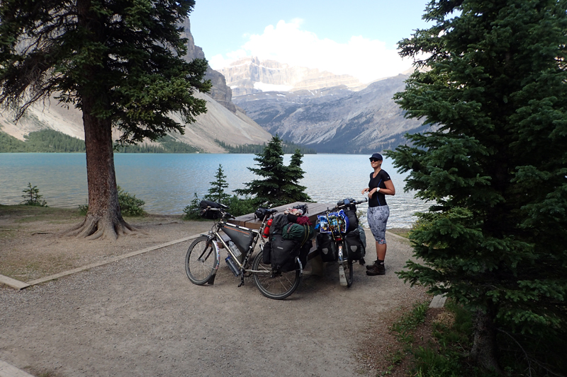
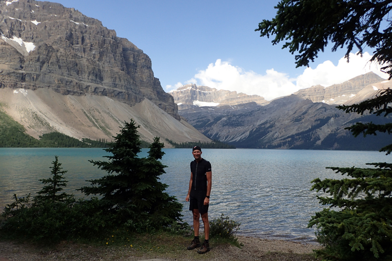
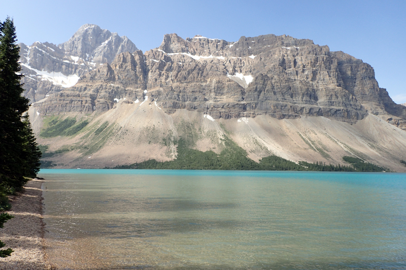
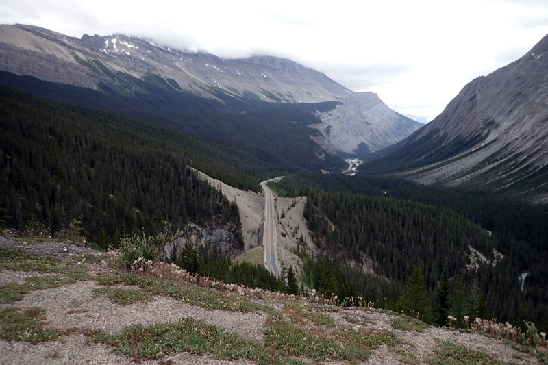
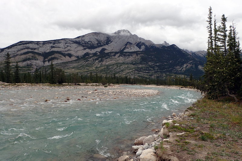
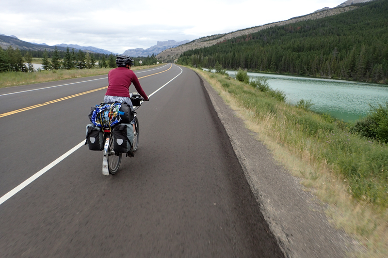
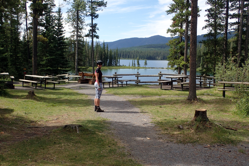
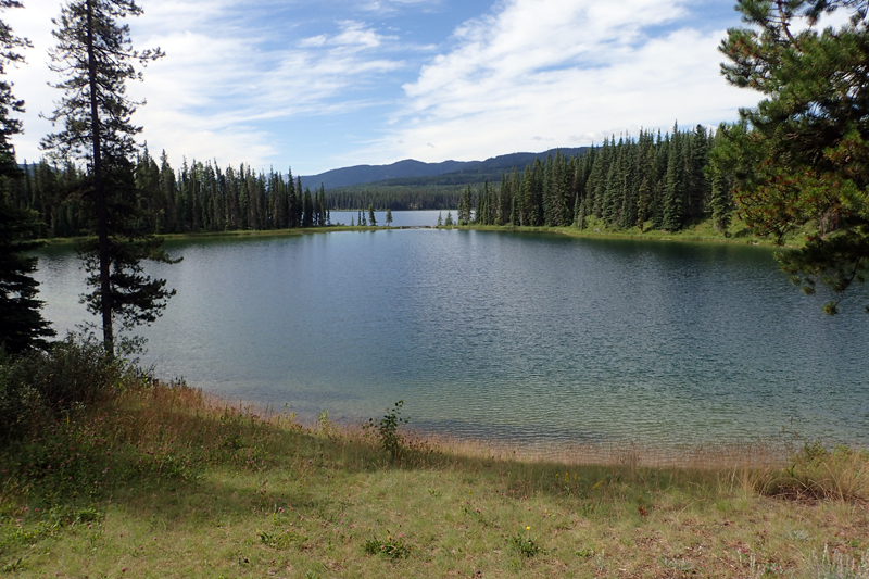
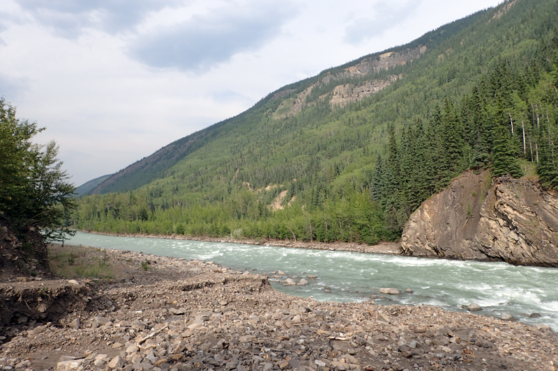
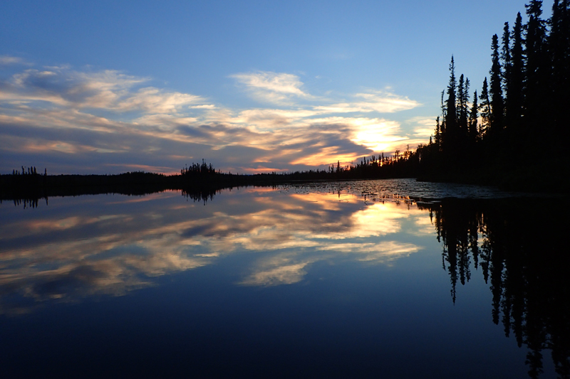
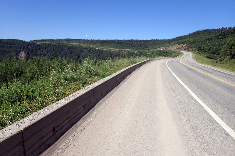
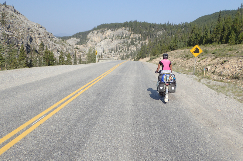
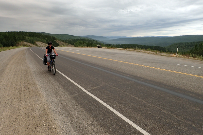
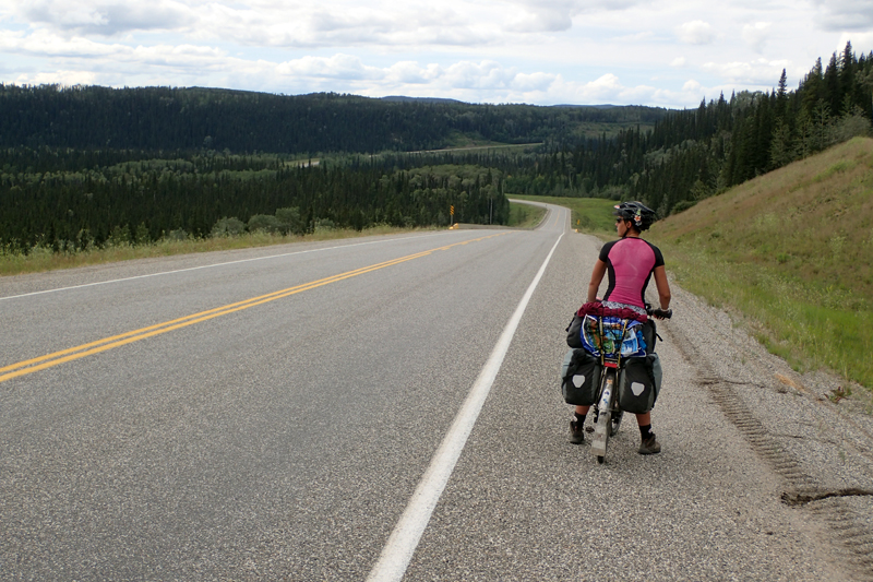
We woke to a cold morning (2 degC) and CLEAR skies - no hint of smoke haze. Wow, the views are spectacular. We left at about 8:30 am, looking forward to the day as we would climb to 2,000 m and would have superb views. The road between Lake Louise and Jasper is the Icefields Parkway, so named we assume due to the number of glaciers visible along it. The road is busy, being one of the most beautiful drives in the world, so we had RV's, campervans and buses today whereas we did not yesterday; they would have been on the main route then. The road is beautiful and has wide shoulders. The climb was 500 m in about 46 km, so pretty steady and not too steep. We stopped at a few viewing sites along the way, the most notable being Crowfoot Glacier. The parking area was crammed with various types of motorhomes and buses. There was also a picnic area about 200 m down a road and we went along there to find a paradise of picnic tables scattered along the lake shore, trees dotted around and small pathways for walking in between. No one there. Too much effort? We sat down to drink our hot chocolate (yes, can you believe it, we are back onto that!) when another couple came walking along. They had travelled from New Mexico. We had a laugh about the beautiful spot that all the selfie-takers in the carpark didn't come to.
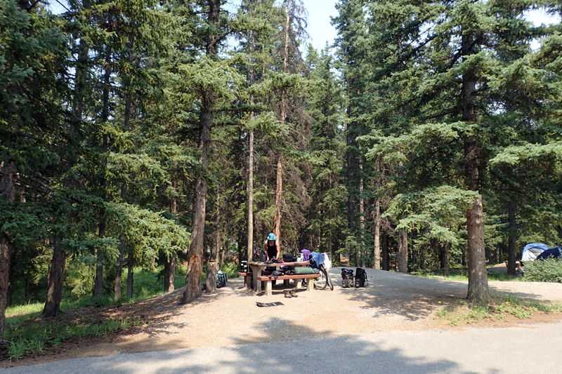
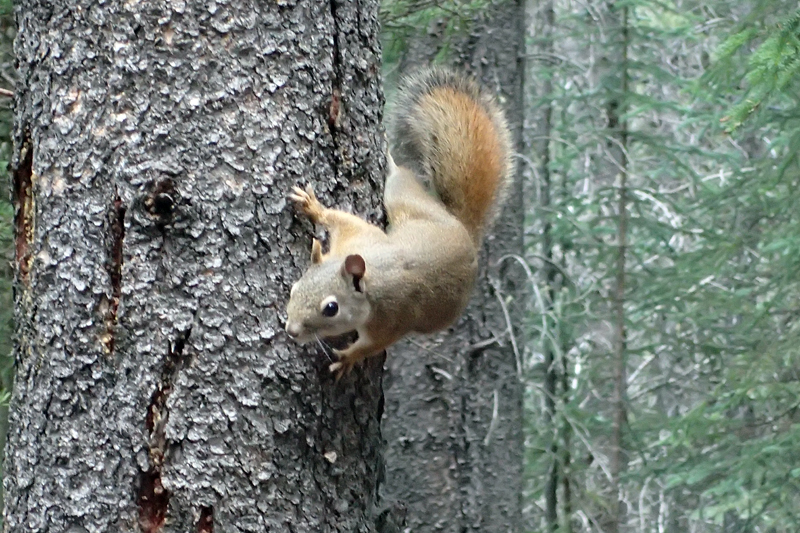
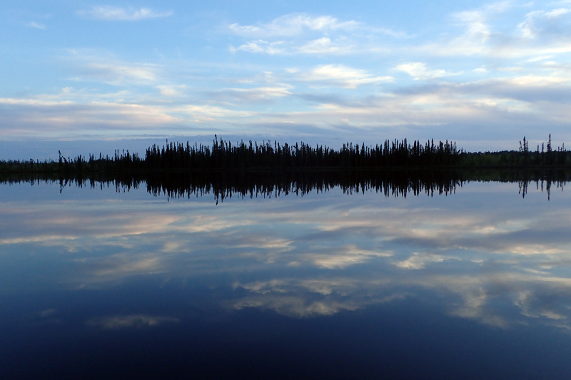
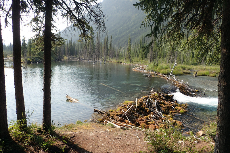
We reached the high point after a few more kilometres and then had an amazing downhill sweep, losing about 300 m very quickly. At times the shoulder widened to 4 m! Amazing! We saw quite a few cycle tourists today. Bear in mind that the last time we had seen any was in Neepawa, Manitoba, many weeks ago! The start of the prairies. Banff is certainly a beautiful place and we can understand why it draws so many tourists. We arrived at our campsite, Waterfowl Lake, which was self-registration and were pleased to see that it had a section of walk-in sites and food storage lockers closeby. It really is a beautiful campsite, our favourite so far in Banff. We have a friendly squirrel (always) and we were amazed to see her move two baby squirrels from one tree to another. She sort of bundled them one at a time under her chest, ran up the tree and shoved them into a hole in the trunk. They didn't seem too happy! We are the luckiest campers in Banff National Park tonight as we have no other neighbours closeby. We were expecting rain, so had a quick (!) wash in the beautiful glacial river and then ate and unpacked. No sooner had we done so, it started to rain and did so quite heavily for some hours. We were able to go for a stroll and eat again at the picnic table later in the evening before the rain came again.

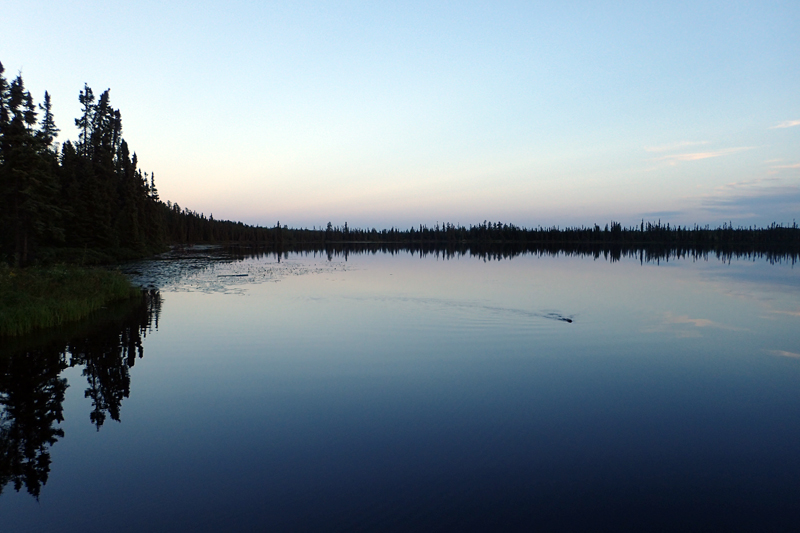
We really liked the campsite and it rained a bit in the morning, so we decided to have a rest day at Waterfowl Lake. We met a Dutch couple who were touring from Vancouver in a campervan. They confirmed that at the petrol station 15 km down the road there was a big restaurant. We were pleased to hear it and woould stop there for breakfast in the morning. We had picked up a couple of loaves of bread and some bananas before leaving Lake Louise so were fine for food for today.
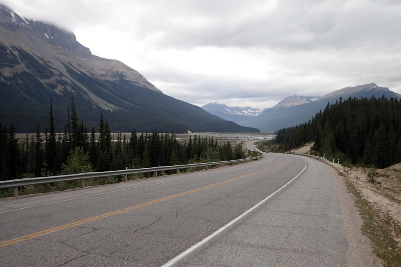
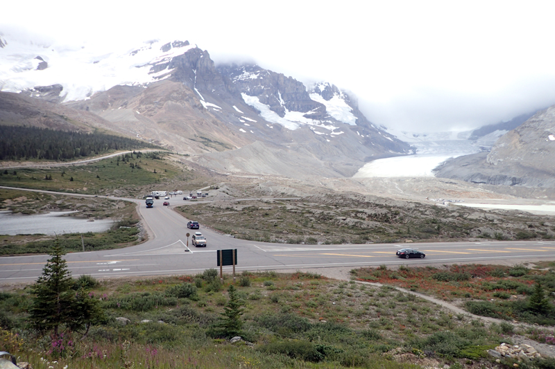
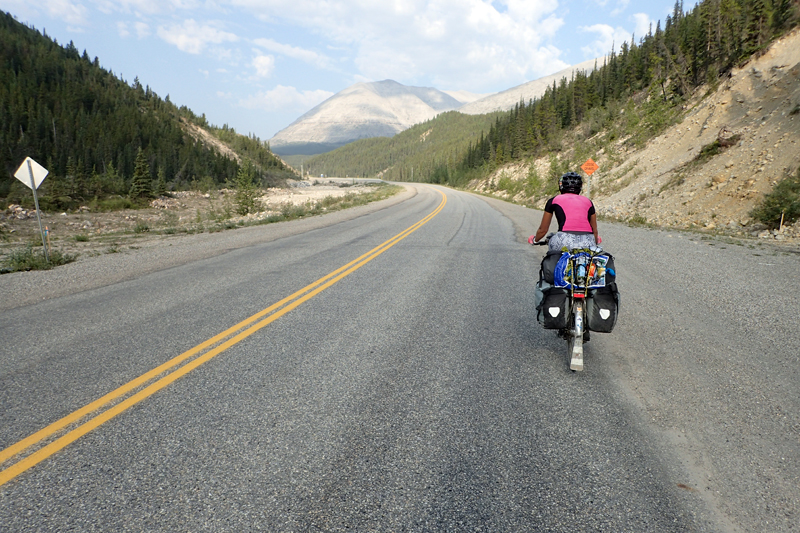
It was still overcast, but a better day today than yesterday and we set off down the hill at 7:30 am. We arrived at the petrol station at the junction of Icefields Parkway and David Thompson Highway (to Red Deer) and it had a large souvenier/grocery store and big dining area. We chose the continental buffet which was good value. I got over-excited when I saw waffles and cream and my eyes proved bigger than my stomach! It kept me going all day. Our food restock consisted of a tin of soup and a loaf of bread, costing $7 each - Extortion! We had a steep climb up to Sunwapta Pass and then entered Jasper National Park, with the road continuing on towards the Columbian Icefields. We stopped at two campgrounds, but both were full and didn't look inviting at all. The scenery is very impressive and it was cold as we descended towards the icefields. There are quite a few glaciers that edge the valley. The crowds at the Icefields Centre had to be seen to be believed. Hundreds of people. We popped into the centre to get some updated information on services on the road ahead but the Canada Parks desk was so small and there was not even a map to be had. Quite surprising that National Parks have fallen so far behind the private enterprise which seemed so unappealing. We left as soon as possible. The whole place is largely funded by private tour groups and not much investment has been made into the infrastructure, it will never cope with the numbers of people who arrive here on a daily basis throughout the season. When compared to Norway and New Zealand with similar natural assets which are so uncommercialised, it's disappointing. We were happy to jump back on the bikes, all our warm gear on, and hurtle down the valley a little way further to camp in peace and quiet.

We had a pretty restful night, although just as we fell asleep we each thought we heard a growl which was possibly the other person's stomach, but neither of us thought it was ours. Anyway, no nocturnal visitors that we knew of. This was a good test for our bear containers and bear bag. Always a relief to find them all present and accounted for in the morning. It rained most of the night and was cold and misty. We wanted to get an early start but it takes a while to get sorted with all the "bear safety" gear. Man, are we happy we started this in Ontario as if we had to get into the rhythm of it now it would be quite stressful. We were looking forward to a downhill run to Jasper as we had about 550 m to lose. The road was quiet but after about an hour we started to get traffic coming towards us as the first of the day made their way up to the Icefields. We stopped after 30 km to look at some Sinking Sand at a picnic stop and met Kai, a cycle tourist who had also left Toronto on 11 May (we left on 10th!) and had taken more of less the same route as us, however, he followed the Red Coats route (south of us) across the Prairies. He was pretty excited as he had just been suprised by a bear when he was having breakfast. He was part-way into a 2 year adventure by bicycle. We rode together to Jasper. It was an easy run in, the scenery still very good. We exchanged stories about our travels. As always, we are filled with admiration by the solo traveller, particularly in this case as the guy in question has just finished high school. Solitude is usually a skill aquired, so at his age to undertake this type of trip is commendable. Follow his blog HERE.
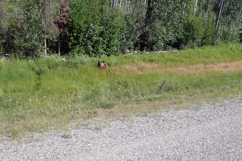
At one point during the ride we came across many vehicles stopped on both sides of the road, something was up. It was a grizzly bear! An oncoming motorist warned us. We stopped and waited a bit and when the cars pulled off, so did we. Poor bear was looking alarmed, shaking his head in the bush along the roadside. He can't stand campervans either? We were very happy to see a grizzly a short distance away in a mangeable environment.
Kai was heading west to Kamloops at Jasper and we were heading north, so we parted company. Jasper seemed far more palatable than Banff. It was still busy but not as highly strung! We were suprised that the cabin resorts we passed had "vacancy" signs up. That was a change from the Icefields and beyond where there was not a campsite to be had. We did stop at Timmo's, which was the first one where all seats were taken. All those campervan drivers have to have somewhere to rest their legs I guess (I promise to become less cynical about all this by the time we get to the Yukon and stop seeing them). We picked up some more food for the evening and headed off to our campsite a little further along the river. The river scenery had been amazing today. You could not believe that the teeny stream that took up so little of a very wide gravel river bed where we had camped, was now 500 m lower down a raging, glacial blue torrent, with tourists going down on river rafting trips.
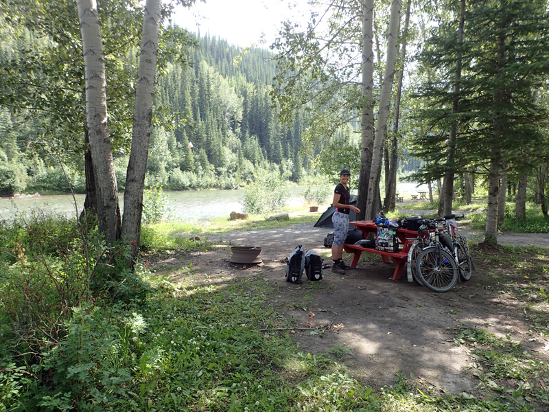
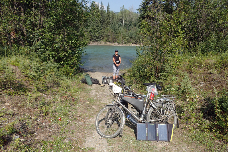
Our campsite is 5 km off the road, which we don't usually like, but it has walk-in sites which is great for us, and roomy food lockers. Also, it is not crowded and very reasonably priced. We did have a swim in the gushing, glacial river, concentrating on not being washed downstream, or being frozen to death. It was our first in three days so that felt good. Tomorrow we head to Hinton and leave these parks behind. It has been an interesting experience!
We left Jasper National Park today on our short ride to the temptations of a laundry (for clothes) and hot showers (for bodies) at the KOA which is a bell's and whistle's type affair but now and again just what you need. The scenery was still very beautiful as the mountains diminished, finally giving way to small lakes and sandy stretches. We had a bit of drizzly rain and got quite cold suddenly as we left the park. Hinton is about 25 km from the park boundary, but we had bought a loaf of bread at a trading post at Pocahontas Cabins and were confident that the campsite would have a well-stocked store, being the KOA. The delights of Hinton (ie. Timmo's, Subway and the boys) could wait 'til morning. Also we didn't want to get wet.
We have only stayed at one other KOA, in Ontario, and again we were impressed by the professionalism of the place. We were checked in even though it was before 11:00 am. A few minutes later we were very impressed by the hot showers. They have a large camper's kitchen here as there are cabins for rent which are quite basic, i.e. no stoves or sinks, so those people need to be catered for. After doing the laundry and eating we have settled in here and are charging everything at the plug that Mike is trained to look out for. It is just under the eaves. This is known as cycle touring survival skill no. 1!
The KOA had a good feeling about it and the other campers were all friendly and interesting. Except for the group of three kids who arrived in a campervan rental and proceeded to start playing drinking games from the early afternoon. Luckily not near us, but loud enough for the whole campsite to hear. They were pretty organised games with different coloured paper cups and ping pong balls. Views of the Rockies be damned! Campsite Management sorted them out sooner rather than later. Anyway, we met a lovely couple from the Netherlands who also had a Hilleberg tent, the first people we have met in 6 years with the same make of tent as ours.
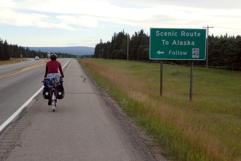
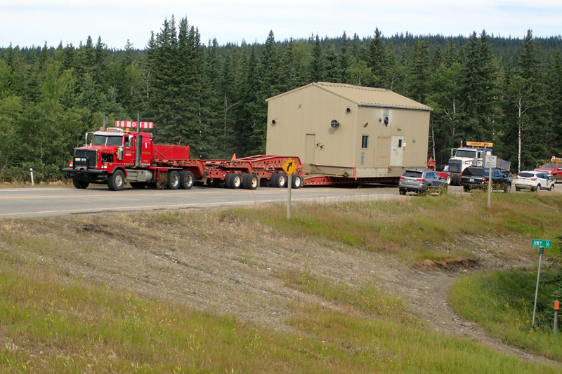
We struggled to wake up early, just wanted to stay in bed, but Timmo's in Hinton was calling so we were on the bikes at 7:30 am. We had a great brekky and coffee and a major restock of food at Safeway. It always amazes us - all this food, where is it going to go? It always fits in somehow. We took highway 40 off the Yellowhead; the sign read Scenic Route to Alaska!!!! I must say here that we rejoined the Yellowhead for the first time since Manitoba, it crosses the country through Edmonton. This highway will take us via Grande Cache to Grande Prairie, and there we will leave Alberta. At the junction to highway 40 we were halted for an oversized load that was turning towards Edmonton. Three vehicles managed the road closure and then three massive loads came through, the first two so big that they had trucks pushing them from behind. Large storage buildings and other equipment.
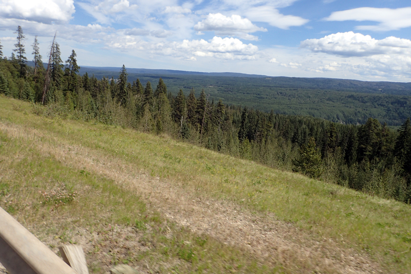
After that we got going and the route entailed a lot of climbing today, particularly at the start. We crossed the raging Athabasca River (remember the one we camped near off Icefields Parkway? It is now huge!) and kept climbing. By the end of the day we would have climbed 1000 m which is a lot for an 80 km day. The road is beautiful though, the surface varies in an interesting way, from great to really, really bad. We actually had peace and quiet at times, although the road is well-used. It was a beautiful day and got quite warm. We stopped for a snack at the William Switzer Provincial Park and the picnic area and visitor's centre were lovely.
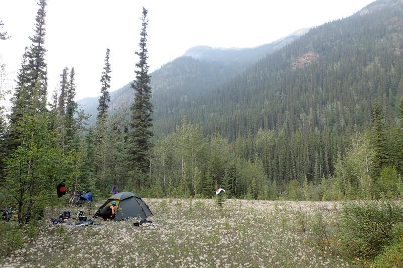
The climbing was not as steep in the second half of the day. The scenery is of thick forest, it is a logging area. The hills roll gently. For us, it feels as if after nearly 5,000 km the journey has begun! We chose a bushcamp at the Little Berland River which was easy to get to and there was privacy for the tent. The river swim was wonderful (freezing) and we had a relaxing afternoon watching many massively oversized loads being transported along the road.
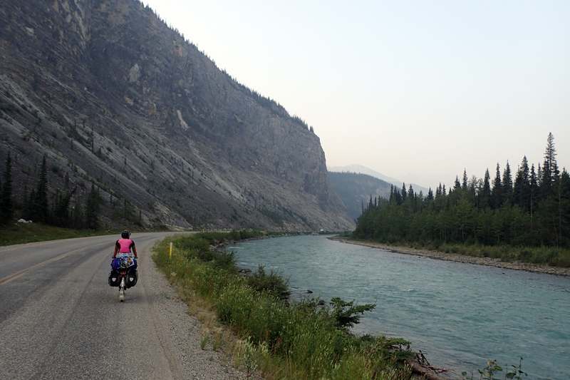
Today was more about descending than ascending. The air was quite smoky once again, from the BC fires. Strange that we had not had any smoke for nearly a week and now we had it again, not as bad though. The road from our campsite at Little Berland to the community of Muskeg was very good, wide shoulder and sweeping bends. From Muskeg the shoulder narrowed and the road conditions deteriorated, mainly due to the high volume of logging trucks in the area. Not so many oversized loads today! We saw three solo cycle tourists on the road today, our first since going towards Jasper. Always good to see others out there too.
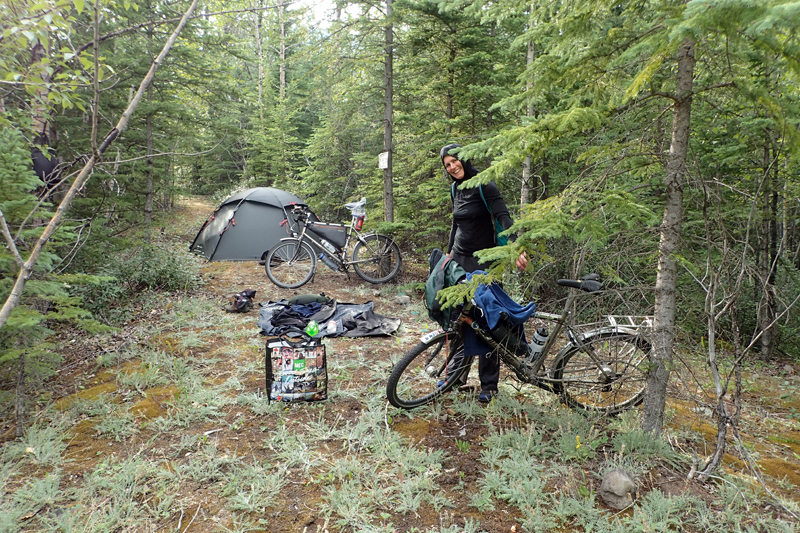
We were looking forward to having lunch at Grande Cache and after a steepish 2.5 km climb to the town we stopped at the visitor information office where staff were very informative and friendly. After a delicious Subway lunch we did some grocery shopping before heading on. Although there is a municipal campsite in town, we wanted to make the most of the freedom of "Random Camping" that Alberta allows. There was a geocache at some rapids on the Smokey River which sounded as if one could camp there so we were going to give that a go. After a steep descent into the river valley below the town, we crossed the Smokey River over an old wooden bridge and then had a few more kilometres to our proposed camp spot. On the desecnt there was a sign post advising travellers "No tourism services for 192 km". We passed a "Random Camping Area" (they are signposted) with quite a few RV's parked there. When we got to the rapids we found a great place to camp, quite well-shaded and of course all the water we could want. The strange thing was that when we came back to the bikes (we left them at a vehicle pull-off), there was this high-pitched hissing sound and we looked at each other, wondering what it was. Mike's front tyre had suddenly punctured. Timing is everything. Hurtling downhill a few minutes earlier and this would have been catastrophic! We took it was a sign that the end of the day had arrived! We spent an hour or two seeing to various mechanical things (puncture, my rear spokes which required tightening) as well as sorting out the food, organising a bear hang, etc. No rest for... a cycle tourist in bear country?
We had a good dip in the chilly river and a bite to eat. We have decided on a rest day here tomorrow as we think we have enough food for the three days to Grande Prairie (2 riding days and a rest day).

Of course we practised good bear safety as always, but felt pretty confident that we would not get any visitors as our canmpsite was right on the edge of a shooting range! Bears are smarter than that...
Our initial plan had been to camp at Kakwa River and then just short of Grande Prairie at an organised campsite. We started feeling depressed about all the good food we might miss in Grande Prairie if we just passed through though i.e. breakfast, lunch and supper. Also, on this trip we find we miss small conveniences more than usual. Must be old age! So, as we've not had a shower or seen a toilet for 4 days, we decided to book into a hotel in Grande Prairie. We had not had internet access since leaving Grande Cache and as we had a 400 m climb in the early stages of our day, we thought once we were out of the valley we would try to get online and book into a hotel.
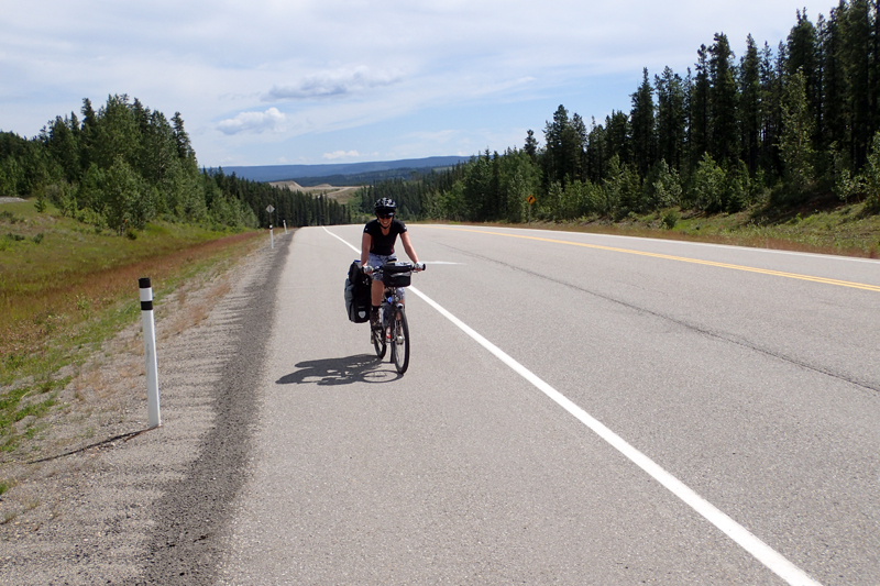
The riding along this highway 40 has been very good almost all the way from Hinton. Today the shoulder was wide all day which makes things so easy as you don't have to be adjusting to it disappearing and coming back. No rumble strips either! Five climbs of varying lengths took us to our high point and luckily we got internet access and booked into a good hotel tomorrow night. Now we could relax and enjoy the rest of the day. The views had been wonderful as we dragged ourselves out of the valley onto the ridge and there were rolling hills to come. We saw a deer with two calves crossing the road. We stopped for a snack at Southview Recreation Area which is also a small campsite (no services) and quite nice. We had decided to try to push on beyond Kakwa River to the next river valley to shorten our ride into Grande Prairie and lengthen our time in the town (and the hotel room!). When we got the Kakwa it was a beautiful river and we were in two minds about stopping there anyway, but decided to go on. We had another long climb out of the valley and then things got interesting. Forestry, gas and oil are the big industries around here and there are many logging trucks and other heavy vehicles around. Being Friday afternoon it seemed the race was on to finish work and/or go home. The last 15 km were like running the gauntlet as heavy truck traffic in both directions, with an RV or two thrown in for good measure, raced past us. The road was dusty and many of the vehicles threw up stones and gravel as they flew passed making for a pretty uncomfortable ride. There were some steep descents and we had to concentrate on the road to stay in the shoulder as well as blink out the dust and grit that landed in our eyes.
With about 3 km to go we saw a mirage... a little signboard that promised "POP COFFEE HAMBURGERS and FRIES" 2 km further on. Could it be true? As we crossed the river at the base of the descent we saw the little van with tables set up outside. We screeched to a halt (almost) and ordered hamburger, fries and pop and they tasted GOOD! This was the best suprise of the tour. Tinned soup and instant potato can wait for another day! We then spent some time checking out the camping area around the river. It is one of the "Random Camping Areas" and as it is on the river, quite sandy and the tracks heavily rutted. We then crossed back over the bridge to camp on the other side where there was a bit more tree cover, and more secluded for the tent. Behind our campsite there is a little stream that comes down and we kept hearing noises from there. A little later further up the track we saw a deer watching us through the leafy trees. I think we are camping in her track to the river. She just watched us and then came out and started eating leaves. There are lots of berries about here, so if any bears do visit, that's what they will be here for! We had a great river swim which felt like a spa with the rapids, and are settling in for the night. Trucks are still frantically going to and fro over the bridge, spitting stones as they go (not at us though).

Much to our suprise, the trucks continued raging up and down highway 40 ALL night, thundering over the bridge at crazy speeds. It was a pretty noisy night but we were tired so slept well. We started the day as you do on most bushcamps at rivers, by pushing a reluctant bicycle up a steep and unforgiving gravel slope to the road where you usually pop out on to the bitumen to the surprise of passing moterists. Sometimes, if there is somewhere to lean one of the bikes (a conveniently placed tree is good for this) then you can work together and we often do, Mike pushing the bike from behind and me steering and pushing from the front. Generally these early morning capers are accompanied by my grunting as I try to inspire my upper body to work harder. It all adds up to being totally puffed by the time you even get on the bike. At least when you get moving your legs work harder than your arms!
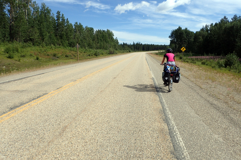
We had a climb out of the river valley and then settled in. The weather was good, the road surface was excellent, with a wide shoulder all the way. We were excited about the shorter day and the Subway meal we had been craving which awaited us, as well the hotel room of course. We were interested in seeing what Grande Prairie would look like after nearly two weeks of mountains. But... the TRUCKS. We have never seen truck traffic like this on any road, anywhere. They passed us in droves, must have been hundreds. They were SO loud. At first there were more coming towards us so not such a problem, but after a bit they were moving in both directions. Although we had the wide shoulder, we rode on the right edge of it to stay as far away as possible. The driver's seemed highly skilled in their ability to measure getting passed you with centimeters to spare. It was not unsafe, but boy we have had more pleasurable rides. Must say that a great job is done keeping the shoulders relatively gravel free in most places.
About 12 km short of the town, we descended to the Waipiti River and crossed the bridge to climb up to the town. As the trucks thundered by a cyclist out for his morning ride came hurtling down the hill towards us, smiling and waving, oblivious to it all. What are the other roads like if this is his preference?! We were soon at Subway, where we chatted to two locals, one of whom had years of experience as a surveyor in BC, the Yukon and Alaska and was able to give us a few tips about things to see. Also useful tips like if a black bear approaches you put a jacket over your arms and head to make yourself look bigger, if a grizzly approaches you back away slowly trying not to trip and fall over something. We all agreed that luckily with it being late in the season there is plenty of food so the bears are happy. Funny thing happened this morning packing up. Mike was tipping the tent to one side to get the dirt and leaves etc. out when a Special K Double Chocolate Protein Bar fell out! It had been trapped between the groundsheet and the tent for days. Now, we have been so disciplined with bear safety, not even leaving out a protein bar wrapper. It all goes into the bear container or is hung with garbage in the bear bag. We have been told not even to leave lipbalm in the tent! So how we have gotten away with our lives when we were sleeping on this tasty snack, we don't know. We did clock over 5,200 km today and have lived to tell the tale, so we must be doing something right!!
We had planned to have one night at the hotel, but it was all so fabulous that we stayed for two instead. The rest day was really just catch up; on laundry, sleep and eating. As we would have had a pretty strong headwind on the bike, we were happy with our decision. The hotel had the exact same layout as the Canalta we stayed at in Kindersley and the similarities did not end there, it had the exact sameview as well - prairie as far as the eye could see! It was a great stay.
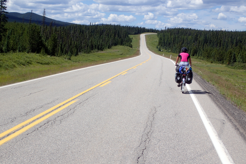
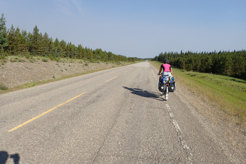
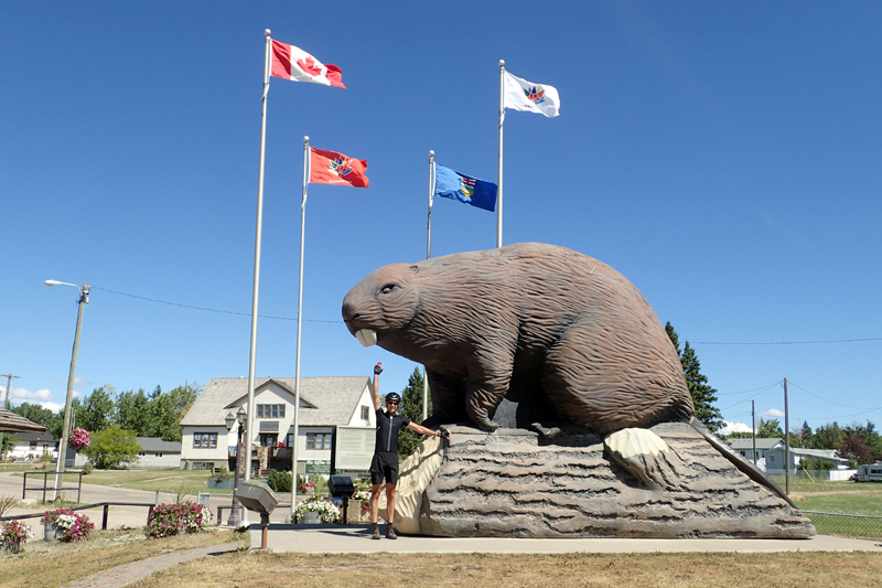
Check out was 12:00 pm and we left at 11:00 am. We only had 55 km to ride to Hythe so there was no rush. It was a fabulous ride, wide shoulder, good surface and interesting scenery, and very few trucks. We are back in the rural heartland of Alberta. It's hard to imagine that for the last few hundred kilometers we have been "in the sticks". We stopped by the roadside for some "hotel" coffee from our flasks and in the distance the animals in a paddock caught our attention. We got the monocular out and saw that they were caribou; our first siting, albeit in captivity! We passed four campsites today which was a nice change. We rode through Beaverbrook about halfway, home to the Giant Beaver statue. It seemed to be a lovely town. Especially given it had a Subway, so of course we stopped and ate. It was already 2:00 pm after all. Not long after, we arrived in Hythe and the campsite was lovely. Nice hot showers set up in old railway carriages (kabooses). Good rates too. Grocery store nearby. All in all it was a good day. We are enjoying the wide open skies again.

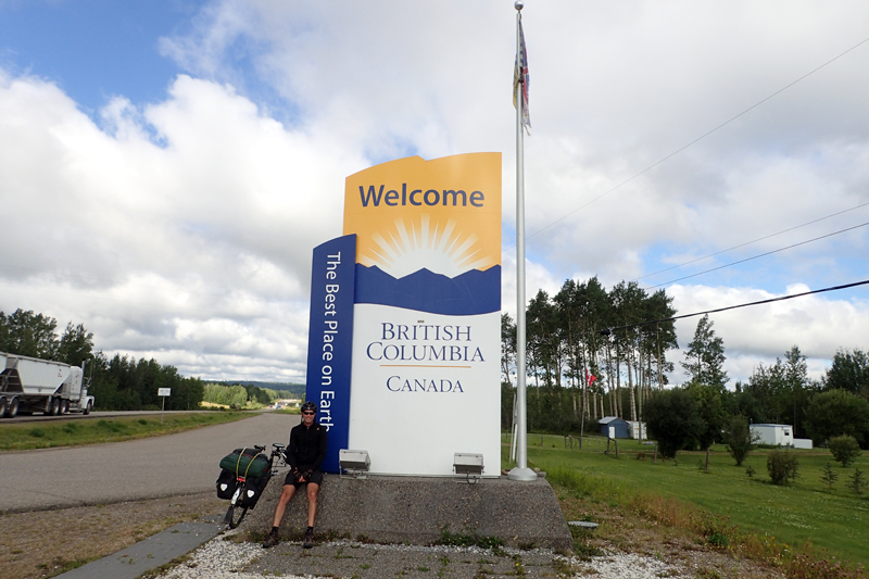
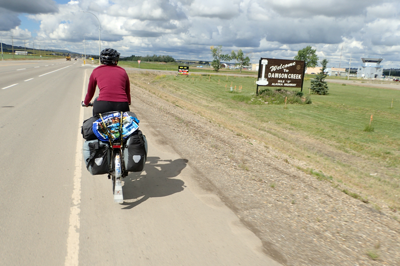
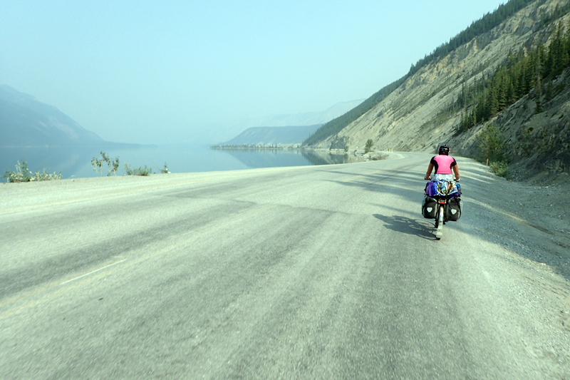
We had quite a big thunderstorm surprise last night. It hit at about 10:00 pm, we were already asleep. Mike was a bit worried as we hadn't put pegs in as it was dead calm when we went to bed, and the tent sides were flapping quite badly. It stood up to it all though. Difficult to get out of bed, but we have a timezone change today so that should help. We could only get up at 7:00 am. I chatted to a lady in the bathroom this morning who was travelling back from Anchorage to Missouri. They had made the trip for Salmon fishing but "got skunked". This means they caught no fish. Some guy they camped next to had two freezer's full of fish. Disappointing for them (maybe the other guy had cleaned out the river!). We had 33 km to the BC border where BC announced itself as "The Best Place on Earth". Wow - that's either great self-confidence or very good marketing. The road was good, fewer trucks, good weather and BC served up 6 km worth of dual carriageway on entry. Show offs! The riding was easy and it didn't take us long to get to Dawson Creek. We stopped for muffins at Timmo's and I asked what the time was as we had not passed a sign advising of the expected timezone change. We were happy to receive the gift of an extra hour in our day. Bonus! Dawson Creek is a great town. It is the start of the Alaska Highway - Mile/ KM Zero. There is a signpost in the middle of an intersection in town which indicates KM 0 and also the distances to various points along the highway. The Alaskan Highway runs to Delta Junction and we will ride it to Whitehorse in the Yukon. The building of the highway was quite a mean feat, and is worth checking out online. Suffice it to say that when war threatens, money, manpower and motivation miraculously appear in spadefuls. Now of course it is a big "bucket list" item for many people as well as a means to actually get to Alaska.
We visited the tourism centre which had helpful maps and advice about services along the road. This is pretty important to us so we know how much food we need to carry, etc. Adjacent to the tourism centre is the Art and Artisan's Gallery which interestingly is housed in a renovated grain elevator. The elevator was purchased by the gallery for $1 and relocated to it's current location and then renovated to house the gallery. There was a photo of a similar move in Edmonton. Let's just say you'd have to hope for no wind that day. They had to dismantle and reconnect all the telephone lines along the way. We made our all important BEAR purchase at the gallery. He is a lovely bear who has just caught a fish and it made from BC jade. Very special and also a nice small size. After that we had Subway for lunch; we can't get enough of the freshness of it! Mike then got an appointment at an optometrist as he has been having problems with his contact lenses. Happily this was solved by a slightly different prescription. Must be all that intense focussing on the bush looking for bears! Our campsite is good with a large tenting area. Our neighbour looked at us in amazement at how quickly we got the tent up. He said "I just looked down at my phone and your tent is up already! It's like magic!". Practice makes perfect...

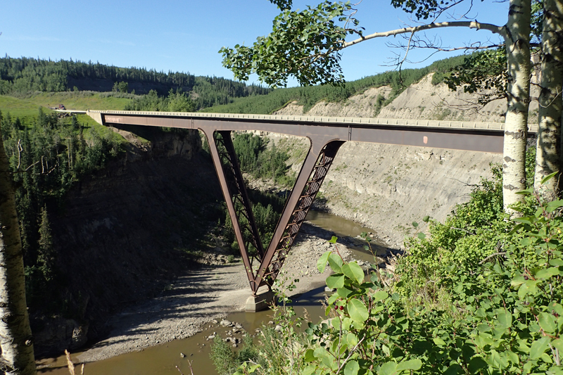
It was a cold, clear morning that turned into a beautiful, hot day. We hopped onto the Alaksa highway and until kilometer 45 we had distance markers each 5 km but they stopped at that point. We had lovely rural views for much of the day. The road was busy once again with heavy truck traffic, but we did have a wide shoulder. We stopped at the Kiskatinaw River Bridge and admired the views of the very steep canyon below, the river just a trickle. The optometrist Mike saw yesterday had warned us of a dangerous descent on the Highway today where the road had required repair but the shoulder was not replaced in parts, he suggested we walk this section. Also, he told Mike about the Peace River Bridge after this descent which was metal grid and very difficult to drive. So we were primed!
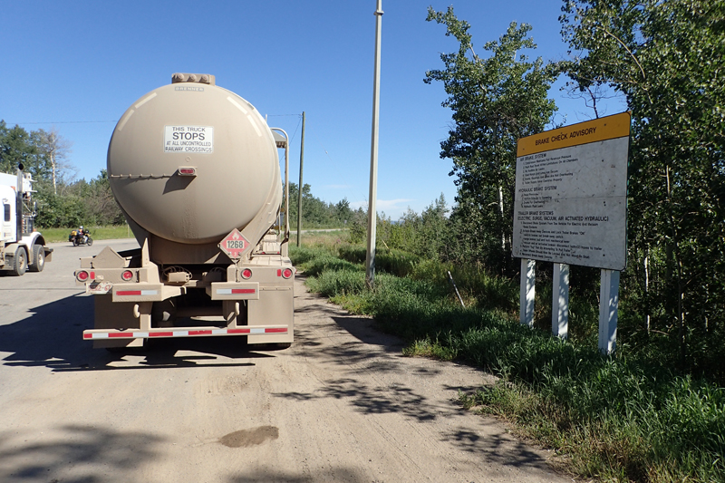
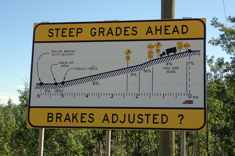
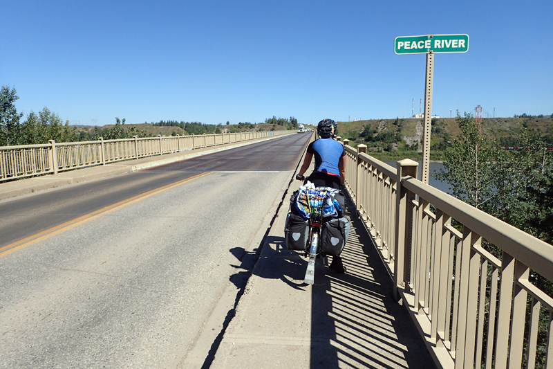
Just before all of this the road had been beautifully resurfaced and there was a lovely new rest/picnic area on the other side of the road, which we couldn't access. We hoped our next rest area would be as nice! It wasn't, but our minds were occupied with the road information so we didn't really mind. It was a truck pull off in order to check brakes for the descent and there was an information board detailing what they were expected to do to ensure their brakes were in working order. Then there was a diagram which showed the gradients they would encounter on the descent too. Very useful for us as well! The grade did get to 10% and we were concentrating on the sweeping descent and also looking out for the point the optometrist had warned us about, where the shoulder disappeared. You wouldn't want to get stuck at that point with a truck on your shoulder. The trucks and cars take this descent very slowly and we pulled off about halfway down at what is supposed to be a view site, but trees obscure the view. There we encountered a small Asian man with a very overloaded motorbike which he seemed to have dropped whilst trying to take a photo. An obliging motorist was helping him keep it upright. "Bicycle is easier", joked the motorcyclist. We watched him wobble off down the road. Once we were safely off the descent we encountered the metal bridge which fortunately had a wide footpath we could ride, avoiding the metal which would have been difficult to ride, we know from experience having ridden this type of bridge before.
This all took us to Taylor, where we stopped for a snack (Timmo's muffins from yesterday) and then it was a MUCH easier climb out of the valley than it would have been at the other side, and an easy 18 km or so to Fort St. John where we bought Subway for lunch and more Timmo's muffins and then went on to the provincial park. We have a huge site which is shady (it is a warm day) and near the entrance to the park. Strangely there is a truck weighing station on the highway right behind us so the trucks are still with us, constant companions it would seem!
Concidentally we had a short day planned which worked out well as rain was forecast to arrive by midday. We had a stop halfway, at Shepherds Inn to pick up some supplies and then only 30 km to go to the lake. The road is still busy, perhaps not quite as busy as yesterday. The rain began about an hour from the lake and we put on wet weather gear for the first time since Manitoba! There was a 2 km dirt road from the highway to the lake and it was super muddy and slippery in the wet. The last kilometer was unrideable and our tyres and shoes were completely caked in mud, so much so that our tyres would not turn! The mud was trapped between the tyres and the mudguards, front and back. We walked the last bit, hopefully the road dries out by tomorrow so that we can at least ride out of here! We arrived around 12 pm and bravely had a swim with the geese before relaxing for the afternoon, after attacking our tyre and shoes with sticks to prise off the mud! The rain stopped after a few hours and the skies cleared up for a beautiful evening.
It had dried out overnight and we woke to a clear day. We were so happy that we could easily ride out of the campsite along the dirt road and keep our shoes and tyres clean! We passed through Wonowon after about 18 km (named for being Mile 101 of the Highway). Instead of places existing mainly to service tourist traffic, services and towns on this highway seem mainly to exist to service work crews who come in on rosters for oil, gas and forestry work. Wonowon had a large "Open Camp" which is rows of demountables used as motel-type accomodation. The road seemed quieter today, far fewer trucks, and grew quieter still thoughout the day. Today's ride took us to the Pink Mountain, the highest point in this section of Fort St.John - Fort Nelson. It was a challenging day as we climbed almost all day. We remained on the top of the ridgeline, so no rushing rivers. We spotted a large fox closeby as it followed us in bush along the road.
We stopped briefly for a drink and a snack at the side of the road, there were no rest stops for us today. We got to Pink Mountain and had a good lunch at the Buffalo Inn across from the campsite. The campsite is quite rough and ready, but we don't mind the contruction crew element of it. We had not had a shower for two nights so appreciated the one we got, even though it cost $1 for 4 min and took 90 seconds for the water to warm up! The campsite manager told us we didn't have to worry about bears as he has a German Shepherd called Simba that he brings out in the late afternoon to keep control! We could have a Simba versus Bear showdown later this evening, who knows!
We decided to have an active rest day and ride the short distance to Sikanni River. This meant we could sleep in, wake up when we felt like it, have a meal and then a 2 hour ride to get to the next campsite. We had been finding that taking a whole day off was too long and by the afternoon we were wanting to get going again, so this seemed like a good solution. At about 11:00 am we left to go across the road to the Buffalo Inn for brunch and popped into the office to let them know that we were going to leave a little later. The manager told us that there had been an accident northbound on the highway and the road was closed. He suggested that we "buy a few beers and think about leaving at three o'clock". Last night a different manager had told us that there was a long contruction section on the road as well and a long stop-go wait time. So this all seemed quite complicated. The accident had been between a semi-trailer and a ute (canadian truck) and there was serious injury. We had heard a siren earlier, around 10:00 am. We waited a little longer at the tent and saw a helicopter flying the injured person to hospital. We went over to eat at about 12:00 pm and whilst there heard that the road was open again, business as usual.
We packed and left at 1:00 pm after a good meal and arrived at the construction zone after a speedy 7 km descent. We were told that we would be driven by the pilot car to the end due to the length of the zone, being 8 km. So we unpacked and loaded the bikes onto the back of the pilot vehicle and hopped in for a drive through. On the way we picked up one of the construction workers. They were both quite chatty and clearly everyone on site had had a dreadful day with the accident, them in particular as they were both senior first aiders. We drove past the scene, the semi apparently had not noticed that the traffic in front had been halted and had just driven into the back of the waiting ute. The driver of the ute was badly injured it would seem. Everyone on site had been given the day off tomorrow. We hopped out the pilot car after our free ride and set off again. The road was very quiet. We had a bit of a climb and then a STEEP descent down into the Sikanni River valley where the campsite was just on the left on the river bank.
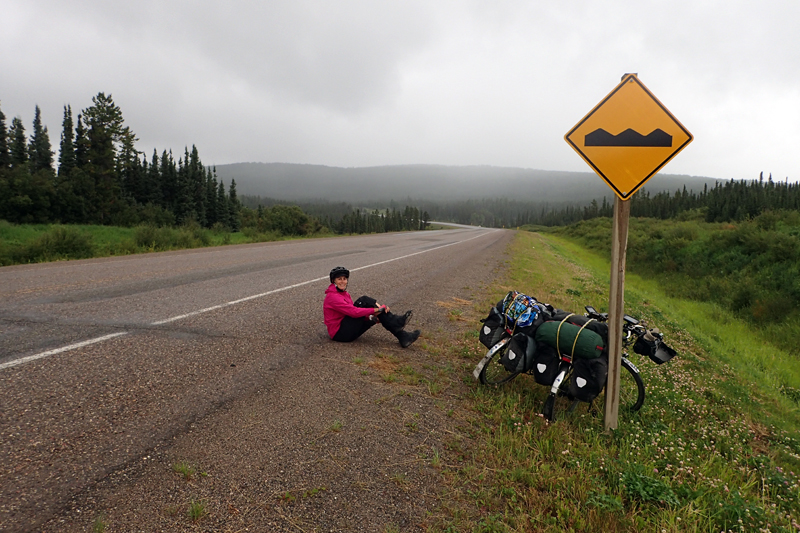
It rained lightly overnight and for much of the day. We were a little worried about the climb out of the Sikanni River valley as it was so steep coming down. It started right at the campground and we had watched countless cars, trucks, RV's and motorbikes labour up it last night. The campsite was particularly noisy due to traffic slowing down over the bridge and then trying to make it up the other side. Suprisingly, it was not all that steep and we were happy with that. We had a few more climbs to Buckinghorse RV and Restaurant where we stopped after 23 km at 10:00 am. The views had been very nice, lots of forest and rolling hills. The road was quiet, perhaps being a Sunday less truck traffic? Buckinghorse served up delicious hamburgers and coffee, and we also nearly cleaned out their supply of cakes and biscuits for treats later.
Due to the rain and generally miserable conditions, we decided to camp at a river after 73 km. The day seemed to consist of a lot of climbing up long, low gradients where we had expected a descent. When we got to the river it was not that suitable for canmping so we chose to ride the extra 20-odd kilometers to an Airstrip that we had read about. Just as we made this decision and got back on the bikes, I got a front wheel puncture which Mike fixed in the rain (of course).
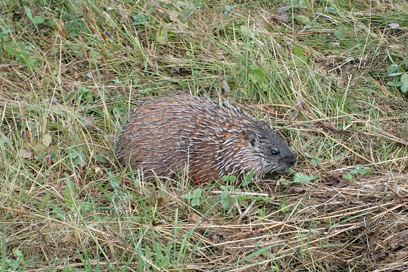
The remaining 20 km were pleasant, the rain stopped and the expected descent to the Prophet River occurred. Along the way we saw a porcupine. It did not mind posing for a pic. The camp area used to be a provincial park but has been allowed to return to the wilderness. It has large area where you can camp though, along with a spring for fresh water. It was still too high above the river to make swimming possible, but we used the spring water for a cold make-shift shower. There was a large party camped on the airstrip itself, which is not unusual. It did not rain again which was great, many mozzies around so we used about 10 coils to keep them away.

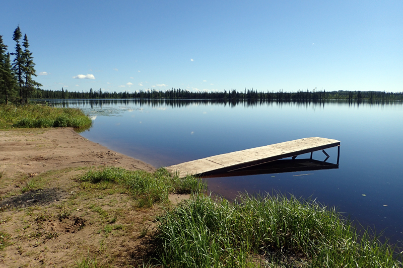
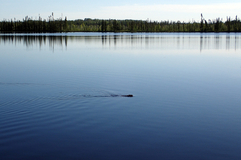
Good weather today, but we struggled to get up and only left at 9:00 am! The ride was much easier than yesterday, and we wondered if we should stop where we had planned or go on to Fort Nelson and a formal campsite. The views were good; a lot or forest and we met another cycle tourist, going in the opposite direction. Her name was Natalie and she had started her ride at Deadhorse, Alaska, and was headed for Argentina. She confirmed the advice given us by a lady from Hudson's Hope who we met at Shepherds Inn a few days ago - the cinnamon buns at Testa can't be beat. So there you have it. We will eat some and let you know. We arrived at the little lake campsite at 2:00 pm which Mike had discovered. It is a picnic site complete with table, pit toilet and a lake full of beavers that kept us entertained all afternoon. We had not realised it was a public holiday today which explained why the road was nice and quiet yet again! We have had a peaceful and relaxing afternoon! A group who pulled in here in their car to have a look even gave us two cans of ginger ale! Bonus!
A very peaceful night and an early start. We were on the road at 7:00 am, must have been the lure of the Timmo's brekky. Bit of a descent and a climb into Fort Nelson and immediate left to Timmo's. We bought brekky and half a dozen muffins of course! We then went on to shop for essentials, bit of a restock and I even bought some stickers for my bike! We also bought Subway meals to go. They don't travel very well, but are still good! All this took nearly three hours! Things like popping in to the visitor's centre and filling up with water and so on.
Leaving Fort Nelson the road was very quiet, the quietest road we've ridden in weeks. It seems that the truck traffic is very reduced as is the tourist traffic. We had planned to ride further but it was a hot day and so when we got to quite a big river we chose to stop and relax for the afternoon and camp there. The rivers around here are no longer blue, but quite dark brown in colour. Filtered water looks like tea, but tastes perfect. I went down to find a spot to swim from and stepped onto the mudflats. I immediately sank to my ankles in my boots! What a mess! Anyway, we found a better spot to enter and had a couple of swims. It grew very hot and humid in the evening. We have only a squirrel for company!

We had planned an early start as we had Steamboat Hill to climb and we wanted to do that before the heat hit. Apparently summer has only just arrived here, all of July was rainy, rain nearly everyday. Steamboat Hill is so named as a steamboat engine was required to winch up vehicles when this section of the highway was first built. I had read that it served up 10% grades, and the guy in the Fort Nelson visitor's centre said they were 11%. So now we were a little worried about the hill and on the road at 7:20 am. The first 25 km were largely sweeping from one river valley to the next and very nice riding. The road surface has varied quite a bit and since Sikani River (3 days ago) there have been large patches of gravel quite often, which gets deep in the shoulder. Trucks passing throw up a lot of dust and sometimes stones as result.
We stopped at a bin to throw our garbage away and a truckie came to have a chat. It went something like this: "Where're you guys headed?" "Do you have bear bangers?" (these are small explosive devices that you shoot near troublesome bears to give them a fright and encourage them to run away, they can be tricky as you need to be sure to shoot them between you and bear i.e. they should not land behind the bear, causing it to run towards you! we don't have them) "You've got to get bear bangers. You know how you tell the difference between grizzly turd and black bear turd? Black bear turd has berries and grizzly turd has bear bells and smells like pepper spray! HAH HAH" :" You know what we call you guys (meaning cyclists)? Meals on Wheels! HAH HAH!". Very amusing. He encouraged us to get bear bangers at Watson Lake. He said further up the road were two mama grizzlies with two three year old cubs that were being trained for hunting. All this information is unhelpful. Why would a mother bear train her cubs to eat cycle tourists? And aren't three year old cubs grown up yet? We do not know enough about it.
The climb up Steamboat Hill was about 25 km long and the gradient varied. It did not however come even close to the 10% or 11% that we had been told about. At it's steepest it was 7%, and only then for a very short section. It was long though, so took a while! The views of the northern Rockies were good, if a little hazy. At the top there is a rest area (the sign says "Next Rest Area 389 km"). Not a bench in site to encourage anyone to get out of their cars and enjoy the view. As far as BC being "The Best Place on Earth" - buy a few benches man! We chatted to a father and son motorcycle duo who were cruising around BC, the Yukon and the North West Territories for a few weeks. They knew a lot about the area, the father had actually worked for the army at Muncho Lake in the 60's! Interesting chat.
Testa River Lodge offers famous Cinnamon buns (which are very very good - warm and creamy and fresh - baked on the premises) and some small meals. We were excited about the buns! The gift shop/tea room is very nice and we had a bite to eat, artisan sausage in a wrap and then the BUNS - which were fabulous, warm, cinnamony and creamy. Also freshly baked bread for later. Another highlight was the water which was cold and excellent quality. We did the laundry and showered a few times as its still getting hot during the day. Very clean! As the site relies on generated electricy, unfortunately we had the hum of the generator all night but we were tired enough to sleep.

Firstly, we are unsure when this will be uploaded as we do not foresee any internet access until Watson Lake which is 5 days away. Internet coverage is somewhat lacking in this isolated part of Canada.
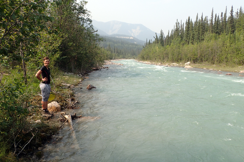
We were disciplined enough for another 7:10 am start. You've got to do it with these hot days. Today's ride may have been the best of the entire trip. The views were spectacular and the road was narrow, windy and beautiful. You cannot believe this is the same truck-belching, noisy, dust-covered highway that we took in the first days out of Dawson Creek. The road was quiet and the mountain and river scenery unparalleled so far on this trip, even taking Banff and Jasper into account. As we left Tetsa we were excited to see that the river was brilliant glacial blue (explains the water quality) over white river stones and rocks. We had a climb to Summit Lake at Stone Mountain Provincial Park. There was a lovely campsite there too, on the edge of Summit Lake. We stopped at a small creek (it had a number, not a name) and there was a beautiful forested area on the shores of a beaver dam. The water was completely transparent and then gushed down a gap in the dam wall, ice blue. We were so tempted to stay and camp, but it was early in the day and we pressed on.
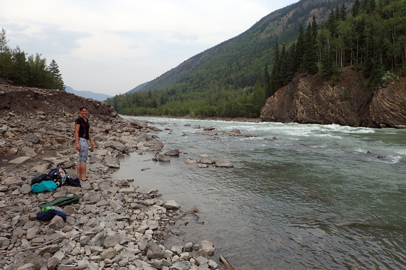
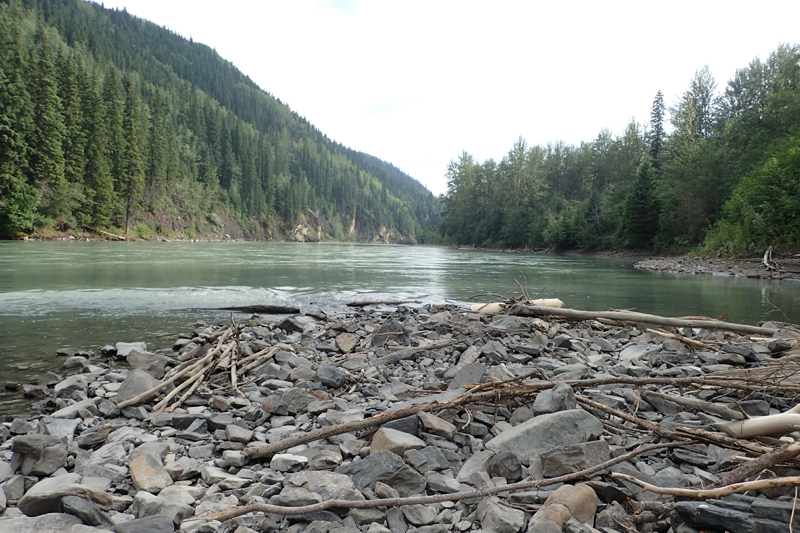
After a short climb we were down along another river, this time Racing River. It did race! It was white with sediment as glacial rivers can be. There was not suitable camping as it was too hot and quite exposed, but many camping spots. We then arrived at Toad River Lodge where we could camp but the blue river was calling. We had a good meal there though and bought some homebakes. I even had a soft serve icecream! Shortly after this we entered Muncho Provincial Park and found the turnoff to an old single lane bridge over the Toad River. There was a huge camping area with a lot of space. We found a spot right at the river's edge and had many swims over the course of the afternoon. The cold water also cooled the temperature, which made the afternoon even better. It is a beautiful river and we have pitched the tent just in the forest alongside. There are a couple of other campervans here too. Today we reached the 6000km milestone.


Another early-ish start, today 7:30 am. Amazingly as we left our campsite there was a lynx sitting in the road looking directly at us, which only after a while then skulked off into the bush. Quite a hazy day with the smoke from the BC fires STILL burning. How exhausted must the fire services be! The smoke haze did take away from the views but they were still impressive. The narrow, winding Alaska Highway seems to retain it's original character (it was built in 1942 and "evened out" in the 70's) and the folding mountains just dive down into the raging Toad River, brilliant blue. It is picture perfect Canada, all those postcard images in real life. The road climbed up to Muncho Lake and we sweated in the morning heat. There are wide, empty and boulder strewn river valleys now. About 10 km after our high point we reached Double G, where we met the character of Muncho Lake; one man show Captain Jack. He runs the store, cooks the breakfasts, takes the weather readings and I imagine manages the post office which is on site too. Best full cooked breakfast of the trip and possibly the best bacon we have ever eaten. He gets it specially from Dawson Creek. Coffee came in polystyrene mugs as he told us he "couldn't be bothered with more washing up". The walls were covered with quotes and sayings which possibly underpin Jack's persepctives on life. I think my favourite was "Why can't a closed mind be accompanied by a closed mouth?". Bread is freshly baked on site and we bought a loaf, which came out of the freezer and ensured it retained it's loaf shape even squashed under a net on the back of my bike! We also bought some homebakes. We chatted to another couple who were from Vancouver and had just completed a driving holiday which included driving the Inuvik Road.
The road flattened out until we reached the jade coloured waters of Muncho Lake. The views would be amazing, but we had a lot of smoke there. It was very still, with the water like glass. Reminded me of the ride into Interlaken, Switzerland. As we left the lake, the landscape became very dry and rocky, no water to be seen, but the effects of the huge spring melt were obvious with very wide river valleys, empty now, running down the mountains and under the road into the distance. We came across a family of stone sheep; mother, father and baby on the road. They moved off as we approached. We also saw another type of buck, we are unsure if it was an elk or a caribou.
We heard a car slowing down and pulling up along side us as we cycled. The driver shouted hello and was after a chat. He asked "Were you on the road when those stone sheep were there?" "Yes" I replied. "What did you do?" he asked. "Kept peddalling" I replied. He asked where we were going and when I said Anchorage he said "Me too!" and drove off. This exchange got us thinking that maybe the sheep aren't as harmless as we think. Imagine the headline "Cycle tourist mauled by Stone Sheep". Come to think of it, the ram did not look too impressed. Who knew the sheep could be out to get you too?
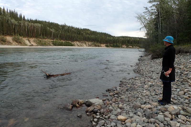
Not too much further on we dropped down back to the river, this time the Trout River, still as beautiful and blue as the others. We saw a small pathway in, not accessible by car, and it led into a large, flat field full of dandelion, with river access. It was hot, but the views were clearing and we had a few river swims. The river is like a spa as it descends to rapids below us and so you can wedge yourself between rocks and it pummels you 'til you are freezing. Tomorrow we hope to see the famous bison herd and also Liard Hotsprings.


We had a thunderstorm last night, but otherwise it passed uneventfully. We were on the road at 7:30 am, keen to get to Liard Hotsprings for a swim before moving on trying to beat the heat of the day. We followed the Trout River, being on the look out for Bison. Well, they can't be missed, people had been telling us since Grande Cache that they are "all over the road", "they won't budge", etc. etc. We did come across a group of wild horses by the roadside. There were about 6, and 5 looked quite nervy. They had cow bells, or should I say "horse bells" around their necks and their front legs had chains in between, you know, like prisoners on a chain gang. As Mike said, if the horses' legs are in chains, how bad a bear problem can there be?
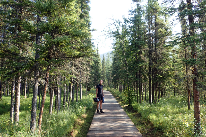
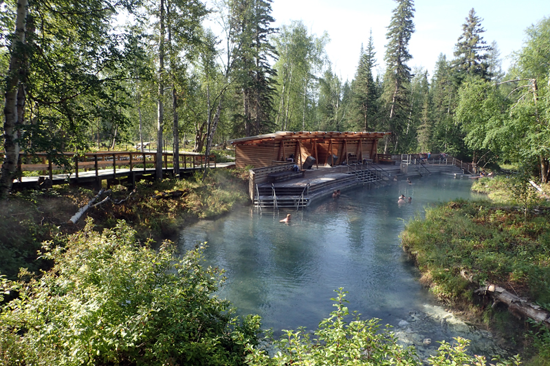
There was very little traffic on the road and just as we rounded the bend to drop down to Liard we saw a large black bear up front crossing the road from left to right. We stopped and watched him as he stopped and watched us. Then he bounded across the road and into the bush on the other side. We carried on riding and he stopped again to check us out. As we arrived at Liard there was a digital signboard warning of bison on the road for the next 90 km. As we had 60 km of that to ride today, we hoped to see them. Liard Hotsprings is a provincial park and you pay $5 for day use to use the hotsprings. It's about a 5 min walk along a lovely wooden boardwalk to the hotsprings, the forest around this area is beautiful, very lush with many different types of plants due to the humidity and the warm water around. Swimming at the springs was a great experience as they are in their natural state, surrounded by banks of plants and mosses and timber decking has been laid down with concrete steps for access. The water is of course crystal clear and the bottom sandy with stones. We spent about an hour here and then moved on.
After Liard the scenery grew a little boring. The road surface was quite chunky which made riding a bit of a chore and the river was too far away to be seen much of the time. This is the Liard River and is blue and very wide. A big river. We kept remembering to look for bison, but although we saw a lot of bison turd, the animals themselves were absent. A passing vehicle warned us of bears ahead and a few meters from us off the road was a mother and cub (and possibly another cub in the bushes). They were unaware of us, foraging in the long grass. As we passed they both looked at us, mother and baby. Very cute! A bit further on a man driving a campervan made arms gestures as he drove by. I thought he was making buffalo horn on the head signs, but Mike thought he was giving two thumbs up. Anyway, it wasn't bison as none appeared. After a little climb we dropped down to Coal River. We first went to check out the river which was beautiful, with wide stony banks, not really suitable for camping though as it was hot and there was little shade. We went over to the campground where we ate bison burgers (if you can't see them right?) and had milkshakes. We decided to camp there and had a relaxing afternoon. We are frustrated by the lack of internet access (no wifi at all since Fort Nelson). Not even a mobile signal.

There was a distant thunderstorm last night. Another traveller had told us of the heavy rainfall that occurs at Liard hotsprings due to the warm air from the thermal springs. We woke up this morning and Mike's first words were "What's going on?". We have never seen weather like this. The sky was an inky black to dark grey colour. The cloud was thick and charcoal grey, all around us. It seemed like the middle of the night, yet it was 6:15 am. We got up in a hurry as we thought any minute now a HUGE storm will be unleashed. Luckily to the north it seemed clearer. We were on the road in just over an hour, breakfast and coffee done, packed and on our way. The road was very quiet. We rode with our lights on and never on a cycle tour have we actually used them to light our way. This morning they shone down on the bitumen as a guide, not just for visibility for motorists. We were unsure what the day would bring, surely it would rain at some point, as although we seemed to be heading away from the worst of it, it was still to both sides of us.
There would be nothing on the road today and our plan was to ride around 80 km to Contact Creek where we would bushcamp on the creek banks. There were some other options too, but it depended on the weather. On the plus side it was very cool, which was a welcome relief after the hot days we have been having. However, we did not want to get rained on! The first 16 km saw us still on the lookout for bison, we were disappointed that there were none. At Fireside there was a sign warning the motorists travelling on the opposite direction of bison in the next 100 km, so we just counted ourselves lucky that we had seen the herd at Buffalo Pound many weeks ago. The road conditions after this point were not so good. Large areas of the road had been covered by gravel in a bid to... slow everyone down?... hack everyone off? ... provide a good business case for opening a windscreen repair shop? We don't know. The chip-sealed road certainly was not full of craters that had to be plugged. However, this is something we have seen before in Canada, when in doubt throw heaps of gravel on it. Except of course for Alberta; their roads are perfect. The passing traffic of course threw up heaps of dust as they crossed it, and we had to be careful in the shoulder of the often deep patches. We stopped for hot chocolate and homebakes (thanks to the ladies at Coal River, the cinnamon bun and pecan muffin were delicious).
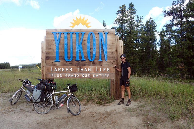
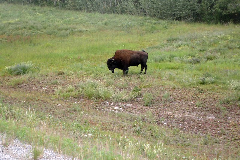
We had passed a few large areas of sand on the grassy, forested roadside and wondered what caused them to look so worn in. Just around the corner we found our answer... bison. A large, lone male lay silently in the shade, munching away. I yelled out "You have no idea how pleased we are to see you!". The sentiment was not reciprocated. We were super chuffed with our bison and continued the ride. We had some climbs today, one which was quite steep but otherwise just uppy-downy. Just before we got to Contact Creek we crossed into the Yukon. The welcome sign left alot to be desired, but it is better not talk yourself up. The camping places around the Creek seemed a bit hemmed in and the road was high above the creek and loud. It was also still early so we headed off again. It was a good thing we did as we came across a large herd of bison crossing the road. We were able to pass quite close to them, babies and all. Amazing - huge animals! Plains Bison. Just after, we popped into the petrol station and had softserve which was a treat. We made two further stops, at Cosh Creek and Irons Creek, but although camping was possible at both it wasn't exactly right. Our last option was Hyland River, around 17 km away and it was already 3:00 pm. However, any kilometre ridden today is one less tomorrow, so off we went. We came across two male bison grazing by the roadside. They were huge, but paid us little attention.
We arrived at the massive Hyland River after 4:00 pm and it was perfect. The area we camped at is cuturally important for the Kaska First Nations people, especially for hunting. The sign at the site explained that we were welcome to camp as long as we left no trace. We had a great river swim and a good soup meal. Then to bed! Only a short ride to Watson Lake tomorrow and we will have a rest day there!

Mike and I both woke at the same time in the middle of the night, thinking we had heard something at the Stumpies (AKA bear containers). Weird. Nothing there of course. It's strange how the river noises at night can make you think of other things. After that we lay gazing at the brilliant stars through the tent netting and watched the moon rise (we like to sleep with the tent open except for the net, which raises a whole other bear question "What do you do if you wake up and a grizzly is breathing in your face on the other side of a bug net?") . We woke again at about 6:00 am to the sound of rain. It grew a bit heavier. We realised that we would be riding in rain gear. We were still up and on the road by 8:00 am and fortunatley the rain stopped soon after getting on the bike. The ride to Watson bay did not take long.
The Yukon was heralded by beautiful forests, just our kind, flat moss-covered floors. We were used to this scene from our trips to Finland. We passed the border into the Yukon and checked to see if there was cell reception/wifi. Not really. We knew that our coverage would be patchy in this area. We had hoped to try and book into an hotel before arriving and there weren't many. As we drew into Watson Lake we had to race against a huge thunderstorm which broke as we reached the Recreational Centre and were indoors. Phew - big rain but we were dry! The town is teeny and two hotels and a cabin-style accomodation were fully booked. We rang The Big Horn Hotel (standing across the road) and luckily they had a vacancy for two nights and we went to check in. This is not Booking.com territory, but the prices are reasonable and the room is huge (our bicycles are inside with us) with fridge, bath, etc; all the facilities you expect in a city hotel just not as modern. One plus is there is a window you can open! How retro and FUNCTIONAL! We are happy to stay in this tiny town and recover from 9 days riding without a break.